All Activity
- Past hour
-

Clipper Fires In Wednesday Feb 25 Disco/ Obs
ineedsnow replied to Damage In Tolland's topic in New England
for most.. 12z Nam is very meh -

Clipper Fires In Wednesday Feb 25 Disco/ Obs
CoastalWx replied to Damage In Tolland's topic in New England
I’ll go 1-2 here. -
ya looks warm.. but the way this winter has gone.. we wait and see
-
24”
-
Cold is done after next week. Big time -PNA and east coast ridge.
-

Winter 2025-2026 Thoughts
FPizz replied to donsutherland1's topic in Weather Forecasting and Discussion
It just goes to show you no matter how smart people might be in the weather world, long range forecasting will never be very accurate. We will wind up way above normal snow wise and well below normal temp wise. If anyone forecasted that back in the fall, they would have been blasted everywhere for being a weenie. Turns out that cold snowy winters still exist, how about that! -
It’s been pretty good. It was AN for awhile and now we coast to March. Always can squeeze in a storm when back is broken.
-
It’s been a persistent pocket of cold in the northeast…just a little too much for up here (snowfall wise).
-

Pittsburgh/Western PA WINTER ‘25/‘26
colonel717 replied to Burghblizz's topic in Upstate New York/Pennsylvania
The guy who runs the site is a ball buster and can give certain posters abuse. But they have been around for a long time. Its 95% NY centric so you have to put up with that. As RDD said SnowMiser is a Pgh met in some capacity. He is from NJ so that is his connection there and lives in Allison Park now and works for NWS. -
February 24 1835: The temperature at Ft. Snelling falls 26 degrees in only three hours. For Tuesday, February 24, 2026 1852 - The Susquehanna River ice bridge at Havre de Grace, MD, commenced to break up after forty days of use. A total of 1738 loaded freight cars were hauled along rails laid on the ice. (David Ludlum) 1936 - Vermont and New Hampshire received brown snow due to dust from storms in the Great Plains Region. A muddy rain fell across parts of northern New York State. (24th-25th) (David Ludlum) (The Weather Channel) 1987 - A massive winter storm began to overspread the western U.S. In southern California, Big Bear was blanketed with 17 inches of snow, and Lake Hughes reported four inches of snow in just one hour. Snow pellets whitened coastal areas of Orange County and San Diego County, with three inches at Huntington Beach. The storm also produced thunderstorms with hail and waterspouts. (The National Weather Summary) (Storm Data) 1988 - Strong winds produced snow squalls in the Great Lakes Region which created "white-out" conditions in eastern Upper Michigan. Squalls produced up to 14 inches of snow in Geauga County of northeastern Ohio. (The National Weather Summary) (Storm Data) 1989 - A total of thirty-three cities in the eastern U.S. reported new record low temperatures for the date, and an Atlantic coast storm spread heavy snow from Georgia to southern New England. Snowfall totals in New Jersey ranged up to 24 inches in May County, with 19 inches reported at Atlantic City. Totals in North Carolina ranged up to 18 inches in Gates County, and winds along the coast of North Carolina gusted to 70 mph at Duck Pier. Strong winds gusting to 52 mph created blizzard conditions at Chatham MA. (The National Weather Summary) (Storm Data) 1990 - Strong northerly winds prevailed from Illinois to the Southern and Central Appalachians. Winds gusted to 68 mph at Sewickley Heights PA. High winds caused considerable blowing and drifting of snow across northern and central Indiana through the day. Wind gusts to 47 mph and 6 to 8 inches of snow created white-out conditions around South Bend IN. Traffic accidents resulted in two deaths and 130 injuries. Sixty-five persons were injured in one accident along Interstate 69 in Huntington County. Wind gusts to 60 mph and 4 to 8 inches of snow created blizzard conditions in eastern and northern Ohio. (The National Weather Summary) (Storm Data) 2004 - Heavy snows blanket wide areas of northern New Mexico, closing schools and highways. he mountains east of Santa Fe receive 20 inches. Sandia Park, east of Albuquerque, measures 11 inches. 8 inches falls at Los Alamos.
-
Wouldn’t be very shocking with the way this winter has performed. Wants to stay cold.
-
..RECORD DAILY LOW MAXIMUM TEMPERATURE SET AT ASHEVILLE THE HIGH TEMPERATURE WAS ONLY 28 DEGREES MONDAY, FEBRUARY 23 AT THE ASHEVILLE REGIONAL AIRPORT. THIS BREAKS THE OLD RECORD LOW MAXIMUM OF 29 DEGREES, SET IN 1989. RECORDS FOR THE ASHEVILLE AREA GO BACK TO 1869.
-
yeah, I don’t know what flooding rain they’re talking about. Gradual melting with snow chances over next week
-
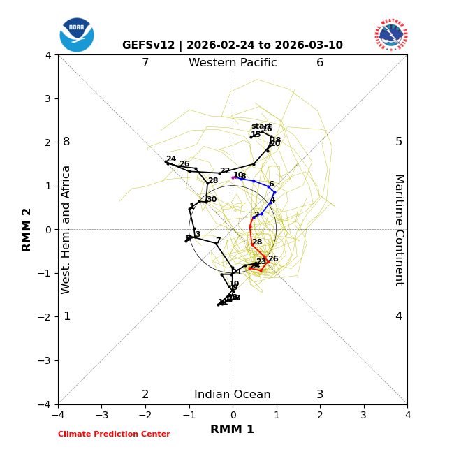
Weak run thru Phase 6-might not get that warm
-
Yes. Agreed. But the cold seens to always find a way this winter…but as I just said, 2nd week of March or so…let’s warm it up some.
-
I’d love one more bigger system…then it could end by the second week of March, and that would be perfect for me. I don’t need the second half of March being cold…it’s been a fabulous winter, as some of us figured it would be very early on…despite the ratter and dud and mediocre calls from knowledgeable folks.
-
It has to end sometime, but I’m broken down to the point where I’ll believe it when I see it.
-

Winter 2025-26 Medium/Long Range Discussion
Malacka11 replied to michsnowfreak's topic in Lakes/Ohio Valley
-

"Don’t do it" 2026 Blizzard obs, updates and pictures.
Baroclinic Zone replied to Ginx snewx's topic in New England
Without question. -

Is we back? February discussion thread
Damage In Tolland replied to mahk_webstah's topic in New England
We’ve got weeks and weeks after next weeks big un. maybe late Morch ? -

E PA/NJ/DE Winter 2025-26 Obs/Discussion
Ralph Wiggum replied to LVblizzard's topic in Philadelphia Region
6z euro if it went out past 144 would drive the developing waa precip into our region with HP centered over Toronto. Probably a good thump to mix scenario. -
Band of +SN moving through this a.m. with some blowing. 1-2" looks to be what I'll get.
-
Lol…obviously this is sarcasm…but your calls of back broken haven’t been very accurate. It’s been anything but, for all of SNE, Especially now for your area. One more good one for us who couldn’t maximize yesterday, and then let it end.
-
I legit thought about how quickly I can put out buckets once the snow melts.
-