All Activity
- Past hour
-
Okay, thank you for the explanation. It just seemed weird to have it as an all day thing - but I guess you can't just say AQ will be code purple after 6pm, but before it will be orange
-
Finished up a good, if not hot, week down the shore. Water temp was again 58 here, but crystal clear water.. kids loved it at low tide.
-
This is what kills many potential record high minimum temps.
-
Our AQ folks are concerned about the increased number of fireworks in DC combining with increasing pooling of low level moisture from convection. Combine that with the nocturnal boundary layer and it's a recipe for Code Purple inside the beltway.
-
Looks like our high was 95.
-
Hoping those storms in northeast PA that are moving southeast hit here in a few hours. NAM3km says we're going to get hit. A heavy downpour would be very welcome.
-
.thumb.jpg.6a4895b2a43f87359e4e7d04a6fa0d14.jpg)
Central PA Summer 2026 Discussion/Obs Thread
Yardstickgozinya replied to Voyager's topic in Upstate New York/Pennsylvania
Continuous LEMPs being picked up on my AM frequencies. The flash rate tonight should be intense if we can hold on to some of this stuff until the sun sets.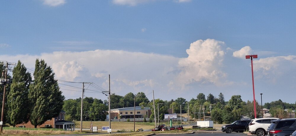
-

Central PA Summer 2026 Discussion/Obs Thread
canderson replied to Voyager's topic in Upstate New York/Pennsylvania
If you look close you can see a formation of the famous Tamaqua split! -
A short but severe heatwave will continue to scorch the region into the start of the weekend. However, the most severe heat has already occurred yesterday and today. Through 5 pm, highs included: Allentown: 101° Atlantic City: 105° (old record: 104°, 1966) Baltimore: 102° Boston: 100° Georgetown: 102° (old record: 101°, 1954) Harrisburg: 103° Hartford: 98° Islip: 98° Manchester: 97° New York City-Central Park: 98° New York City-JFK Airport: 100° New York City-LaGuardia Airport: 100° Newark: 102° Philadelphia: 102° Poughkeepsie: 101° Providence: 98° (tied record set 2002) Raleigh: 101° (tied record set in 2012) Reading: 102° Trenton: 101° Washington, DC: 102° (old record: 101°, 1872, 1873 and 1966) Wilmington, DE: 102° (tied record set in 1966) A few areas could see a thunderstorm this evening. Tomorrow will be a few degrees cooler, but still very hot. Temperatures will likely peak in the middle to perhaps upper 90s. Some showers or thunderstorms are possible, especially late in the day. Sunday will turn a bit cooler with readings returning to near normal levels. A soaking rain is possible Monday into Tuesday. The potential exists for a general 0.50"-1.50" rainfall. Highs will reach the middle and upper 70s on both days. It will turn warmer to end the week. The ENSO Region 1+2 anomaly was +3.1°C and the Region 3.4 anomaly was +1.8°C for the week centered around June 24. For the past six weeks, the ENSO Region 1+2 anomaly has averaged +2.60°C and the ENSO Region 3.4 anomaly has averaged +1.37°C. The ongoing El Niño will continue to strengthen through the summer. The SOI is not available due to data feed issues. The preliminary Arctic Oscillation (AO) was +1.312 today.
-
 160 mph now cat 5
 -
Northern Hemisphere pattern continues to disconnect from ENSO
-
My thermo hit 102. Texas hots.
-
Lake Geneva, WI was hit hard. Widespread and significant damage across that area, including several boats that were capsized on the lake. Seven people were rescued from the lake and three children lost their lives.
-
Saw the storm up in Morris county while biking.

-
Hoping that cell making its way into Essex County gets here in Jersey City. Need some relief.
-

E PA/NJ/DE Summer 2026 Obs/Discussion
Psychguy replied to PhiEaglesfan712's topic in Philadelphia Region
My parents live in a suburb of Phoenix and summers down there are very brutal. While it’s a dry heat in theory, when the monsoon season begins dewpoints ramp up into the 60s and sometimes even 70s and that combined with temperatures of 105 to 110° is truly truly unbearable. Not to mention many nights do not drop below 90-95. In fact, one morning when I was there a couple years ago the overnight low was 97°. It’s truly bizarre to wake up in the morning and turn on the TV at 8 AM and see the temperature already over 100. -
High of 87. Currently 84/77
-
folks are starting to chirp about a death ridge out west.
-
Topped out @ 102 here today.
-
https://x.com/i/status/2073156007291699252
-

Central PA Summer 2026 Discussion/Obs Thread
Voyager replied to Voyager's topic in Upstate New York/Pennsylvania
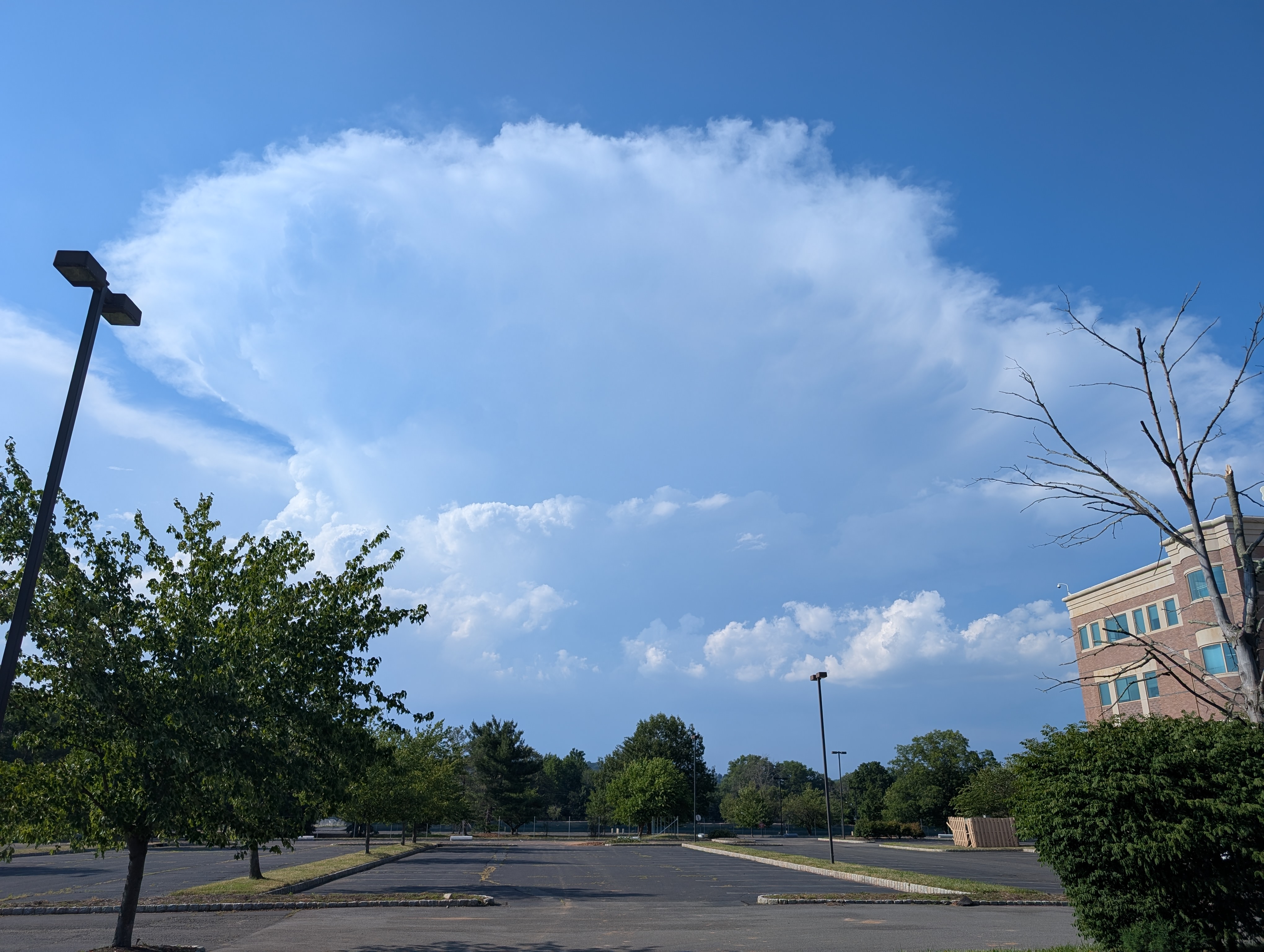
Things are starting to get interesting with regard to storms. Looks like some good cells are popping from Williamsport to Bloomsburg moving southeast. -
Severe thunderstorm watch extended to cover NYC and Nassau: THE NATIONAL WEATHER SERVICE HAS EXTENDED SEVERE THUNDERSTORM WATCH 448 TO INCLUDE THE FOLLOWING AREAS UNTIL 11 PM EDT THIS EVENING IN NEW JERSEY THIS WATCH INCLUDES 2 COUNTIES IN NORTHEAST NEW JERSEY BERGEN HUDSON IN NEW YORK THIS WATCH INCLUDES 9 COUNTIES IN SOUTHEAST NEW YORK BRONX KINGS (BROOKLYN) NASSAU NEW YORK (MANHATTAN) PUTNAM QUEENS RICHMOND (STATEN ISLAND) ROCKLAND WESTCHESTER
-
Strong cell coming through morris to essex counties. Temps should plummet for a few.
-
But they dont go off until way late
-
 Storms in ENY make into New England?