mikeysed
-
Posts
273 -
Joined
-
Last visited
About mikeysed

- Birthday February 24
Recent Profile Visitors
1,952 profile views


-
Yeah futurecast looks like a central NJ special. Anyone have any short range models now through midnight?
-
Issued By New York City - NY, US, National Weather Service Affected Area Portions of northeast New Jersey, including the following counties, Bergen, Essex, Hudson and Union and southeast New York, including the following counties, Bronx, Kings (Brooklyn), New York (Manhattan), Queens and Richmond (Staten Island) Description ...FLOOD ADVISORY IN EFFECT UNTIL 645 PM EDT THIS EVENING... WHAT...Flooding caused by excessive rainfall is expected. WHERE...Portions of northeast New Jersey, including the following counties, Bergen, Essex, Hudson and Union and southeast New York, including the following counties, Bronx, Kings (Brooklyn), New York (Manhattan), Queens and Richmond (Staten Island). WHEN...Until 645 PM EDT. IMPACTS...Minor flooding in low-lying and poor drainage areas. ADDITIONAL DETAILS... - At 339 PM EDT, Doppler radar indicated heavy rain due to thunderstorms. Minor flooding is ongoing or expected to begin shortly in the advisory area. Between 0.5 and 1 inch of rain has fallen. - Additional localized rainfall amounts of 1 to 2 inches are expected over the area through 7pm. This additional rain will result in minor flooding. - Some locations that will experience flooding include... Newark, Jersey City, Jamaica, Elizabeth, Flatbush, Flushing, Bayonne, Mott Haven, Hoboken, Plainfield, Bloomfield, East Tremont, Linden, Orange, Coney Island, Summit, Lyndhurst, Millburn, Rutherford and Secaucus. - This includes the following Event Locations... New York/New Jersey Stadium, Brooklyn Bridge Park, Sports Illustrated Stadium and USTA Billie Jean King National Tennis Center. -
-
Any hrrr or updates? I flood where I am and I dont want to move the cars if its just going to be 1 inch or so of rain in an hour or so. TWC future cast shows back building severe storms from about 11 to 130 am. Noaa barely mentions anything but showers. Radar looks like a line but TWC future cast creates huge red cell over all of north NJ
-
About to go boom in about 10 minutes where I am. Its moving super fast at 55 mph though.
-
Dynamic ratio wxnerds spitting out a 2.5 hour period of 7 to 8 inch an hour snow. Has the northeast in general ever seen 8 inch an hour snow?
-
When does this start Sunday? Im on a cruise and flying home from miami on Sunday at 230pm . I hope I dont get trapped down here
-
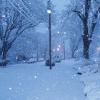
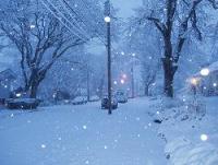
ripping snow now and huge flakes
-
Back to moderate snow in North Caldwell ~550 elevation. Was mostly sleet for last 4.5 hours or so.
-
What town in bergen county?
-
Light sleet now. Radars show heavy echos but its light.
-
dry slot it seems.
-
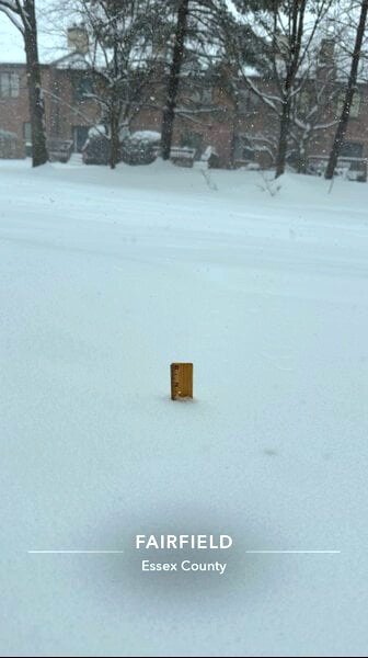
12 inches officially here. North Caldwell NJ
-
10 inches northwestern essex county. ~550 elevation
-
9 inches in Northwestern Essex County. ~550 elevation
-
Lee Goldberg on ABC 7 said suburbs will have another 9 to 14 inches and city can see another 7 to 8. If thats the case, I have 8.5 inches in northwestern essex county . Another 10 will put me at almost 20