All Activity
- Past hour
-
E PA/NJ/DE Summer 2026 Obs/Discussion
Albedoman replied to PhiEaglesfan712's topic in Philadelphia Region
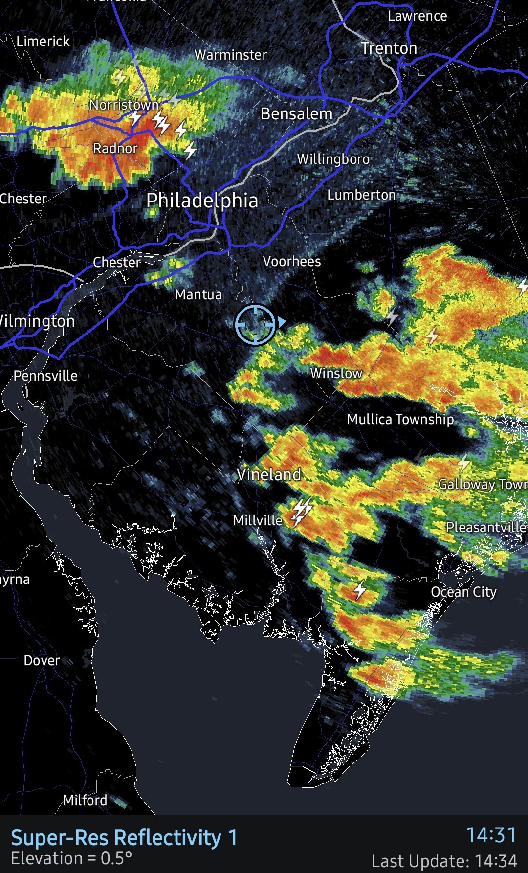
LV swing and a miss strike 3 we are out of t storm chances for today. The 7 10 split lives on. Just incredible outflow boundaries preventing us from getting decent rain. 50 miles on either side of the lv gets 2+ in of rain. This is no longer funny. Another week of no rain and temps near 100 , the little lehigh will go dry in spots. I really see a drought emergency issued by Lehigh County Authority by next weekend. The lawns will be burned if people mow them this week and corn will be spiking. -

E PA/NJ/DE Summer 2026 Obs/Discussion
BBasile replied to PhiEaglesfan712's topic in Philadelphia Region
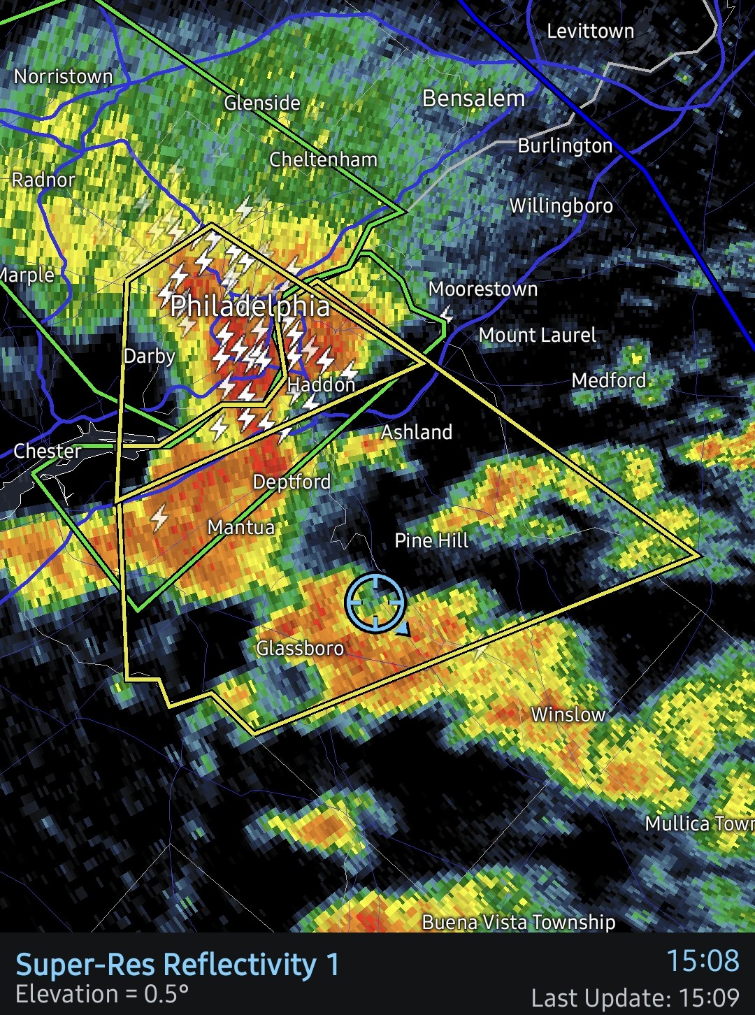
Gust front definitely helped. Rainfall up to 0.64" now. More on the way.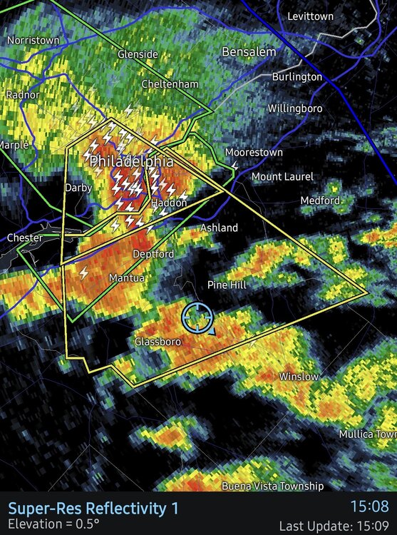
-

E PA/NJ/DE Summer 2026 Obs/Discussion
hosj III replied to PhiEaglesfan712's topic in Philadelphia Region
Intense storm here. Very strong (guessing 58+ mph wind) and hail nearly quarter sized. Best storm of the year. Pouring right now still. Everyone overdoes winds but hard to see how that wasn't severe. I got soaked standing under a covered porch. -

E PA/NJ/DE Summer 2026 Obs/Discussion
LVblizzard replied to PhiEaglesfan712's topic in Philadelphia Region
Radar says this will happen today too. The cell over Schuylkill County looks to miss to the west. -
Intense rain again
-
Records: HIghs: EWR: 100 (1988) NYC: 98 (1988) LGA: 98 (1988) JFK: 98 (1966) Lows: EWR: 58 (1934) NYC: 57 (1898) LGA: 62 (1945) JFK: 61 (2002) Histprical: 1888 - Heavy snow reached almost to the base of Mt. Washington, NH, and the peaks of the Green Mountains were whitened. (David Ludlum) 1909: A deadly, estimated F2 tornado moved ESE across the Simpson Park section of Big Stone City in South Dakota. A bus was thrown from the road and the driver was killed. Two homes and several barns were destroyed. As the tornado crossed the foot of Big Stone Lake, it tore apart a railroad yard and killed four of the 26 Armenian laborers who were living in box cars at Ortonville, MN. 19 people were injured. A tornado in the eastern St. Louis metropolitan area in Missouri began as a waterspout on the Mississippi River, drove a steamer into a bridge. On land, the tornado destroyed several barns and damaged 15 homes and two factories in the west part of Alton. (Ref. Wilson Wx. History) 1912: Boston, MA recorded the end of the longest heat wave ever. It was 9 consecutive days with 90 °F or more. (Ref. NOAA Boston Weather Events) 1936: From July 5-17, temperatures exceeding 111 degrees in Manitoba and Ontario claimed 1,180 lives (mostly the elderly and infants) during the most prolonged, deadliest heat wave on record. Four hundred of these deaths were caused by people who drowned seeking refuge from the heat. In fact, the heat was so intense that steel rail lines and bridge girders twisted, sidewalks buckled, crops wilted and fruit baked on trees. Some record temperatures include; 112 degrees at St. Albans and Emerson, Manitoba, 111 at Brandon, Manitoba, 108 at Atikokan, Ontario, and Winnipeg, Manitoba. 1936: Unbelievable heat occurred across the Mid Atlantic states and the deadliest heat wave ever in parts of Canada. Ontario, Canada recorded its hottest temperature ever as the town of Atikokan hit 108°. On the same day in Manitoba, Winnipeg also reached 108°, the highest recorded temperature there since records began in the 1870's. St. Albans set Manitoba’s all-time record as they soared to 112°. In the United States, the all-time record high was set at Rochester, MN with 108°. Other daily record highs were set at Lincoln, NE: 109°; Peoria, IL: 108°; Rockford, IL: 108°, Grand Forks, ND: 108°, Decatur, IL: 107°, Moline, IL: 107°, Dubuque, IA: 107°, Minneapolis, MN: 106°, St. Cloud, MN: 106°, Fargo, ND: 106°, Springfield, IL: 105°, Champaign, IL: 105°, (Ref. Additional Temperatures Listed On This Link) 1939: All-time record highs of 110 °F and 106 °F were set for the city of Scottsbluff, NE and Kimball, NE, respectively, while Cheyenne, WY tied their all-time record high of 100°. Sioux City, IA also tied their all-time record high with 111°. Chadron, NE recorded its 3rd warmest day on record with a record high of 110°. (Ref. Wilson Wx. History) 1970: Seminole County in Oklahoma was hit hard by severe weather during the evening hours. Thunderstorm winds, estimated between 90 and 100 mph, damaged several buildings and blew out several plate-glass windows. Up to 5 inches of rain was also reported producing isolated flash flooding. (Ref. Wilson Wx. History) 1980: Hot weather prevailed from the southeast to the Plains. Daily records included: Wichita, KS: 111°, Columbia, MO: 108°, Dodge City, KS: 108°, Topeka, KS: 107°, DFW Airport, TX: 107°, Macon, GA: 104°, Savannah, GA: 103°, Memphis, TN: 103°, Houston, TX: 103°, Columbus, GA: 102°, Paducah, KY: 102°, Atlanta, GA: 101°, Chattanooga, TN: 100 °F. (Ref. Additional Temperatures Listed On This Link) 1981: Severe thunderstorms moved eastward across the entire length of South Dakota along the northern portion of the state. The storms produced large storms and an incredible amount of wind damage. Hail chicken egg size and up to 9 inches in circumference resulted in 100% crop loss in some areas. Many farmers reported that their crops were devastated by the storms winds and hail. Many trees were stripped of their leaves and large limbs were frequently lost. Winds exceeded 70 mph in many areas. Damage was so extensive that damage estimates were not even attempted. (Ref. Wilson Wx. History) 1987 - Early morning thunderstorms produced wind gusts to 90 mph at Parkston, SD, and wind gusts to 87 mph at Buffalo, MN. Later in the day strong thunderstorm winds at Howard WI collapsed a circus tent injuring 44 persons. (The National Weather Summary) (Storm Data) 1988 - Thunderstorms produced heavy rain in southern Texas, with totals ranging up to 13 inches near Medina. Two men drowned when their pick-up truck was swept into the Guadalupe River, west of the town of Hunt. Ten cities in the eastern U.S. reported record high temperatures for the date. Baltimore, MD, reported a record high reading of 102 degrees for the second day in a row. (Storm Data) (The National Weather Summary) 1989 - Afternoon and evening thunderstorms produced severe weather from North Dakota to Indiana. Thunderstorms in North Dakota produced tennis ball size hail at Carson. Thunderstorms in Indiana produced wind gusts to 75 mph at Fort Wayne. Five cities in the Southern Atlantic Coast Region reported record high temperatures for the date, including Lakeland, FL, with a reading of 100 degrees. (The National Weather Summary) (Storm Data) 1990: The costliest hailstorm in U.S. history occurred along the Front Range of the Colorado Rockies. (Denver, Colorado): Softball-sized hail destroyed roofs and cars, causing more than $600 million in total damage. 1992: An isolated thunderstorm developed over northeast Nebraska and moved into west-central Iowa. Windows were blown out at a store in downtown Onawa and high winds downed trees about 6 miles northwest of Onawa. Golf ball size hail also produced crop damage in Monona County and 3.50 inches of rain fell in a short period of time. (Ref. Wilson Wx. History) 1993: The Great Midwest Flood continued as flood waters came close the Des Moines, IA water treatment plant, leaving the city's 250,000 residents without water for 12 days. (Ref. Wilson Wx. History) 1995: Winds gusted to 86 mph at Barstow, FL damaging several small airplanes and buildings.(Ref. Wilson Wx. History) 1995: Shortly before 2 a.m. a house in Danielsville, PA, was hit twice by lightning. The chimney and roof were damaged and debris from the house damaged 3 cars. (Weather Guide Calendar with Phenomenal Weather Events 2011 Accord Pub. 2010, USA)
-
76 / 71 0.12 in the bucket - monthly now to 3.79
-
Have had several intense rounds of rain this morning and currently. So far 2.35in of rain and storms still training over my area. This is definitely the most rain in one day that I’ve had in a long time.
-
Do you not have any AC?
-

E PA/NJ/DE Summer 2026 Obs/Discussion
Hurricane Agnes replied to PhiEaglesfan712's topic in Philadelphia Region
Under a red blob but just getting tupjca thunderstorm rain. My sister whose flight to FL was already 90 minutes late (due to overbooking), finally got off the ground about 45 minutes ago as the storm cells were approaching. Currently have 0.06"with temp 75, dp 73. -
E PA/NJ/DE Summer 2026 Obs/Discussion
BBasile replied to PhiEaglesfan712's topic in Philadelphia Region
Been living on the edge of this rain for a couple hours. A few drops have been falling periodically. Gust front is approaching now. Hopefully that triggers some more activity. 0.02" this far.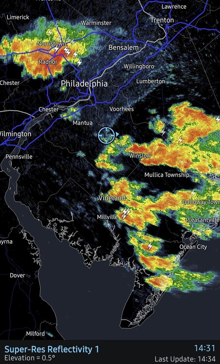
-
K1L8 - Hurricane UT K68S - Davenport WA KE35 - Fabens TX KNWL - Corpus Christi/Waldron NOLF US TX KRIF - Richfield UT
-
Wonder when the STW will go up today?
-

E PA/NJ/DE Summer 2026 Obs/Discussion
JTA66 replied to PhiEaglesfan712's topic in Philadelphia Region
0.50” in the bucket. - Today
-

2026-2027 Super El Nino
PhiEaglesfan712 replied to Stormchaserchuck1's topic in Weather Forecasting and Discussion
All I know is that if we get a 5.0 and the PDO stays negative, then we're likely in a permanent -PDO. -
Definitely wasn't expecting that much
-

2026-2027 Super El Nino
snowman19 replied to Stormchaserchuck1's topic in Weather Forecasting and Discussion
Here comes another DWKW ”40 knot westerly wind anomalies potentially emerging right over the warmest water east of the dateline. The synoptic elements are too small scale to be accurately predicted here. What it's indicating is enhanced risk of seasonally extreme equatorial westerlies through the middle and into the end of July.” -
Have a great time!
-

2026-2027 Super El Nino
Keith Central PA replied to Stormchaserchuck1's topic in Weather Forecasting and Discussion
How do we know that a 5.0 would act differently than a 2.5?.. more flooding in California?..All Super el nino's have done is give warm weather through most of the country for the winter and more rains in the southwest. Somehow that doesn't seem like a big deal, or maybe I'm missing something. This has really been hyped by social media. -
 How could I forget ‘55! No doubt. I just thought their average highs would be much lower. Of course Denver isn’t feeling like South Beach on July 10…That would be rough lol though I wonder if they’d take that over wildfire risk.
 -
Just got a quick .15" here in a 5 minute downpour
-
I'm in Piscataway but near the border of South Plainfield. Those heaviest red radar echoes went right over me. It was a quick half inch.
-
Yesterday hit 99 at 4pm, 0.19" of rain.
-
 Two rain events sandwiched around a Steinmmer the rest of the time. Mem Day and the days after the 4th only real rains . Next one probably Labor Day
 -
E PA/NJ/DE Summer 2026 Obs/Discussion
JTA66 replied to PhiEaglesfan712's topic in Philadelphia Region
Getting a good downpour. Glad the NAM and HRRR sniffed it out. 77F/DP 74F