All Activity
- Past hour
-
It’s been snowing at Forsyth, GA nearly 30 min. Patience is recommended in Macon area as it’s about to start there:Here are 7AM hourly readings:COLUMBUS LGT SNOW 31 29 92 NW9 30.16R VSB 3/4 WCI 23 6HR MIN TEMP: 31; 6HR MAX TEMP: 44; 6HR PCP: 0.04; MACON LGT RAIN 37 35 92 NW10 30.10R WCI 30 TC 3 6HR MIN TEMP: 37; 6HR MAX TEMP: 45; 6HR PCP: 0.13; ROBINS AFB RAIN 39 36 87 NW16 30.09R WCI 30 TC 4 CITY SKY/WX TMP DP RH WIND PRES REMARKS LAGRANGE* CLOUDY 34 14 44 NW9 30.14R WCI 26 TC 1 SYLVANIA* RAIN 42 42 100 N6 30.04R TC 6 MILLEDGEVILLE* LGT RAIN 39 37 93 NW14G20 30.08R FOG WCI 31
-

Winter 2025-26 Medium/Long Range Discussion
A-L-E-K replied to michsnowfreak's topic in Lakes/Ohio Valley
Zzzzz -

First Legit Storm Potential of the Season Upon Us
CoastalWx replied to 40/70 Benchmark's topic in New England
Well just stating like Will said too. Anyways good luck. Getting off for some time. -
(002).thumb.png.6e3d9d46bca5fe41aab7a74871dd8af8.png)
January 18th Back Door NW Trend Snow OBS Thread
ChescoWx replied to Mikeymac5306's topic in Philadelphia Region
As of 710am a new 1.0" of snow so far here in East Nantmeal - temperature at 28.5 degrees all surfaces re-covered.
-
First Legit Storm Potential of the Season Upon Us
CoastalWx replied to 40/70 Benchmark's topic in New England
Yeah I noticed that. Hence the pull back. -

Rise of the Machines: January 18-19 Winter Storm Obs Thread
SouthCoastMA replied to WxWatcher007's topic in New England
snow pellets here -

January 16-18th: Rolling the dice
Stormchaserchuck1 replied to SnowenOutThere's topic in Mid Atlantic
-

Rise of the Machines: January 18-19 Winter Storm Obs Thread
moneypitmike replied to WxWatcher007's topic in New England
If I had any furniture and a kitchen there, I'd be down at the new place for this......sitting here in PVD just isn't cutting it. -

First Legit Storm Potential of the Season Upon Us
Baroclinic Zone replied to 40/70 Benchmark's topic in New England
Donny Boys Obs -
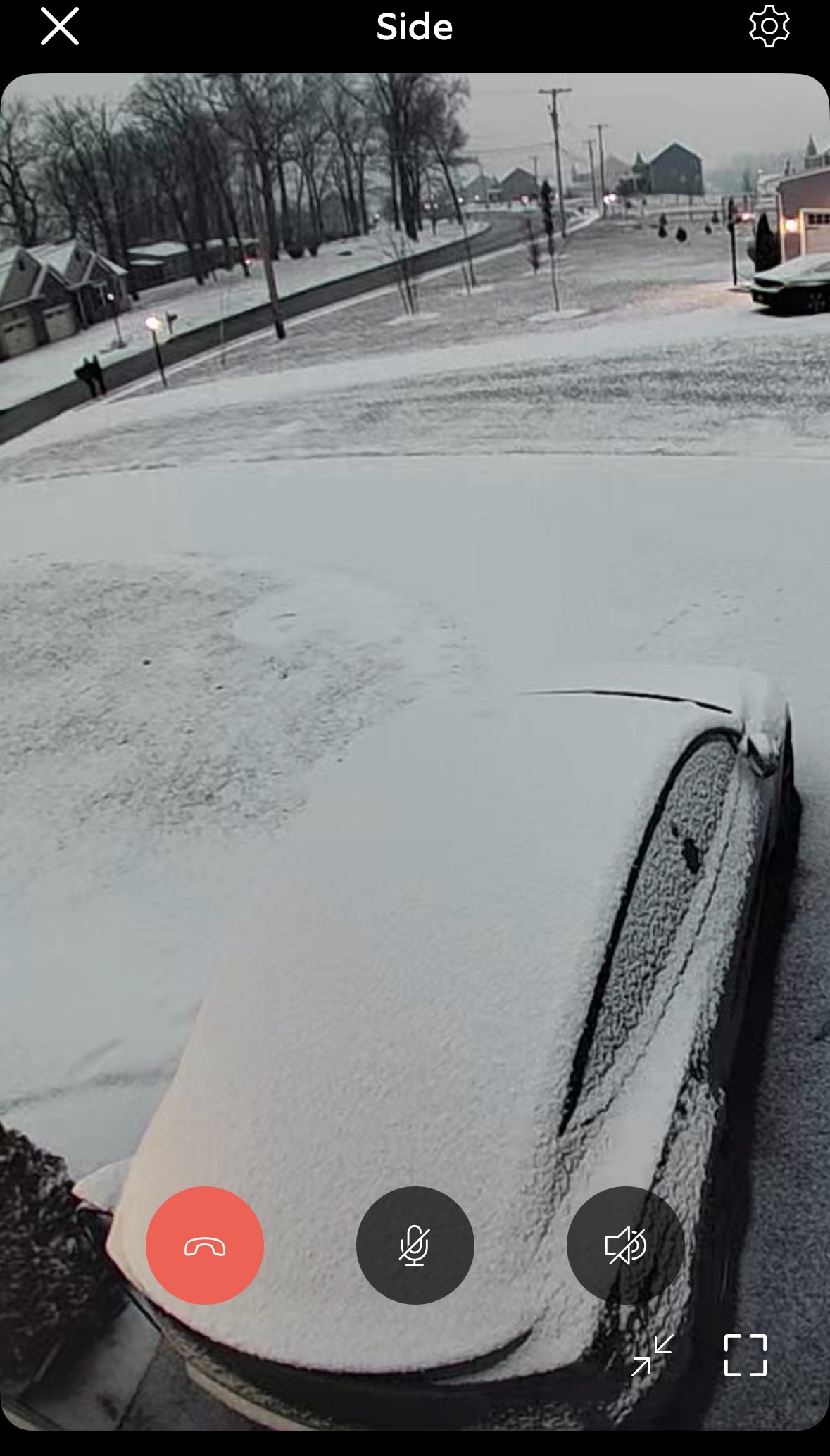
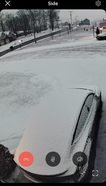
Woke up to a nice coating
-
First Legit Storm Potential of the Season Upon Us
Baroclinic Zone replied to 40/70 Benchmark's topic in New England
GWDLWOTR -

First Legit Storm Potential of the Season Upon Us
ORH_wxman replied to 40/70 Benchmark's topic in New England
I think I’d go 3-6/4-7 here. Don’t think the dynamics are there for lots of 6-8 type amounts. Maybe that changes, but subtle trend overnight of reducing the “curl” in the vort as it passes by. -

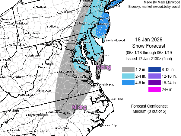
Storm potential January 17th-18th
Stormlover74 replied to WeatherGeek2025's topic in New York City Metro
Hoping for a little more but a 5 or 6 hour lull in the action will probably allow for some melting -

First Legit Storm Potential of the Season Upon Us
Damage In Tolland replied to 40/70 Benchmark's topic in New England
You too .See you on the other side after the pull back -

Central PA Winter 25/26 Discussion and Obs
canderson replied to MAG5035's topic in Upstate New York/Pennsylvania
Real nice surprise of 1.5-1.75” snow when I woke up. -
Light snow. Gorgeous out.
-

Central PA Winter 25/26 Discussion and Obs
Caveman replied to MAG5035's topic in Upstate New York/Pennsylvania
Nearly identical observations for the Saturday and Sunday light snow events from Valley Green, northern York County: Saturday: 1.5" of snow with a liquid eq. of 0.08" Sunday: 1.4" of snow with a liquid eq. of 0.07" Snow on snow is always kinda nice; NFL officials playing such a huge role in any and all games, well, not so much! -
Moderate snow 32° 4 miles west of Hunt Valley
-
This is hot off the press new:URGENT - WINTER WEATHER MESSAGE NATIONAL WEATHER SERVICE PEACHTREE CITY GA 713 AM EST SUN JAN 18 2026 GAZ089-090-181800- /O.UPG.KFFC.WW.Y.0001.000000T0000Z-260118T1800Z/ /O.EXA.KFFC.WS.W.0001.000000T0000Z-260118T1800Z/ MUSCOGEE-CHATTAHOOCHEE- INCLUDING THE CITIES OF COLUMBUS AND FORT BENNING 713 AM EST SUN JAN 18 2026 ..WINTER STORM WARNING IN EFFECT UNTIL 1 PM EST THIS AFTERNOON * WHAT...HEAVY SNOW. ADDITIONAL SNOW ACCUMULATIONS UP TO 1 TO 2 INCHES * WHERE...CHATTAHOOCHEE AND MUSCOGEE COUNTIES. * WHEN...UNTIL 1 PM EST THIS AFTERNOON. * IMPACTS...PLAN ON SLIPPERY ROAD CONDITIONS.
-
Rise of the Machines: January 18-19 Winter Storm Obs Thread
Baroclinic Zone replied to WxWatcher007's topic in New England
Snowing -
Rise of the Machines: January 18-19 Winter Storm Obs Thread
moneypitmike replied to WxWatcher007's topic in New England
Snowing lightly in PVD. Radar showing the band about to tickle Mattapoisett. Meanwhile, GYX even is calling for 4-6" up at Pit2 tonight. -
Was hoping the models would bring the PM snow more in line with my track, but looking more like now this will be lower-end/under my forecast in the DMV region. I wasn't really relying on this morning's activity to do much south of the MD/PA border, but would have liked to see at least a coating IMBY by now instead of rain/mix.
-
First Legit Storm Potential of the Season Upon Us
moneypitmike replied to 40/70 Benchmark's topic in New England
Snowing lightly in PVD. Radar showing the band about to tickle Mattapoisett. Meanwhile, GYX even is calling for 4-6" up at Pit2 tonight. -
Man these model runs showing the precip hole out here are a riot. I didn't move out here for snow although I thought it could be a plus having an extra temp cushion but no precip no matter. I experienced the biggest snow of my life in Leesburg and will always cherish it. Looking back at my life the biggest storms at each location. Takoma Park - PD 1 and the Air Florida storm Venice Beach- not a damn thing Annandale - Blizzard of 96 Woodbridge- PD 2 Leesburg - Winter 09-10 all of them Nokesville - 2016 Lansdowne - nothing memorable Aldie - nothing memorable Stephenson- TBD Fuck I have moved alot lol...we are definitely in an extended dryspell that's for sure
-

Rise of the Machines: January 18-19 Winter Storm Obs Thread
butterfish55 replied to WxWatcher007's topic in New England
on the northern edge of that band. road covered right away. 29 Upstream looks good for SEMA