All Activity
- Past hour
-

super el nino banter thread
George001 replied to forkyfork's topic in Weather Forecasting and Discussion
This is good advice. I started doing DBT as a patient fairly recently and it helps a lot. Having poor emotional regulation really sucks, it got me banned from countless online forums (multiple weather forums, sports forums, reddit, etc). Once I stopped blaming everyone else and realized the common denominator was me it clicked. I got help, since doing that I’ve started letting things go more. It’s still a work in progress but I haven’t challenged anyone to a duel in a while so that’s good. -
 It's a gusty flow too. Going to remain well mixed, especially with the front approaching
 -
 Some folks may get a minimum heat wave. I might score another low 90s day... maybe 2. Good for the pool though
 -
 Does it hold together for SNE? Back door Derecho for DIT?
 -
 Tomorrow night is interesting as far as temperatures go. We are warming aloft. With the flow southwest to west, places like BOS and BDL probably won’t drop all that much.
 -
Impressive as model. All around. Gonna be some nasty stuff from Northern Vermont to Maine.
-

2026-2027 Super El Nino
LakePaste25 replied to Stormchaserchuck1's topic in Weather Forecasting and Discussion
-
Several upper 50s for lows on the mesonet
-
Missed me again. Only .12. It looks like South and North did well. To show you how unlucky I have been as far as big rain totals, here is a Cocoras report from North of Candler. 7/13/2026 8:40 AM NC-BC-91 Candler 1.3 N 1.90 Well, you have to scroll to see it, but it is 1.9 inches. 1.9 inches compared to .12. I am happy that we have had at least some rain every day. How we keep missing storm after storm is amazing... Just by miles or even less. Oh well, they say slow but steady wins the race, lol.
-
one of the only miss north heatwaves i can remember
-

2026-2027 Super El Nino
snowman19 replied to Stormchaserchuck1's topic in Weather Forecasting and Discussion
@40/70 Benchmark My apologies for yesterday. My response was uncalled for -
Suppose to be the hottest of the heatwave today. Lets see if anyone hits 100. As noted below, the Lake cooled some with SW winds yesterday, so that might keep things in check here in town. Winds are to be breezy out of the SW again. .UPDATE... Issued at 253 AM CDT Mon Jul 13 2026 We remain trapped under the influence of a stout upper level high pressure today. With 2AM temperatures still in the 70s across the Northland (outside of some areas right along Lake Superior on the North Shore), today will provide little to no relief from the ongoing heat wave. Guidance continues to point towards today being the hottest day of the heat event. High temperatures could touch or even exceed 100F for the Borderlands in Koochiching, northern St. Louis, and inland Lake/Cook Counties while high temperatures in the 90s are expected across the rest of the Northland. An Extreme Heat Warning continues through the day for the entire area except Price County. The Extreme Heat Warning for areas along and south of Hwy 2 in MN and everywhere in NW WI except Price County has been extended through Tuesday evening due to another very warm night and afternoon expected in those areas. Once the warning expires for the areas north of Hwy 2 in MN, a Heat Advisory will likely be needed at least through Tuesday evening there. In Price County, the Heat Advisory has been extended to run through at least Tuesday evening. A Heat Advisory may be needed along our southern tier of counties for Wednesday. One small note of uncertainty: there has been significant upwelling of cold water in Lake Superior from Duluth to Two Harbors due to the southwest winds over the last 24 hours. This could affect temperatures today very close to the lake, similar to the extremely tight temperature gradient we have seen further up the North Shore. For now, have opted to stay on the hotter side for much of the forecast.
-
I'll admit that's the first time I've read 'siting' in a met wx station context. That will be something for you if the century mark is reached. Are you rooting for it?
-
2026-2027 Super El Nino
snowman19 replied to Stormchaserchuck1's topic in Weather Forecasting and Discussion
-
July 13 1933: An intense heat wave affects Grand Marais with a high of 90, extremely rare for that location. Most of Minnesota would exceed 100 degrees on this date. 1890: A tornado hits Lake Gervais north of St. Paul. People rush from St. Paul to help victims and look for souvenirs. One reporter notes that 'nearly everyone who returned from the disaster last evening came laden with momentoes (sic) denoting the cyclone's fury.' For Monday, July 13, 2026 1895 - A tornado struck Cherry Hill in New Jersey causing fifty thousand dollars damage. It also descended into the Harlem and Woodhaven areas of New York City killing one person, and finally ended as a waterspout in Jamaica Bay. (David Ludlum) 1975 - Dover, DE, was deluged with 8.50 inches of rain to establish a 24 hour record for the state. (The Weather Channel) 1977 - Lightning struck a key electrical transmission line in Westchester County of southeastern New York State plunging New York City into darkness. (David Ludlum) 1980 - Afternoon highs of 108 degrees at Memphis, TN, 108 degrees at Macon, GA, and 105 degrees at Atlanta, GA, established all-time records for those three cities. The high of 110 degrees at Newington, GA, was just two degrees shy of the state record. (The Weather Channel) 1987 - Unseasonably cool weather prevailed across the Midwest. Ten cities reported record low temperatures for the date, including Casper, WY, with a reading of 39 degrees. By way of contrast, record heat was reported in the eastern U.S., with highs of 93 degrees at Burlington, VT, and 101 degrees around Miami, FL. (The National Weather Summary) 1988 - There were just three reports of severe weather across the country, and just one record high temperature reported. Thunderstorms brought much needed rains to the Tennessee Valley area, producing nine inches at Senatobia, MS. (The National Weather Summary) 1989 - A thunderstorm at Albany, GA, produced 1.40 inches of rain in forty minutes, along with wind gusts to 82 mph. Afternoon highs of 98 degrees at Corpus Christi, TX, 110 degrees at Tucson, AZ, and 114 degrees at Phoenix, AZ, equalled records for the date. Greenwood, MS, reported 55.65 inches of precipitation for the year, twice the amount normally received by mid July. (Storm Data) (The National Weather Summary) Observances: 13 Mon National French Fry Day 13 Mon International Town Criers Day 13 Mon Beef Tallow Day 13 Mon Embrace Your Geekness Day 13 Mon Fool's Paradise Day 13 Mon National Delaware Day 13 Mon National No Splinters Day 13 Mon National Paul Day 13 Mon National Rock Day 13 Mon Gruntled Workers Day 13 Mon National Beans 'n' Franks Day 13 Mon National Barbershop Music Appreciation Day
-
I think the El Nino pattern is finally starting to take shape.
-
We picked up 0.09” additional which brings event total here to 0.97” and MTD 5.69”
-
2026-2027 Super El Nino
George001 replied to Stormchaserchuck1's topic in Weather Forecasting and Discussion
That’s certainly possible. Imo the issue my area (near Boston) has in super ninos isn’t just the temps, it’s temps + storm track (miller A setups which are more common in super Ninos are very prone to screwing us). In Michigan you have more buffer room with the temps than we do, and if we do get some MC forcing it could lead to more of an inside runner track which is good to you guys out west. -
Low of 63. I was surprised. Shockingly pleasant for mid-July in the swamp
-
NBM argues BOS may not fall below 80F. BDL would have a legit shot of trying or even breaking their all time overnight low record
-
I’d say most of central NC likely is above July normal amounts for the entire month and it’s still the first half of July. Yesterday’s rainfall was widespread and affected many areas that had missed out somewhat earlier in month. It seems the tide has turned on the drought looking forward with no signs of extended dry weather at all
-

Central PA Summer 2026 Discussion/Obs Thread
canderson replied to Voyager's topic in Upstate New York/Pennsylvania
Heat advisories up for Tuesday - not sure why they didn’t automatically extend through Wednesday. . -
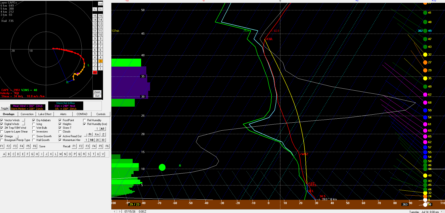
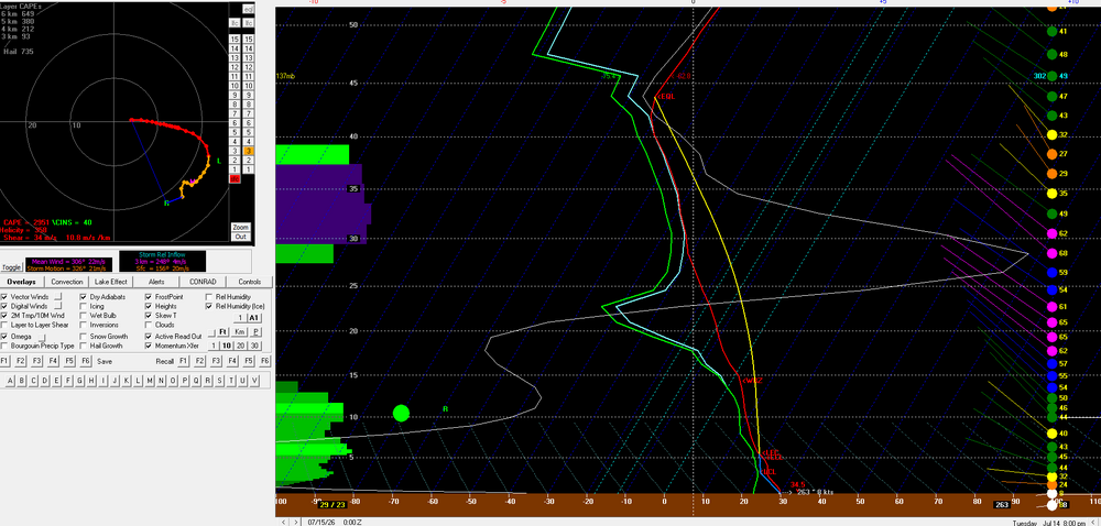
6z/13 NAM bufkit for BTV. About as impressive as an environment as you'll see around here out ahead of storms
-
-
Records: Highs: EWR: 100 (1966) NYC: 101 (1966) LGA: 99 (1966) JFK: 94 (1992) Lows: EWR: 57 (1940) NYC: 54 (1888) LGA: 58 (1990) JFK: 58 (1990) Historical: 1895 - A tornado struck Cherry Hill in New Jersey causing fifty thousand dollars damage. It also descended into the Harlem and Woodhaven areas of New York City killing one person, and finally ended as a waterspout in Jamaica Bay. (David Ludlum) 1922: The mercury hit 134 °F at Greenland Ranch in Death Valley, CA on July 10, 1913 the hottest reading of record for the World. The old world record has been revoked. Sandstorm conditions accompanied the heat. The high the previous day was 129° following a morning low of 93 degrees. The previous world record of 136 °F at El Azizia, Libya has been revoked The World Meteorological Organization (WMO)committee concluded that "the most compelling scenario for the July 13,1922 event was that a new and inexperienced observer, not trained in the use of an unsuitable replacement instrument that could be easily misread, improperly recorded the observation and was consequently in error by about seven degrees Celsius." Death Valley is now the Earth's Highest Temperature Record 1936: Mio, Michigan : The highest temperature ever recorded in Michigan: 112 °F. Dells, Wisconsin : The highest temperature ever recorded in Wisconsin : 114 °F. (Ref. Lowest and Highest Temperatures for the 50 States) (Ref. Additional Temperatures Listed On This Link) 1951: Rivers across eastern Kansas crest well above flood stage, causing the most significant destruction from flooding in the Midwestern United States at that time. Five-hundred-thousand people were left homeless, and 24 people died in the disaster. Click HERE for more information from the History Channel. 1964: Clouds, rain and a cool northeast wind holds the high temperatures in the upper 50s to mid 60s across West Michigan. The high of 59° at Grand Rapids, MI was only the second time in over a hundred years of record that the temperature did not reach 60° on a July day. Early morning lows dropped in ot the lower and middle 30’s across parts of the northern Plains. (Ref. Wilson Wx. History) 1975 - Dover, DE, was deluged with 8.50 inches of rain to establish a 24 hour record for the state. (The Weather Channel) 1977 - Lightning struck a key electrical transmission line in Westchester County of southeastern New York State plunging New York City into darkness. (David Ludlum) 1980 - Afternoon highs of 108 degrees at Memphis, TN, 108 degrees at Macon, GA, and 105 degrees at Atlanta, GA, established all-time records for those three cities. The high of 110 degrees at Newington, GA, was just two degrees shy of the state record. (The Weather Channel) 1982: Lightning struck a woman in Chesterfield County, VA . She was sitting on a metal swing set in her back yard, and though she could hear thunder, she did not go indoors. She heard a loud noise and felt pain. Lightning struck the swing set and traveled through her body to the ground. Her shoes were blown off her feet and she received burns on her back and legs. (Ref. Lightning - Virginia Weather History) 1987 - Unseasonably cool weather prevailed across the Midwest. Ten cities reported record low temperatures for the date, including Casper, WY, with a reading of 39 degrees. By way of contrast, record heat was reported in the eastern U.S., with highs of 93 degrees at Burlington, VT, and 101 degrees around Miami, FL. (The National Weather Summary) 1988 - There were just three reports of severe weather across the country, and just one record high temperature reported. Thunderstorms brought much needed rains to the Tennessee Valley area, producing nine inches at Senatobia, MS. (The National Weather Summary) 1989 - A thunderstorm at Albany, GA, produced 1.40 inches of rain in forty minutes, along with wind gusts to 82 mph. Afternoon highs of 98 degrees at Corpus Christi, TX, 110 degrees at Tucson, AZ, and 114 degrees at Phoenix, AZ, equalled records for the date. Greenwood, MS, reported 55.65 inches of precipitation for the year, twice the amount normally received by mid July. (Storm Data) (The National Weather Summary) 1993: Heavy rains of 3 to 5 inches in an hour caused flooding of streets and roads at Dodge City, KS. Standing water of one and a half to two feet was reported in southwestern Dodge City. In south central Kansas, heavy rains in Kiowa County caused widespread flooding and as much as 8 inches of rain was reported in portions of the county. The Rattlesnake Creek was out of its banks throughout the county and was reported to be as wide as five miles near the Edwards county line. Railroad tracks were washed out south of Kiowa County Lake. The water subsided around 5 AM the next day. Major flooding on the Mississippi River produced a record river crest at Quincy, IL of 32.3 feet; eclipsing the old record of 28.9 feet set in April 1973. At mid-month, only 5 of 28 bridges that cross the river into Illinois were open. (Ref. Wilson Wx. History) 1995: Many daily record high temperatures and three all time record highs were recorded as the deadly July 1995 heat wave continued unabated from the Midwest to the Atlantic coast. All time highs set included: Genoa, WI: 109°, Milwaukee, WI: 108°, La Crosse, WI: tied at 108°, Chicago, IL: 106°, Necedah, WI: 104°, Trempealeau, WI: 103°, Decorah, IA: 102° and Guttenberg, IA: 102°. Heat indices soared to well over 120° in many areas and close to 130° at Chicago, IL & Cedar Rapids, IA as dew point temperatures were in the upper 70’s to low 80’s. 553 people died in Chicago alone from the heat. (Ref. Wilson Wx. History) 1996: Annandale Weather Center had 2.11 inches rain in 24 hours from Hurricane Bertha. (Ref. Annandale Weather Records - KRIC)(Ref. More information about Hurricane Bertha) 2002: Winds up to 80 mph swept through Kingman, AZ damaged or destroyed dozens of homes. Four people were also injured from flying debris. In Chloride, winds were estimated at 100 mph which caused significant damage. (Ref. Wilson Wx. History) 2004: A violent tornado quickly developed across Woodford County, Illinois during the mid afternoon. This tornado was at F4 intensity as it demolished a manufacturing plant four miles west of Roanoke. Although 140 people were inside at the time, all escaped injury by reaching storm shelters a few minutes before the tornado's arrival. Steel beams and metal siding from the plant were found approximately three quarters of a mile east in a farm field. (Ref. Wilson Wx. History) 2008: A streak of 24 consecutive days (ending August 5th) of 90° or higher began on this date at Denver, CO. This shattered their previous record of 18 days established in 1901 and 1974. (Ref. Wilson Wx. History)