All Activity
- Past hour
-
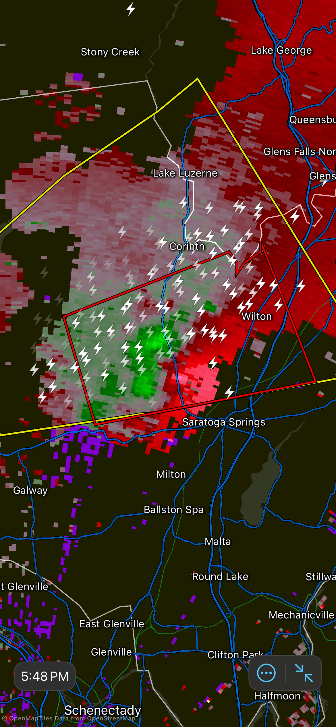
Kind of evolving into a slow moving MCV. A decently strong but also broad mesocyclone aloft.
-
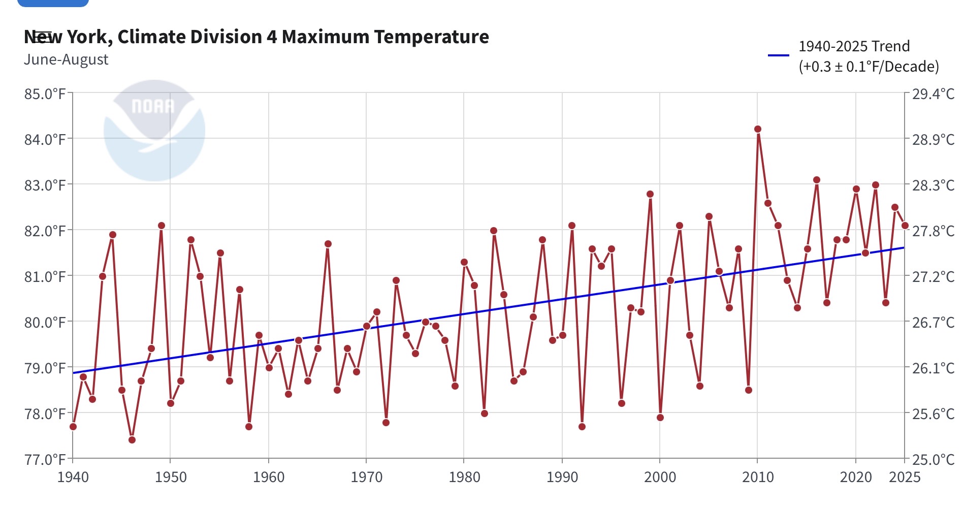
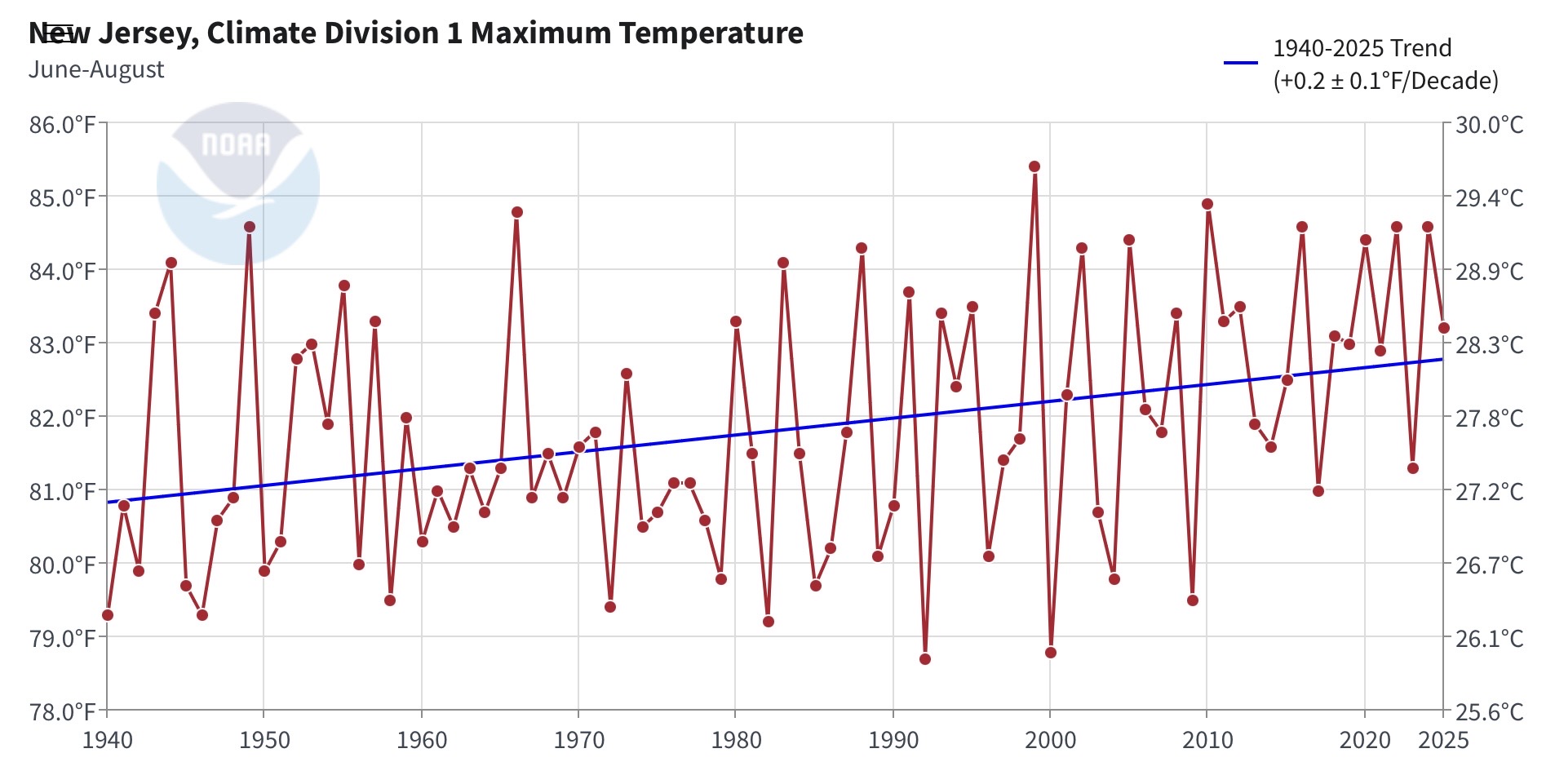
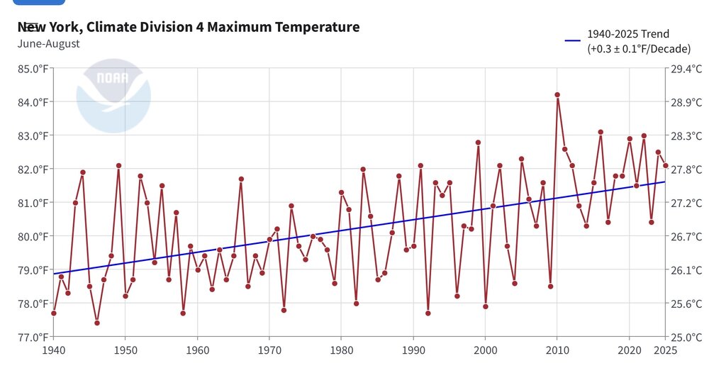
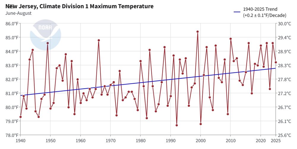
I think what you have been noticing is that the high temperatures during coolest summers each decade back to the 1940s are rising more rapidly than the warmest ones. Notice how we haven’t had any cooler summers after 2010 like we regularly got through 2009. Most of the record heat since 2010 during the summers has occurred in June and July. Maybe the late August into early September record heat of the 1940s into 1950s was a function of the late summer droughts from the Plains into the East.
-
That storm has been eating very well, I can tell you that much. Starting to cross the mountains now.
-
It's looks like you're about to get a slow moving beast. I'm a little jealous! Enjoy!
-

E PA/NJ/DE Summer 2026 Obs/Discussion
JTA66 replied to PhiEaglesfan712's topic in Philadelphia Region
2.40” -
Sounds like a war zone on the other side of the Catoctin’s lol
-
Classic rain shield performance. Pure classic.
-
 More details can be found at http://www.medguideusa.com/guide/cytotec/ - Cytotec guide to avoid side effects.
 -
Noisy storm, but it’s having a helluva time making it over the hills of Catoctin.
-
Thanks. Maybe not a valid comparison though, particularly in recent times, given the warming oceans. Seems logical it would be more difficult to achieve anomalous cold of the same magnitude during a La Nina.
-
Showers and thunderstorms are likely into early tonight. Some areas could still see flooding downpours. Following the frontal passage, tomorrow through Monday will see highs reach the upper 70s and lower 80s. It could turn somewhat warmer to end August and start September. However, no excessive heat appears likely through the remainder of August and into the opening days of September. The ENSO Region 1+2 anomaly was +4.0°C and the Region 3.4 anomaly was +2.6°C for the week centered around August 19. For the past six weeks, the ENSO Region 1+2 anomaly has averaged +3.87°C and the ENSO Region 3.4 anomaly has averaged +2.43°C. The ongoing strong El Niño, which has reached super El Niño threshold, will continue to strengthen through the summer. The SOI was -9.83 today. The preliminary Arctic Oscillation (AO) was -0.553 today. Based on sensitivity analysis applied to the latest guidance, there is an implied near 50% probability that New York City will have a cooler than normal August (1991-2020 normal). August will likely finish with a mean temperature near 76.1° (near normal). Supplemental Information: The projected mean would be 0.9° above the 1981-2010 normal monthly value.
-
Storms fired early today around 11 30 AM, picked up 1.02'' from a localized cell. Gets me over 6'' for the month.
-
I see a report of quarter sized hail from a spotter as well as utility wires downed
-
If you go onto 511WV and click on the I-81 cameras in and around Martinsburg, you can actually see the hail/rain falling.
-

Augdewst 2026: Summer's Last Stand
OrangeCTWX replied to Prismshine Productions's topic in New England
At least Saratoga area seems to be having some fun.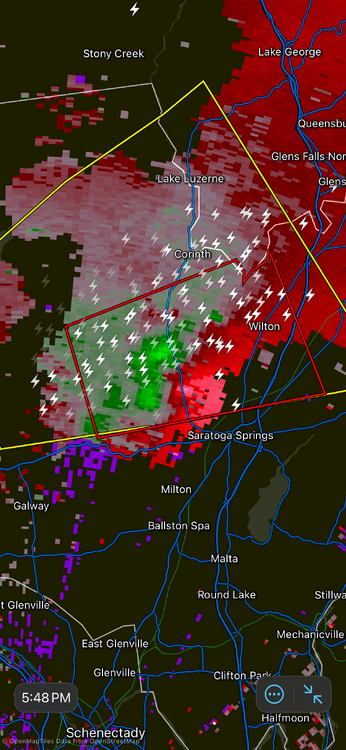
-
There's a lot of reports down near Harrisonburg
-
Finally getting that Martinsburg blob IMBY
-
Even a blind squirrel finds a nut every now and then...
-
No but they love heat. Just look at where the greatest growth and movement of people is happening, to warmer climates. This can be explained if you look at where humans came from-- Africa. So we are naturally attuned to a hotter climate. Most of the die offs our species has had were associated with ice ages not heat. If you asked people to chose where to live strictly based on weather most people would pick hot summer over cold winter every time. They just don't want to pay excessive heating bills. Look at it this way the warmer the winter is the less the amount of fossil fuels that will be used. This summer was not hot not on the level of the truly historic summers I often reference. Speaking of death traps the highest number of heat related deaths happened in years like 1980 and 1995. We really have not had that kind of widespread coast to coast heat that lasts for months since then. Flooding is far more of a concern now. I think next year we will see that kind of heat though and hopefully not the deaths or the smoke. I hate to say this but the forests need to be trimmed back.
-
Martinsburg?
-
Trust me I’m already jealous.
-
I'd like to see what kind of pattern we had in late August 1948 and late August and early September 1953 with the kind of late season heat that hasn't been matched since. Speaking of hot August weather that was some real multi-day triple digit heat! If those patterns happened now what would the temperatures be? As far as el nino heat is concerned how does this summer compare to 1991, 1994 and 2002, those are my benchmark summers for el nino heat. There is some speculation that the type of heat we had between 1944 and 1955 and 1966 which really has not been matched since had to do with nuke testing, specifically hydrogen bomb testing.
-
She was under the worst core. Practically ground zero for rain/hail. Have her send a video so you can post it here later and we all be jealous of her.
-
I guess it's official. Within 30 days all federal agencies must refer to Lake Ontario as Lake America. I would assume the NWS and NOSS must follow this rule. Any employee that disregards it I would also assume could or would be fired. More stupidity and confusion for the public.
-
Star Trek terminology. Collected all of 0.04" over the last two hours...there is some rogue thunder and lightning in eastern Queens but failing to amount to much here. Even saw a patch of blue sky to the north and east around 1700.