All Activity
- Past hour
-
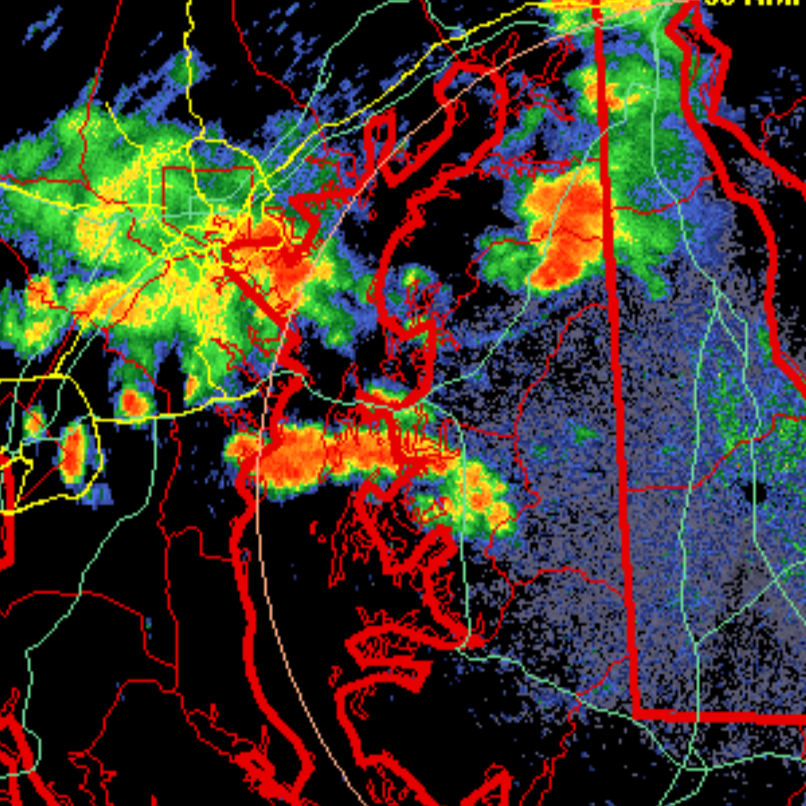
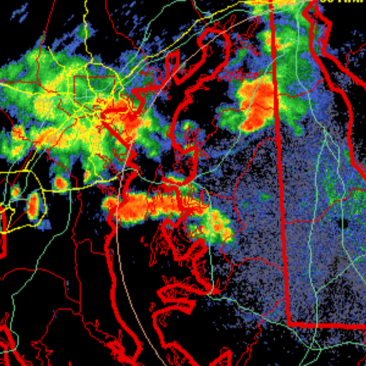
Still in the zone of nothingness lol. Ridgely getting crushed 3 miles to my SW. That back edge to the NW is gonna have to do it.
-
Kind of looks like it. Lots of thunder. We shall see.
-
YOUNG getting hammered. Starting pitching and lousy D gonna limit this team. And please, get Kevin and Ben back in the booth.
-
Looks like something is headed your way
-
Who knows?? As a wise wolf once said "nobody knows"
-
 Paul, you are correct that the magnitude of the adjustment is inferred, but not well documented in the sense that is has been verified by field measurements. This is how PHA works, and this is the data we have. Ideally all station moves should include a multi-year parallel observation period, where observation are made at both the old site and the new site to find the actual temperature difference. Here are two studies on that topic Valk, T., et al. (2023). "Homogenization of daily temperatures using covariates and statistical learning — The case of parallel measurements." International Journal of Climatology. Four Dutch KNMI stations (Den Helder/De Kooy, Groningen/Eelde, Vlissingen/Souburg, Maastricht/Beek) relocated from city to airport sites with true overlapping parallel measurements at old and new sites; used to build and test a statistical method against the directly-measured offset. Vincent, L.A., et al. (2018). "Uncertainty in homogenized daily temperatures and derived indices of extremes illustrated using parallel observations in Canada." International Journal of Climatology. 88 site pairs across the Canadian network with 5-year parallel observation periods, used to quantify how much uncertainty homogenization introduces relative to real, directly-measured ground truth. But, Berkeley Earth Surface Temperature's approach does not work like PHA. The magnitude of the temperature shift that BEST finds for a station moves is a byproduct--not an objective.
 -

2026 Spring/Summer Mountain Thread
Maggie Valley Steve replied to Buckethead's topic in Southeastern States
I have a mess to clean up tomorrow with the large limbs and branches down, but I never lost power. Crazy lightning/thunder still ongoing, but the worst is over here -

Central PA Summer 2026 Discussion/Obs Thread
mahantango#1 replied to Voyager's topic in Upstate New York/Pennsylvania
. 35 rain here this afternoon. -

Augdewst 2026: Summer's Last Stand
ineedsnow replied to Prismshine Productions's topic in New England
slowly getting there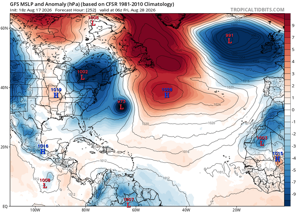
-
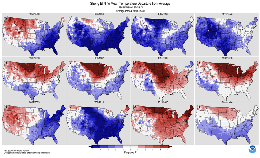
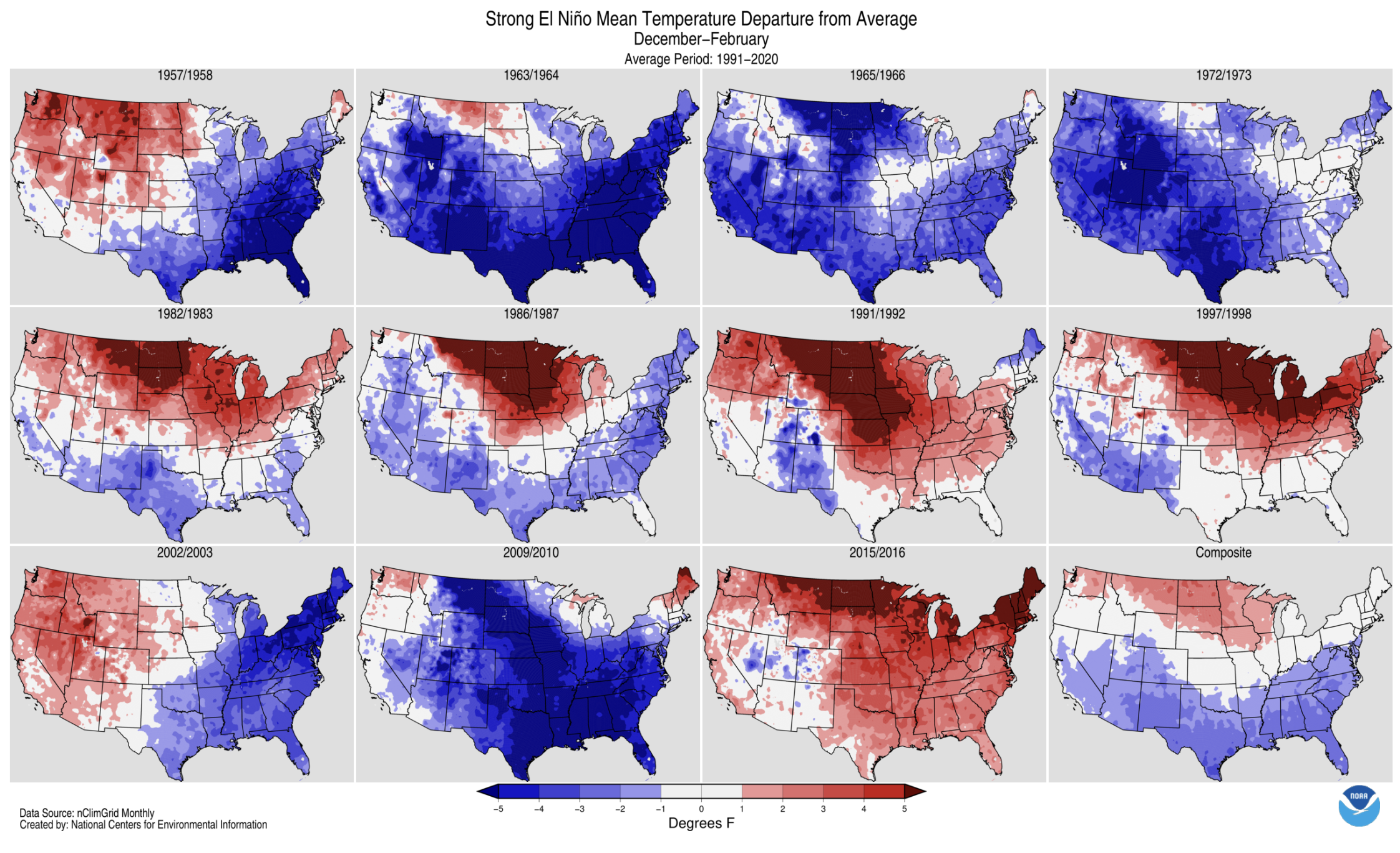
Perhaps the 82-83, 97-98, and 15-16 outcomes were the result chance and a small population set, rather than us saying goodbye to winter... Lots of different players on the field, keep the faith!
-
.89" for the week here. .71" for DEN.
-
Wow, hope everything is OK. Storms rolled in here in Asheville with some strong winds but not as bad as what hit you.
-
About 0.15”. So more than yesterday lol. But still got split in a few directions.
-
A few spots could see an evening shower or thundershower. Most of the region will remain dry. Tomorrow and Wednesday should mainly fair and warm. Highs will likely reach the middle 80s to perhaps upper 80s across the region. Another cold front could bring some showers or thundershowers to the region Wednesday night or Thursday. The frontal passage will be followed by a reinforcing shot of cooler air. Thursday and Friday could see highs in the lower 80s. The weekend could feature cool and perhaps unsettled weather. The ENSO Region 1+2 anomaly was +4.0°C and the Region 3.4 anomaly was +2.7°C for the week centered around August 12. For the past six weeks, the ENSO Region 1+2 anomaly has averaged +3.80°C and the ENSO Region 3.4 anomaly has averaged +2.32°C. The ongoing strong El Niño, which has reached super El Niño threshold, will continue to strengthen through the summer. The SOI was -18.45 today. The preliminary Arctic Oscillation (AO) was -0.064 today. Based on sensitivity analysis applied to the latest guidance, there is an implied near 50% probability that New York City will have a warmer than normal August (1991-2020 normal). August will likely finish with a mean temperature near 76.1° (near normal). Supplemental Information: The projected mean would be 0.9° above the 1981-2010 normal monthly value.
-
Still can't get to 99 but oh so close. High of 98.4 today. Currently just before 7 pm it is 95/82 for a feels like of 118. Brutal out there.
-

Augdewst 2026: Summer's Last Stand
CoastalWx replied to Prismshine Productions's topic in New England
Bingo -
Had a narrow but intense line move through here earlier. Dropped 0.96" in about 45 minutes. High was only 78 but still felt like Florida. I've had 8 of my in-laws from Ecuador visiting for the last 2 weeks and they're like "does it always rain this much" and I'm like nope...you guys just got lucky.
-
Augdewst 2026: Summer's Last Stand
CoastalWx replied to Prismshine Productions's topic in New England
I feel like I know how to analyze the NAM (both 3km and 12km). The RRFS just seems unstable run to run. Version 2.0 is better and it’s on platforms like Weatherfront for example. -

Augdewst 2026: Summer's Last Stand
dendrite replied to Prismshine Productions's topic in New England
I actually thought the 3k did a good job most of the time…especially if the synoptics were being handled relatively well by most models. I had little to no use for the 12k. But at least we had a lot of experience with the nam and when to use it as guidance. I’m not a fan of trying to learn a new model with a (pun intended) rotten core. -
FCC had an inch: https://mesonet.umd.edu/station?stid=MDMSNT-45. I think that’s probably in line with what I received.
-
2026 Spring/Summer Mountain Thread
Maggie Valley Steve replied to Buckethead's topic in Southeastern States
Big time severe storm just hit. Lots of damaging wind gusts exceeding 50 mph. Lot of large limbs down all around the house and I heard and felt trees coming down above the house. -
Lots of normies talking about the perfect weather today
-
The usual lol
- Today
-
I love the vintage Accord. A survivor.
-

Augdewst 2026: Summer's Last Stand
vortex95 replied to Prismshine Productions's topic in New England
But it still better than the NAM! Geez, the 3km NAM same res as the RRFS and look at what the 3 km NAM does. Talk about overdoing convection and QPF in general. That's the "garbage model." I avoid it! RRFS can actually show mesocyclones and local low pressure from intense supercells.











.thumb.JPG.418e8a9a2902ae687ec35ff4bc0e038e.JPG)