All Activity
- Past hour
-
82 here, pretty humid.
-
Fantasy Land GFS today has a buzzsaw at 928 going through Cuba and up the east Florida coast.
-

E PA/NJ/DE Autumn 2026 Obs/Discussion
Mikeymac5306 replied to PhiEaglesfan712's topic in Philadelphia Region
Something to keep an eye on albeit fantasy land GFS has been consistently throwing a hurricane through the Caribbean into Florida last three days. The 12Z today has a 928 buzzsawing through Cuba the up the east side of Florida. -

Septorcher 2026 Discussion - Endless Summer
Brian5671 replied to Damage In Tolland's topic in New England
AC back on today and tomorrow-maybe done for season after this-looks cool Sat into next week -

2026 Atlantic Hurricane Season
A-L-E-K replied to Stormchaserchuck1's topic in Tropical Headquarters
-

Septorcher 2026 Discussion - Endless Summer
weatherwiz replied to Damage In Tolland's topic in New England
I'll say...it was very weird last week wearing a Pats jersey on the couch while wearing shorts and not jeans. Will be even more weird on September 29 if I'm wearing a Bruins jersey with shorts. In fact, depending on which jersey I'm wearing I may not even need pants because a few of them are game replicas so on the longer side. -

Septorcher 2026 Discussion - Endless Summer
40/70 Benchmark replied to Damage In Tolland's topic in New England
Yes...this weekend is when I consider summer, and 80s over. -
Made it up to 84 before the clouds arrived
-
I'm kind of fine with punting December. We haven't really had much cold and snow the past few years anyway in that month. Granted, I don't want 70s... but it seems as many knowledgeable posters have stated across the numerous threads... December is gone
-

Septorcher 2026 Discussion - Endless Summer
Typhoon Tip replied to Damage In Tolland's topic in New England
That's going to go bye-bye over the weekend. Pretty good early cold in mid/N Ontario scooting into the Maritime of Canada, and the big polar high associated goes over-top our latitude Sunday. Coolest look we've seen since spring Thickness are below 560 much more convincingly for a couple days early next week. We'll bounce back, but at the continental scale this appears to be a kind of first step in seasonality, although it looks more pattern specific. Still, it is nearing the Equinox so some sort of 'step down' isn't outlandish. Doesn't mean we wont get a warm humid but the 570s ambience might be done until next spring. -
2026-2027 Record-breaking El Nino
40/70 Benchmark replied to Stormchaserchuck1's topic in Weather Forecasting and Discussion
Yea, I used that chart in my last blog....likely explains the continuation of the warm pool east of Japan. -

Septorcher 2026 Discussion - Endless Summer
Damage In Tolland replied to Damage In Tolland's topic in New England
Dews near or over 70 out there. Feels awesome . Endless summer rolls on -

Septorcher 2026 Discussion - Endless Summer
Snowedin replied to Damage In Tolland's topic in New England
A little sticky but pleasant out there to start today..been clearing out some old brush in the back and it def has that summery feel to the air which is nice when everyone and their grandma seems to be ready to close the books on this precious season. Gotta enjoy it while we still can. -
Last September we had <0.50" for the whole month, so this year is much wetter. Sitting at 2.76 for the month already here.
-
Been such a snoozer up my way for the longest time.
-

Central PA Summer 2026 Discussion/Obs Thread
canderson replied to Voyager's topic in Upstate New York/Pennsylvania
.25” rain this morning. Very very nice. Next week looks incredible!!! -
we're gonna be doing a lot of torching this winter
- Today
-
2026-2027 Record-breaking El Nino
Typhoon Tip replied to Stormchaserchuck1's topic in Weather Forecasting and Discussion
AAM is an abbreviation for Atmospheric Angular Momentum try searing on the full text instead of AAM - -

2026-2027 Record-breaking El Nino
LakePaste25 replied to Stormchaserchuck1's topic in Weather Forecasting and Discussion
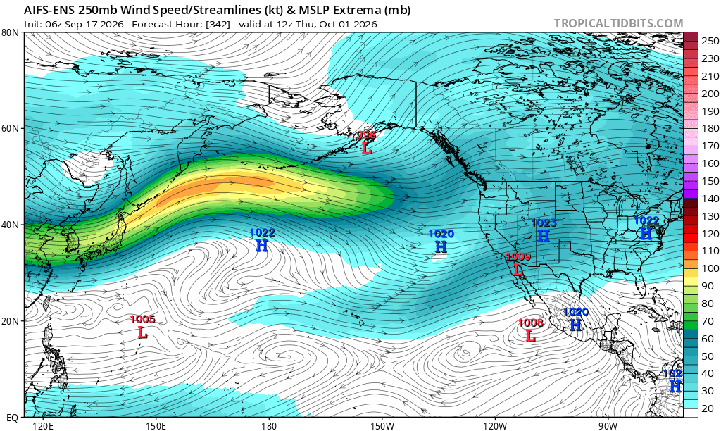
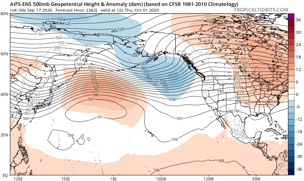
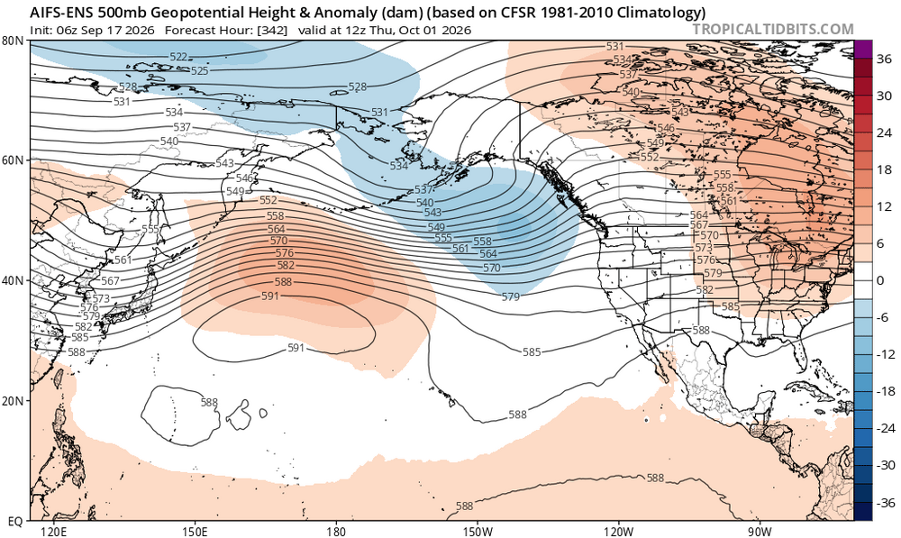
You can tell we are slowly getting to that warm ENSO state. Plenty of +U in the NH. Still some residual ridging out west of the Aleutians but even that’s weakening and probably flattens out with time.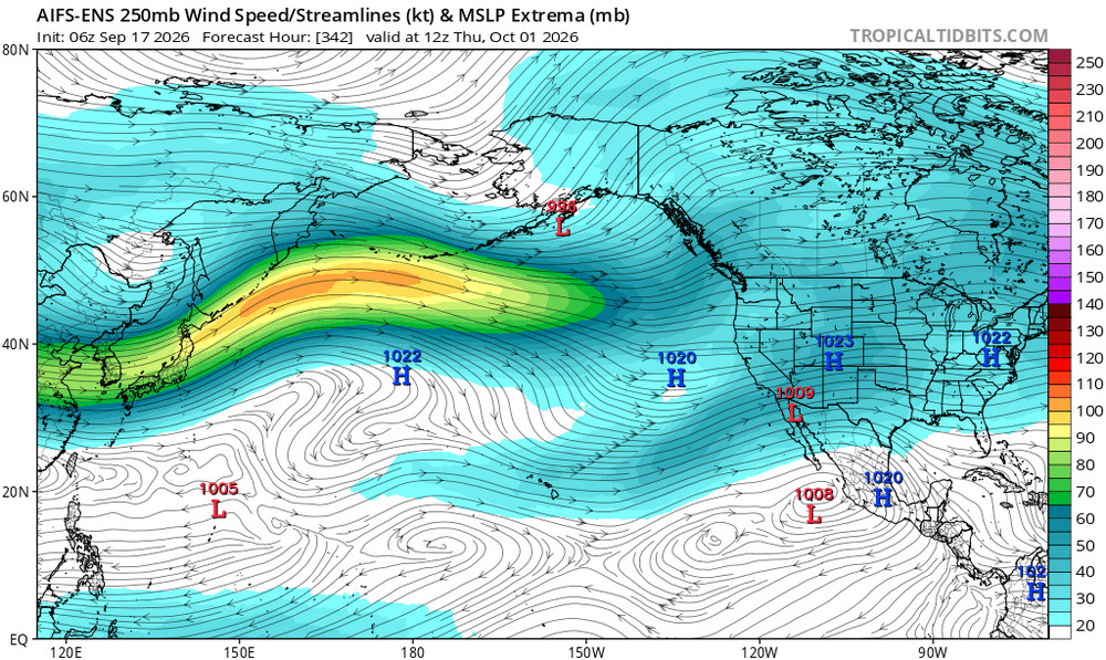
-
Fall 2026 Medium/Long Range Pattern Thread
Daniel Boone replied to John1122's topic in Tennessee Valley
It's the big Heat Dome that plagued the Southern Plains all Summer. Question is, will it finally dissolve, shift Eastward out into the Atlantic, become a Bermuda High, weaken then rebound etc.. The back Westward shift.is unlikely as the STJ should barrel into the SW. Come Winter, if there's any semblance of this Feature,whether stll alive(low odds) or ressurrected, it could have quite an effect, especially if it becomes formidable then. IF it were to it would probably setup in the SW Atlantic due to the STJ forcing. Where out there would determine our Pattern Outcome; out by the Sargasso Sea would be great if you want Snow. Further West mild and probably wet. -
Warm/dry, cold/wet?
-

2026-2027 Record-breaking El Nino
Winter Wizard replied to Stormchaserchuck1's topic in Weather Forecasting and Discussion
An interesting thing about the GLAAM is that when it's plotted on a latitudinal basis, it's actually shown to be strongly in the negative direction around the mid-latitudes. It almost looks like a glitch but it has been moderately to strongly negative at various other points since July. Perhaps some interference somewhere? -
BAM is anticipating an Omega block to form next week. https://x.com/bam_weather/status/2100011954584617218
-
That's pretty typical in the warmer months, though, right? That said, this has been one of the most humid summers that I can recall...certainly since those legendary summers of 2017 and 2018. What we're really missing are those southern storms or even tropical remnants, but the overall base state airmass since spring implies we may get more of those this year.
-
Showers and storms a bit early?