All Activity
- Past hour
-
lol Knicks
-
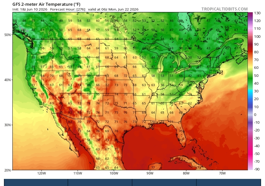
Todays HRRR modeled today’s convection pretty good and it has all of western lower MI under the gun tomorrow evening. The caveat is it’s Michigan. The strength of the low might have a lot more of influence. It’s more of a spring-like system with better wind fields than you typically see in the summer. Stronger mid-level westerlies may shunt the leftover debris east and keep mid-level lapse rates steep. But, it’s Michigan, so who knows.
-

Late May/June 2026 Medium/Long Range
Stormchaserchuck1 replied to JenkinsJinkies's topic in Mid Atlantic
Another severe wx pattern setting up, ahead of a strong trough -

2026-2027 Super El Nino
BuffaloWeather replied to Stormchaserchuck1's topic in Weather Forecasting and Discussion
It only takes 1 storm to make a winter for the big cities and lake effect country. The rest of the area is screwed this upcoming winter. 15/16 was my lowest snowfall total year since I've been measuring here in Hamburg for the last 13. Right around 80" -
A/C is on tonight. 70/70 with fog and mist. Feels tropical out there.
-
0.43" Not bad. Need a lot more.
-
0.15” on the day
- Today
-
Yeah not surprised by the zero rain today.
-
I watered my vegetable garden this afternoon because I figured the northern part of the line would fall apart. No luck today as expected, but hopefully better luck tomorrow or Friday.
-
Was he really warm last winter? Any seasonal forecaster will bust badly from time to time if they are being honest. I've honed my El Niño intensity composites today and will give the EMI ones a quick check before my next update later this month.
-
So much for the extended heatwave, but nice to have less humidity for a while.
-

Junorch obs and discussion 2026
CT Valley Snowman replied to Damage In Tolland's topic in New England
Stein of a month so far. Only about .10 -

2026-2027 Super El Nino
40/70 Benchmark replied to Stormchaserchuck1's topic in Weather Forecasting and Discussion
Raindance has intimated that it's shifting, as well...must be at least getting close. I do agree that the PDO will take a few, perhaps several, years longer. -
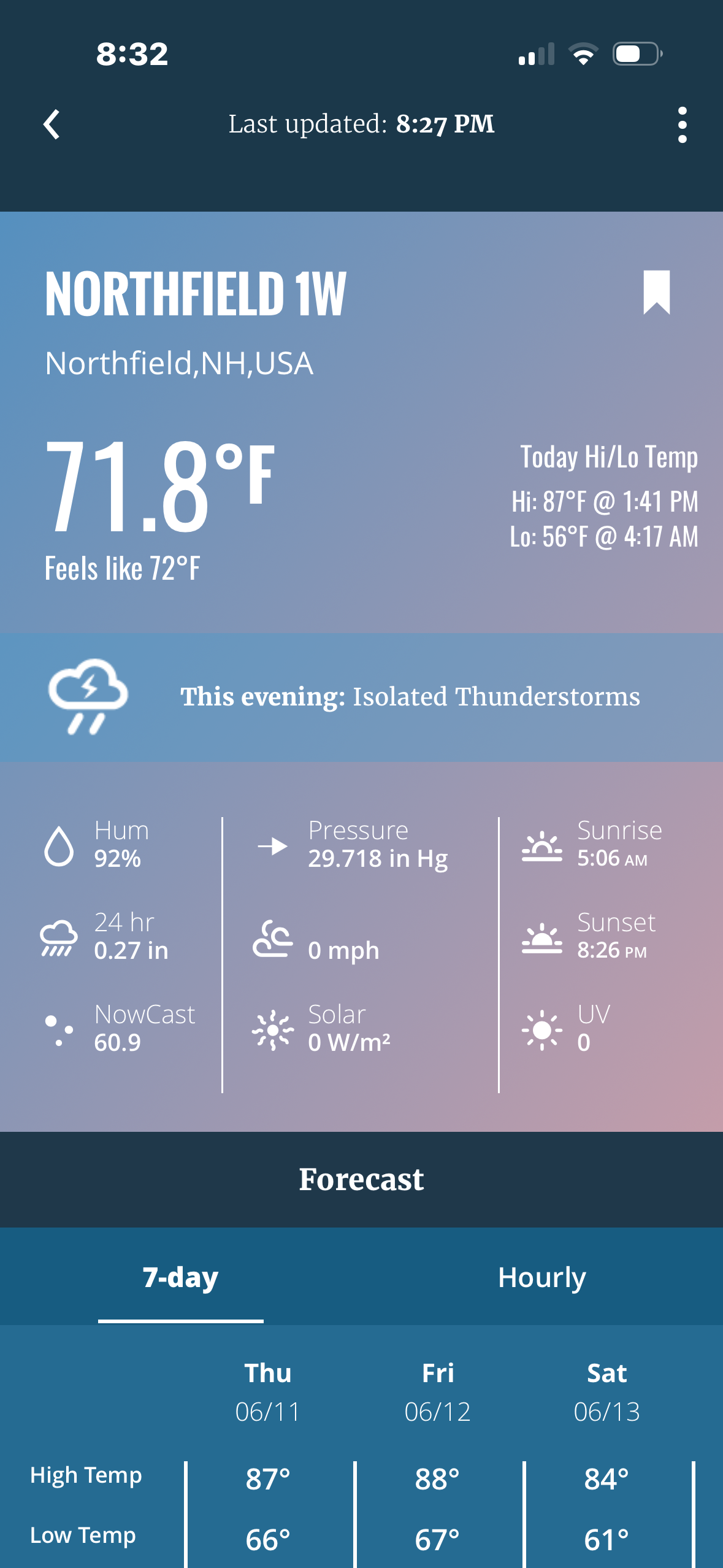
Today was one the first days where it felt downright hot, looks like one more hot day and possible severe tomorrow evening before another cool down.
-
Yeah it doesn't look too bad.
-
True, but hopefully things start to change as we exit August. We have seen rapid improvements in as little as 90 days during previous Fall seasons leading into Winter.
-
Flood headlines and flash drought over
-

Junorch obs and discussion 2026
Damage In Tolland replied to Damage In Tolland's topic in New England

-
But nice cool breeze here now, if it wasn’t slightly humid it would be another open window night of sleep
-
What’s the point of making a watch THIS close to the city but not going all the way? The line is heading in that general direction; they’ll just add it later
-
It often falls apart around Allentown and Scranton, as was the case today. That's what was noteworthy of the line on Saturday evening - that it actually held together, which has been uncommon in the current long term pattern.
-
Tons of power outages over here, but locally only had 30-40 mph gusts with about 5 minutes of heavy rain. No thunder here. Considering we were at 88/73° I’m surprised everything fell apart as it did. Eyes turn to the MCS over northern Missouri tonight. If that stays tame and south, tomorrow will be rocking around here. If it blows up and feeds off the nocturnal LLJ tonight and we end up with 2-3 hours of rain then tomorrow will end up a lot like today with more rotation embedded in the discrete cells.
-
Poor Patrick Ewing had to deal with the Bulls during his whole career lol.
-
Junorch obs and discussion 2026
Damage In Tolland replied to Damage In Tolland's topic in New England
Please remove the disagree . WTTY -
This.