All Activity
- Past hour
-
Yep.
-
Guy uses CPC probability forecasts. Fucking joke. Enjoy 84-88 with dews Saturday in this frigid pattern.
-
Funny because I thought the modeling looked warmer in the extended overnight…more signs of persistent ridging and fewer cold intrusions.
-
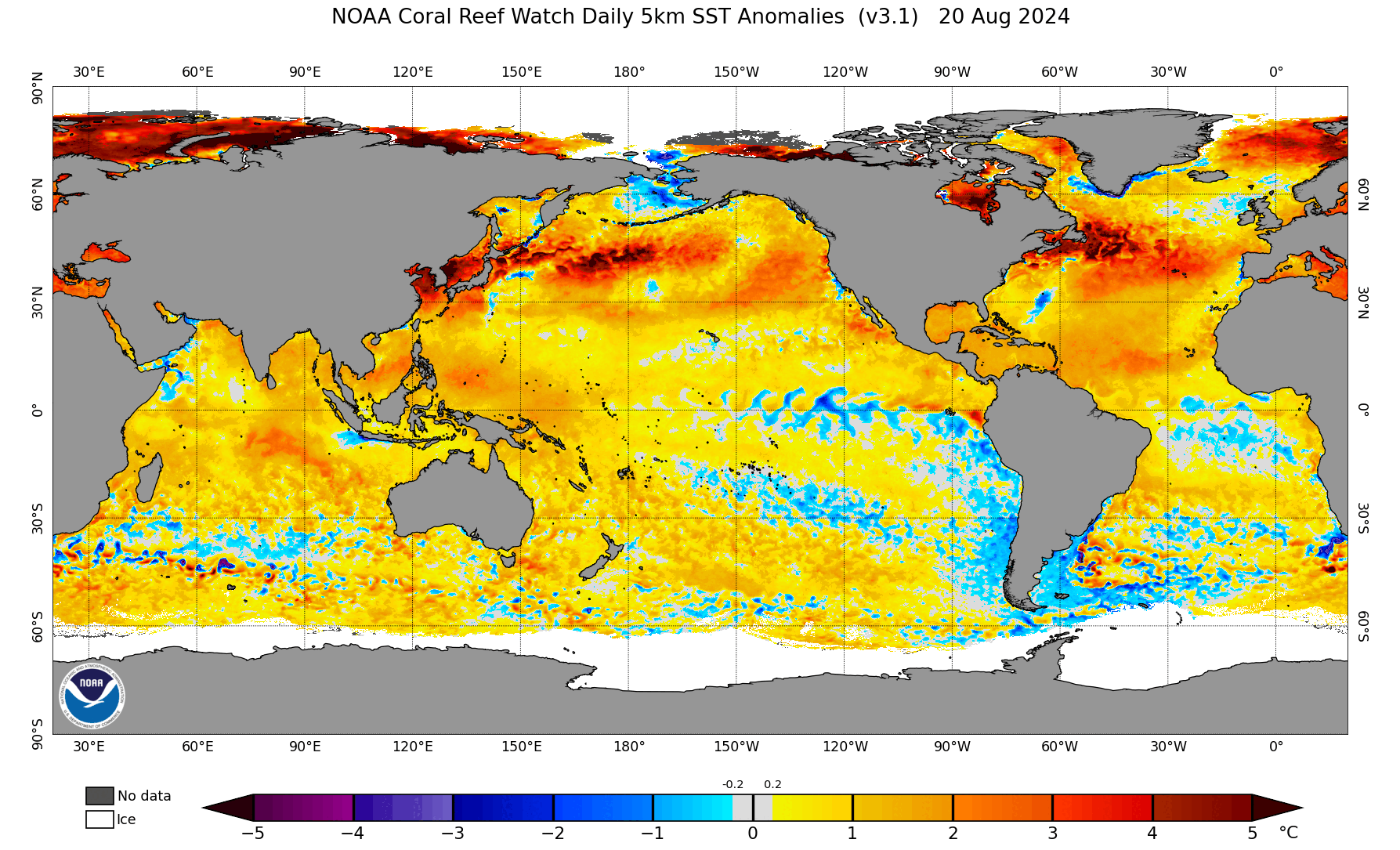
Enso anomalies reluctant to make any major moves in latest readings. The -.4 is 3.4. 27AUG2025 20.5-0.3 24.3-0.6 26.3-0.4 28.5-0.2
-
-
Erin left a heck of a cold wake across the nw Atlantic, while the ENSO regions have cooled dramatically past two weeks. How will this influence Atlantic hurricane activity this month, and what are the two areas I am watching besides the E. Atl system? I go into depth on the large-scale factors for the next few weeks including Sep analogs, while looking at the "elephant in the room" that is being largely ignored IMHO because most tropical enthusiasts are focusing on the East Atlantic system. https://hurricanehacker.substack.com/p/the-times-they-are-changin
-
49 degrees this morning. Looks like we are going to get a little fog.
-
53 for my Marysville low.
-
EPS look mild in the extended, def not a lot of action across the entire continent next couple weeks tho
-
Overall pattern doesn’t seem to support an east coast threat. It’s early still but this might be the first season in 6 years that the maritimes don’t get a direct hit or very close shave. Luck may have run out. Fun ride though.
-
Hell yeah somethings happening!

-

September 2025 OBS-Discussion centered NYC subforum
bluewave replied to wdrag's topic in New York City Metro
Looks like Friday into Saturday will be our next chance for 90° heat at the usual warm spots. Could be some scattered convection with the cold front. But should become cooler and drier into next week as Canadian high pressure dominates again.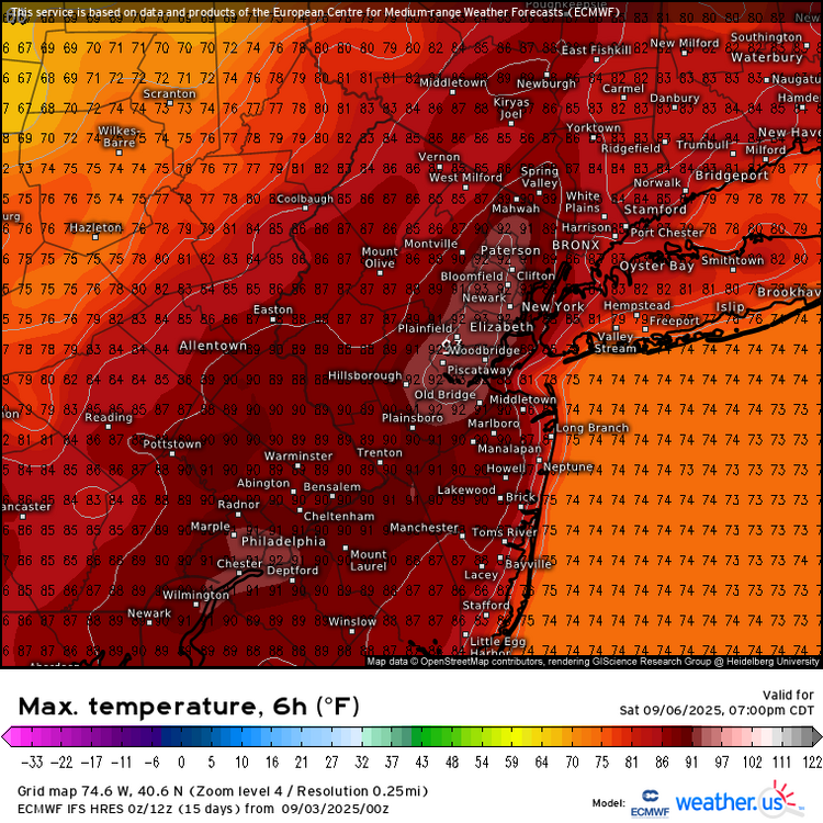

-
Models look stormy up here for Thursday. WBAL futurecast had a robust looking storm moving thru after 4pm.
- Today
-
First two consecutive years with a quiet Labor Day weekend following a Cat 5 hurricane.
-

Central PA Summer 2025
Mount Joy Snowman replied to Voyager's topic in Upstate New York/Pennsylvania
54 when I left the house, 50 through the rurals with some nice valley fog. -

2025-2026 ENSO
so_whats_happening replied to 40/70 Benchmark's topic in Weather Forecasting and Discussion
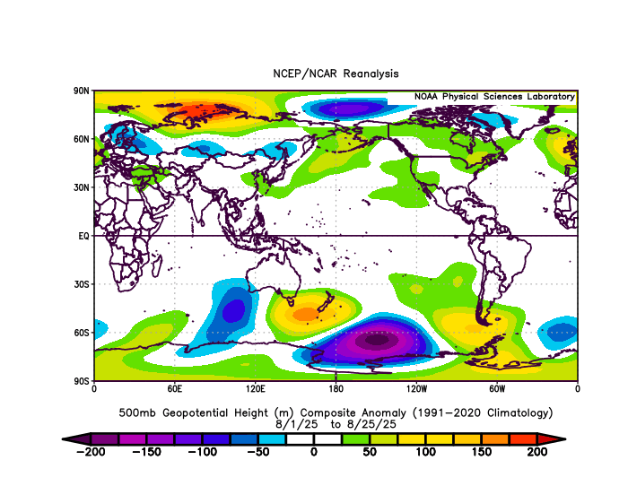
Lucky for you I have an anomaly map I saved from last year around this time. Im going to have to delete some images from earlier on this thread and last thread because im running out of space again. 400mb is a killer
-

September 2025 OBS-Discussion centered NYC subforum
donsutherland1 replied to wdrag's topic in New York City Metro
I saw that Lytton reached 40.0C. A large number of sites in BC exceeded 35C. Today, Lytton could surpass 40C. -
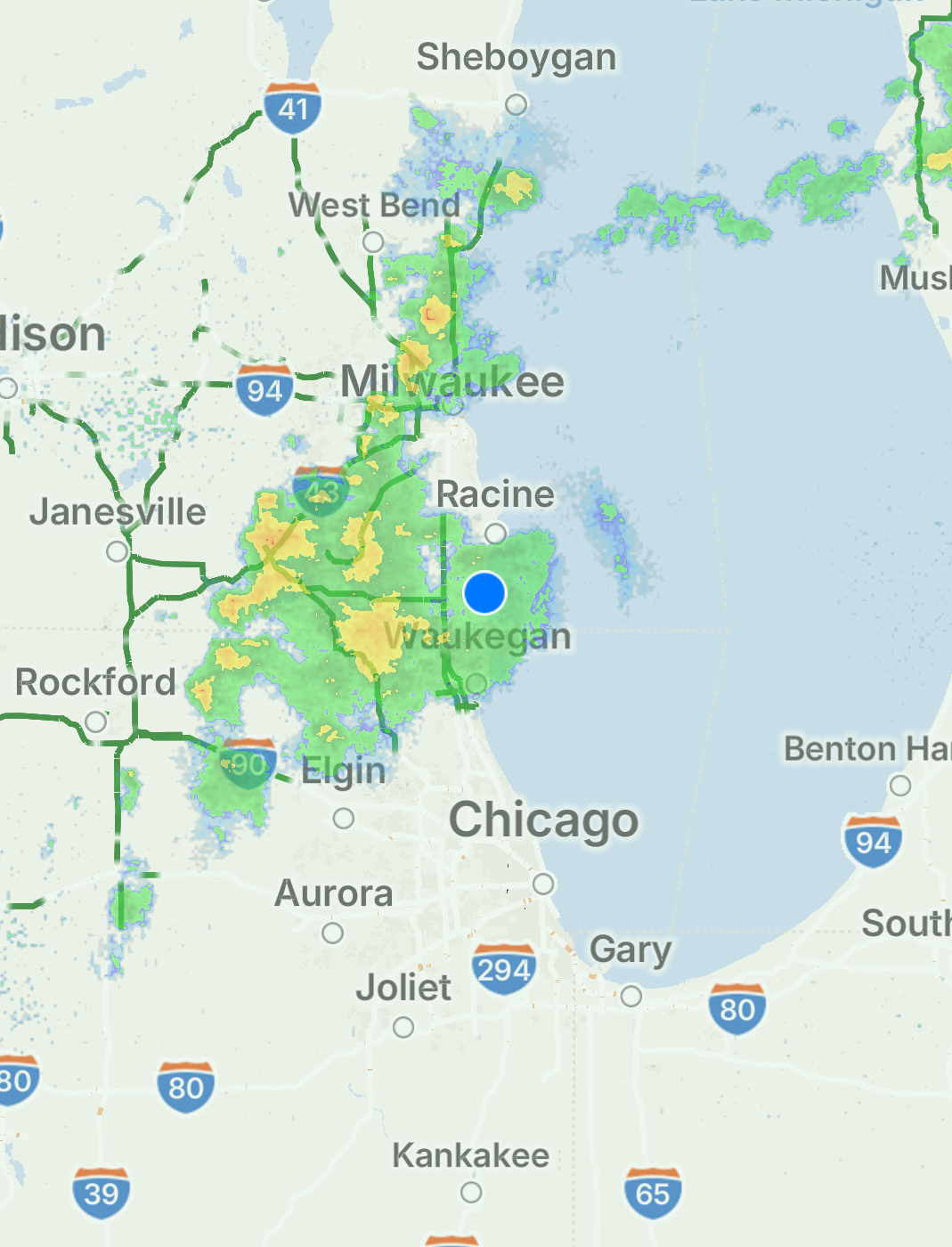
6z 3k NAM read your mind
-
Yes, should have phrased it different, “entrenched”, but definitely a difference from last year. I also noticed the change in storm track, by this time last year, the warm pool/marine heat wave around Japan was getting beat to hell with storm after storm, this year, not so much. It is going to take a lot to get any meaningful change out that way, the +11F SSTs aside, the subsurface is just as anomalous
-
2025-2026 ENSO
so_whats_happening replied to 40/70 Benchmark's topic in Weather Forecasting and Discussion
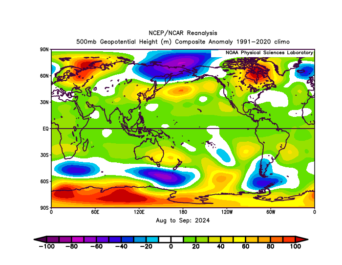
Never said it was going to warm back up only said the pattern is still well entrenched, but we are continuing to see changes occur (slowly). The storm track was much further north last year than this year. Here is the first 25 days of August last year and this year. (Can't get to the end of the month because it has not updated) Here is August and September last year storm track significantly further north and toward the Bering sea with a strong low.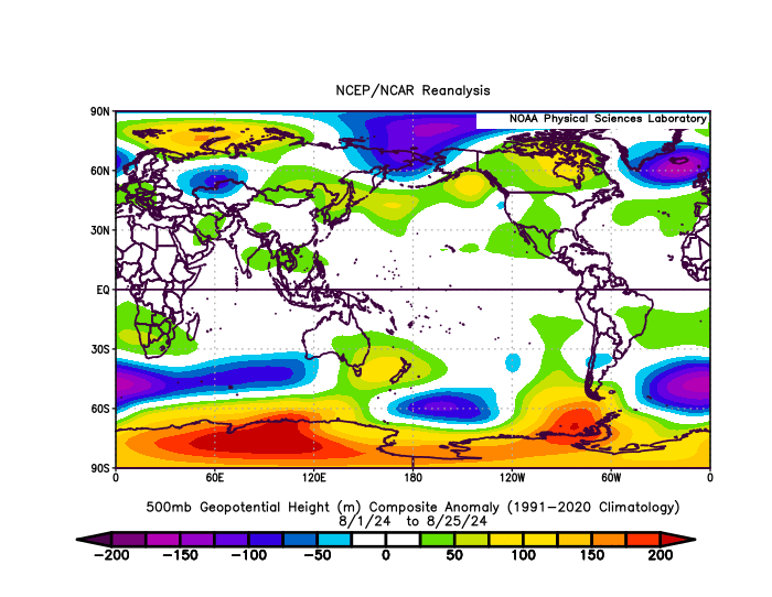
-
-
Last year there was a parade of storms, tropical and extratropical, this year, nothing. Like you said, that’s going to warm right back up quickly
-
Yes it was crazy hot here and will be for several more days. Also in eastern WA, Spokane had a record high of 99F (previous 97F 1988) and on the regional roundup it was 101 at CDA and 100 at Colville WA which is just south of my location. A lot of small fires in that area too, nothing really close to my location. Quite a lot of forest fire smoke developing across Alberta now from fires in the Rockies and north central BC. Some of that smoke could appear in parts of the central U.S. soon.
-
Very interesting video. I liked they way he went through his reasoning. Now we wait...