All Activity
- Past hour
-

2026-2027 Super El Nino
40/70 Benchmark replied to Stormchaserchuck1's topic in Weather Forecasting and Discussion
No way in hell this is going to be a cold winter in the mean for the NE...even 1957 and 1965 were near normal. -
2026-2027 Super El Nino
40/70 Benchmark replied to Stormchaserchuck1's topic in Weather Forecasting and Discussion
Yes. -

2026-2027 Super El Nino
LakePaste25 replied to Stormchaserchuck1's topic in Weather Forecasting and Discussion
PV aside, if we can shift that warm pool east it’ll allow for some brief periods of -EPO/+TNH during jet retractions. We missed out on that during ‘23-‘24 because W pac forcing instantly reverted us to the canonical Aleutian ridge La Niña pattern whenever the jet retracted. -
2026-2027 Super El Nino
40/70 Benchmark replied to Stormchaserchuck1's topic in Weather Forecasting and Discussion
I nailed it in 2016, though granted I was too cold and snowy. I have no issue with a big snow risk, but the cold that Europe site was selling is BS....maybe an arctic outbreak like Feb 2016, but not in the seasonal mean. -

-
Is it bad that I am already sipping on a bourbon?
-
It is a bit yes. I mean it could happen, but heavy snows in the deep south?? Even northern Florida? that's just ridiculous. Even more so in a strong El-Nino winter. Sure it will be cooler than normal and generally wet there, but not white.
-

2026-2027 Super El Nino
bluewave replied to Stormchaserchuck1's topic in Weather Forecasting and Discussion
While the warmth in the Northeast during super El Niño winters has been a main feature for us, the snowfall has been more variable. Would need SPV activity at least somewhat like 2015-2016 to at least make the snowfall a little more interesting than 1997-1998 and 2023-2024. But probably wouldn’t be able to forecast such a reversal until the winter is already underway. So not many people would be willing to include it in their seasonal forecasts with the warmer risks of such an extreme El Niño event that is developing. Plus not sure if we could go 3 winters in a row with such strong blocks like we had in February 2025 and the 2025-2026 winter at different intervals. 2015-2016 was a reversal of the record +NAO +AO pattern in 2014-2015 +AO. So may not be able to use it as a reasonable blocking analog. Very extreme NAO and AO reversals have become the norm since 2009-2010. https://agupubs.onlinelibrary.wiley.com/doi/full/10.1002/2016JD025288 In January 2016, Asia and North America experienced unusual cold temperatures, although the global average of surface air temperature broke the warmest record during a strong El Niño event. This was closely related to the remarkable phase transition of the Arctic Oscillation (AO), which can be explained by stratosphere-troposphere interactions. First, the quasi-biennial oscillation changed to its westerly phase in summer 2015 and the stratospheric polar vortex was stronger in early to midwinter 2015/2016. As blocking did not occur in December, the associated downward propagation signal resulted in a strongly positive AO in late December 2015. Second, after late December, the positive phase of Pacific-North America pattern became apparent in El Niño event, which strengthened the Aleutian anticyclone in the stratosphere. In addition, an equivalent barotropic (“blocking”) anticyclone was established in the troposphere over Asia. The coexistence of blocking over Asia and North America characterized the negative AO and a strong zonal wave number 2 pattern. Due to stronger zonal wave number 2 signals from the troposphere, the stronger stratospheric polar vortex was elongated, with two cyclonic centers over Asia and the North Atlantic in January. The resultant southward displacement of polar vortices was followed by rare snowfall in the subtropical region of East Asia and a heavy snowstorm on the East Coast of the United States. -
The water table barely broke the surface in my seasonal woodland wetland this Spring. Just some patches of "puddles" here and there. Normally it ends up an expansive area(an acre) of water a foot deep. Applying larvicide was an easy job.
-
countdown to more sunlight as well! Exciting
-
Holy wind
-
From several showers and a severe thunderstorm, I received ~1.75” yesterday. That put me then at ~3.80” MTD. I received more rain overnight of varying intensities and it’s still falling very lightly with constant rain since late last night. I’ll post the total for this later. It will be >0.5”. No more watering for at least awhile!
- Today
-
.39 here, but better than nothing. It is a beautiful day out there today! Glad that you guys cashed in.
-
2026-2027 Super El Nino
40/70 Benchmark replied to Stormchaserchuck1's topic in Weather Forecasting and Discussion
Grain of salt....this guy is kind of a weenie IMHO. https://www.severe-weather.eu/ -
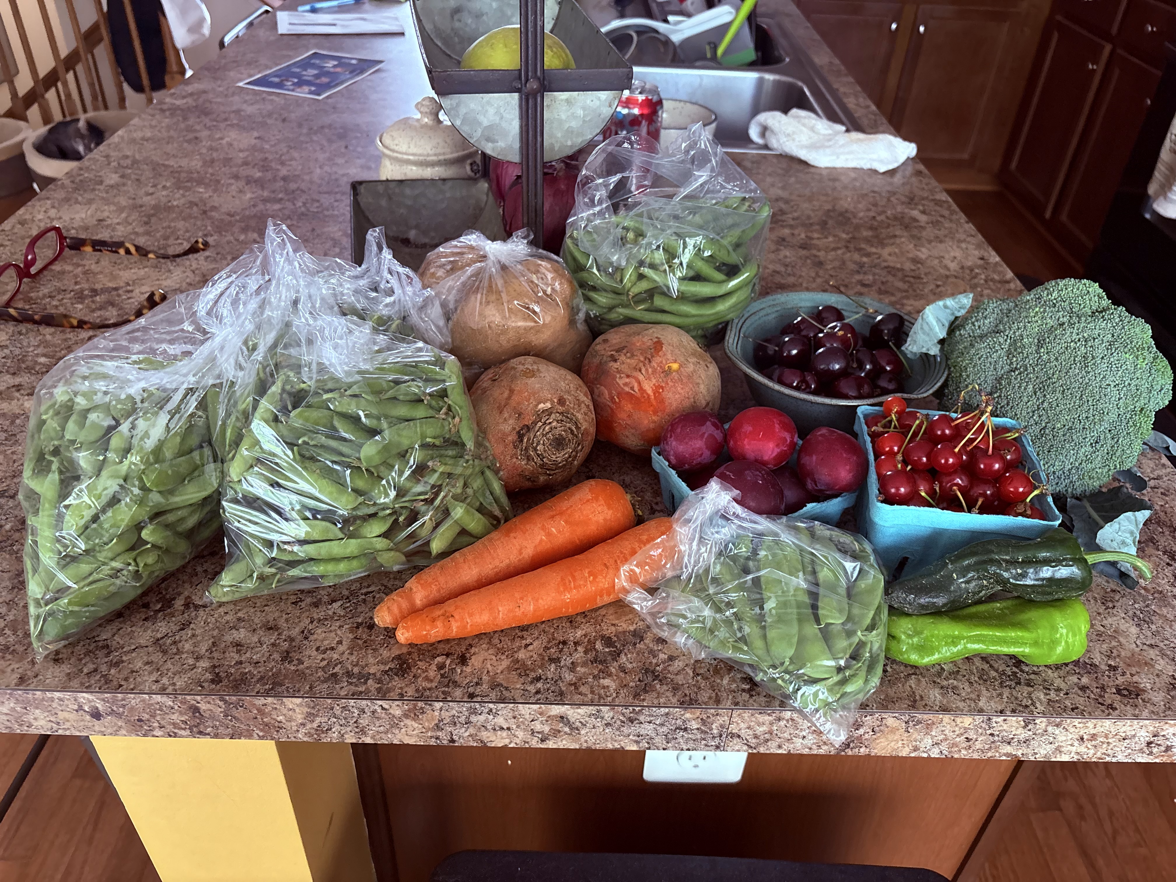
Excellent summer so far. Here is my local CSA haul for this week. Going to sit on the deck and shell those 3 bags of English peas.

-

Central PA Summer 2026 Discussion/Obs Thread
canderson replied to Voyager's topic in Upstate New York/Pennsylvania
Parents are here this weekend. They’ve been here during the Halloween blizzard, Sandy, Irene and several 100 degree, humid as Houston days. Nice they get a taste of what true PA summer should be. -
I managed .65 as things were mostly south or north of me.
-
Got some great rainfall with highs today and tomorrow in the 70s with lows in the 50s. More rain coming Monday.
-

2026-2027 Super El Nino
snowman19 replied to Stormchaserchuck1's topic in Weather Forecasting and Discussion
The El Niño standing wave/forcing around the dateline has become extremely well pronounced with organized and strong, persistent convection in that area. Negative OLR and negative CHI200 anomalies are really showing up now, indicating the strengthening of organized deep convection and upper tropospheric divergence…. @GaWx Given that the MEI is a measurement of SSTs, sea level pressure (which includes SOI in part of that measurement), surface winds and OLR, my guess is that it continues to rise at the current record-breaking pace on the next update -
Yes sir! Had just a hair under you at 1.67 but that really beats any forecast that was put out which im happy about. Got some really beneficial rainfall and it was even raining at around 6 this morning.
-
The risk turned out to be a very windy sunny warm day. This was nothing for days storm wise.
-
Down in Morehead City, NC. Impressive line coming through the county and a good spin right over Havelock.
-
Countdown to less sunlight begins
-
Countdown to less sunlight begins


.thumb.gif.f92b16c631a1d15d405ed77b33f0710d.gif)