All Activity
- Past hour
-
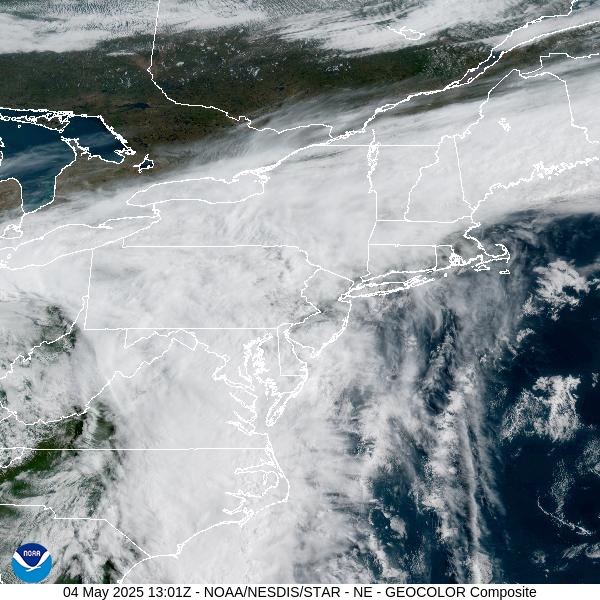
I’ve had 1.21” so far. Looks like most of the activity today stays east. 0.85” at HGR. 1.59” at MRB.
-
.22 last night..unimpressed
-
El shito here
-
I’m down in Tiger’s old stomping grounds Bedford, NH and spent yesterday in Derry… pretty shitty here. Poured off and on after 12pm yesterday and have to get my sister and brother-in-law a rain gauge, had to be over 1”. This morning is fog and tree-top clouds, mist. SE MA FTW. Nice little postage stamp of some sun down there.
-
anotherman started following Winter 2025-26
-
.83 yesterday, .65 since midnight
-

E PA/NJ/DE Spring 2025 Obs/Discussion
Hurricane Agnes replied to PhiEaglesfan712's topic in Philadelphia Region
And unexpectedly, the sun has popped out. Ended up with 0.11" from that isolated shower. Will have to see if it becomes "self-destruct" and the sky clouds up again. Currently partly sunny with the temp quickly rising and at 68, with dp 67. -

2025 Lawns & Gardens Thread. Making Lawns Great Again
Brewbeer replied to Damage In Tolland's topic in New England
with the super long wet stretch coming up, get that seed down now -
Our typical two week window for 3 inches of TV Snow. Then waiting on a can kick pattern for 3 months that never materializes.
- 1 reply
-
- 1
-

-
I don't even know what to say about this system. Several days ago I was hoping for a more organized area of rain for the area but instead getting rain out of this is more like hitting the lottery, at least at the coast.
-
It was a mini derecho that tracked over 100 miles
-
Spring 2021....we got about 3 inches of rain in a day and a half. I had put a flood sensor out on 1898 Brighton Dam Rd two days before that and was surprised to see the river come up 6 feet in under 10 hours. We got the road closed down once the sensor tripped.
-

Central PA Spring 2025
Itstrainingtime replied to canderson's topic in Upstate New York/Pennsylvania
Rainfall total here is 1.68" with more inbound. -
63F, drinking coffee here
-
No rain here since Thursday night
-
Great AM. Upper 60s.
-
One cell surrounded by 200 miles of downpours with occasional ltg. At least Wiz saw something.
-
All these people thought the weekend was a wash out. So bad. Either the apps sucked or the OCMs didn’t communicate well. I had to put out a post claiming it would be a good weekend. Just wish we stayed dry in the evening.
-
One more than it usually is though, ha.
-
Sunny and 68 here.
-
It was one cell.
-

2025 Lawns & Gardens Thread. Making Lawns Great Again
jbenedet replied to Damage In Tolland's topic in New England
It ain’t pretty out but this is perfect weather for whipping garden into shape and establishing a solid base. -
.30 inches of rain here from that one cell this morning. Amazing cut off to the East and the SE. Odessa bascially zip. Radar looks good for continous rainfall in this area and the Eastern Shore soon. After this cycle of rain is over by this Wednesday it looks to get dry again. Very happy for the Western areas yesterday. Those were some amazing storms.
-
Picked up 1.10" of rain since last night here in East Nantmeal. Showers and thunderstorms today before tapering off this evening. Some spots could see between another 0.50" to 1.00" of rain. Much cooler today with temperatures remaining in the low to mid 60s. Showers and cooler temperatures will continue through early Tuesday before we dry out on Wednesday. Rain chances increase again by the end of the new work week.
-

E PA/NJ/DE Spring 2025 Obs/Discussion
ChescoWx replied to PhiEaglesfan712's topic in Philadelphia Region
Showers and thunderstorms today before tapering off this evening. Some spots could see between another 0.50" to 1.00" of rain. Much cooler today with temperatures remaining in the low to mid 60s. Showers and cooler temperatures will continue through early Tuesday before we dry out on Wednesday. Rain chances increase again by the end of the new work week.


