All Activity
- Past hour
-
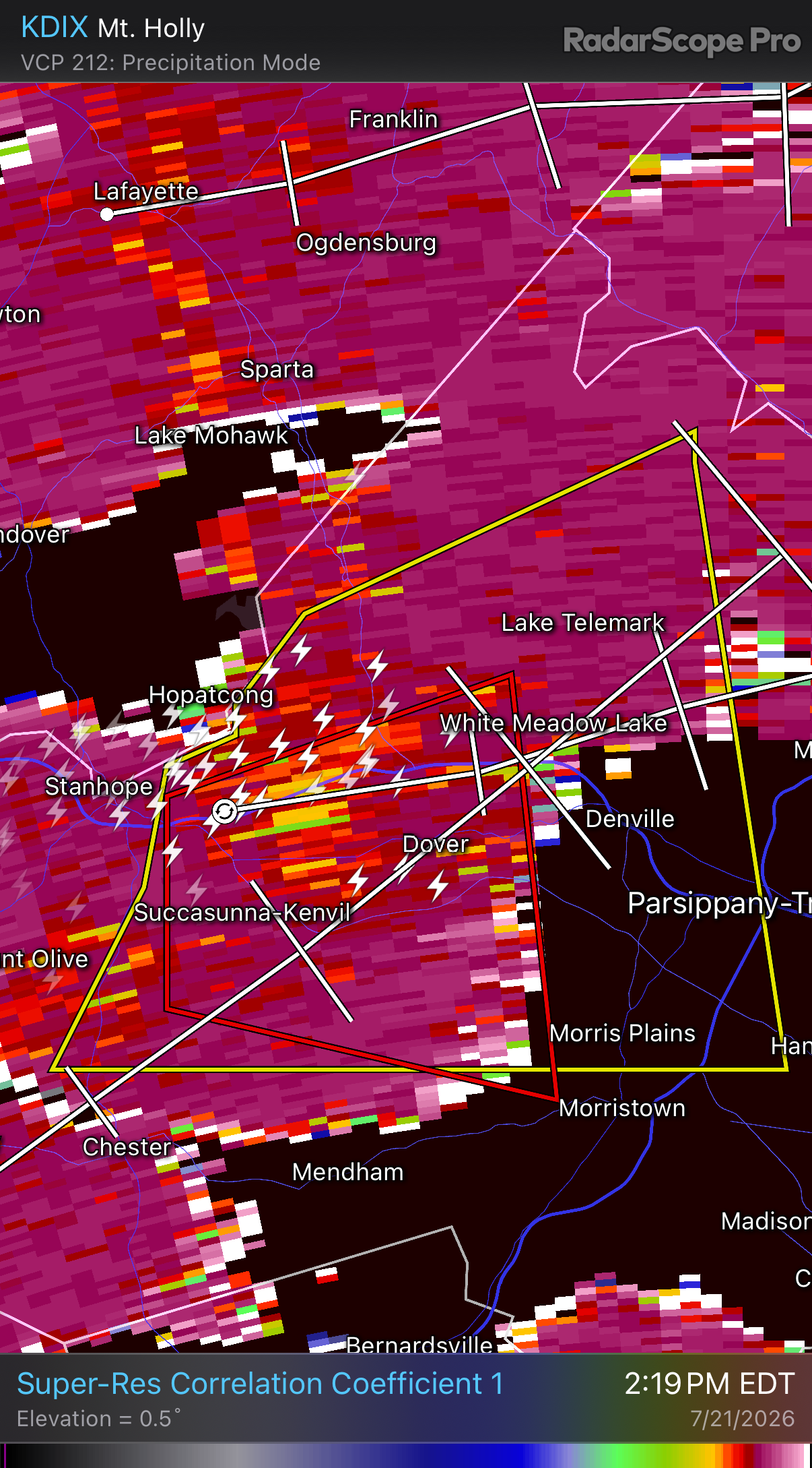
That cell in C-NJ all by itself has to be watched to go tornadic over the next hour
-
this is turning out to be one of the most busiest severe days of the summer - take a look at this long list Severe Weather Warnings Page
-
one thing about these storms is they're moving extremely slowly!
-
Passed here. Rainfall was the most extreme part of it. Winds briefly gusted to 40-45 mph. Just some small branches and twigs down. If there was anything more significant damage wise I think it would have been just south of me. Impressive nonetheless.
-

E PA/NJ/DE Summer 2026 Obs/Discussion
BBasile replied to PhiEaglesfan712's topic in Philadelphia Region
Have some partial sun and blue skies here. The atmosphere is juicy. Maybe I'll get more than a short downpour and 0.3" this time?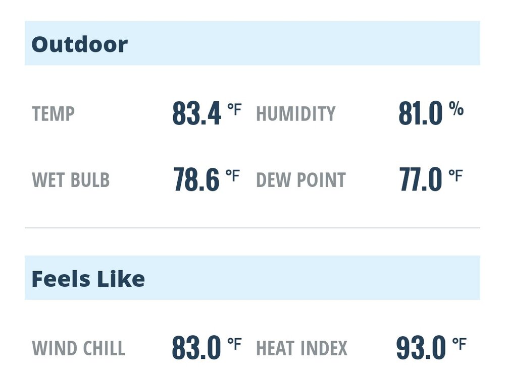
-
 Yanks game for tonight has been postponed. Much of shoreline CT continues to get spanked, with more to come.
 -

Central PA Summer 2026 Discussion/Obs Thread
canderson replied to Voyager's topic in Upstate New York/Pennsylvania
Yup, just saw that! -
E PA/NJ/DE Summer 2026 Obs/Discussion
BBasile replied to PhiEaglesfan712's topic in Philadelphia Region
Used to try to chase around these parts. Breaking the speed limit would just end up with me watching the storms run away. Could sometimes get it right by picking an area I thought might be good. Now, I stay put and just send up the drone. lol. Population density is too much. -
 Got very good rains here with this first batch…no flooding though. Best of both worlds…good rains, but no flooding.
 -
 i am trying to stay safe under brightening skies with 0.2" on the day
 -

2026 Mid-Atlantic Severe Storm General Discussion
wxmeddler replied to Kmlwx's topic in Mid Atlantic
The best looking hodographs come in around 20z and last through about 3z. Eastern shore looks thermodynamically best right now given the satellite but the are better west. Convective temperatures around 95-ish, and we're not gonna get there in N/W of I-95 with the clouds. This is all for semi-isolated supercell stuff... if you just want a thunderstorm, you'll get a good chance of that everywhere later. -
It's beyond the echo tops product range for LWX too! Impressive that it's showing so strongly. Must have a heck of an updraft...
-
 Even Saturday we were crushed here with heavy rain in the evening-so if this setup is better I'm all in.
 -
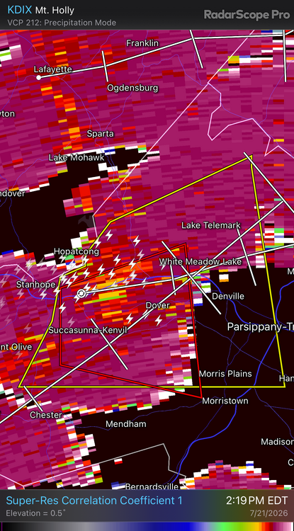
Looks like some potential debris being lofted.
-

Central PA Summer 2026 Discussion/Obs Thread
HBGCPA10 replied to Voyager's topic in Upstate New York/Pennsylvania
Good I've already had two Tornado warnings this year in Harrisburg. I'm good for the year. -

E PA/NJ/DE Summer 2026 Obs/Discussion
LVblizzard replied to PhiEaglesfan712's topic in Philadelphia Region
Figures…the one day my car is in the shop is the one that has tornadic supercells everywhere. Would have loved to chase today. -
 Just can’t catch a break HFD BDL north and east this summer . Living the extreme vicariously yet again
 -
Gushing rains. Winds gusting 40-45 briefly.
-

Central PA Summer 2026 Discussion/Obs Thread
Itstrainingtime replied to Voyager's topic in Upstate New York/Pennsylvania
Not for you! Lancaster and Lebanon on east got the TOR Watch. Dauphin was left out. -
My girlfriend who works at the U.N. just said they're letting employees out early. Some spots will get hard but this isn't some huge widespread event where flooding will happen everywhere. Odd
-
https://phys.org/news/2026-07-arctic-winter-sea-ice-significant.html
-
nice couplet
-

E PA/NJ/DE Summer 2026 Obs/Discussion
Violentweatherfan replied to PhiEaglesfan712's topic in Philadelphia Region
Insert here “Well that escalated rather quickly “ -
 Its worth watching. Much different versus Saturday. Per mesoanalysis any CIN from the rain moving through has essentially eroded and instability is building quickly. Just have to probably push the warm front a little more east but western areas definitely need to watch this given how radar is unfolding. Pushing 1500 J MLCAPE into SW CT with 200 m2s2 of effective SRH.
 -
this past Saturday it was training storms in central NJ today it is north and west of Rt 78





.thumb.jpeg.f5c6ba9d911ec96b3b124f8606aee58e.jpeg)