All Activity
- Past hour
-
GFS is looking better in the long term.
-

2025-2026 ENSO
Stormchaserchuck1 replied to 40/70 Benchmark's topic in Weather Forecasting and Discussion
I don't really get this "negative ENSO turned -PNA to +PNA" since 1980 thing. 1. Why does it only start in the 1980s? Data was not unreliable before then, so it's not like you're starting from a blank point. I think a lack of examples increases the odds of random. If it didn't work before 1980, that's telling, not an ignored difference. 2. That's not what Negative ENSO does. Negative ENSO does not support a +PNA in January. The Hadley cell is extended in the N. Pacific in La Nina more often than not, and that supports -PNA. Since we are having such a strong -PNA December, here is a fun roll forward. This is what 500mb January looks like after -PNA Dec.. this is a total composite of 73 years, both - and + signs considered, going back to 1948: That's an Aleutian ridge in the mean for January. But the ridge is a little further NE, which makes January a cold month for a lot of the US. The reason why it will sometimes switch is the MJO runs if 45-day cycles and Kelvin and Rossby waves sometimes run in 45-60 day cycles. We don't have a strong phase of those things now -- it will be interesting to see if we do go more +PNA after the 1st week of January. I think you are discovering a high mathematical random skew. -
Just drove home from work crossing Afton Mt... Temp went from mid / upper 20s in Charlottesville to 39 on the mountain back down to 25 in Waynesboro ( according to the car temp gauge ) ... Definitely warmer air is moving in aloft..
- Today
-

December 2025 Short/Medium Range Forecast Thread
Daniel Boone replied to John1122's topic in Tennessee Valley
Are you in a mountain Valley in any way ? It's 35 here. There was snow still lying around up in Wise County today. Half inch to an inch in some shady areas in Norton and Wise . The Temperature was near 40 there this Afternoon. -
There’s close to 8” of black ice. You could drive a tractor-trailer truck out on the ice. It’s not going anywhere with one warm day.
-
2025-2026 ENSO
Daniel Boone replied to 40/70 Benchmark's topic in Weather Forecasting and Discussion
Not here either. December '89 was colder and snowier. -

December 2025 regional war/obs/disco thread
WinterWolf replied to Torch Tiger's topic in New England
Good point. But as I said earlier, in Jan if you’re AN by a bit, it’s not a big deal due to what you just pointed out too. -
2025-2026 ENSO
Daniel Boone replied to 40/70 Benchmark's topic in Weather Forecasting and Discussion
Everyone of them went to a +PNA. Wow . -
.thumb.png.4150b06c63a21f61052e47a612bf1818.png)
December 2025 regional war/obs/disco thread
HIPPYVALLEY replied to Torch Tiger's topic in New England
I get out in the weather a few times a day, the dog certainly aids that endeavor, it's been a cold December. Still 75% snow cover of at least 3" here and it hasn't snowed in two weeks. -

December 2025 Short/Medium Range Forecast Thread
John1122 replied to John1122's topic in Tennessee Valley
I'm verifying much cooler than forecast lately. Last night my predicted low was 21, it was 15 this morning. Predicted high was 45, it was 41. Predicted low of 32 tonight, it's already 26. -
Thats like a -7 NAO on the GFS at 300. I'm sure the GEFS will look different.
-
But I thought doom memes of Santa with fire meant Christmas was certain to be super warm for all?
-
Today’s GEFS is progging ~-1.7 PNA for Dec as a whole. That would be ~5th strongest -PNA since 1950. But what were similarly strong -PNA Dec followed by in Jan since 1984-5 during -ENSO? 1984-5: from -1.6 to +1.6 2008-9: from -1.4 to +0.6 2010-1: from -1.8 to +1.3 2021-2: from -2.6 to +1.0 All 4 of these Januaries were cold in the E US.
-
Gfs is one constipated mess right after Christmas.
.thumb.png.a6c5b15e96f0791b7d6822cf8b535b96.png)
-
merry mixmas has a nice ring to it
-
And it begins . More fun as analog agrees. We got good benefit out of this last one. That night in teens and sustained 20 gusting 35 just after dark was real wind chill. Wakes one up
-

Winter 2025-26 Short Range Discussion
cyclone77 replied to SchaumburgStormer's topic in Lakes/Ohio Valley
Hi-res Canadian flips us over to a brief period of heavy snow on Thursday depositing a quick 2-3". Some other models have hinted at a quick switch to snow before ending as well. Something to watch just for fun. -
Next Week we will have blocking with strong HP in southeast Canada - the position of the HP and strength will determine how far south and west this cold enough air will spread and any disturbance that runs into it could cause frozen precip in the cold enough regions - this has been showing up on various models for days now
-
Ggem says mix for us.
-
GFS says Merry Christmas for NYC lol
-
GFS says Merry Christmas for y'all lol
-
Both sets of maps are horribly wrong for Hickory and Catawba County. Definitely no measurable snow has accumulated in our county, not even a single trace, much less multiple instances. I don’t know where those numbers are coming from. Regardless, I remember when we used to measure snowfall in inches, not traces. How many traces make an inch? Three? Twelve? 5280?
-
If you scroll the last few pages there is the typical doom and gloom that we just got lucky with the last event and more cutters to come! People love winter so much, then enjoy what you have instead of what's on a model run 10 days away.
-
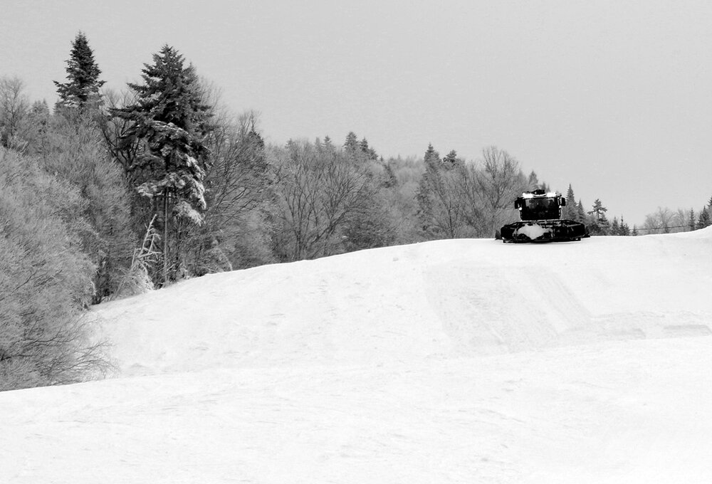
Yesterday I was up at Bolton Valley for some lift-served skiing with a couple of colleagues who were in town for work, and that was a nice change of pace after several days in a row of touring. Apparently Bolton is doing $50 lift tickets on Mondays, so that’s a nice incentive for folks who don’t have season’s passes. Indeed the mountain was fairly quiet with a relatively small number of visitors, so I can see why the discounted tickets make sense. It was fairly cold, with temperatures probably in the upper single digits F at Village elevations, and they must have been near zero F up at the summits. I knew from the temperatures and blustery conditions in the valleys that it was probably a day I wouldn’t have gone out for lift-served skiing, but having my colleagues heading out for turns was enough to tip that balance in favor of a visit. The resort was running both the Vista Quad and the Wilderness Chair, as well as the lower mountain lifts, so they had quite a solid amount of terrain open now that they are operating during the midweek periods. Conditions were decent, with manmade snow on the main routes of Vista Peak, and all natural snow over at Wilderness. Both areas saw substantial weekend skier traffic, and you could tell the snow had seen some wear and tear. There were some slick spots on the manmade surfaces, and some areas of imperfect coverage on the natural snow terrain at Wilderness. This has obviously been a strong early season for snowfall and natural snowpack, but natural snow depths still aren’t quite at the level yet where coverage will really remain fully pristine on steep, ungroomed slopes. The temperatures were also cold enough that the groomed skiing was a bit slow It would be nice to get back up into the 20s F, and it seems like the coldest weather has passed and we’ll be warmer for the rest of the midweek period.
-
Off topic, but not sure where to post the news, that a move is underway to dismantle NCAR! The critical role NCAR plays in vital / critical research associated with climate assessment and all types of hazardous weather is huge.


.png.0380cac348ae11d008917fb616eb33c8.png)


