All Activity
- Past hour
-
If I’m remembering correctly, we had a super El Niño during the winter of 2015–2016. That November brought an unusually cold outbreak, with highs in the teens around midmonth, before a more typical El Niño pattern took hold for the rest of winter. With a recurving typhoon, Ural blocking, a weakening polar vortex, and other factors potentially lining up, I’m wondering whether we could see a similar November this year. Thoughts or rebuttals?
-
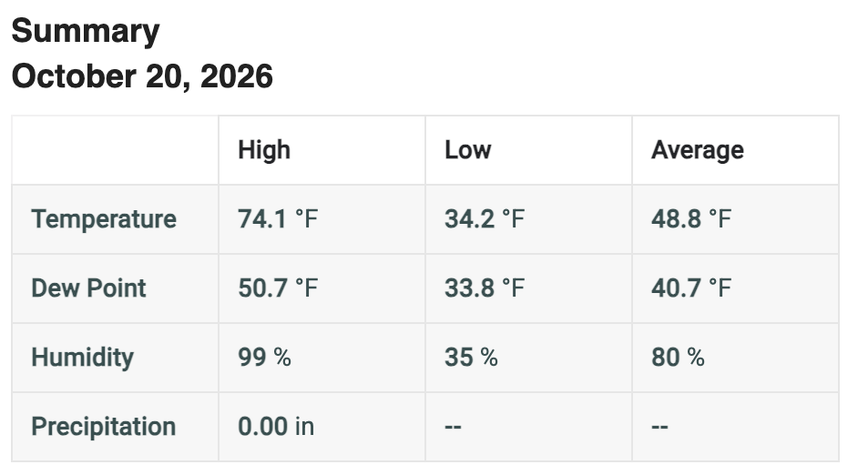
Max 64.1° What a beaut. Hopefully a few days like this every month until spring.
-
12z Euro looks great through early Novie
-
google it - its not made up AI Overview A polar vortex stretching event occurs when the large, circular ring of freezing stratospheric air above the North Pole loses its tight shape, elongating or warping into an oval or multi-lobed form. [1, 2]
-
Hopefully we get a nice late Fall threat, otherwise May isn't too terribly far off
-
Not to be weird but I wish you could enjoy it too!
-
I think it’s Indirectly a fallout from all the tropical systems off the Mexico coast this year. All that moisture swarming north. But I’ll take it!
-
Enhanced risk added with the D2 this afternoon for hail
-
 toprol xl rxlist: Pulse Guard Direct - metoprolol side effects first week
-
I've never heard of Polar Vortex stretching before. This is a made up term!
-
Same up here and most of Maine where I've been this past week.
-
I think it’s a rare severe threat out there too.
-
Yeah the water restrictions will likely come back.
-
Beauty of a day here. Wife and I got almost the whole woodpile stacked but it got warm out there. No complaints!
-
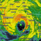
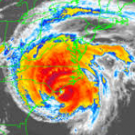
 Based on old recon finding lots of sub 900 storms in that basin and this having that very high end look it likely was below 890. .
-
 Pressure data from a buoy on the edge of the eye sugguests sub-900mb pressure
-
The red oak sapling outside the window has a nice but not vibrant burgundy color but the 24"/90ft red oak 50 yards away is going toward brown. The only bright red oaks I see in this area are the pin oak street trees in Farmington - moderately common in the mid-Atlantic but not native to Maine. Jeff has a couple of them in his yard; haven't heard how they've colored this fall. Other than the oaks and some dark yellow understory beech, we're in stick season. Many of those beech leaves will turn tan and hang on until bud break in May. 22/25/27 lows the most recent 3 mornings.
-
 JTWC had this at 155kt this morning, and so that's an incredible situtation, it's much above the 137kt cutoff for Category 5.
- Today
-

2026-2027 Record-breaking El Nino
forkyfork replied to Stormchaserchuck1's topic in Weather Forecasting and Discussion
the center of the pac warm pool is east of the dateline!!! you would need this event to collapse to have any chance -

Yellow Medicine County, MN - Climate Fact or Climate Fiction?
Cobalt replied to Cobalt's topic in Climate Change
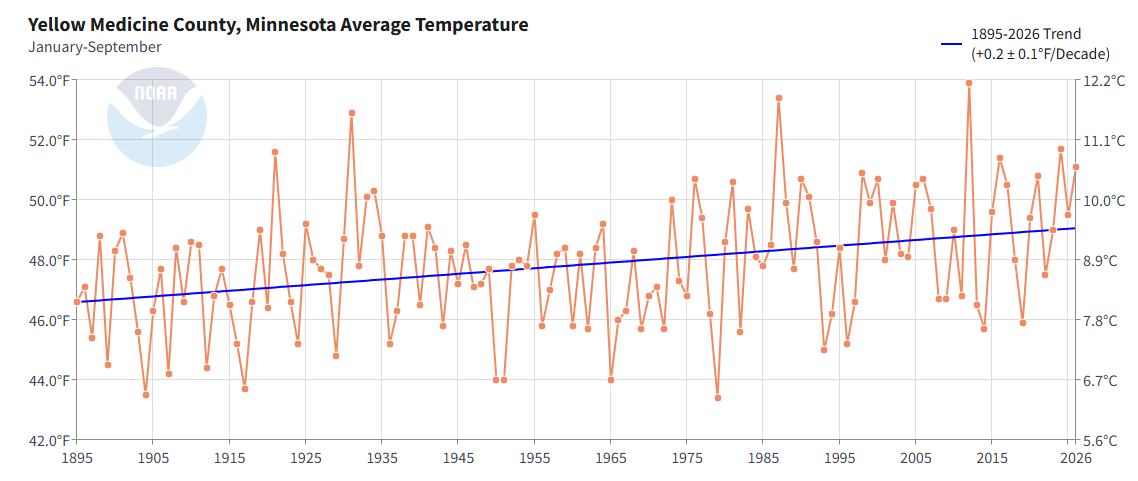
Yellow Medicine County is currently having its 7th warmest start to the year on record (1895-2026).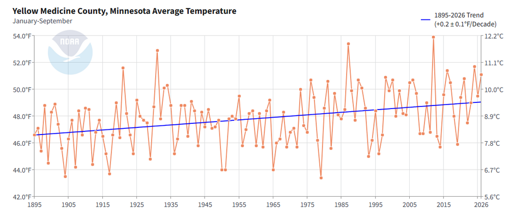
-

E PA/NJ/DE Autumn 2026 Obs/Discussion
ChescoWx replied to PhiEaglesfan712's topic in Philadelphia Region
I have added some additionals stations within 3 miles of the Chester County border to enhance our climate data. The support and rationale is included in our latest study on the website. Thanks! https://chescowx.com/chester-county-area-3-mile-rule/ -
Could not have foreseen this when I came out here last week: In addition to the heavy rainfall and flash flood threat, another threat to watch out for will be severe weather. Given the moderate levels of instability in place combined with strong 0-6 km vertical shear in excess of 50 kts, the thunderstorms that do develop will likely have some organization to them with the potential to acquire supercellular characteristics. In fact, the Storm Prediction Center has highlighted much of the higher terrain areas east of Phoenix in a slight risk (Level 2 out 5) for severe weather for Wednesday, with a marginal risk (Level 1 out 5) across the rest of south-central AZ, including the Phoenix metro area. The thunderstorms that do develop will be capable of producing damaging wind gusts, large hail, and even an isolated tornado given that there will be about 10-20 kts of low-level shear. The threat of severe weather will also exist into Thursday as well, especially Thursday morning, as the instability and shear parameters will still be sufficient.
-
I have added some additionals stations within 3 miles of the Chester County border to enhance our climate data. The support and rationale is included in our latest study on the website. Thanks! https://chescowx.com/chester-county-area-3-mile-rule/
-
I'm thinking about it
-
I don’t think we see a drop of rain for the rest of the month