All Activity
- Past hour
-

Central PA Spring 2026 Discussion/Obs Thread
Ruin replied to Voyager's topic in Upstate New York/Pennsylvania
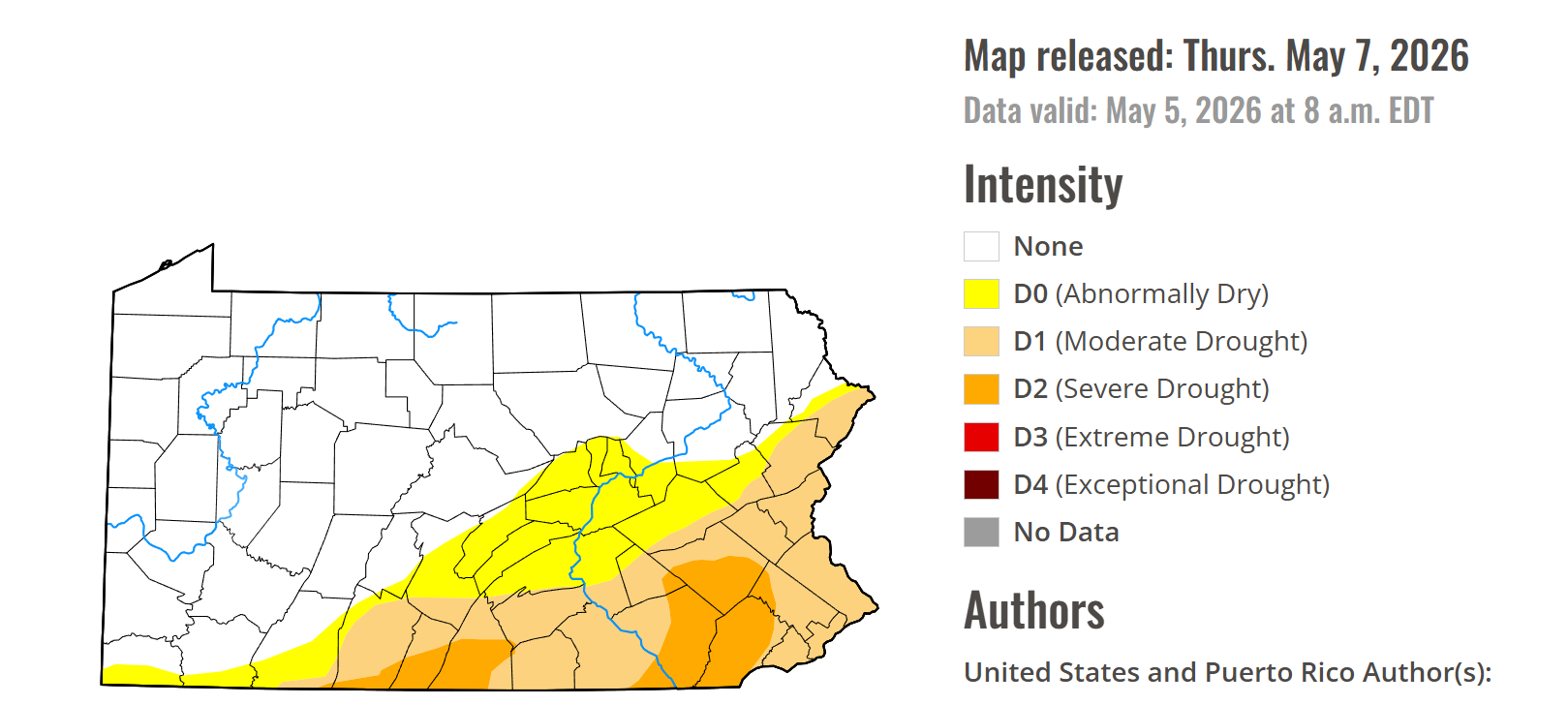
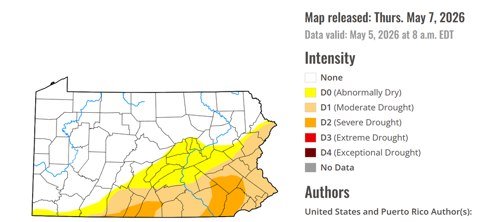
still the same bs map they havent updated it tho they claim they have -
Yes, it is now EXTREME DROUGHT For Waynesboro.
-
Central PA Spring 2026 Discussion/Obs Thread
Ruin replied to Voyager's topic in Upstate New York/Pennsylvania
-
-
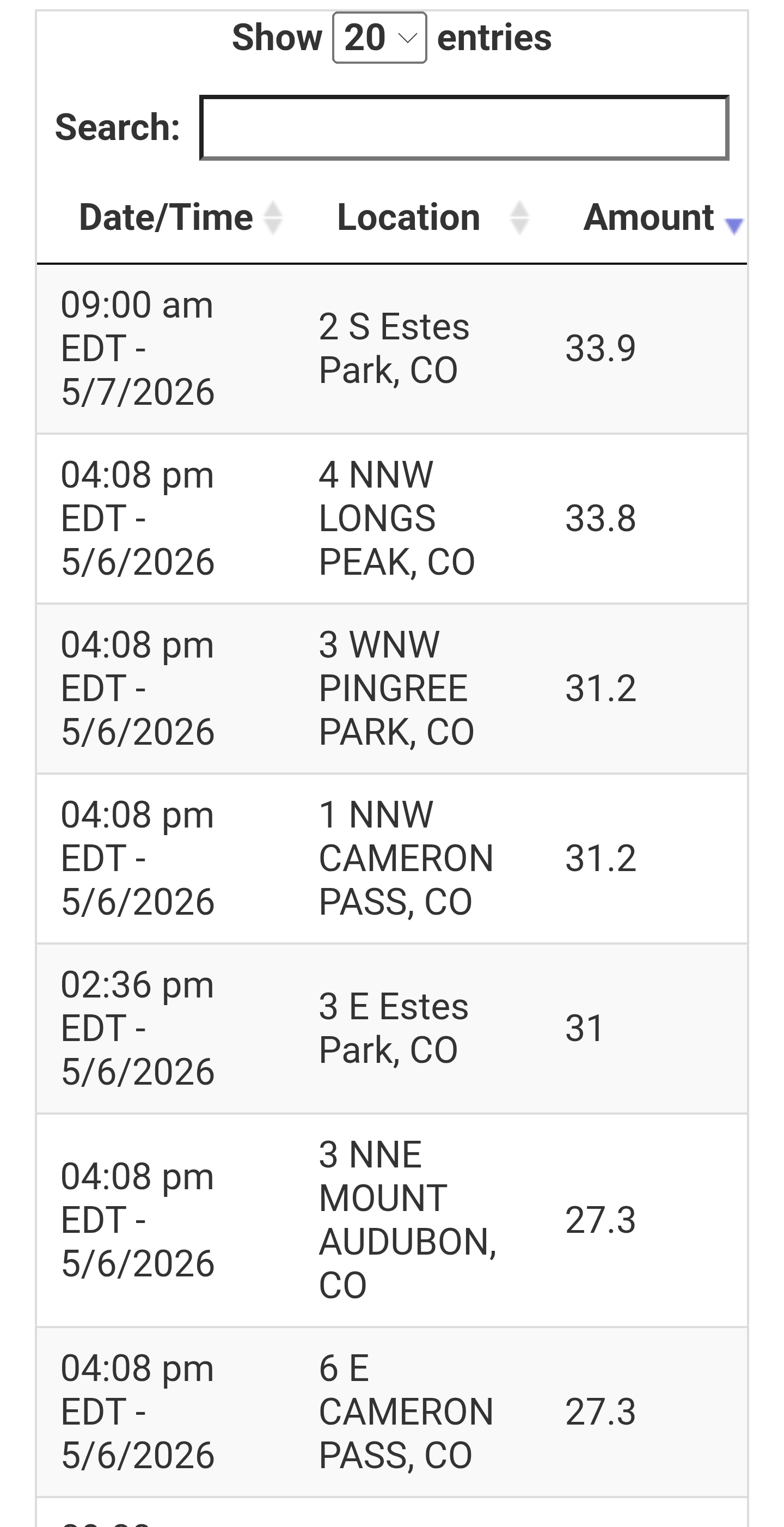
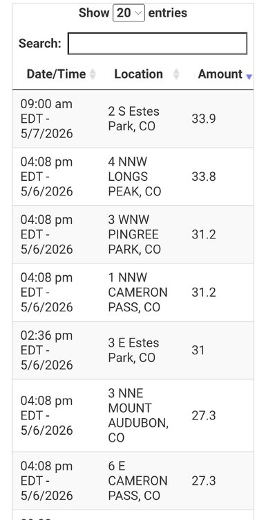
So for the DEN snowstorm... Max measured amount I could find was 33.9" 1.8 S Estes Park (about 8000 ft). Max estimated from SNOTEL was 33.8" 4 NNW Long Peak (about 9100 ft). HRRR fcst snow totals were over 40" and odds are that did indeed occur above 10,000 (hard to verify tho since no in situ obs). Global models fcst max amounts just over 30" in the highest elevations w/ their lower resolution for terrain, so a great fcst overall for the absolute highest amounts. Yes, not a drought buster, but quite significant snowfall event w/ high LEQs, so this can only help. You can choose to look at things the glass half empty or full. Emphasize the negative or positive. Just the MSM tends to focus on the negative, which is nothing new really, but social media and overall divide these days often amplifies it to the extreme w/ context and perspective lacking. Denver officially had 5.8" but the climate location is 16 mi ENE of the downtown. SW suburbs had up to 9.5". Also, it seems that May snowstorms ranking for Denver is all over the place on social media. https://kdvr.com/weather/wx-news/this-may-snowstorm-is-one-of-the-largest-in-denver-history/ The above link lists the biggest snowfalls for the city and it inclusive for the 3 different locations where snow has been measured (earliest event listed is 1931). It states this most recent snowstorm was the 5th biggest in the city's history, but that is incorrect. It leaves out 12.4" on May 5-6, 1978 and May 13-14, and 15.5" May 1-5, 1898. And when I have mentioned this on social media posts, ppl have said, "that's what the NWS provided to me." Yet you go on the NWS BOU site, and the 3 May snowstorms I just mentioned are listed. NWS Boulder Denver Top 20 Records - May It just goes to show how easy bad or incorrect information can spread. Too many media outlets and individuals just parrot what others say and do no fact-checking themselves! This is important in the large pix when talking about wx and climate b/c the details count and can make a big difference in stories/statements.
-
I assumed the faucet would turn off and it very well may have already. I hope not.
-
Done right now it cost me 20 month for this. After all the suggestions and its done right i will hopefully publish to the App store and ask for maybe $2 a month
-
-

-
-
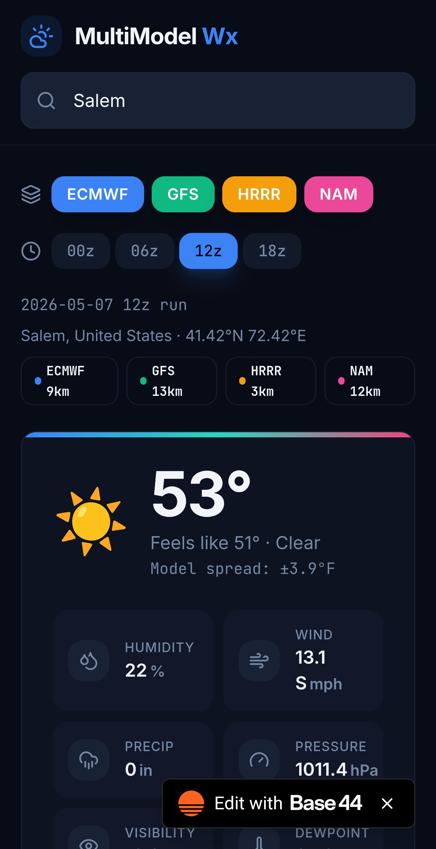
what about adding NBM and NBM probabilities?
-

-
Looking for suggestions
-

2026 Mid-Atlantic Severe Storm General Discussion
NorthArlington101 replied to Kmlwx's topic in Mid Atlantic
Yeah, I was obviously wrong. Earlier scans made it clearer. Thought there was a shot it was just sidelobe contamination but very clearly was a tornado on the ground from those damage reports. -
This is pretty cool!
-
Added GEFS AND EPS https://synoptic-weather-lens.base44.app
- Today
-
 Looking forward to the king, February 2026, being written about.
 -
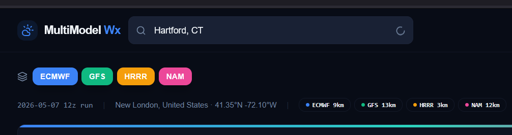
Awesome Steve! Some quick testing, the search field for locations might need a little work. I was able to change it to New London, CT from New York, but subsequent searches seem to be stuck with the little search icon in the right of the field just bouncing up and down instead doing anything.

-
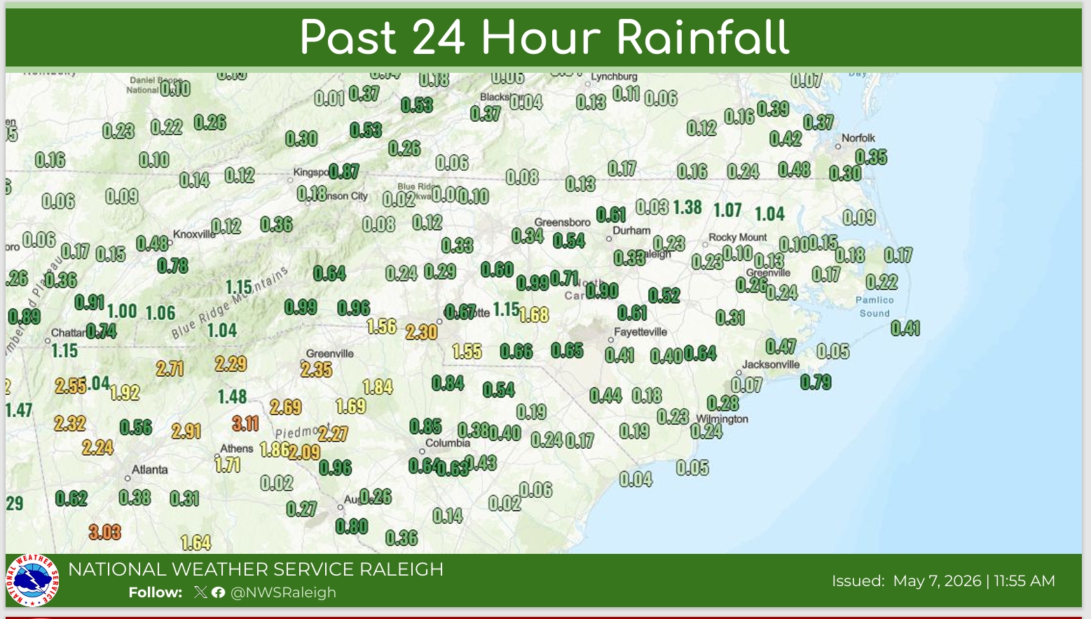
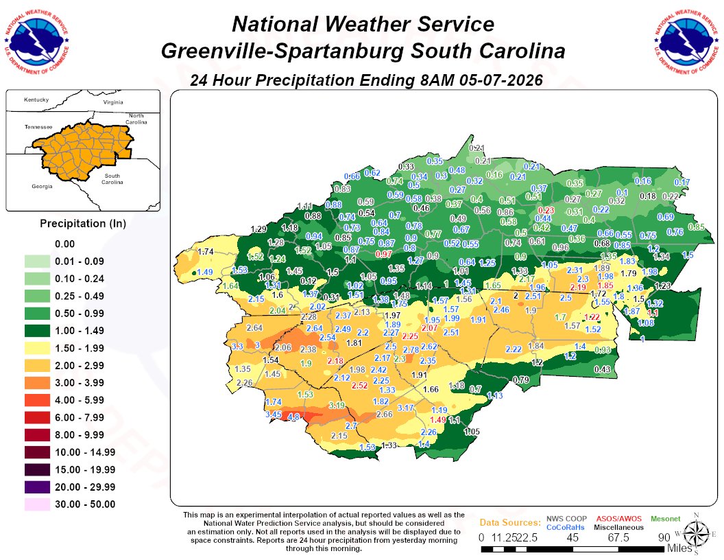
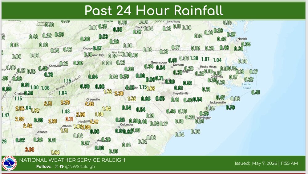
.86 inches of rain here. Not as much as forecasted, but still appreciated.
-

Winter 25-26 (All Snowfall Maps & Season Total)
SouthCoastMA replied to The 4 Seasons's topic in New England
I'm probably within a few inches, but on the low end. I'm also at a disadvantage in some storms being within 1.5 miles from the water, so there can be some minor variation locally. -
Looks like Saturday is slipping away from us too.
-

E PA/NJ/DE Spring 2026 Obs/Discussion
RedSky replied to PhiEaglesfan712's topic in Philadelphia Region
same -

Occasional Thoughts on Climate Change
Typhoon Tip replied to donsutherland1's topic in Climate Change
https://phys.org/news/2026-05-rapidly-antarctic-ice-shelves-global.html -
We’re not going to break 3/4” here so today’s rain while helpful will not get near close enough to alleviate the drought. Realistically we need what we got today twice a week to get back on track