All Activity
- Past hour
-

Septorcher 2026 Discussion - Endless Summer
Damage In Tolland replied to Damage In Tolland's topic in New England
Please eat all of our Oak trees lantern fly . Tell your friends
-

E PA/NJ/DE Autumn 2026 Obs/Discussion
Newman replied to PhiEaglesfan712's topic in Philadelphia Region
I think we're on the same page regarding temps and precip and the overall distribution of positive/negative anomalies. I have some reservations regarding some of the climate long range model outputs, at least what they are predicting verbatim right now. The CanSips literally follows a climo Nino winter almost to a T, and I just don't know if I want to throw all my eggs into that basket right now. I guess it's why we don't write winter forecasts in September haha, the atmosphere still has almost 3 months to respond to the current Nino + things will become more clear once wavelengths shorten and the larger Rossby wave train settles into place heading into the late fall. Unfortunately the general public doesn't care if we nail temperature and precip departure forecasts... they care about snow. And that is just so hard, almost impossible, to predict with long lead time accurately without just getting lucky. However, in general, I wouldn't be surprised if the central Appalachians, up through interior portions of the Mid-Atlantic and Northeast, finish above average in snowfall. Coastal plain, NC piedmont, etc could get close to normal once the cold gets more established into late Jan and Feb nearer to the coast. -

Septorcher 2026 Discussion - Endless Summer
JACKASS replied to Damage In Tolland's topic in New England
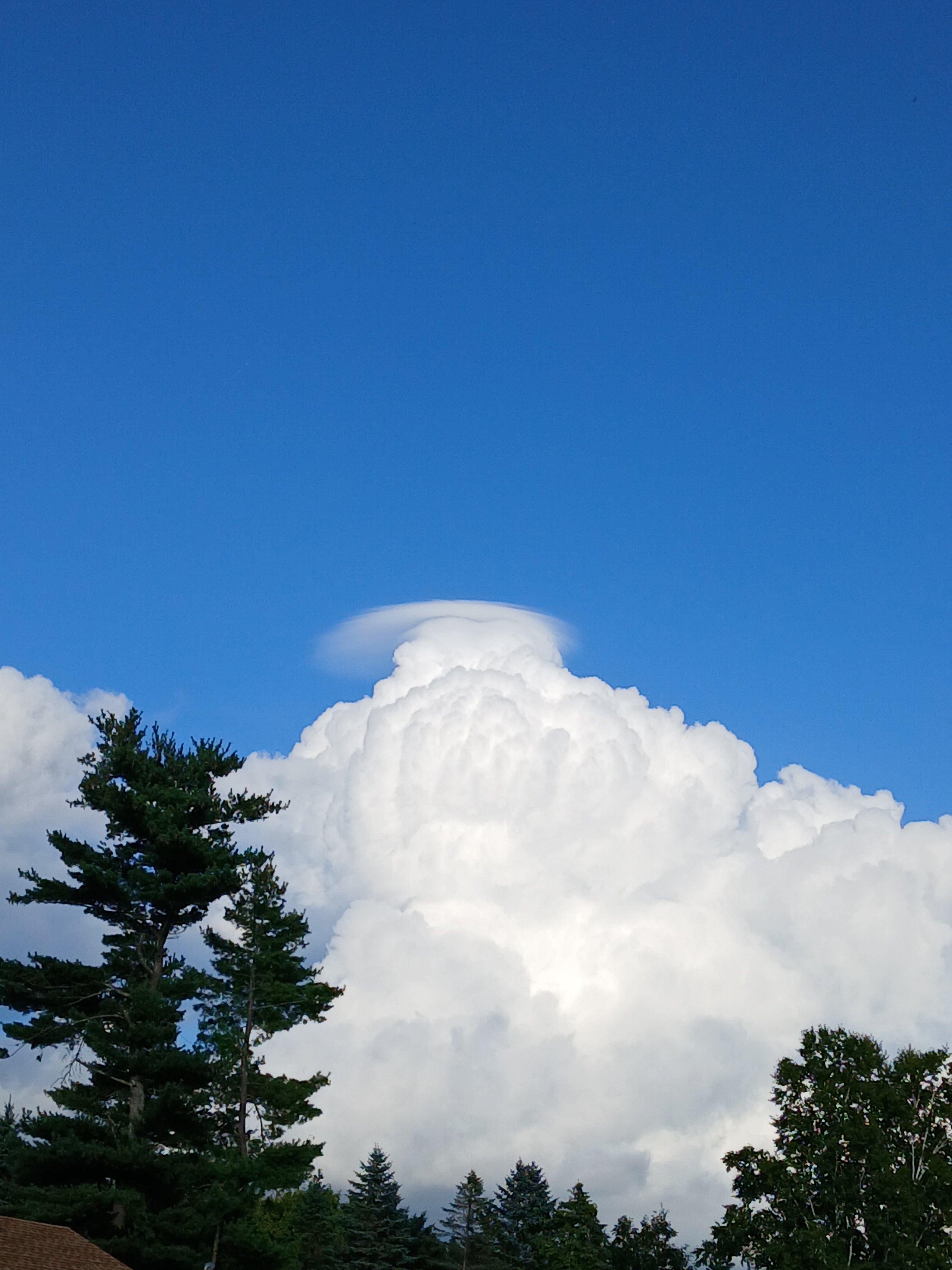
Nice trump combover at the top. Sure sign of failure! -
Looks like RDU made it at least to 101
-

Septorcher 2026 Discussion - Endless Summer
ineedsnow replied to Damage In Tolland's topic in New England
-
Septorcher 2026 Discussion - Endless Summer
ineedsnow replied to Damage In Tolland's topic in New England
I was sick for a couple weeks just fully getting better now.. still a bit of a cough but feel fine.. i went to the doctors and they just said it was something viral and alot of people had it.. tested for Covid flu and something else but all was good -

Central PA Summer 2026 Discussion/Obs Thread
Superstorm replied to Voyager's topic in Upstate New York/Pennsylvania
Here we go again. Late night boomers for many. . -
Some really nice early fall weekends coming up if models are right.
-
.thumb.jpg.6a4895b2a43f87359e4e7d04a6fa0d14.jpg)
Central PA Summer 2026 Discussion/Obs Thread
Yardstickgozinya replied to Voyager's topic in Upstate New York/Pennsylvania
The whole state of pennsylvania has 3000jkg+ to work with. -
Central PA Summer 2026 Discussion/Obs Thread
Yardstickgozinya replied to Voyager's topic in Upstate New York/Pennsylvania
I'm surprised no one posted this yet. Maybe everyone's burnout. Severe Thunderstorm Watch SEVERE THUNDERSTORM WATCH OUTLINE UPDATE FOR WS 650 NWS STORM PREDICTION CENTER NORMAN OK 435 PM EDT THU SEP 3 2026 SEVERE THUNDERSTORM WATCH 650 IS IN EFFECT UNTIL 1200 AM EDT FOR THE FOLLOWING LOCATIONS PAC001-009-013-021-023-027-033-035-037-041-043-047-055-057-061- 067-071-075-081-083-087-093-097-099-105-107-109-111-113-117-119- 123-133-040400- /O.NEW.KWNS.SV.A.0650.260903T2035Z-260904T0400Z/ PA . PENNSYLVANIA COUNTIES INCLUDED ARE ADAMS BEDFORD BLAIR CAMBRIA CAMERON CENTRE CLEARFIELD CLINTON COLUMBIA CUMBERLAND DAUPHIN ELK FRANKLIN FULTON HUNTINGDON JUNIATA LANCASTER LEBANON LYCOMING MCKEAN MIFFLIN MONTOUR NORTHUMBERLAND PERRY POTTER SCHUYLKILL SNYDER SOMERSET SULLIVAN TIOGA UNION WARREN YORK $$ -
Septorcher 2026 Discussion - Endless Summer
JACKASS replied to Damage In Tolland's topic in New England
What the hell? Haven’t heard of anyone coming down with that, in what seems like forever. Speedy recovery man!! -
incoming miss north for brian d?
-

2026 Mid-Atlantic Severe Storm General Discussion
Eskimo Joe replied to Kmlwx's topic in Mid Atlantic
Check out the left moving supercell into that line in Pittsburgh. Man SW PA is just a thunderstorm machine this summer. -
Had plenty of recovery time. If doesn’t storm here it’s not cause of that. The area in pa that is getting smacked now was just as “worked over” this morning.
-
Doubt they will be as strong if they reach here... but... this is headed into Pittsburgh metro shortly Severe Weather Statement National Weather Service Pittsburgh PA 531 PM EDT Thu Sep 3 2026 OHC029-PAC003-007-019-125-WVC029-032200- /O.CON.KPBZ.SV.W.0335.000000T0000Z-260903T2200Z/ Columbiana OH-Allegheny PA-Beaver PA-Butler PA-Washington PA- Hancock WV- 531 PM EDT Thu Sep 3 2026 ...SEVERE THUNDERSTORM WARNING REMAINS IN EFFECT UNTIL 6 PM EDT FOR SOUTHEASTERN COLUMBIANA, NORTHWESTERN ALLEGHENY, NORTHWESTERN WASHINGTON, SOUTHERN BUTLER, BEAVER AND HANCOCK COUNTIES... At 531 PM EDT, severe thunderstorms were located along a line from 6 miles northeast of Zelienople to near Midland, or along a line from 10 miles west of Butler to 7 miles southeast of East Liverpool, moving southeast at 20 mph. THESE ARE DESTRUCTIVE STORMS FOR BEAVER, MONACA, CONWAY, ALIQUIPPA. HAZARD...80 mph wind gusts and quarter size hail. SOURCE...Radar indicated. IMPACT...Flying debris will be dangerous to those caught without shelter. Mobile homes will be heavily damaged. Expect considerable damage to roofs, windows, and vehicles. Extensive tree damage and power outages are likely. Locations impacted include... Ross Township, McCandless Township, Cranberry, Moon Township, Butler, Franklin Park, East Liverpool, Aliquippa, Beaver Falls, Monaca, Hampton Township, Robinson Township, Economy, Bellevue, Kennedy Township, Ambridge, Wexford, Homeacre-Lyndora, West View and Stowe Township. PRECAUTIONARY/PREPAREDNESS ACTIONS... Seek shelter now inside an interior room on the lowest floor of a well-built structure. These storms are capable of producing widespread destructive winds and large hail. && LAT...LON 4062 8062 4079 8053 4085 8025 4085 8016 4087 8016 4088 8013 4094 8007 4082 7971 4056 7999 4031 8028 4053 8062 4056 8065 TIME...MOT...LOC 2107Z 294DEG 18KT 4091 8023 4077 8041 4063 8061 THUNDERSTORM DAMAGE THREAT...DESTRUCTIVE HAIL THREAT...RADAR INDICATED MAX HAIL SIZE...1.00 IN WIND THREAT...RADAR INDICATED MAX WIND GUST...80 MPH
-
I’ll take the happy hour rgem lol that’s also a sentence I hope to post a lot this winter
- 2,431 replies
-
- 2
-

-
- severe
- thunderstorms
- (and 7 more)
-

Monday, August 31 - Thursday, September 3, 2026 Convective Episodes
Brewbeer replied to weatherwiz's topic in New England
checked the radar and thought of you -
LWX AFD did mention a boundary in the area
-
Made it to 94F here. Unreal.
-
2026 Mid-Atlantic Severe Storm General Discussion
Eskimo Joe replied to Kmlwx's topic in Mid Atlantic
Looks like the Potomac River into NOVA is favored. Maryland side is just too worked over. -
Although they seem more piecemeal, 19z and 20z HRRR are speeding up the "threat"... now it arrives around 11pm to midnight. Earlier HRRR runs were after midnight to 3am
-

Monday, August 31 - Thursday, September 3, 2026 Convective Episodes
weatherwiz replied to weatherwiz's topic in New England
Just got a brief downpour! -
wow! I hope nobody got hurt It started to rain heavily here with several lightning bolts in the clouds, 20-40mph wind gusts, a few (minor?) wind reports around Toledo, including a tree down in the downtown Toledo area. Low bits of clouds were moving quick with the onset of the storm, like 40mph or more.
-
 the canadian pharmacy: best canadian pharmacy online :: canadian pharmacy no scripts
 - Today
-

Septorcher 2026 Discussion - Endless Summer
Baroclinic Zone replied to Damage In Tolland's topic in New England
Pretty sure I’m recovering from Covid. Coming up on 2 weeks since I got sick. Fuggin sucks.