All Activity
- Past hour
-
Make this garbage weather end...the same week repeating four weeks in a row...we are almost in frickin June I swear if next week promised sun and 80s gets muted somehow.....
-
should be a decent wx day here in ne il with storms later
-
What time do you or anyone think the onset will be for the rain this evening? My daughter has a softball game scheduled this evening at 6 pm, so I’m wondering if we will get the game played or not.
-
That trophy just might be going to the right place afterall.
-
The steeper ridge allows these lows underneath to cut off and crawl around. If you want real heat anymore we have to go to Montreal lol.
-
Currently 55 degrees Looks like guys in the southern tier are getting hit with the heaviest rains again. keep that heavy stuff down there Hope everyone stays safe and flood free!
-
Continuing with expectations as described above posts. GEFS continues more aggressive with the warming than the EPS.
-
Even at the end of May we get a last minute westward push with the low lol
-
62-88 for highs.
-
Yep if we have that to our south, no way there’s much heat for our subforum. Maybe way north in New England where it clears out.
-
Still quite a bit of inshore flow with the cutoff low lingering nearby. The usual warm spots will probably get back to the 80s. But the first 90° still looks delayed to beyond the first week of June.
-
Very summery with 60s and 70s all week next week
-
Quite remarkable. Luckily a relatively small glacier but none less still quite destructive and life altering for many.
-
Flood Watches are up .
-
Probably our last 40s for lows until mid-late September coming up. Models transition into full summer mode after this weekend
-
The record high pressure east of Japan in association with the record warmth has shifted the timing of the rainy season there.
- Today
-
Looks COCY
.thumb.png.299de5fd39a6bd08201d3c0c91c888b7.png)
-
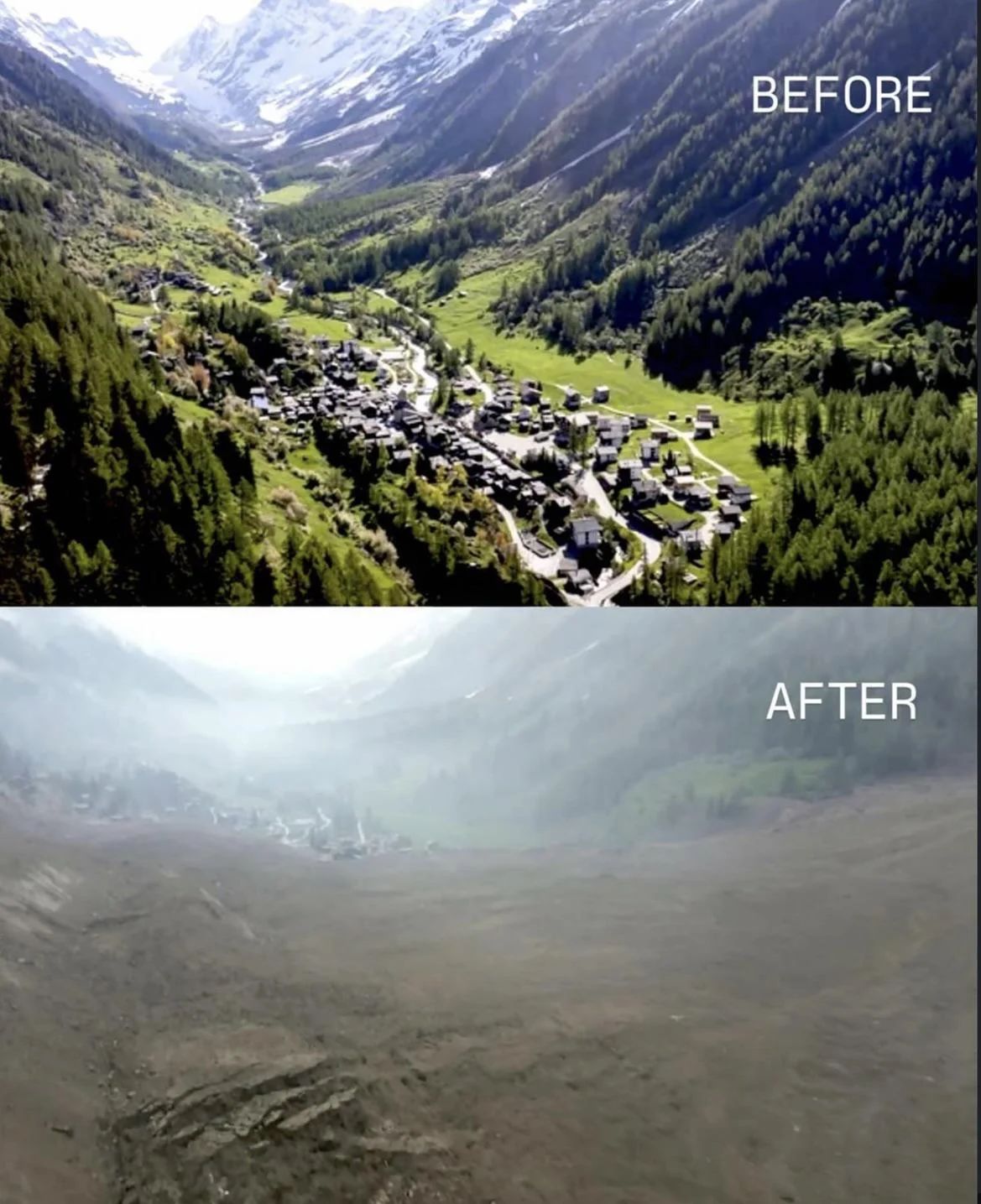
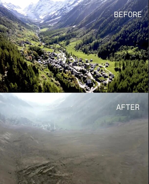
I would imagine after several landslides and seeing that plug in the upper valley everyone would get out fast. The before and after is nutz
-
GFS is still trying to push 90° in S NH Wed. GGEM is hot too.
-
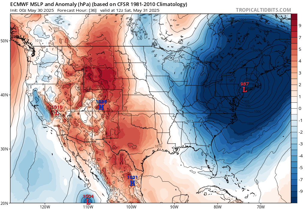
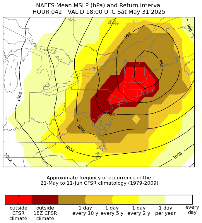
NYC metro will approach the lowest late May pressures on record tomorrow. We will probably come in about 5mb above the all-time May and June lows. 987 mb is a record for May 31st and just above the monthly lows in the low 980s. So people will be looking at their home barometers and asking what month is this.


-
Nice moisture slug down in south Jersey. Trajectory looks to be eastern Li.
-
It rained between midnight and 5 in hunt valley area I think / there’s puddles in the parking lots over here by the light rail
-
Well, THIS caught me off guard this morning.... Tonight: Showers and thunderstorms likely before 11pm, then showers and possibly a thunderstorm between 11pm and 2am, then showers after 2am. Low around 53. Light north wind. Chance of precipitation is 100%. New rainfall amounts between 1 and 2 inches possible.
-
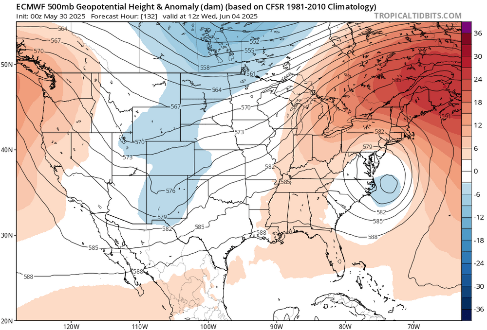
Euro says cutoff back north again. Meh.
-
"Looking at Tuesday through the end of the week there remains a good deal of uncertainty with the mid-level pattern. Model guidance is not handling the evolution of the departing weekend system. As the cut-off low becomes more of an open trough in eastern Canada, isn`t able to easily move eastward because of the mid-level ridge across the North Atlantic. To the west of southern New England an amplifying mid-level ridge spills northeastward. Does it shift the trough out to sea or does it pinch off the trough into another closed low. If we can shift it out to sea likely a rather nice forecast with dry weather and warming temperatures. The other scenario, it becomes a closed low/cut-off and is stuck east of New England and may result in cooler temperatures and spotty shower activity. As there is a good deal of uncertainty, leaned heavily on the NBM. Which is leaning toward the first outcome, dry conditions and summer warmth. Highs in the upper 70s to low 80s and nighttime lows in the 50s." You've got to ask yourself one question: 'Do I feel lucky?' Well, do ya, punk?"


.png.250711152973cacc1c15816ac27241bd.png)