All Activity
- Past hour
-
Possible tornado moving onshore near Holland, MI
-
Central Park is a veg head!
-
Hobart IN pop 29,000 taking a direct hit
-

2026 Mid-Atlantic Severe Storm General Discussion
wxmeddler replied to Kmlwx's topic in Mid Atlantic
It's always been an issue, but it seems when models get upgraded to more vertical levels it's more of an issue.- 563 replies
-
- 1
-

-
- severe
- thunderstorms
- (and 7 more)
-
-

2026 Mid-Atlantic Severe Storm General Discussion
AmericanWxFreak replied to Kmlwx's topic in Mid Atlantic
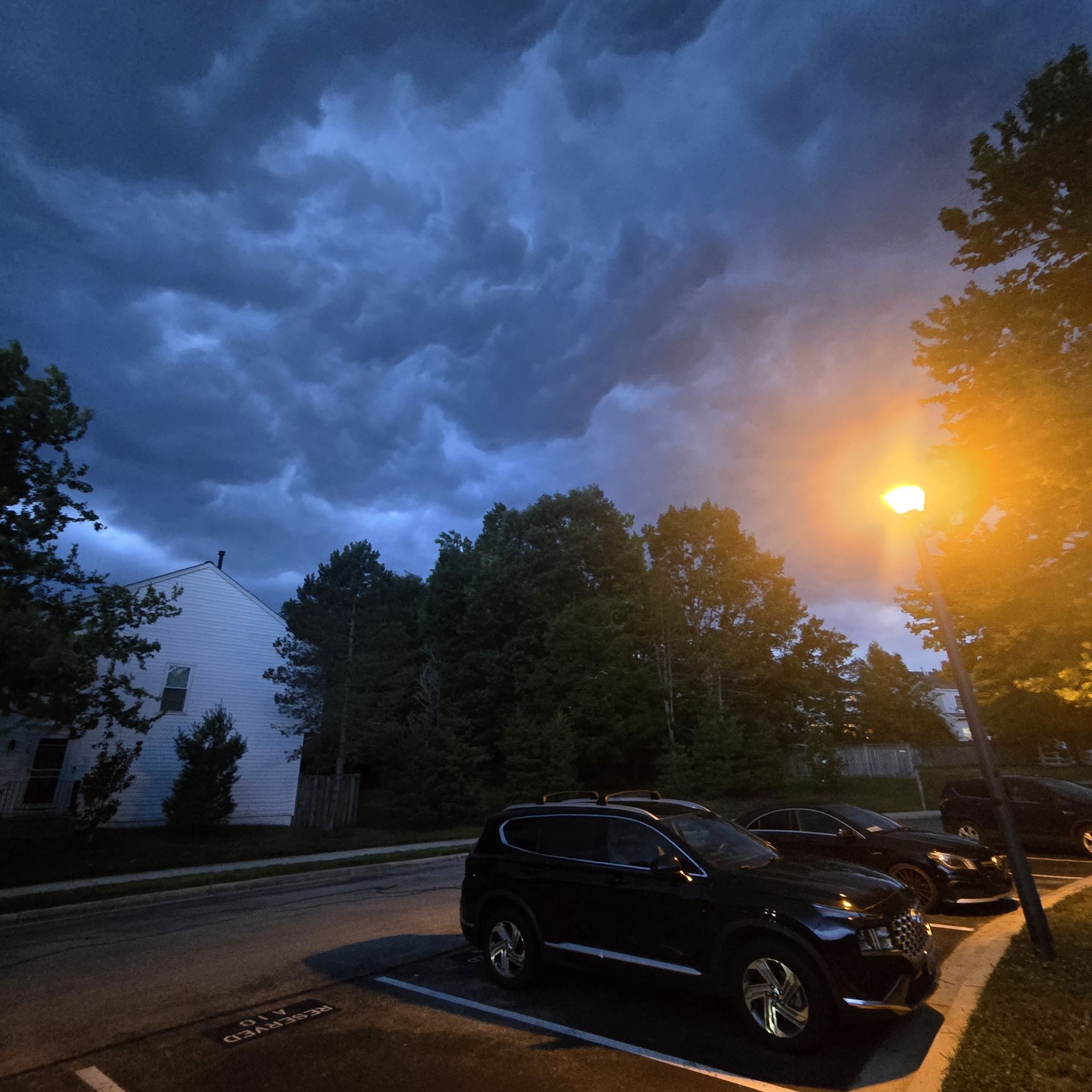
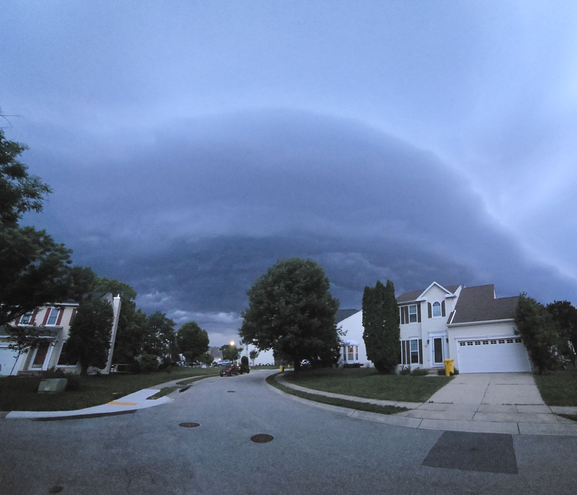
Driving along the spine of the shelf was sort of a cool view -
This is why we have kids. So we aren’t doing it
-
Had 30-40mph here with the gust front
-
Was able to get this before it hit
- 563 replies
-
- 1
-

-
- severe
- thunderstorms
- (and 7 more)
-
May be cycling near portage. Will see if it drops another down
-
Yeah a tor was likely on the ground while unwarned. Or at least was about to drop
-
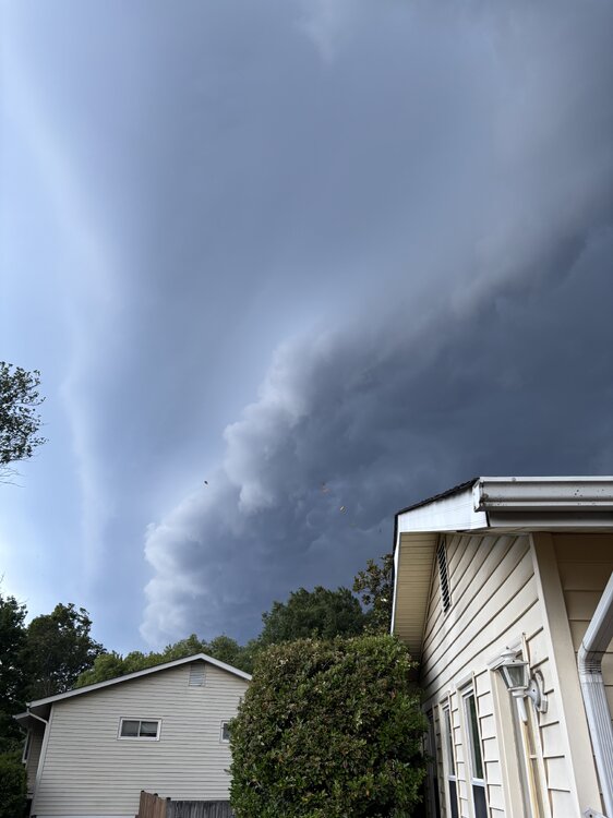
Yeah wind is legit. Very little thunder
-
2026 Mid-Atlantic Severe Storm General Discussion
wxmeddler replied to Kmlwx's topic in Mid Atlantic
The whales mouth was very good. Very high LCL's though. Would estimate 35-40 mph which lines up with most of the non-sonic wind reports. -

Central PA Summer 2026 Discussion/Obs Thread
mahantango#1 replied to Voyager's topic in Upstate New York/Pennsylvania
Wind with .10 rain from the storm. Seems like they fell apart. Anyway we have tomorrow. Let's see if tomorrow produces anything. -
Today's highs - hot in the city EWR: 97 PHL: 97 BLM: 97 TEB: 97 LGA: 96 ACY: 96 New Brnswck: 96 JFK: 95 TTN: 93 ISP: 92 NYC: 91 (4-6 cooler)
-
Need a TORE on that
-
Maybe it can improve things?
-

- 563 replies
-
- 2
-
-
- severe
- thunderstorms
- (and 7 more)
-
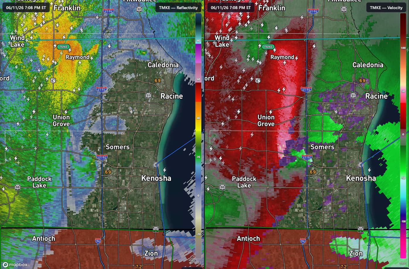
MKE terminal doppler looked pretty telling for a brief tor, will try and get a framegrab
-
The CC drop is immense on it. Those traffic cams with the dark ominous blue hue reminds me of the joplin vid where that trucker drives into it, the sky goes from modest dark to total pitch black darkness.
-
Here too. We sent the kid out to the pool to grab floaties just before gust front hit
- 563 replies
-
- 2
-
-

-
- severe
- thunderstorms
- (and 7 more)
-
Hobart, IN is about to be absolutely smoked
-

- 563 replies
-
- 7
-
-

-
- severe
- thunderstorms
- (and 7 more)
-
Massive debris ball near Merrillville


.thumb.gif.f92b16c631a1d15d405ed77b33f0710d.gif)


.thumb.jpg.ad3a2e31d30aff035044689b311a0540.jpg)