All Activity
- Past hour
-
I believe once it enters a small of radius around the radar you will lose sight of it? Can still draw that line across the gap to estimate where it is.
-
It's so funny what we call powder here, and I also agree with you. This is DMV powder. I was up on the Tug Hill a couple weeks ago like I've mentioned 100 times now lol. The snow there is just different. It's harder to walk in this 3" i have on my street than it was to walk in 20" up there. I walked in fresh stomach high snow on morning and you could almost run in it. Once it packs down it's a different story.
-

Southern Crippler - Get well soon Jimbo Storm Obs
Coach McGuirk replied to BooneWX's topic in Southeastern States
I'm staying up until It gets above freezing. Currently 28.3. -

Southern Crippler - Get well soon Jimbo Storm Obs
NGTim replied to BooneWX's topic in Southeastern States
29.5/29.3 here in Dahlonega Ga which was supposed to be one of the hardest hit cities. about a quarter to half inch of sleet on the ground, no ice in the trees. Power still on. So far have dodged a huge bullet, but probably not out of the woods yet. -
Clarksburg, MD @5:30am +SN 4.6"
-

January 25-26 Winter Storm Potential
Fields27 replied to Ralph Wiggum's topic in Philadelphia Region
Just woke up. Have 1.8" on the board in Reading with SN. 10*. Radar is juiced! Hope we can all bust high and enjoy the snow day! Sent from my SM-S938U using Tapatalk -
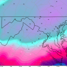
Literally about to post this. It didn't fall south it's like it collapsed completely. Wonder if it's just not picking it up?
-

1/24-1/25 Major Winter Storm - S. IL, IN, and OH
A-L-E-K replied to A-L-E-K's topic in Lakes/Ohio Valley
Doing quite well -
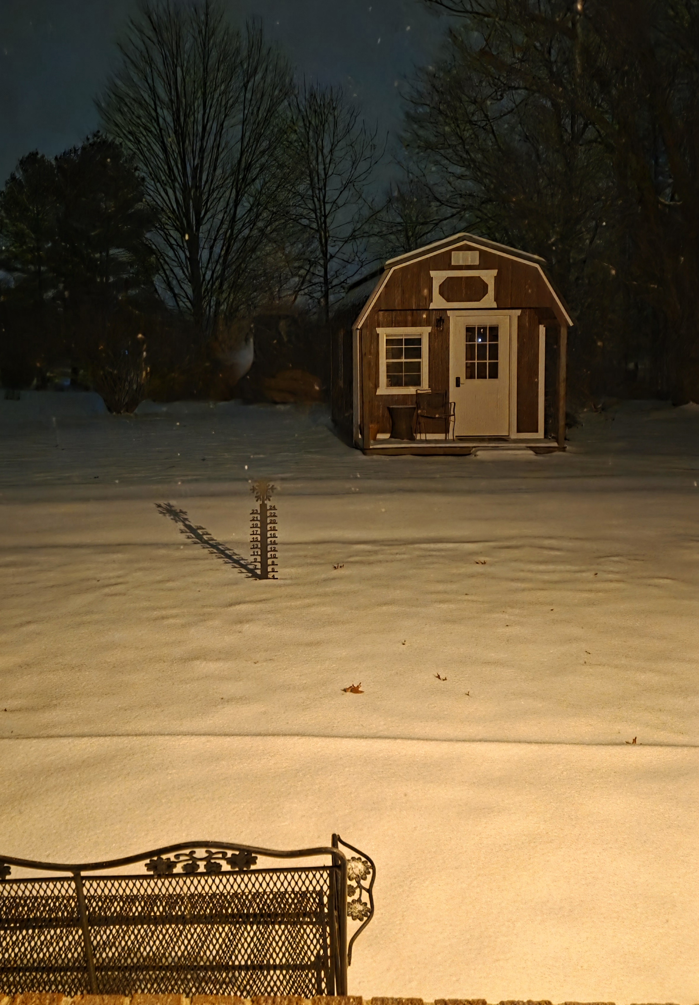
We have the same snow stick thingy!
-
Just got up with not enough sleep but don’t care. 2-3 inches on the deck. Snow falling nicely. Decent, not massive (yet) flakes but coming down. Seeing the mixing line get absolutely clobbered by rates on the radar is a thing of beauty. Here’s hoping we all get a turn at that band as it works its way up. If we do end up switching at 9-10am as the HRRR is saying, I think it will be a good result!
-
I hope that IS the case, because it would mean so much to so many
-
Moderate snow began about 5:20 am in Melville LI. Road already covered by 5:50 am Glad this is occurring on a Sunday
-

Central PA Winter 25/26 Discussion and Obs
Ruin replied to MAG5035's topic in Upstate New York/Pennsylvania
Um guys why do we have a L off the south east coast? that wasnt modeled at all? not only that but we have a low in the gulf too? -
 New BOX map just issued
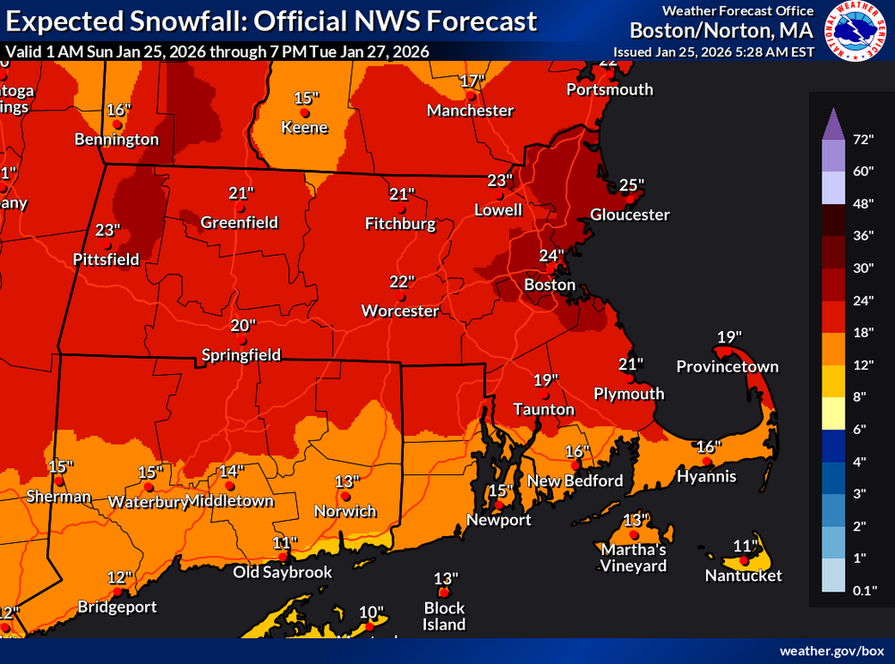
-

January 24-26: Miracle or Mirage OBS Thread!
urbansnowlover replied to Jebman's topic in Mid Atlantic
In western Culpeper County right on the radar sleet line, can confirm 4 inches on the unofficial measurer and pingers started about 30 minutes ago.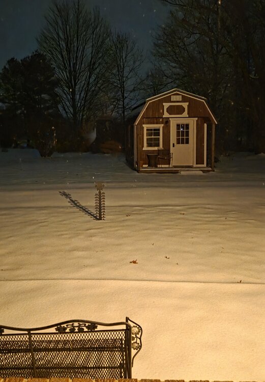
-

Extreme Cold, Snow & Sleet: SECS 1/24 - 1/26
nycsnow replied to TriPol's topic in New York City Metro
RRFS drops the mix line again from Hour 12-14 hopefully it really happens -
Heavy Sleet with some snowflakes mixed in too.
-
God that looks so sick. Coming right for dc
-
Ping ping ping in Colonial Beach. Transitioned at 530am, just a bit ahead of schedule. I'm rooting for either all sleet at this point or 33F and rain (didn't think I'd ever say that)
-
Pd2 was just as cold lol
-

Southern Crippler - Get well soon Jimbo Storm Obs
DTP replied to BooneWX's topic in Southeastern States
I was one of the people who thought the model depiction of a squall line into the wedge looked kind of fishy- I may have to eat my words on this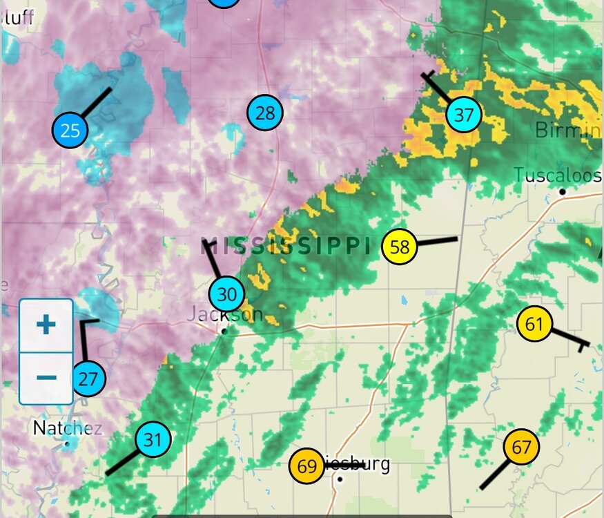
-
7° w/ lgt snow dusting on all surfaces
-
 Current 30 with .3-.5 ice accumulation. Winds are whipping and I can hear tree/limb falls everywhere. Still have power but not expecting it for long.
 -
Get those yellows in here baby
-
If the radar is correct, maybe this heavy batch is cooling the column as psu said would happen