All Activity
- Past hour
-

Winter 2025-26 Medium/Long Range Discussion
Baum replied to michsnowfreak's topic in Lakes/Ohio Valley
Confirmed. -
The Euro is currently caving to the KING GFS for Augusta............................... 00z Euro had Augusta County at 62 for Christmas afternoon. The 06z Euro drops that 62 to 56....... Sterling NWS forecasters are at a loss. Later today, Sterling Thur thru Saturday likely to change significantly.... 13.2 at 7 am.
-

E PA/NJ/DE Winter 2025-26 Obs/Discussion
Mikeymac5306 replied to LVblizzard's topic in Philadelphia Region
Love opening up this forum and seeing the last post from Wiggum cause that means something is cooking. 6Z Euro has a sleet storm. Give it till tomorrow before we cue up the Patton speech. -

White Christmas Miracle? December 23-24th
40/70 Benchmark replied to Baroclinic Zone's topic in New England
I'd hit it- -
Over the years I've noticed there's a ton of night owls on here. They're probably just asleep lol
-
Weather channel just talked about that. Icy and snowy potential!
-
Euro isn’t going to move 300 miles in one run but my guess is gfs is way too far south
-

Central PA Winter 25/26 Discussion and Obs
mahantango#1 replied to MAG5035's topic in Upstate New York/Pennsylvania
1 in. -
2025-2026 ENSO
40/70 Benchmark replied to 40/70 Benchmark's topic in Weather Forecasting and Discussion
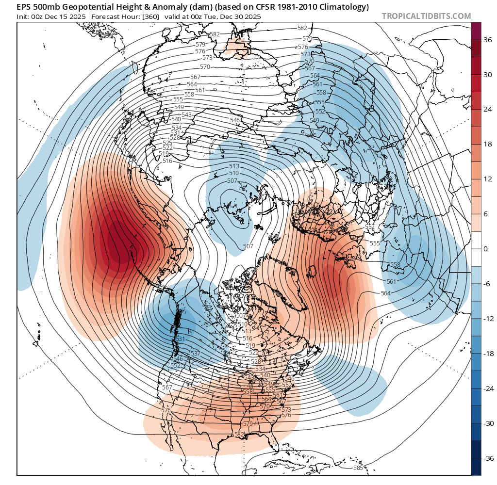
I haven't put much effort into whether or not we trend colder in the shorter term (don't really care), but expect this Pacific trough regime to last into mid January before the flip, which is consistent with his timeframe. It's important to keep in mind that the Pacific trough regime doesn't have to mean an all out torch, which some may be conditioned to believe. BAM is right about the PV being on our side of the hemisphere, so that would help to mitigate that. -
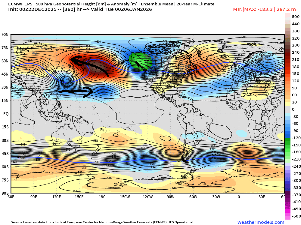
All we can say for sure is that the -NAO corrected much stronger and the PNA more negative with a stronger trough digging into the West. Certainly an unusual looking setup for snow here. But the kicker low over the Dakotas prevents the low near our area from riding too far north. So in an odd way the stronger -PNA actually helps which we don’t see much. The solution could change in the coming days with all the moving parts. New run Old run

-
6z Euro came south some, but not far enough. Slams NYC. Nobody's safe with this one before Christmas imho.
-
I think half of CWG posts are written 12 hours out and then get scheduled to post during certain high fb traffic times
-
You become closer to your weenie friends than your own spouse during winter?
-
What happens when you’re the wife running off to check the models??
-
I think because some storms are just coming into focus? Things will pick up soon..
-

December 2025 regional war/obs/disco thread
mahk_webstah replied to Torch Tiger's topic in New England
I’m starting to think we may be at the start of a very strong run of snow at least up here but probably in southern New England as well. And maybe even the northern mid Atlantic. Maybe starting Tuesday for a couple of weeks? -
Yeah nice video from him. Brought up some of what I posted about on Saturday. I'm a little quicker with the process though. Don't need convection at the dateline for things to happen. It's well underway before that. Still think a +PNA is a very real possibility though too. But same general idea. Pacific jet fires off and these waves break. I think the 00z EPS is still suggesting that the whole process gets underway too TBH.
-

December 2025 regional war/obs/disco thread
Kitz Craver replied to Torch Tiger's topic in New England
I know it! We actually have some potential and everyone is MIA? -
Nevermind CWG just posted warming trend through the weekend...the geese and Webb were right
-

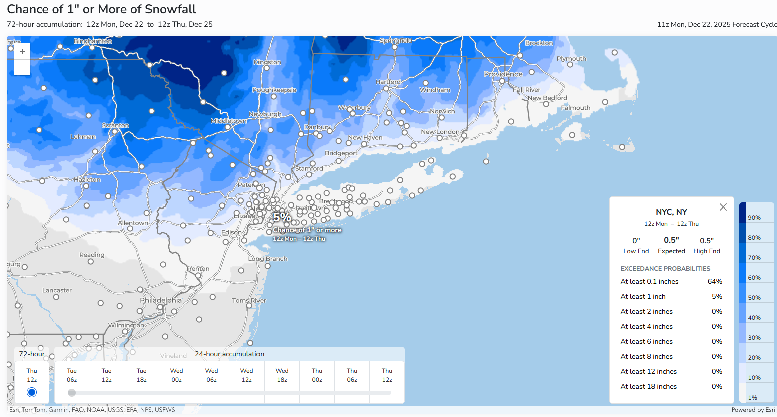
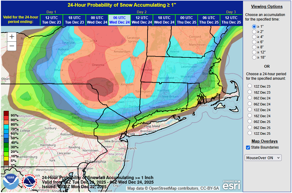
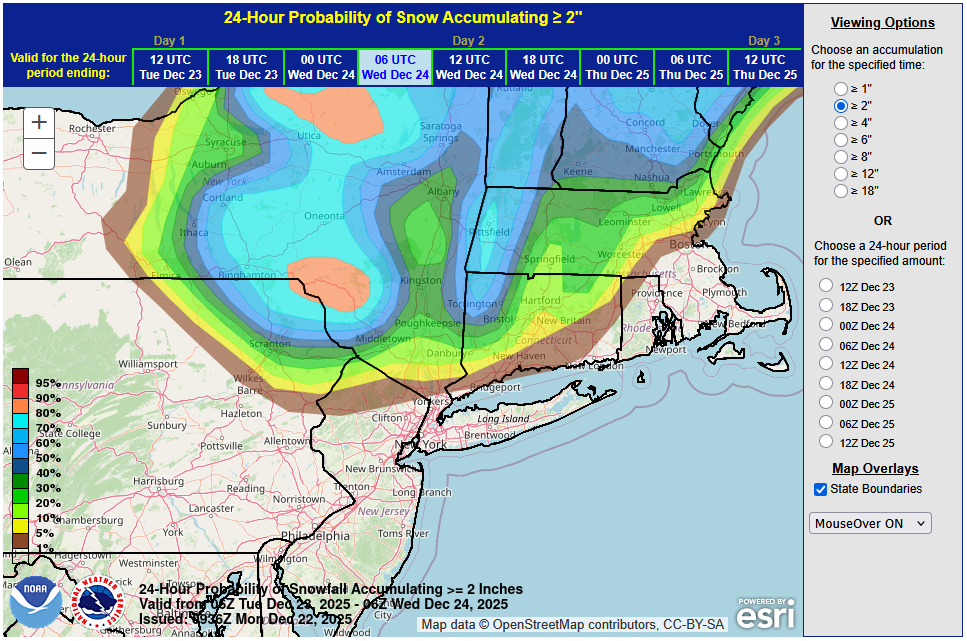
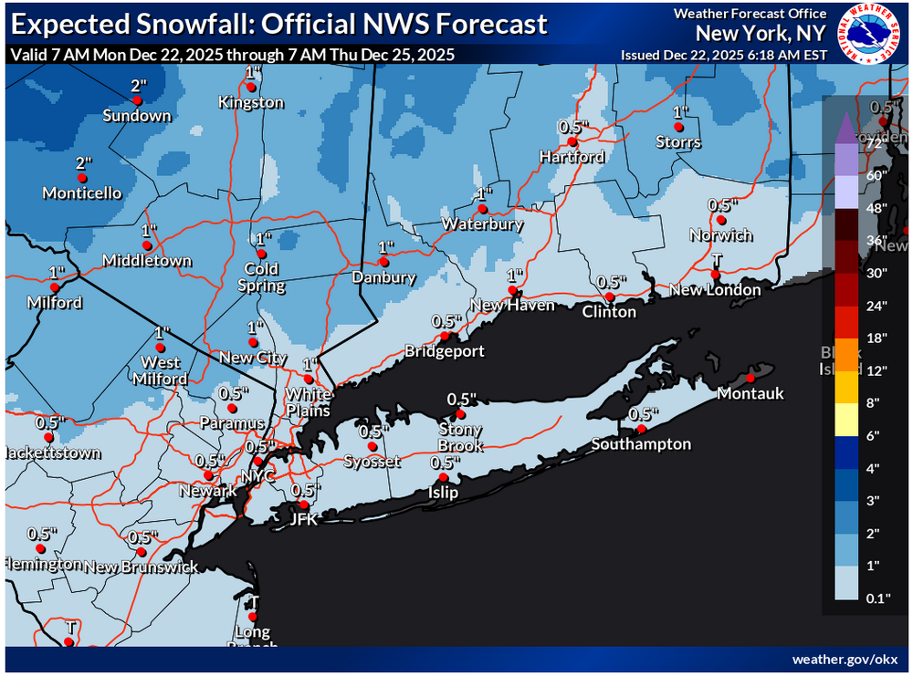
Possible Light Snowfall (1" - 4") on Tuesday Dec 23
donsutherland1 replied to Northof78's topic in New York City Metro
Not much has changed overnight. A coating of snow seems likely in New York City and its nearby suburbs due to a combination of marginal temperatures and light precipitation rates. 1"-2" is likely in the distant northern and western suburbs. There could be some 3" amounts in places like Binghamton. Overall, the system remains on course to be a minor one. The latest WPC maps: For reference: the latest NWS Map: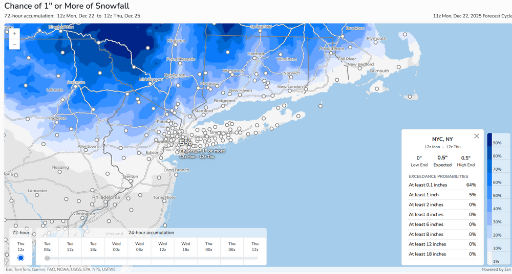
-
So no way right? This would be a time I would be thankful for the mountains.
-
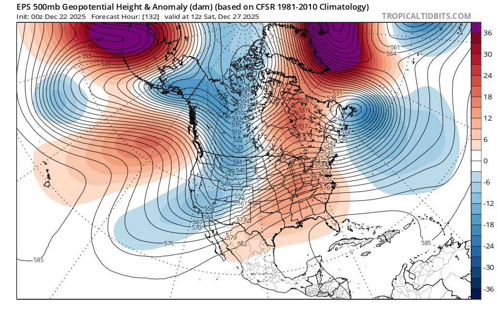
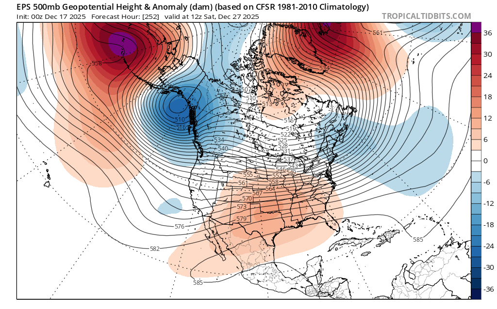
Eps is now correcting with the blocking. Its hard to take these models seriously in the long range. Courtesy of another forum

-

E PA/NJ/DE Winter 2025-26 Obs/Discussion
Ralph Wiggum replied to LVblizzard's topic in Philadelphia Region
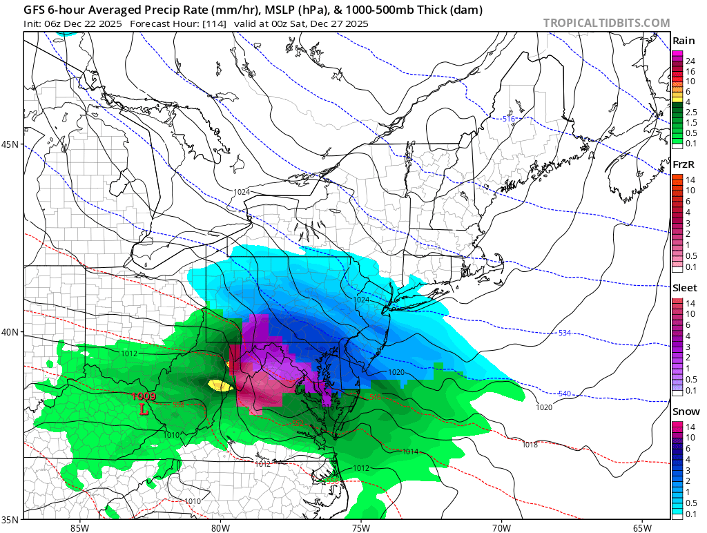
6z doubled down for Friday and the euro moved towards the gfs. HP in near perfect spot.
-

December 2025 regional war/obs/disco thread
Sey-Mour Snow replied to Torch Tiger's topic in New England
Crickets in here lately for two possible accumulating snow events this week. Then if we had no snow in the forecast and a raging SE RIDGE at day 15 I'd wake up to 25 posts from the warmistas and negative nancys .. -
At least someone gets to get away. Social gatherings are exhausting. I host Christmas so I get the home team advantage. Thankfully, we have very few friends and they rarely have parties