All Activity
- Past hour
-
Yep
-
Use ignore and act like adults. There’s no obligation to respond back to garbage/insults. Use the report button. Life happens and mods don’t monitor this place every second. When it gets absurd here and I’m around I delete posts but I’m not here much during the boring as hell weather periods we have more and more of. Life takes priority over babysitting adults acting like 5 year olds.
-
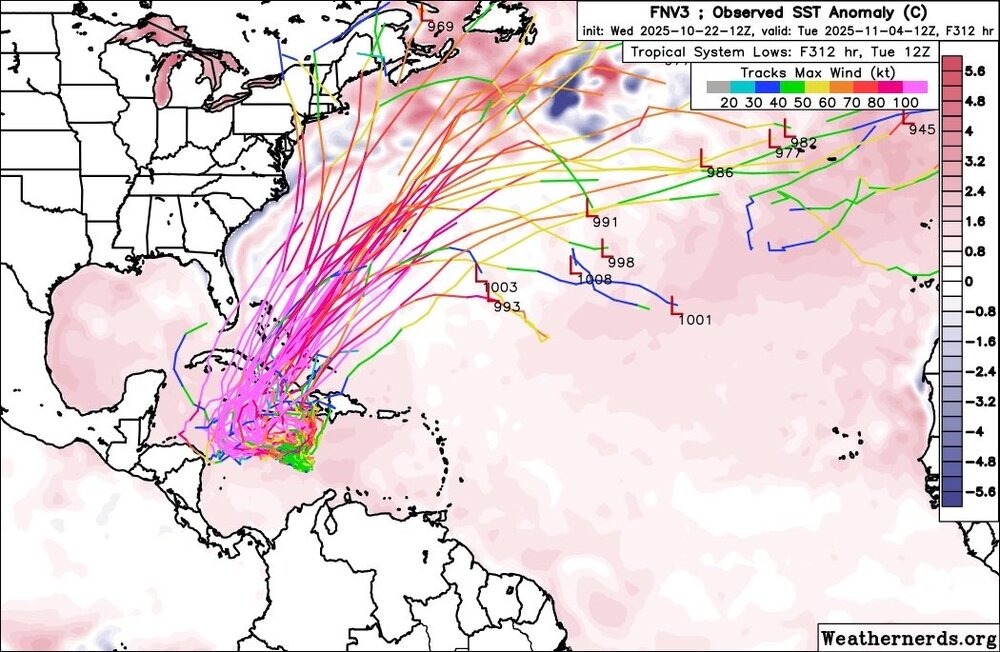
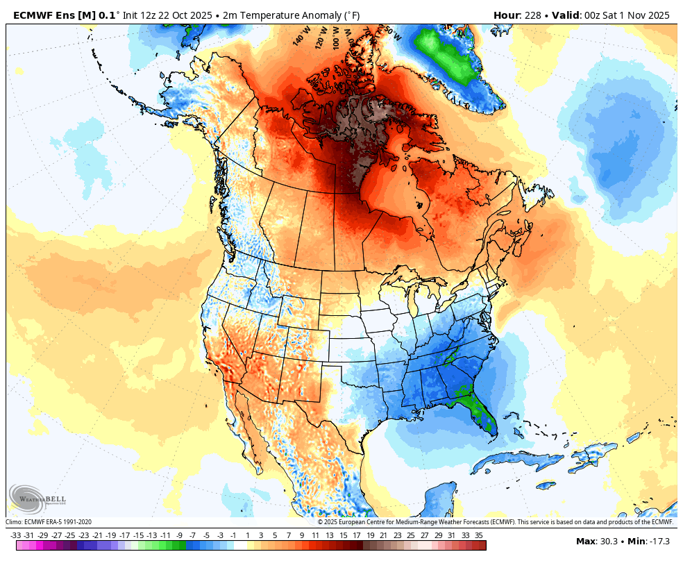
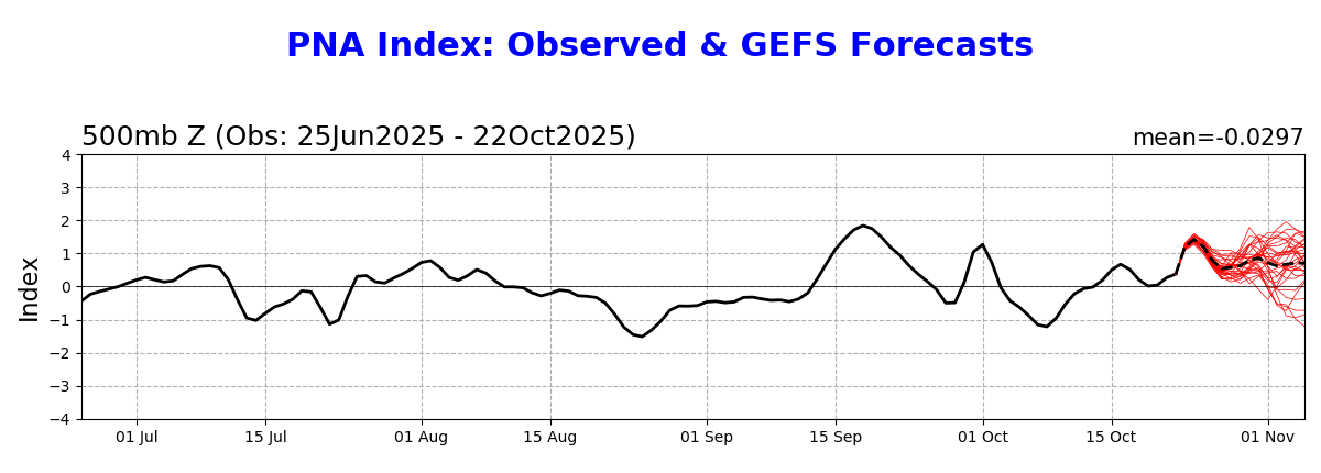
An AO+/PNA- blocking regime has developed. As a result, an extended period of cooler than normal weather lies ahead. Highs tomorrow will top out in the upper 50s tomorrow and Friday. It will then turn even cooler during the weekend. Temperatures will reach the lower and middle 50s. The unseasonably cool weather will continue into at least early next week. There is a possibility that the closing days of October into the opening days of November could experience a significant rain event. The ENSO Region 1+2 anomaly was -0.4°C and the Region 3.4 anomaly was -0.6°C for the week centered around October 15. For the past six weeks, the ENSO Region 1+2 anomaly has averaged -0.15°C and the ENSO Region 3.4 anomaly has averaged -0.47°C. La Niña conditions will likely continue through mid-winter. The SOI was +15.73 today. The preliminary Arctic Oscillation (AO) was -0.694 today. Based on sensitivity analysis applied to the latest guidance, there is an implied 51% probability that New York City will have a warmer than normal October (1991-2020 normal). October will likely finish with a mean temperature near 58.0° (0.1° above normal). Supplemental Information: The projected mean would be 1.1° above the 1981-2010 normal monthly value.
-
Would have been prolific for inland snow amounts, I think this is probably one of our all time inland lake effect rain events ever. Got two inches in my gauge already.
-
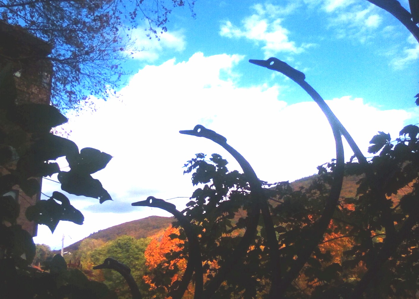
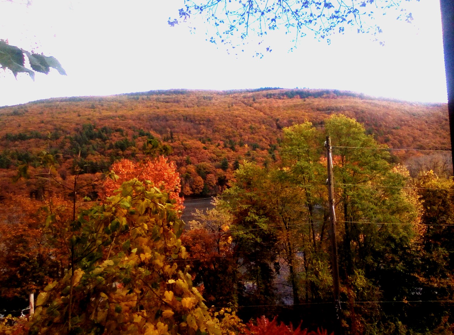
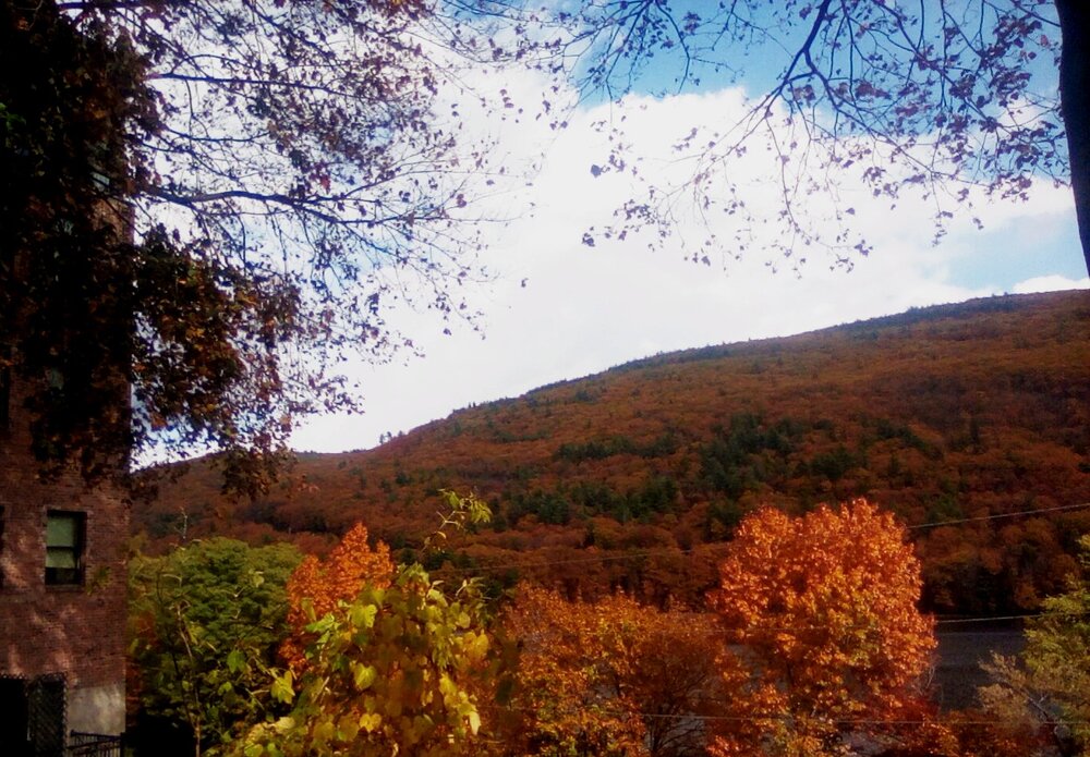
We have achieved peak color!


-
Model's are only as good as they're programmed and what's ingested into them. Probably either broadbrushes your area or the Data ingested is from Station's such as Lafollette ; warmer Locations. So, the Model's reflects that for your area. That's my Guess. Same way they are here. Pennington gap and the County Airport 7 Miles SW of Jonesville are the " official" Station's. They are warmer than most of the County.
-

Spooky Season (October Disco Thread)
Chrisrotary12 replied to Prismshine Productions's topic in New England
Stein continues on the GFS huh? Oh well. -
Spooky Season (October Disco Thread)
Chrisrotary12 replied to Prismshine Productions's topic in New England
Congrats Bermuda. It's always Bermuda. -
None of this is true but ok, it’s insane I’m 5 posted but he just runs around with nonsense… especially since I’ve been around since the 2000s but whatever
-
It's not that big of a deal. This forum isn't someone's personal curated playlist. @LibertyBell should definitely use the multiquote feature though lol
- Yesterday
-
Yeah, probably a couple feet in some spots. A promising sign of how primed the lake is again this season.
-
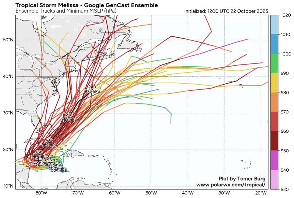
18Z Euro gives much of Jamaica near or just over 20” qpf with heavy rain still likely continuing for a few more hours with the storm still centered over SW Jamaica and SLP way down at 943 mb; it’s then moving slowly NNE while SSE of a strong upper trough that’s then over the E US.
-
Because us moderators dont have the ability to 5 post, and banning certain ppl just makes our jobs harder because ip banning makes no difference. Plus i cant immediately respond to every time he posts nonsense. I try to keep up on days im around more.
-
Verified much cooler than model guidance again this morning. MRX low forecast was 40, it was 35 and frosty.
-

E PA/NJ/DE Autumn 2025 Obs/Discussion
Birds~69 replied to PhiEaglesfan712's topic in Philadelphia Region
I wasn't really expecting anything but maybe a quick shower. Looked at the radar at 9:00 p.m. and said that's going to be more than a shower. If cold that would have been a nice little snow surprise...1-2" with a little more in some areas. .. . -
65 today. Slip sliding away into deep autumn
-
Got through 2 minutes and fell asleep
-
The rest of the mountains will get there's tomorrow night.
-
Avery-Yancey-Mitchell- Including the cities of Busick, Poplar, Celo, Newland, Spruce Pine, Burnsville, Ramseytown, Ingalls, Micaville, Banner Elk, and Swiss 153 PM EDT Wed Oct 22 2025 ...FREEZE WATCH IN EFFECT FROM LATE THURSDAY NIGHT THROUGH FRIDAY MORNING... * WHAT...Sub-freezing temperatures as low as 28 possible. * WHERE...The northern mountains of North Carolina. * WHEN...From late Thursday night through Friday
-
I think the 12z GGEM might have been listening in.
-
I really hope it doesn't get that bad, with stalling, for Jamaica.
-
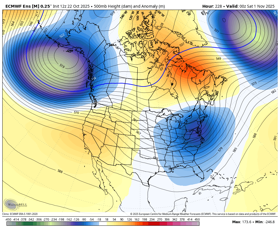
I love this look for Halloween with quite a chilly one in much of the E US! Nice +PNA:


-

Spooky Season (October Disco Thread)
bkviking replied to Prismshine Productions's topic in New England
October 21, 2012 CMC forecast.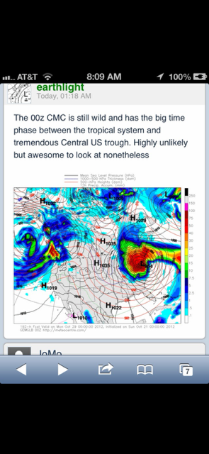
-

Spooky Season (October Disco Thread)
ineedsnow replied to Prismshine Productions's topic in New England
hopefully next week -
Another thing to keep in mind too is late October is the only real window for these hybrid storms to form with the perfect conditions. The only two storms we have recorded Sandy and The Perfect Storm in 1991 both happened at the very end of October. So it's interesting given the time period we're in and that the overall setup is very similar. Maybe once the GFS stops being absolutely useless and figures things out we'll have a clearer picture of what will happen. Definitely worth keeping an eye on.