All Activity
- Past hour
-
Congrats AllwetandallcoldATT. The blight on the tomato plants is running rampant. Just pulled a tomato of limbs off with it . And oh by the way the mosquitoes today .. unbearable
-
Well just got new tires down in Indy. Time to road test lol Sent from my SM-S134DL using Tapatalk
-
dogs living with cats, real biblical stuff. meanwhile, I thought it was supposed to be rainy all day. just hit 90f by my office in the bronx.
-
if you look at this loop, literally over just the last 1/2 hour or so, all of NE PA/E NY, W MA and W CT just went more sun than clouds. My guess is the warm front is mixing out. It's 76/70 here up from 73/66 and hour ago, and though we're in the clouds its noticeably jumped.
-
Don't models tend to poorly handle MCS propagation, especially in these regimes? Models in general though seem to struggle with how convection behaves when you have sharp instability gradients. In real time the convection will follow the instability axis but models tend to place a greater emphasis on other variables. Anyways look at the GFS and where it tracks the MCS then look at MUCAPE...if we were to fast forward to verification time my bet would be the MCS making a sharp turn across southwestern NY into PA.
-
Blue sky starting to peak thru now. Big rainer mostly.
-
And just like that. The sun comes out and dewpoints into the 70s. Feels like summer.
-
Completely off topic but if your interested in Artificial intelligence and comedy, this is ai comedy gold. Don't miss the fight. https://youtu.be/9HJZYjkNs_s?si=x78edUZQuyMNM8DA
-
Good post. Although I do disagree with this part: "While at this juncture it doesn't look like record highs are in jeopardy..." Below, is the current point-click forecast centered on DTW Airport. Record highs for Saturday through Tuesday are: 96, 98, 95, and 97. Record high minima are: 75, 73, 74, and 74. So this forecast would imply a new record high on Monday, June 23, and record high minima on Sunday, Monday, and Tuesday (tie). So I don't agree with that conclusion. Clearly, records are in jeopardy or else the NWS forecast is out to lunch. And this is just one location. I'm sure other locations will be at or near record high temperatures as well.
-
77/72 with BINOVC. AWT.
-
there's goes our boating day.
-
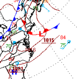
you actually beat us ... Why you sumna bish ... Yeah, judging by this cut out of WPC's "always" trustworthy never odd looking computer generated frontal tapestry ... ( haha) that we're getting the old end-around warm frontal passage - it's likely through you guys up there and we're getting quasi nut pinched down here.
-
Well ... what do you mean by that - the models are tracking where they see it. How do we know where that axis will be at this time. In principle, that's true. They'll pac-man along the elevated thermodynamic gradient.
-
My initial wondering/thinking is whether the models are too far northeast with the MCS. Verbatim I am wondering if this would track to our southwest as that is where the instability gradient is most defined.
-
Wow, that line/system looks quite intense. Have to wonder if it will reach derecho criteria.
-
85/68 up here at MVL. What a summer day today.
-
Good to finally see some sunshine. Temp popped to 86 here. Feels steamy out there with the dewpoint at 72.
-
Erick appears to be going through nuclear intensification, not just rapid lol. That’s the sat presentation of at least a 3
-
Getting blasted right now in Edgewater. Thunder woke me up. Start a stretch of nights tonight. I’ll take the rain cooled air. Bring it
-
It's hauling. ...A SEVERE THUNDERSTORM WARNING REMAINS IN EFFECT UNTIL 330 PM EDT/230 PM CDT/ FOR WHITE...PULASKI...NORTHWESTERN CASS...STARKE AND SOUTHERN LA PORTE COUNTIES... At 259 PM EDT/159 PM CDT/, severe thunderstorms were located along a line extending from Roselawn to near Wolcott to near Brookston, moving northeast at 75 mph. HAZARD...70 mph wind gusts and penny size hail. SOURCE...Radar indicated. IMPACT...Expect considerable tree damage. Damage is likely to mobile homes, roofs, and outbuildings.
-
Just heavy rain, not even strong winds. Lots of lightning though.
-
Heavy tropical rain and lots of ground shaking thunder. This is a fun one. It looks like there's a row of storm developing behind this batch. There's a flash flood happening here in the South River watershed. If anyone is on 450 between Crofton and Annopoils mall beware. There's a torrent headed through the watershed. Edit: 1.03" in 20 minutes
-
Heavy rain and lightning in the Lake Shore area of Pasadena. No wind at all. Nothing severe.
-
All the models have the MCS now... interesting. Euro most aggressive
-
The forecast has really zeroed in on a potentially quite significant heat wave for most of the subforum starting tomorrow and going through at least the weekend. At least 3-4 days of mid 90s over mid 70s dew points is going to cause heat index values to rise over 100 degrees over the weekend, especially in the Chicago and Detroit UHI's. While at this juncture it doesn't look like record highs are in jeopardy, the heat index and warm nights could cause some issues in the metro areas. This will probably be the most significant heatwave since the 2 day heatwave back in August 23. Figured that this is significant enough to warrant a thread of it's own. Edit: As I was typing this out, ARX just put out an Extreme Heat Watch. With heat indexes up to 105 mentioned over the weekend.
- 1 reply
-
- 1
-


.thumb.jpg.6a4895b2a43f87359e4e7d04a6fa0d14.jpg)