All Activity
- Past hour
-

Augdewst 2026: Summer's Last Stand
Brewbeer replied to Prismshine Productions's topic in New England
beach weather for hearty New Englanders -
That line blew up at I-84 as it moved east; got woken up to FL like downpours around 10.
-
 No storms unfortunately
 -
Augdewst 2026: Summer's Last Stand
Damage In Tolland replied to Prismshine Productions's topic in New England
Congrats you to Dendy. Couple inches of boring rain -
Augdewst 2026: Summer's Last Stand
Damage In Tolland replied to Prismshine Productions's topic in New England
Did a downpour poo overhead? When I went to bed at 9, there was a shower line showing to the NW -
Septorcher 2026 Discussion - Endless Summer
Damage In Tolland replied to Damage In Tolland's topic in New England
If you look at ensembles it’s AN thru mid month especially this week and then after the 10th -
0.08” in Sunday evening’s 15-20 min pop-up Columbia shower. 4.22” for August thru 8/30.
-
Occurring during such a strong developing El Niño made this even more extreme relative to what has occurred in the past.
-
Septorcher 2026 Discussion - Endless Summer
Brewbeer replied to Damage In Tolland's topic in New England
for the mid west, yes but we live in New England -
JFK was able to finish this summer with the 4th highest number of 95°+days similar to some of the big 90° summers you mentioned. But stronger sea breezes overall lead to a lower total of 90°+ days than those years. So the higher end heat early on boosted JFK into the top 10 of warmest summers. While the developing super El Nino summer of 2015 was also warm for average temperatures at JFK, it didn’t have the major 95°+ and 100°+ heat this summer had. So the magnitude of the heat this summer was a first for such a high end El Niño event. Time Series Summary for JFK INTERNATIONAL AIRPORT, NY - Jun through Aug 95°+ days Click column heading to sort ascending, click again to sort descending. 1 2010 10 0 2 1963 8 0 3 2002 7 0 - 1999 7 0 5 2026 6 2 - 2013 6 0 - 1949 6 0 8 2012 5 0 - 1983 5 0 - 1966 5 0 - 1955 5 0 12 2025 4 0 - 2022 4 0 - 2006 4 0 - 1993 4 0 - 1991 4 0 - 1974 4 0 - 1968 4 0 Time Series Summary for JFK INTERNATIONAL AIRPORT, NY Warmest Summers Click column heading to sort ascending, click again to sort descending. 1 2010 77.1 0 2 2016 76.5 0 3 2022 76.1 0 4 2015 76.0 0 5 2024 75.8 0 - 2011 75.8 0 6 2020 75.7 0 7 1983 75.6 0 8 2026 75.4 2 - 1984 75.4 0 9 2012 75.3 0 - 1991 75.3 0 10 2025 75.2 0 - 1971 75.2 0 - 1949 75.2 0 All-time Maximum 1-Day Mean Max Temperature for JFK INTERNATIONAL AIRPORT, NY Click column heading to sort ascending, click again to sort descending. 1 104.0 1966-07-03 through 1966-07-03 2 103.0 2011-07-22 through 2011-07-22 3 102.0 2026-07-02 through 2026-07-02 - 102.0 2025-06-25 through 2025-06-25 - 102.0 2025-06-24 through 2025-06-24 - 102.0 2011-07-23 through 2011-07-23 - 102.0 1999-07-05 through 1999-07-05 - 102.0 1963-07-01 through 1963-07-01 4 101.0 2010-07-06 through 2010-07-06 - 101.0 2010-07-04 through 2010-07-04 - 101.0 1993-07-09 through 1993-07-09 - 101.0 1966-07-04 through 1966-07-04 - 101.0 1966-07-02 through 1966-07-02 - 101.0 1957-07-22 through 1957-07-22 - 101.0 1948-08-27 through 1948-08-27 5 100.0 2026-07-04 through 2026-07-04 - 100.0 2026-07-03 through 2026-07-03 - 100.0 2013-07-18 through 2013-07-18 - 100.0 2010-07-07 through 2010-07-07 - 100.0 1993-07-10 through 1993-07-10 - 100.0 1983-08-20 through 1983-08-20 - 100.0 1983-07-16 through 1983-07-16 - 100.0 1972-07-23 through 1972-07-23 - 100.0 1948-08-26 through 1948-08-26
-
Of course it’s possible. I’d put odds at ~25% as of now. Based on the fact that none are shown on current models, this being progged to be the strongest Nino on record, and the modern analog 1997, which had its last TC become a H on Sept 4th, it’s a realistic possibility.
-
Looks like Tblizz got steined again. He has to calm down.
-
BS, its well known that glaciers around the world are shrinking rapidly due to climate change. The Himalayas are no exception. The increasing local risk from glacier melting was described as a "crisis" earlier this year: https://www.icimod.org/press-releases/hindu-kush-himalaya-glaciers-losing-ice-at-double-the-rate-since-2000-new-icimod-report-confirm/ Kathmandu, 18 March 2026 – Glaciers across the Hindu Kush Himalaya (HKH) are melting at an accelerating rate, with ice loss rates doubling since the year 2000, according to two new landmark reports that will be released on 21 March 2026 by the International Centre for Integrated Mountain Development (ICIMOD) to mark World Day for Glaciers. The reports, Changing Dynamics of Glaciers in the Hindu Kush Himalaya Region from 1990 to 2020 and HKH Glacier Outlook 2026: Insights from 50 Years of Himalayan Glacier Monitoring, provide the most comprehensive evidence yet of glacier change in the region. They reveal a total loss of up to 27 metres of ice thickness since 1975, sounding an alarm for the nearly two billion people downstream who depend on meltwater from the ‘Water Towers of Asia’. “This isn’t a distant problem; it’s a crisis unfolding in real-time, with new disasters every summer and monsoon. The fact that ice loss rates have doubled this century should shock us all into action,” said Pema Gyamtsho, Director General of ICIMOD. “The Hindu Kush Himalaya is at a crossroads. The rapidly escalating impacts we’re seeing from water uncertainty to catastrophic floods underscore that we are in a critical decade for the cryosphere. We must scale up monitoring and invest in adaptation now. These aren’t blind spots becoming surprises anymore; they are our new reality.”
-

2026-2027 Record-breaking El Nino
GaWx replied to Stormchaserchuck1's topic in Weather Forecasting and Discussion
Today’s release for last week averaged out has a notable rise in 1+2: 19AUG2026 3.2 2.5 1.8 0.0 26AUG2026 3.5 2.6 1.8 0.1 To compare, here’s 1997: 27AUG1997 3.3 2.6 1.9 0.4 https://www.cpc.ncep.noaa.gov/data/indices/rel_wksst9120.txt -

2026 Atlantic Hurricane Season
cptcatz replied to Stormchaserchuck1's topic in Tropical Headquarters
Euro and GFS both out to mid September with no tropical development. The question may start getting real soon... Can we go a whole season without a hurricane? -
Topped out at 78F here yesterday.
-
I don't know, Many times in WNW or NW flow, mountains to the W do well, then is often a gap due to downslope flow between IAD and DCA, and then it picks up again due to the bay breeze and higher dew points E of I95, But its not easy tell on any given days the "DC split" occurs, and w/ an EML present, that makes it more complex b/c nighttime convection is more common and often surface-bases, so downslope flow is not as much of a factor.
-
Texas, Oklahoma and Kansas — known as "Tornado Alley", does the NWS consider adding Illinois to this list? https://www.accuweather.com/en/severe-weather/illinois-sets-us-state-record-for-most-tornadoes-in-a-year/1927594
- Today
-
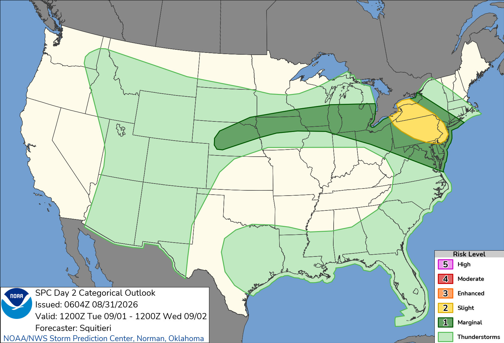
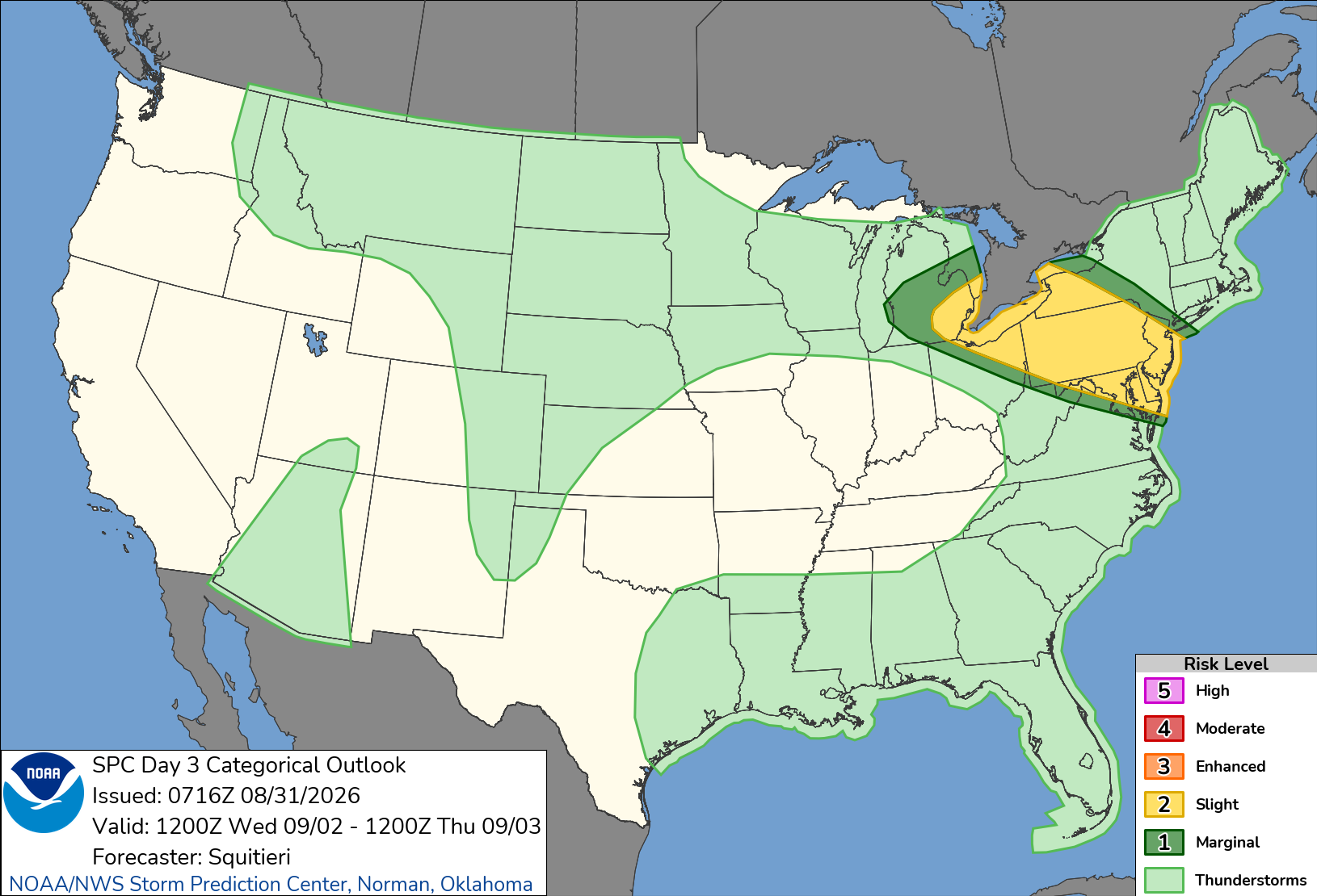
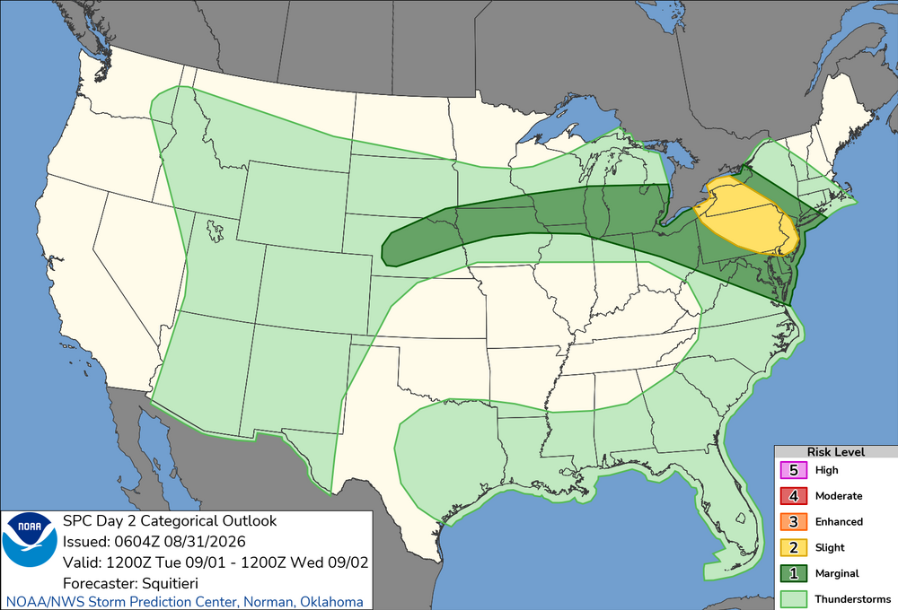
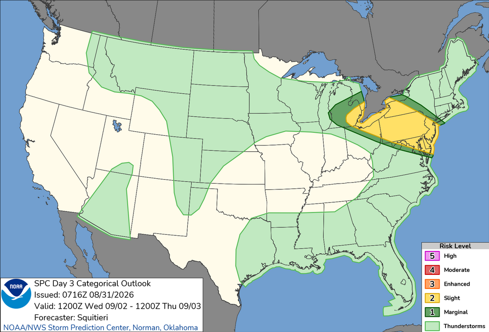
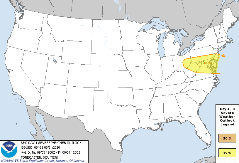
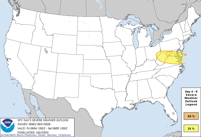
Four days in a row svr risk in this area, esp. this time of year? Sure ,lots of days get upgraded to slight risk the day of and we get 4 days in a row of svr risk, but to have days 3, 4, and 5 outlooked means synoptically it is defined and impressive, which means higher-end svr wx possible. Usually in this part of the country, you don't get multiple days in a row w/ svr wx from NW or WNW flow b/c one wave of convection and it s/w trof clears things for moisture, and it takes a bit of time to recover. Or the front/boundary gets pushed farther and farther S w/ each wave of convection. But the way the mid and upper level ridge is during this period looks like it may force things to be in the same general area repeatedly. Why not? Every so often things do work out for relentless stormy wx in a region! One might say, "4 days in a row, *everyone* should cash in and get crushed at least once during the period!" I hope so. W/ an EML present, you can do some nice things during the overnight hours, esp. with crazy LTG.
- 2,251 replies
-
- 1
-

-
- severe
- thunderstorms
- (and 7 more)
-

Central PA Summer 2026 Discussion/Obs Thread
mahantango#1 replied to Voyager's topic in Upstate New York/Pennsylvania
US National Weather Service State College PA CTP Warning Counts So Far in 2026 SEVERE: 292 warnings is most EVER in a calendar year TORNADO: 30 warnings year-to-date ranks 4th behind 1996 (34), 2011 (40), and 1998 (58) FLASH FLOOD: 80 warnings year-to-date ranks 4th behind 1995 (82), 1998 (105), and 1996 (246) #PAwx -

2026 Atlantic Hurricane Season
codfishsnowman replied to Stormchaserchuck1's topic in Tropical Headquarters
I only check in here from time to time but over the years I have noticed of all the big US land falling hurricanes hardly anyone discusses Camille. I have seen a few documentaries recently and although the better data was in its infancy, this hurricane seems like she could stand solidly against not only any other land falling cat 5s but cat 5s period Just wondering thats all -

Augdewst 2026: Summer's Last Stand
CoastalWx replied to Prismshine Productions's topic in New England
Yeah our best chance might be Thursday, but hrrr pretty wet tomorrow. Not sure I buy it. -
Hard to pin down how much rain we get this week. Some get lucky with with heavy showers others not so much.
-
Augdewst 2026: Summer's Last Stand
CoastalWx replied to Prismshine Productions's topic in New England
Same areas, from him to SE MA. Not even a tenth here. We webbed hands. -
Must have rained a little at some point. Ground is wet but dry in spots.