All Activity
- Past hour
-

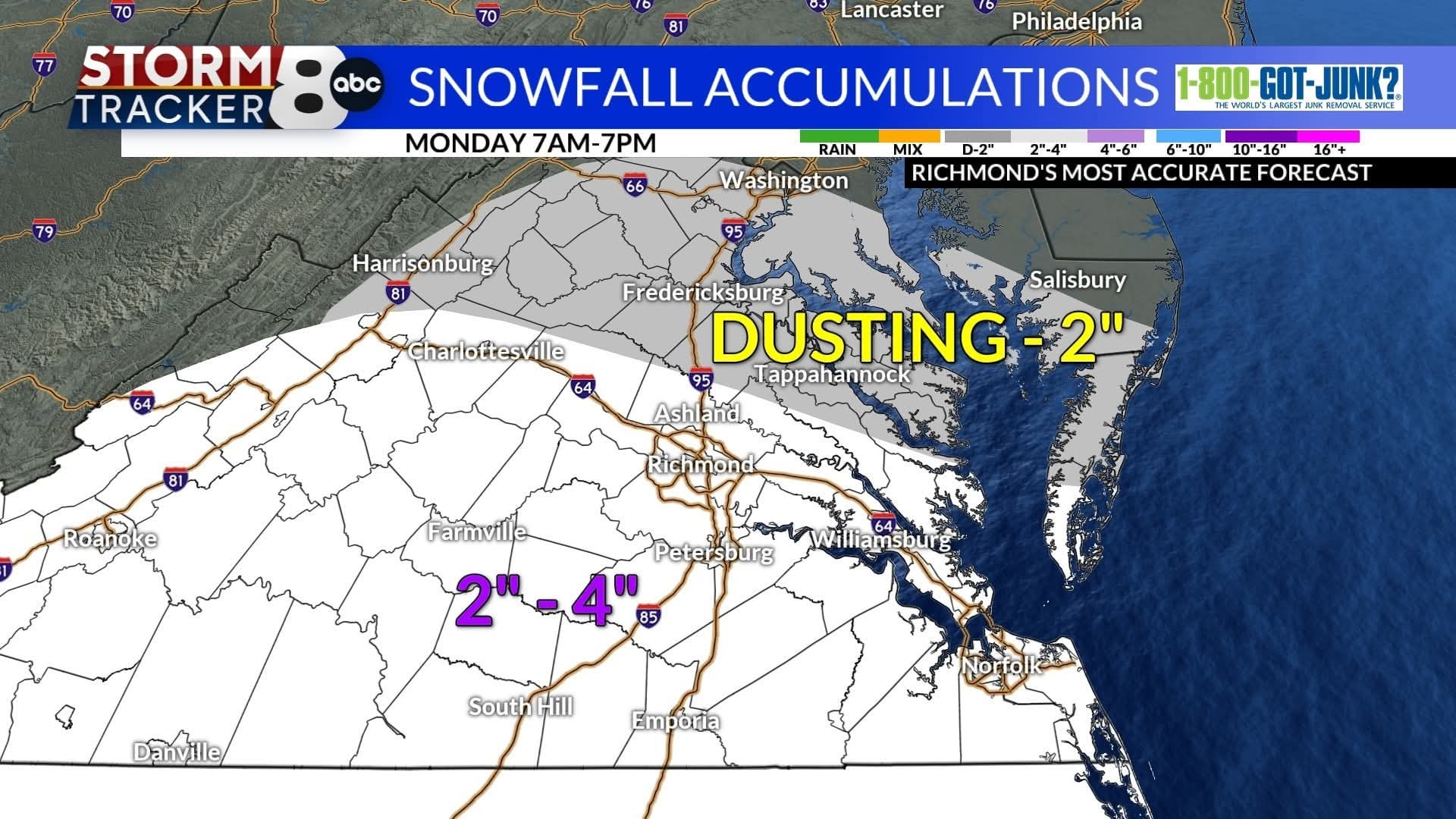
The Monday wintry event potential (12/8/25)
BornAgain13 replied to GaWx's topic in Southeastern States
Close up view of 18z Euro Kuchera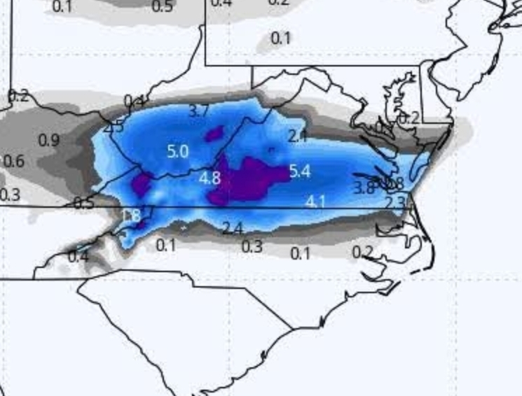
-

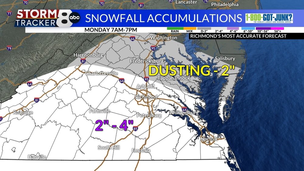
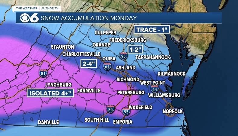
Richmond Metro/Hampton Roads Area Discussion
migratingwx replied to RIC Airport's topic in Mid Atlantic
-
The Monday wintry event potential (12/8/25)
BornAgain13 replied to GaWx's topic in Southeastern States
18z Euro was big time for yall and near us... the kuchera i think was higher than the 10:1 -
I’ve dipped below 33. But unconvinced there will be any actual moisture at this point. Same as last year.
-
Very possible it doesn't get above freezing tomorrow. Currently, the NWS forecast high is 39. If it's 33-32, might get 3 inches.
-
HRRR keeps getting worse. We may not get more than a passing shower
-
Fair enough. I am rooting for everyone. Gonna need more brown liquor.
-

December 2025 regional war/obs/disco thread
Torch Tiger replied to Torch Tiger's topic in New England
NNE is crushing it though -
Wake, Johnston, Durham Co schools closed now.
-

Dec 6-7th (It's not a clipper) Clipper
frostfern replied to Chicago Storm's topic in Lakes/Ohio Valley
I missed most of this one, but it was very cold so the entire 2” or so stuck to the pavement making it very slippery. Previous systems were wetter on the pavement and mostly slush rather than ice. -
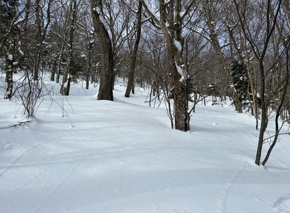
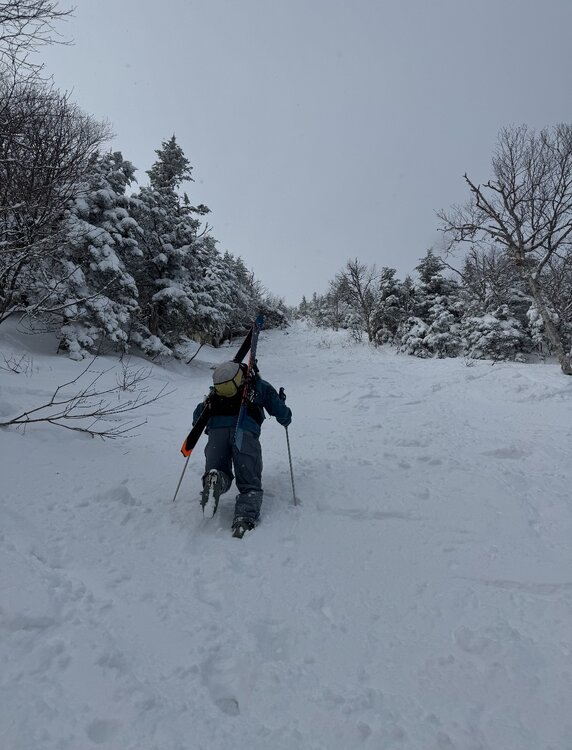
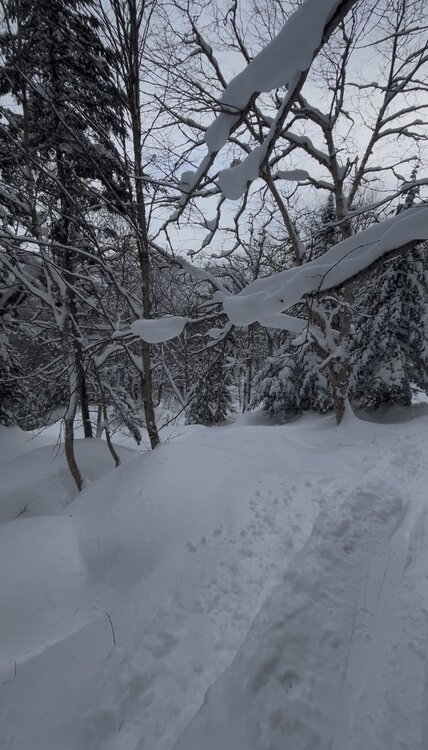
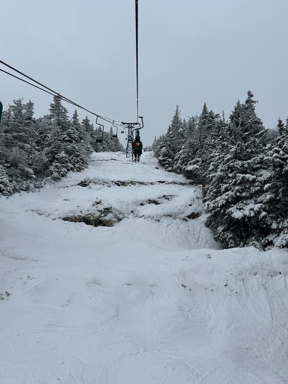
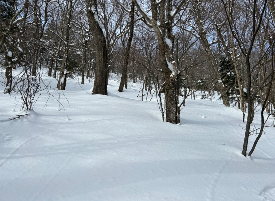
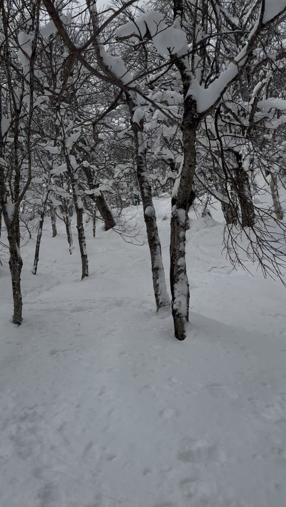
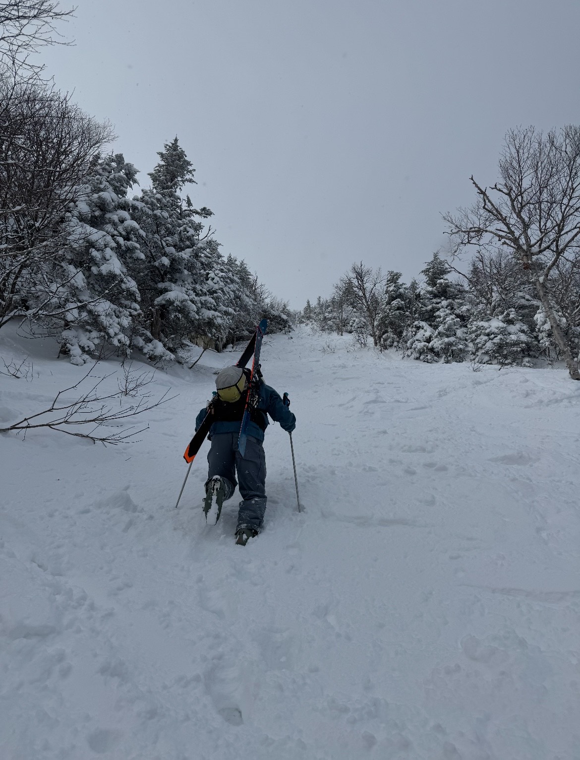
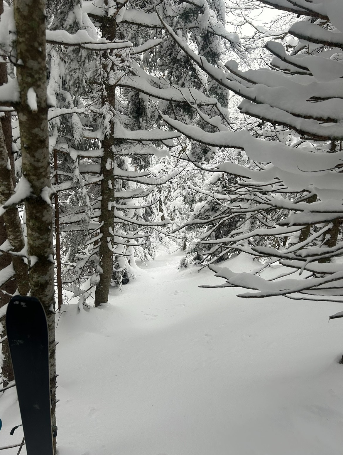
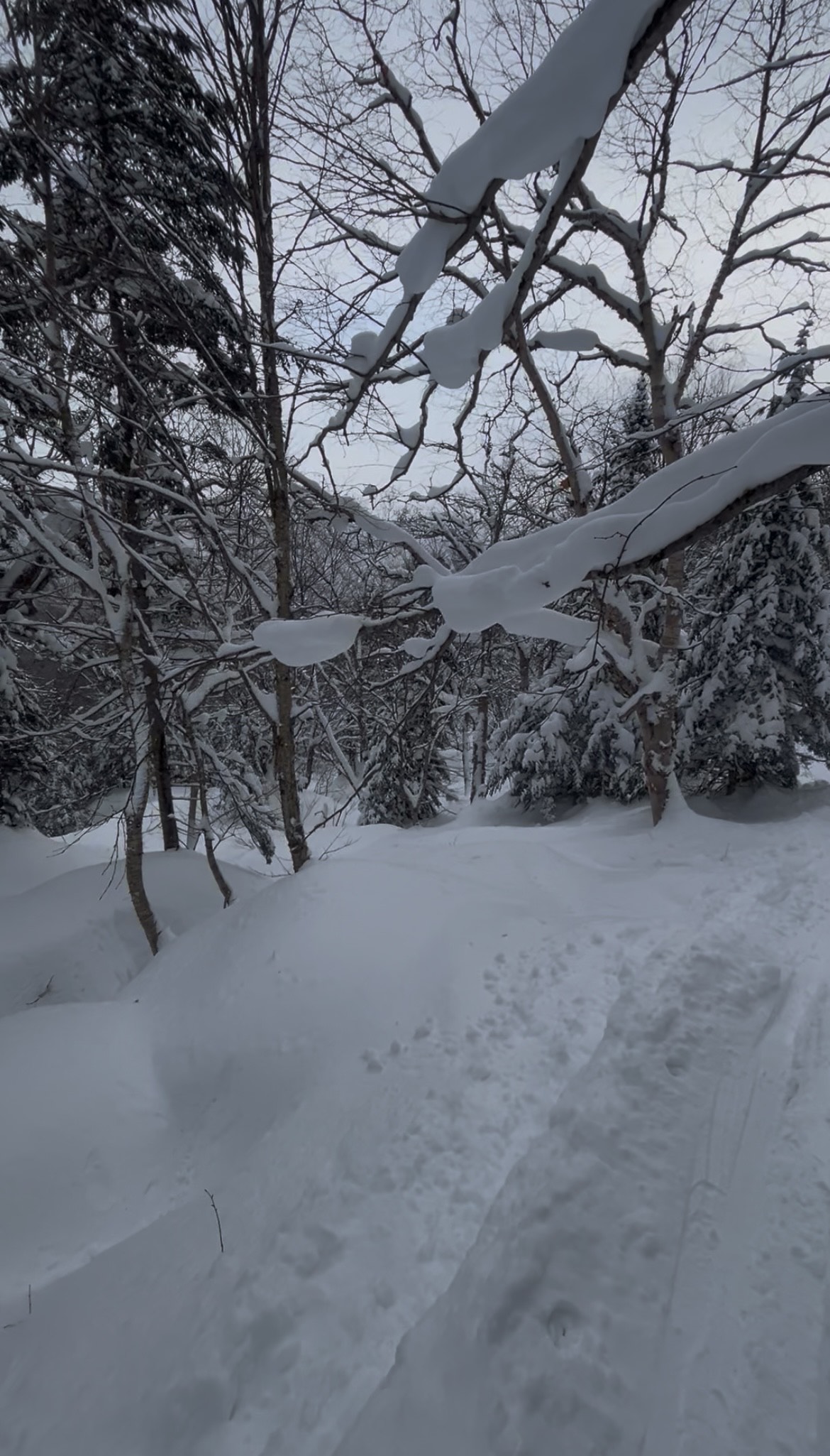
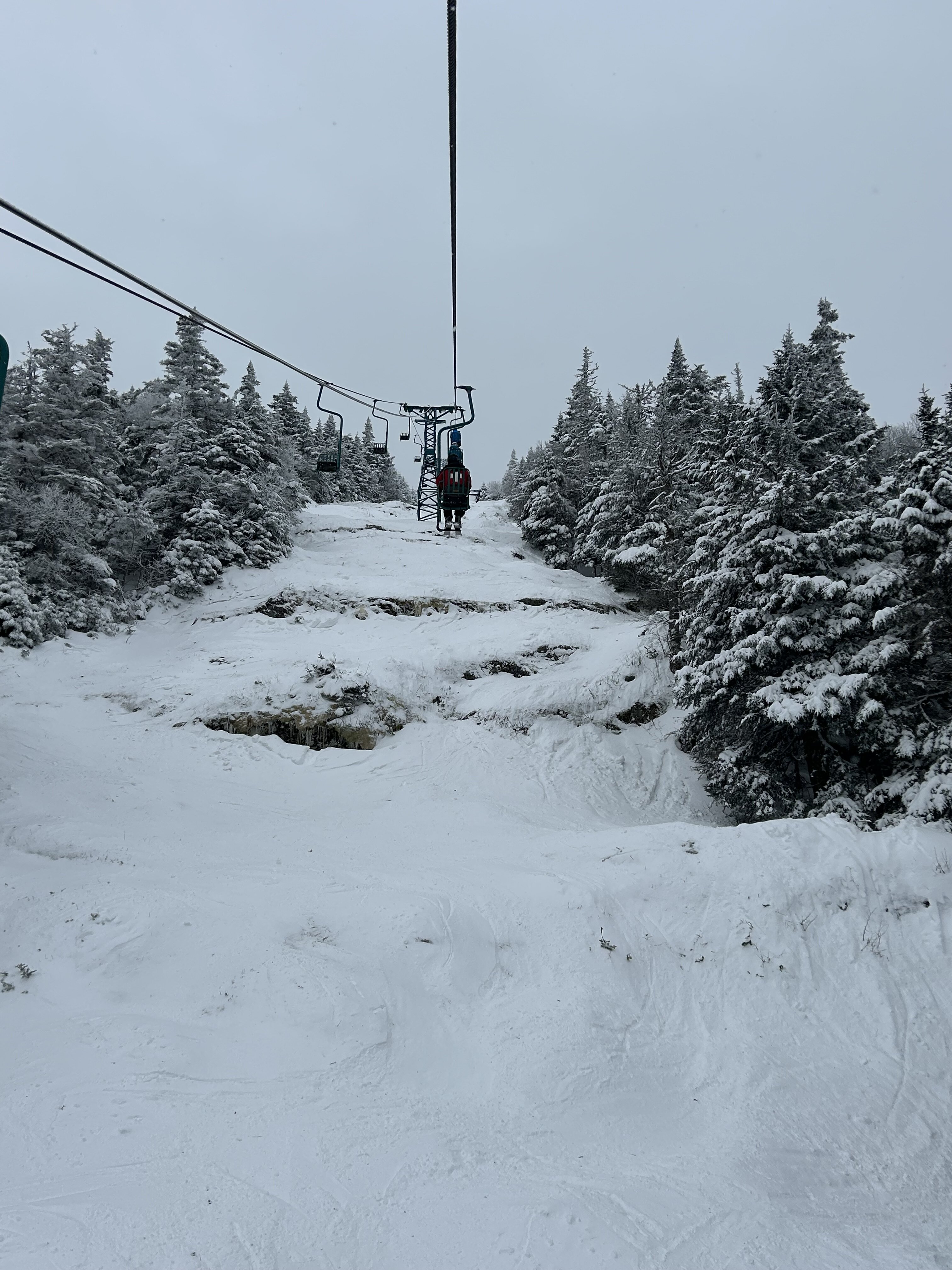
Heard some reports that Jay Peak was a bit wind affected following the squalls on Thursday. That fierce northwest flow deposited a ton of snow downwind into what is usually the deepest locale in New England. I was confident depths would be good, and a thorough exploration on Saturday found conditions that exceeded my expectations. The whole zone is wide open for the taking, though some danger still lurks with a smattering of open drainages poking through. Up high, tight tunnels transition into spacious gladed gullies choked with powder. Bushwacking and bootpacking into a zone famous for it's felonious past yielded a skied off chowder experience. When the forest closes back in on the scar, prior traffic disappears into an extensive menu of deep lines that open up among powder plastered conifers and hardwoods. I've never been to Japan, but I imagine this is as close as the East Coast can get visually. Hard to believe it was December 6th South of I-89, it is a different world. MRG managed to get the single going, but rock skis are an absolute necessity. If you're willing to take a few shots to your skis, conditions were actually pretty ripper up high with tons of funky low tide features. Chute was especially sporty, with a double (or triple) drop that was teed up right under the lift.


-
I'm guessing mid 20's for the ATL lows.
-
33.3
-

E PA/NJ/DE Winter 2025-26 Obs/Discussion
Hurricane Agnes replied to LVblizzard's topic in Philadelphia Region
That big warm blob near Alaska is nuts. And AK has had a swarm of earthquakes the past week. That may kill the Iditarod if they can't build up enough snowpack by March! Looks like a huge lake-effect thing going on by Erie, the rest of NW PA & SW NY! Bottomed out at 26 this morning but it did get up to 42 as a high, where it later clouded up. Currently 34 with 29 dp. -
This has got to be the stupidest thing Harbaugh has done in his ENTIRE tenure here. Letting a dude play on the basis on him being "your guy" like an adopted son, and the heck to how detrimental he is to that line...is stubbornness beyond belief.
-
18z GFS not far from something good next Sunday/Monday.
-
Some times, These little critters bite.
-

December 2025 regional war/obs/disco thread
HoarfrostHubb replied to Torch Tiger's topic in New England
-

December 2025 Short/Medium Range Forecast Thread
Carvers Gap replied to John1122's topic in Tennessee Valley
Basically, the December 1995 pattern would repeat later that winter, but with better climatology in place for cold air to make it to this latitude and hold. IMBY(not the folks at elevation), we are fighting climatology every step of the way right now. It eases up after Dec 10th or so, and becomes more favorable with each day. When I first started tracking, I rarely tracked during the first 20 days of December. But if this pattern were to repeat during the second half of winter, I think the cold presses more. Now, the STJ is inactive...so northern stream systems are gonna have to do the trick. I still think we have a shot to score before this breaks just short of Christmas. One caveat, this may not break down before Christmas. Some MJO plots are stalled through the end of the month and into early January on the left side of the MJO. Also, modeling tends to break down patterns a bit too early. That said, a New Year's thaw seems realistic. If it is twenty below w/ five feet of snow...you can look back on this comment and thank me for it! -
Temp is 33 and steady (if light) snow. Not amounting to much given the marginal temps, but it sure beats 38 and rain. Maybe some of this energy makes it over the hills?
-
Currently 34.9 IMBY, 33 at Newport News International Airport like 2 miles west.
-

Digital Snow/Ice Thread 2025-2026
Leesville Wx Hawk replied to WinstonSalemArlington's topic in Southeastern States
What could go wrong [emoji1783]? . -
Play of the week
-
Yesterday, the forecasted high was 50 and I only got up to 42.
-
December 2025 Short/Medium Range Forecast Thread
Carvers Gap replied to John1122's topic in Tennessee Valley
The Euro Weeklies this evening strongly hint at a 95-96 type of progression. Warmup around Christmas. Cold returns mid-Jan or just after. That also fits the pattern of recent winters. The good thing about all of this...eastern portions of the forum have missed w/ the second cold shot during recent Nina winters. I doubt that happens this winter. I think the cold in later January pushes to the coast. Just a hunch.


.thumb.JPG.418e8a9a2902ae687ec35ff4bc0e038e.JPG)
