All Activity
- Past hour
-
Here ya go- I am lazy tonight so here is what AI says(not perfect, but captures the general idea), and you and I both know this is 'typical' of la Nina winter storms in our region: A Northward-Displaced Jet Stream During a La Niña winter, the Pacific jet stream shifts much farther north across North America. [1, 2] The Missing Southern Track: Unlike El Niño, which features a strong, moisture-rich southern jet stream tracking across the Gulf of Mexico and directly up the East Coast, La Niña suppresses this southern branch. [1, 2, 3] The Continental Route: Instead, storms primarily track across the northern tier of the United States or the Ohio Valley. These are often fast-moving continental systems (like Alberta Clippers) that lack deep subtropical moisture while traveling over land. [1, 2] 2. Offshore Cyclogenesis (Later Development) Because these northern storms travel over dry land, they remain relatively weak and disorganized while passing over inland regions of the Mid-Atlantic. [1] The Gulf Stream Spark: It is only when the system’s energy finally moves offshore and encounters the stark temperature contrast of the warm Atlantic waters (the Gulf Stream) that it finds the thermal energy and moisture required to rapidly intensify. This delayed strengthening means the low-pressure system matures "later" in its lifecycle, positioning its center well off the coast rather than inland. 3. The "Inland Dry vs. Coastal Wet" Divide The offshore positioning of the storm center directly dictates who receives precipitation: [1] Inland Regions Starve for Moisture: Because the storm intensifies far out at sea, its main moisture field is pulled eastward into the Atlantic. Behind the storm, a brisk northwest flow pulls cold, dry continental air down from Canada, suppressing precipitation and keeping inland regions under dry spells. Coastal Areas Get Clipped: Even though the center of the Nor'easter or coastal storm is far offshore, these systems are massive. The western edge of the rotating storm shield—along with strong onshore winds—can still wrap around and clip the immediate coastline and the I-95 corridor
-
2026-2027 Record-breaking El Nino
JACKASS replied to Stormchaserchuck1's topic in Weather Forecasting and Discussion
Do you even know where Europe is on a map? -
I believe the strat split late November 2009. That and 1968 are two of the earliest warmings on record before this one. In 1968 we had some decent early December cold, and a deep freeze shot by mid-December with highs in the 20s and lows in the single digits. There was an additional cold shot for Christmas and then it was extremely cold in early January 1969. A nice snow event and sub zero cold. Temperatures stayed well bn through mid-January.
-
 https://antibiofastdirect.com/# buy zithromax antibiotic
-
2026-2027 Record-breaking El Nino
JACKASS replied to Stormchaserchuck1's topic in Weather Forecasting and Discussion
Get em while you still can! https://ebay.io/m/R3L7Qi -
Weather is my biggest hobby during winter. Ideally CAW suits me in the winter months but I will gladly settle for WAW. WAD just does not work for me for weeks on end. I will find something to do in the rain. Plus this area needs the moisture.
-
Thank you for the very kind words.
-
Now, perhaps you can help me here: Aren't the odds of those kind of storms hitting in a nina already low given the most common storm track in a nina? (Especially the second one). Why is the conversation about these misses seem to be around the idea that it was just bad luck that they missed as opposed to this is typical, and it's very difficult to get a different track than that in a nina enso state? Am I missing something?
-

2026-2027 Record-breaking El Nino
MJO812 replied to Stormchaserchuck1's topic in Weather Forecasting and Discussion
-
Yallsnow.com at least he says he will go back in march and grade his forecast. My guess is he will bust high in the eastern 3rd of the US. If anyone in NYC wouldn’t sign up for 24 inches at this stage, they’d have to get their head examined. NYC will be lucky to get 10.
-
Excellent ECMWF global temperature forecast for October. MONTH MEDIAN 90% RANGE SEAS5 DIRECT DRIVING Oct 2026 1.72 1.56-1.88 1.75
-
It needs to get going fast. Counting October we have finished BN precip 13 of last 14 months now. Just insane longevity to this drought. Streamflows around the area are all at or approaching record lows and lake levels are crashing. We absolutely have to reverse this over the winter or next summer is going to be rough.
-
In 23-24, we were getting rain from every STJ system. Just for a week or so, we got cold air and it snowed from two northern stream systems that trended south last minute. Ironically, the STJ had shut off for that week. Part of me thinks that in the not so distant future we’d be rooting for La Ninas since we can still get cold air in those winters. Just hope for a typically nina suppressed storm track to shift NW for major I-95 snows, since jet streams and storm tracks have been shifting north across the board. Those two misses last year? Get them both to hit, and we may have given 1995-96 a run for its money.
-
40’s for everyone?
-
otc antibiotics or over the counter antibiotics pills Over the counter antibiotics for infection http://clients5.google.com/url?q=http://antibiofastdirect.com::: cheap antibiotics or https://nidobirmingham.com/user/rmfsdlsmjb/ buy antibiotics online [url=http://irc.lc/antibiofastdirect.com/anonplusradio]can you buy antibiotics over the counter[/url] generic antibiotics and [url=https://brueckrachdorf.de/user/vezxxzhbnc/]generic antibiotics[/url] antibiotic without presription
-
The big ones always do...
- Today
-

2026-2027 Record-breaking El Nino
bluewave replied to Stormchaserchuck1's topic in Weather Forecasting and Discussion
Non-linear climate shifts often present with small sample sizes due to their abrupt nature. Non-linear climate dynamics combined with small sample sizes create severe statistical and predictive challenges because the Earth's system can cross critical thresholds or experience abrupt state shifts that short or sparse historical records fail to capture. [1, 2, 3] Climate change alters snowfall in a non-linear fashion, meaning snow loss remains gradual up to a critical temperature threshold, after which it drops off sharply -
2026-2027 Record-breaking El Nino
EasternLI replied to Stormchaserchuck1's topic in Weather Forecasting and Discussion
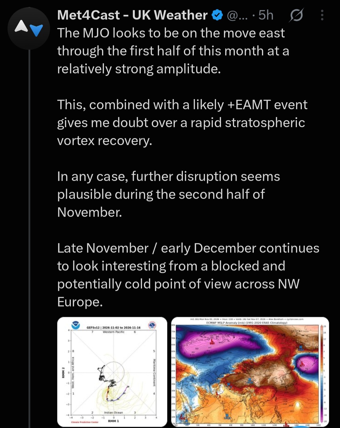
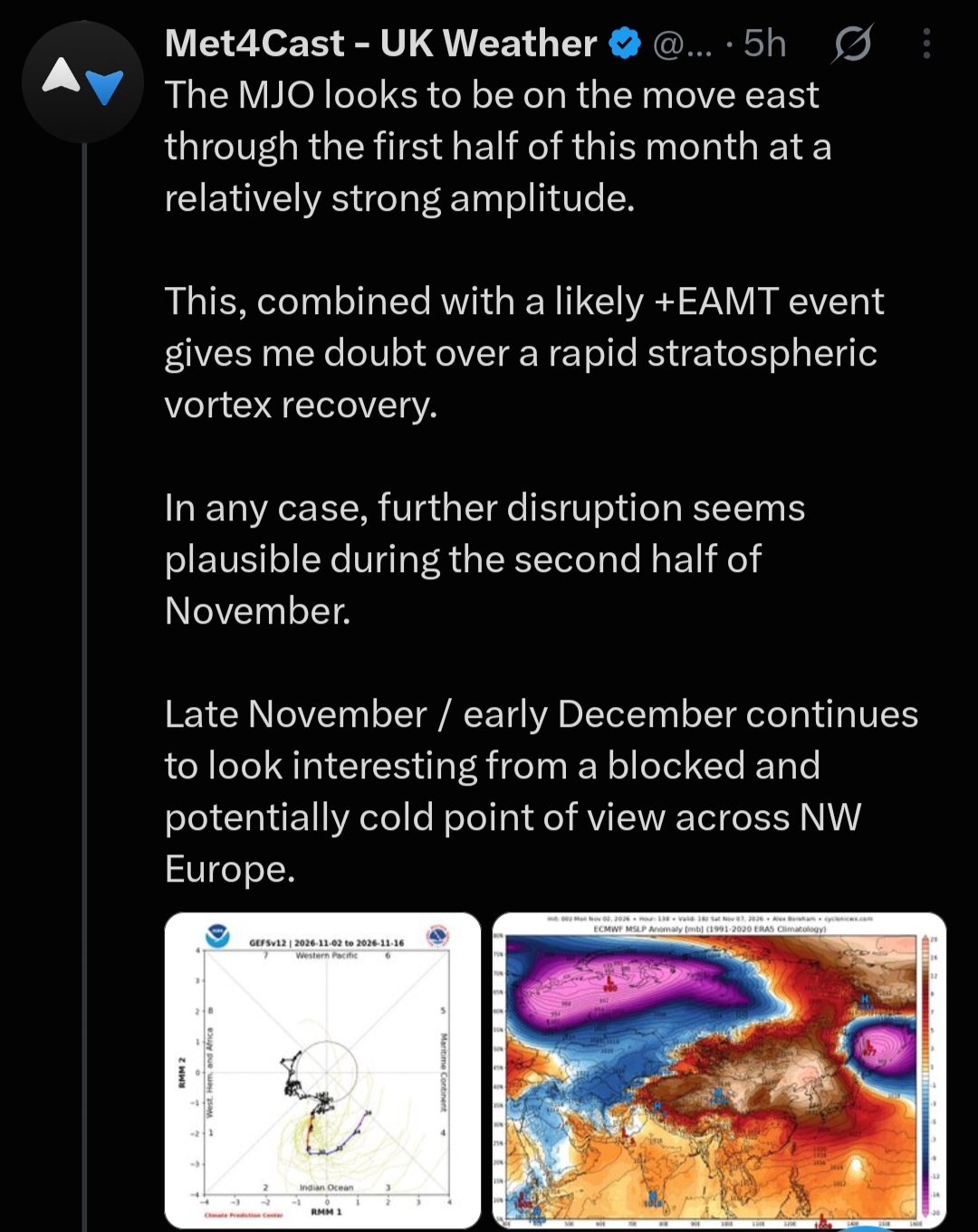
Usually feel like 50mb is a pretty good proxy for where the cold is. We don't have any on this side of the planet. Whatever that event is in the stratosphere. It's booting it all to the other side of the planet. Ultimately, it's dumping into the Pacific. Increase that gradient? Just going to turbocharge the Pacific jet by doing that... Thinking torched thoughts... -
Most likely but I will take it! We may slip back into Extreme Drought soon.
-
Here's the RRFS ensemble, which we'll all have to use for general purposes, since the NAM and standard convection allowing models are ending! tornado chances upcoming today
-
-
They’re WAY more optimistic than what I predicted.
-
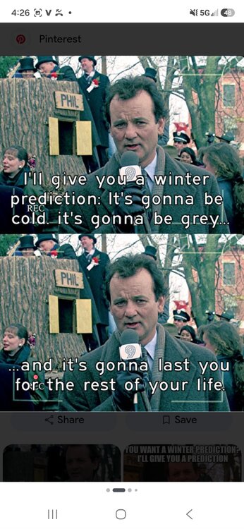
It's going to be a long cold winter that never ends.

-
 In-Fa was very impressive at 130 kt, and slowed down, did a small loop, and is now quite sheared