Birds~69 Posted March 1, 2014 Share Posted March 1, 2014 You can see the cold air from the polar vortex pouring into the country. This is probably why the models are going south. I guess they should....shouldn't they? Maybe the models are overestimating. (wishful thinking) Link to comment Share on other sites More sharing options...
delgto04 Posted March 1, 2014 Share Posted March 1, 2014 Still looks good to me. Being sandwiched in the middle seems like a decent spot right now. Link to comment Share on other sites More sharing options...
Birds~69 Posted March 1, 2014 Share Posted March 1, 2014 New WSW for Abe still 4-8" Sent from my iPad Same here, WSW at 3:34pm....6-10". Just not seeing it... Link to comment Share on other sites More sharing options...
SnowGoose69 Posted March 1, 2014 Share Posted March 1, 2014 I guess they should....shouldn't they? Maybe the models are overestimating. (wishful thinking) Actually the models have been consistently too fast most of the winter bringing those arctic air masses down, it has not been by alot but its generally been the case they have been 6-8 hours or so too quick, in this event that could make a difference. Link to comment Share on other sites More sharing options...
blizzardmeiser Posted March 1, 2014 Share Posted March 1, 2014 Still looks good to me. Being sandwiched in the middle seems like a decent spot right now. It's the 18z nam. Relax Link to comment Share on other sites More sharing options...
MattMal88 Posted March 1, 2014 Share Posted March 1, 2014 The northern shift has helped us a lot this year so hopefully we can have this come just a tick or two north late in the game but this south trend needs to stop and stop right now! Its crazy that in march we are worrying about cold suppression from the PV. What a crazy winter! Link to comment Share on other sites More sharing options...
hazwoper Posted March 1, 2014 Share Posted March 1, 2014 Same here, WSW at 3:34pm....6-10". Just not seeing it... All I see is the watch that was posted at 4:02am Link to comment Share on other sites More sharing options...
Birds~69 Posted March 1, 2014 Share Posted March 1, 2014 Actually the models have been consistently too fast most of the winter bringing those arctic air masses down, it has not been by alot but its generally been the case they have been 6-8 hours or so too quick, in this event that could make a difference. That's what I was thinking...that would be huge. Link to comment Share on other sites More sharing options...
eastonwx Posted March 1, 2014 Share Posted March 1, 2014 All I see is the watch that was posted at 4:02am http://mesonet.agron.iastate.edu/vtec/#2014-O-NEW-KPHI-WS-A-0008/DMX-N0Q-0 sorry then click on "text data" Link to comment Share on other sites More sharing options...
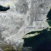
ago4snow Posted March 1, 2014 Share Posted March 1, 2014 Latest projection. Link to comment Share on other sites More sharing options...
Birds~69 Posted March 1, 2014 Share Posted March 1, 2014 All I see is the watch that was posted at 4:02am I'm basically the Philly area...15miles NW but could make a difference. It was listed on my Horsham PA weather underground page. Statement as of 3:34 PM EST on March 01, 2014 ... Winter Storm Watch now in effect from Sunday evening through Monday afternoon... * locations... the Interstate 95 corridor from northeastern Maryland up through the Philadelphia area to central New Jersey. Also, the northern part of coastal New Jersey. * Hazard types... mainly snow with some sleet and freezing rain possible. * Accumulations... snow accumulations generally up to 6 to 10 inches with up to 5 hundredths of an inch of ice possible. * Timing... a mix of rain, sleet and snow should develop on Sunday afternoon with some freezing rain possible in the evening. The mixed precipitation should change to all snow on Sunday night. The snow will become moderate to heavy at times and it is expected to continue on into Monday morning before ending on Monday afternoon. * Winds... from the north increasing to 10 to 20 mph with gusts up to 25 mph. * Temperatures... falling from the upper 30s and lower 40s on Sunday afternoon to the lower and middle 20s for late Sunday night into Monday. * Impacts... the snow, sleet and freezing rain will create hazardous driving conditions. Monday morning's commute will be particularly difficult. * Following the storm... near record cold is possible late on Monday night as temperatures drop to between 5 and 12 degrees above zero. Precautionary/preparedness actions... A Winter Storm Watch means that there is a potential for significant snow, sleet or ice accumulations that may impact travel. Continue to monitor the latest forecasts. Link to comment Share on other sites More sharing options...
ChescoWx Posted March 1, 2014 Share Posted March 1, 2014 Just way too close for anyone to call anything definitively....again models are guidance not a forecast. I like the current NWS snow maps - they can and will change again by tomorrow. A subtle shift of 20 miles N or S could be the difference between 4" and 12"....I am most certainly in the camp that a jog North will likely occur by 12z tomorrow morning. I expect the final outcome to be very close to what we had this AM. Still thinking in the 8" to 12" range for NW Chesco by the time the storm exits. Storms like this make me respect the job the professionals do! Link to comment Share on other sites More sharing options...
Harbourton Posted March 1, 2014 Share Posted March 1, 2014 That latest map could be a bit generous for TTN north. We'll see. DON'T take this as an affront to the guys down in the Holly. Link to comment Share on other sites More sharing options...
Heisy Posted March 1, 2014 Share Posted March 1, 2014 RGEM better than NAM, 10mm up to Philly by 48 hours, waiting for 54hrs. Link to comment Share on other sites More sharing options...
dieselbug Posted March 1, 2014 Share Posted March 1, 2014 Latest projection. Wow, what a shift! While on my way to the (crowded) supermarket, local weather outlets were calling for mainly an ice event. I guess they are still concerned with the warm layer down in central/southern DE Link to comment Share on other sites More sharing options...
hazwoper Posted March 1, 2014 Share Posted March 1, 2014 I don't see a shift north, sorry. All guidance has shifted south. Link to comment Share on other sites More sharing options...
DiehardFF Posted March 1, 2014 Share Posted March 1, 2014 Still have plenty of time for a shift north. Although, if the 18z does not stop the south trend, I may get worried. Link to comment Share on other sites More sharing options...
blizzardmeiser Posted March 1, 2014 Share Posted March 1, 2014 Still have plenty of time for a shift north. Although, if the 18z does not stop the south trend, I may get worried. Typically shift north at the end Link to comment Share on other sites More sharing options...
iceman56 Posted March 1, 2014 Share Posted March 1, 2014 As I posted this morning, I'm not buying the strength of the cold push the models are touting, still expect a north shift. Link to comment Share on other sites More sharing options...
DiehardFF Posted March 1, 2014 Share Posted March 1, 2014 18z GFS* Link to comment Share on other sites More sharing options...
SnowGoose69 Posted March 1, 2014 Share Posted March 1, 2014 the 18Z RGEM is cracked out with how far north it is Monday AM, its also too far south I think from 21-06z tomorrow afternoon and evening...the thermal gradient would suggest any snow before that time is 40-50 miles or so further north...the RGEM has some funky 06 and 18Z runs and this was probably one of them. Link to comment Share on other sites More sharing options...
RevWarReenactor Posted March 1, 2014 Share Posted March 1, 2014 And most of that "spending" is based on the idea we had of a 6" to 12" event. Mitchell Gaines' nightmare of an area that misses out on the first wave due to temps, and is too far north to get much from the 2nd wave, would be the worst case scenario at this point. I'm preparing myself for the possibility that we wind up with less than 6" if the trends continue. The next level after that is something to shovel. If we get more, great, if not then as everyone has been saying it has been an amazing winter. I don't think this is the last hurrah, either. And I'm still watching this one of course... For you and everyone south of Philly including South Jersey, yes, you're due to be in the jackpot zone! I hope you get 12" or more! I still think the jackpot axis just north of the Mason Dixon line would be good for all, no? This is what the NAM is saying and its a big scary, but for now I'll try to think the NAM is overdone and take My Holly's totals and run with the, Link to comment Share on other sites More sharing options...
Treckasec Posted March 1, 2014 Share Posted March 1, 2014 I liked the NWS snow total map. ;3 Link to comment Share on other sites More sharing options...
DiehardFF Posted March 1, 2014 Share Posted March 1, 2014 Sigh. 4"-8" looks better now. Link to comment Share on other sites More sharing options...
Heisy Posted March 1, 2014 Share Posted March 1, 2014 Looks like we may be getting more snow from the first part than the 2nd lol. I'm going to Cape May with a friend, so hopefully it doesn't trend even farther south. Link to comment Share on other sites More sharing options...
hazwoper Posted March 1, 2014 Share Posted March 1, 2014 Sigh. 4"-8" looks better now. More like 3-6" Link to comment Share on other sites More sharing options...
Harbourton Posted March 1, 2014 Share Posted March 1, 2014 Looks like 5 inches is a good call for TTN based on the 18z GFS. Link to comment Share on other sites More sharing options...
anthonyweather Posted March 1, 2014 Share Posted March 1, 2014 2.5" says 18z GFS for Abe. I fold on this storm. Here's to a great winter. Sent from my iPad using Tapatalk Link to comment Share on other sites More sharing options...
Heisy Posted March 1, 2014 Share Posted March 1, 2014 Meanwhile the mean on the EURO ens for late week is 7 inches for Philly Link to comment Share on other sites More sharing options...
MattMal88 Posted March 1, 2014 Share Posted March 1, 2014 Highzenberg ur road trips crack me up you truly are a snow weenie (I mean that in a good way). I wish had the time and gas money to do it man but I'd wait til 00z to plan where I was going. Not sayin cape may wont do well but I just have a gut feeling that this baby's gonna come a little north and jackpot closer to our area. Thats probably just wishful thinking and has no meteorological basis but i just have a feeling about it and thats the way these storms have tended to unfold this winter. Well see though, either way have a safe trip man. Link to comment Share on other sites More sharing options...

Recommended Posts
Archived
This topic is now archived and is closed to further replies.