andyhb Posted August 23, 2012 Share Posted August 23, 2012 Okay. Are these circulations both associated with the tropical wave or is it common for the mid-level circulations to be associated with other atmospheric features? The NHC update on TD10 mentioned that it was close to an upper low but I would find it hard to believe that both circulations resulted from the same wave. Usually they are both associated with the tropical system itself, like if you look on progged model guidance, you'll see there is both a mid level and low level circulation associated with the TC. When they are both aligned in the same place, usually that indicates that intensification is soon to take place or is already occurring. Right now Isaac is still in its developmental stage so the vertical alignment is not quite there yet, and this would also tend to be less prone to major problems caused by interaction with elevated land masses, such as the mountains of Hispaniola and eastern Cuba. Link to comment Share on other sites More sharing options...
wxmeddler Posted August 23, 2012 Share Posted August 23, 2012 Also, 00z GFS should be up and running as I type. 0z GFS ingested 19 of the dropsondes from NOAA-42, 0z NAM ingested 10. Link to comment Share on other sites More sharing options...
andyhb Posted August 23, 2012 Share Posted August 23, 2012 0z GFS ingested 19 of the dropsondes from NOAA-42, 0z NAM ingested 10. Hopefully this means we'll see a more accurate/persistent representation of where this thing might go... Link to comment Share on other sites More sharing options...
andyhb Posted August 23, 2012 Share Posted August 23, 2012 00z GFS to 96 looks to hug the north coast of Cuba, looks deeper up to this point than previous runs. Link to comment Share on other sites More sharing options...
SN_Lover Posted August 23, 2012 Share Posted August 23, 2012 GFS looks a tad more north than the 18z run. Link to comment Share on other sites More sharing options...
Thundersnow12 Posted August 23, 2012 Share Posted August 23, 2012 Hopefully this means we'll see a more accurate/persistent representation of where this thing might go... It should help no doubt but over the next 24-36hrs is when we should get a much better idea on what Issac will do. Looking back, I can't remember the last time NHC's fcst track has stayed this consistent (a slight move left into eastern Gulf with last advisory) Really curious to see what the next two runs of the Euro show. Link to comment Share on other sites More sharing options...
DopplerWx Posted August 23, 2012 Share Posted August 23, 2012 Convection really firing now. Should see some intensification tonight. Link to comment Share on other sites More sharing options...
Hurriplane Posted August 23, 2012 Share Posted August 23, 2012 Convection really firing now. Should see some intensification tonight. I wouldn't count on it just yet, there is still some dry air entrainment coming in from the northern quadrant. I'll tell you something though, this thing is MASSIVE. Link to comment Share on other sites More sharing options...
isnice Posted August 23, 2012 Share Posted August 23, 2012 Out 120 hours, looks a good deal deeper and about 150 miles west of the 12z. Link to comment Share on other sites More sharing options...
Cheeznado Posted August 23, 2012 Share Posted August 23, 2012 GFS landfall FL panhandle hr 144 Link to comment Share on other sites More sharing options...
Dsnowx53 Posted August 23, 2012 Share Posted August 23, 2012 Looks like just west of the "dip" in the Florida Panhandle from 144 to 150 hours. A definite west shift, though not a huge shift. Previous runs seemed to have it a bit east of the "dip" closer to the bend. Link to comment Share on other sites More sharing options...
Marion_NC_WX Posted August 23, 2012 Share Posted August 23, 2012 This has big flood potential inland post-landfall. At 156 still over extreme NW Florida but rainshield as far northeast as Charlotte...large storm, large wind field, slow mover...big flood potential. Link to comment Share on other sites More sharing options...
ALhurricane Posted August 23, 2012 Share Posted August 23, 2012 About 9 mb deeper this run...981 mb just south of Apalachicola/Port St. Joe on 00z 8/29 Link to comment Share on other sites More sharing options...
wxsmwhrms Posted August 23, 2012 Share Posted August 23, 2012 Seems like the GFS has continued to shift ever so slightly west each run while the EC has been shifting slightly east each run. Looking deeper, the GFS has slightly higher mid level heights and lifts the upper trough currently over the SE CONUS a bit faster than earlier runs. One interesting thing is that the 00Z GFS is actually a bit farther right in the early part of the period than the 12Z run. It will be interesting to see how Isaac evolves in the next 24 hours and where the center ends up. Given that as we have discussed that the long term motion is mainly being driven by ridge features, it would not take much deviation to the left in the next few days to end up with a longer term solution closer to what the 12Z ECMWF showed. Of course the converse is true as well. Link to comment Share on other sites More sharing options...
Dsnowx53 Posted August 23, 2012 Share Posted August 23, 2012 Seems like the GFS has continued to shift ever so slightly west each run while the EC has been shifting slightly east each run. Looking deeper, the GFS has slightly higher mid level heights and lifts the upper trough currently over the SE CONUS a bit faster than earlier runs. One interesting thing is that the 00Z GFS is actually a bit farther right in the early part of the period than the 12Z run. It will be interesting to see how Isaac evolves in the next 24 hours and where the center ends up. Given that as we have discussed that the long term motion is mainly being driven by ridge features, it would not take much deviation to the left in the next few days to end up with a longer term solution closer to what the 12Z ECMWF showed. Of course the converse is true as well. Yeah, it certainly was interesting that it started further right in the early part of the period, and still ended up further west. Perhaps this is an indicator that longer term, the GFS is picking up on the fact that the flow that would turn Issac to the north is really not that strong, lending more credence to the further west solutions. The big southern Plains ridge might have an impact. Link to comment Share on other sites More sharing options...
phil882 Posted August 23, 2012 Share Posted August 23, 2012 The run of the GFS was interesting, because it actually had a weaker mid-level ridge in the early going, but the ridge over the midwest was actually stronger in the medium range, which then tried to move overhead of the system. Its still not quite as agressive as the ECMWF with this but it seems to be trending in that direction. Link to comment Share on other sites More sharing options...
Superstorm93 Posted August 23, 2012 Share Posted August 23, 2012 White "T" icon is where the center was as of 11pm. I'm really interested in seeing if the center has continued to moved SW to get under the deep convection and the 700mb low. Otherwise, the center remains on the northern fringe. #N42: Most recent radar analysis shows broad, weak circulation at 2 km and possible circulation displaced at least 100 km to south at 7 km. Link to comment Share on other sites More sharing options...
Dsnowx53 Posted August 23, 2012 Share Posted August 23, 2012 The run of the GFS was interesting, because it actually had a weaker mid-level ridge in the early going, but the ridge over the midwest was actually stronger in the medium range, which then tried to move overhead of the system. Its still not quite as agressive as the ECMWF with this but it seems to be trending in that direction. One thing I will say...as much pro west/LEK train as I'm currently on, it would not shock me if the Euro was overdoing the Plains ridge in the medium range. I think the GFS is definitely right in correcting towards the Euro, but at times, the Euro has had some really ridiculous temperature forecasts in the medium range with that death ridge; as hot as it's obviously been, the Euro has been over zealous at times, which might be an indicator of biasing strong with that ridge. That being said, as stated before, the GFS starting right/weaker with the Atlantic ridge but still having a west trend is certainly telling regarding model trends of the GOM steering flow and how perhaps Issac might not want to turn north so quickly. Link to comment Share on other sites More sharing options...
wxmx Posted August 23, 2012 Share Posted August 23, 2012 It's also interesting because it shows a farther south dive at the start before turning NW towards Hispaniola. It looks like the southwestern dive is occurring, at least the convection is distinctly moving that way, probably as it tries to get stacked with the mid level circulation to it's south, then it probably will tumble around with a more poleward motion. Link to comment Share on other sites More sharing options...
wxsmwhrms Posted August 23, 2012 Share Posted August 23, 2012 One thing I will say...as much pro west/LEK train as I'm currently on, it would not shock me if the Euro was overdoing the Plains ridge in the medium range. I think the GFS is definitely right in correcting towards the Euro, but at times, the Euro has had some really ridiculous temperature forecasts in the medium range with that death ridge; as hot as it's obviously been, the Euro has been over zealous at times, which might be an indicator of biasing strong with that ridge. That being said, as stated before, the GFS starting right/weaker with the Atlantic ridge but still having a west trend is certainly telling regarding model trends of the GOM steering flow and how perhaps Issac might not want to turn north so quickly. FWIW it looks like through 72 hours the UKMET does something similar to the GFS. It actually gets the MSLP center close to PR and then moves it nearly due W across S Hispaniola and ends up over east central Cuba, which is a bit left of previous runs. To no one's surprise Canadian is making a big shift left over previous runs. It actually goes along the S coast of Hispaniola now and in 72 hours is over SE Cuba. Last night at the same time it was E of the Bahamas. Link to comment Share on other sites More sharing options...
wxsmwhrms Posted August 23, 2012 Share Posted August 23, 2012 00Z UK shifted quite a bit left. It is now west of TPA and S of PAM at 144 hours. Looks like it would be headed toward the western FL panhandle (PNS/Destin). Link to comment Share on other sites More sharing options...
yoda Posted August 23, 2012 Share Posted August 23, 2012 FWIW it looks like through 72 hours the UKMET does something similar to the GFS. It actually gets the MSLP center close to PR and then moves it nearly due W across S Hispaniola and ends up over east central Cuba, which is a bit left of previous runs. To no one's surprise Canadian is making a big shift left over previous runs. It actually goes along the S coast of Hispaniola now and in 72 hours is over SE Cuba. Last night at the same time it was E of the Bahamas. Yes, but it seems to still be to the right of the 00z GFS, by 96 hrs it gets pulled northward and is just east of MIA Link to comment Share on other sites More sharing options...
wxsmwhrms Posted August 23, 2012 Share Posted August 23, 2012 Yes, but it seems to still be to the right of the 00z GFS, by 96 hrs it gets pulled northward and is just east of MIA Yep, but 24 hours ago at the same time its forecast was just S of HAT. Pretty big left trend. Link to comment Share on other sites More sharing options...
HurricaneJosh Posted August 23, 2012 Share Posted August 23, 2012 Wow-- so everything's shifting left: a small shift for the GFS, bigger ones for the Canadian and the UK. Very curious to see what the Euro does now. Link to comment Share on other sites More sharing options...
yoda Posted August 23, 2012 Share Posted August 23, 2012 Yep, but 24 hours ago at the same time its forecast was just S of HAT. Pretty big left trend. Agree... seems to be taking its sweet time though of getting into the model consensus as I believe that most of the models are showing what tonights GFS/UKIE are showing of a potential TAL or Panama City hit in the panhandle of FL Link to comment Share on other sites More sharing options...
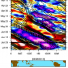
wxsmwhrms Posted August 23, 2012 Share Posted August 23, 2012 Here's the UK at 144 hrs: Link to comment Share on other sites More sharing options...
wxsmwhrms Posted August 23, 2012 Share Posted August 23, 2012 Agree... seems to be taking its sweet time though of getting into the model consensus as I believe that most of the models are showing what tonights GFS/UKIE are showing of a potential TAL or Panama City hit in the panhandle of FL No doubt - but it's the Canadian, LOL. It's been particularly awful this year, for whatever reason. Link to comment Share on other sites More sharing options...
Normandy Ho Posted August 23, 2012 Share Posted August 23, 2012 Watching Isaac today has been truly interesting and its been quite awesome to hear all the thoughts regarding its structure. From my amatuer POV is seems like Isaac started its life as a large monsoonal like gyre with two competing areas of vorticity. Correct me if Im wrong, but it seems that the WSW motion of the southern blob looks kind of like a fujiwhara interaction, where the vorticity to the NE is moving WNW while the vorticity to the SW is moving WSW. It does seem like the center is consolidating around the southern most area, and if thats the case I dont quite see how it moves over Hispanola unless it gains a significant amount of latitude tomorrow. One thing is for sure, its a huge system. Link to comment Share on other sites More sharing options...
yoda Posted August 23, 2012 Share Posted August 23, 2012 No doubt - but it's the Canadian, LOL. It's been particularly awful this year, for whatever reason. Most definitely. At 144, it has Isaac in C GA, but coming in from the SE moving NW I believe... so I would surmise landfall was somewhere in NE FL Link to comment Share on other sites More sharing options...
phil882 Posted August 23, 2012 Share Posted August 23, 2012 Recon is back in the air in an attempt to find a fix. Based off recent microwave imagery, it still seems like dry air is warping into the center, so the deep convection we are seeing tonight might still produce cool downdrafts that will prevent additional organization. The greens towards the South American coastline are dry air being wrap into the circulation. Link to comment Share on other sites More sharing options...

Recommended Posts
Archived
This topic is now archived and is closed to further replies.