Cheeznado
-
Posts
2,155 -
Joined
-
Last visited
About Cheeznado

-
I felt the 10% hatched risk was overdone, I am pretty sure most if not all of the tornadoes reported were gustnadoes.
-
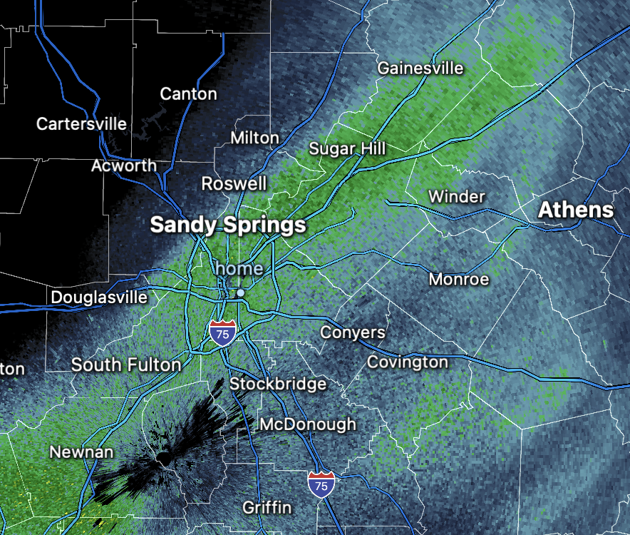
There are a lut of storms interfering wuth each other, the HRRR reflacts this. Could be a bit of an underperformer today.
-
Decided not to chase, The morning CAMs suggest a line, embedded tornadoes are a given but combined with storm speeds and terrain/trees, it does not seem worth the effort. It looked like despite all the PDS warnings last night and the numerous damage reports, the number of fatalities was pretty low, thank goodness. Here in GA another nocturnal event. We seems to never have any afternoon severe situations any more.
-
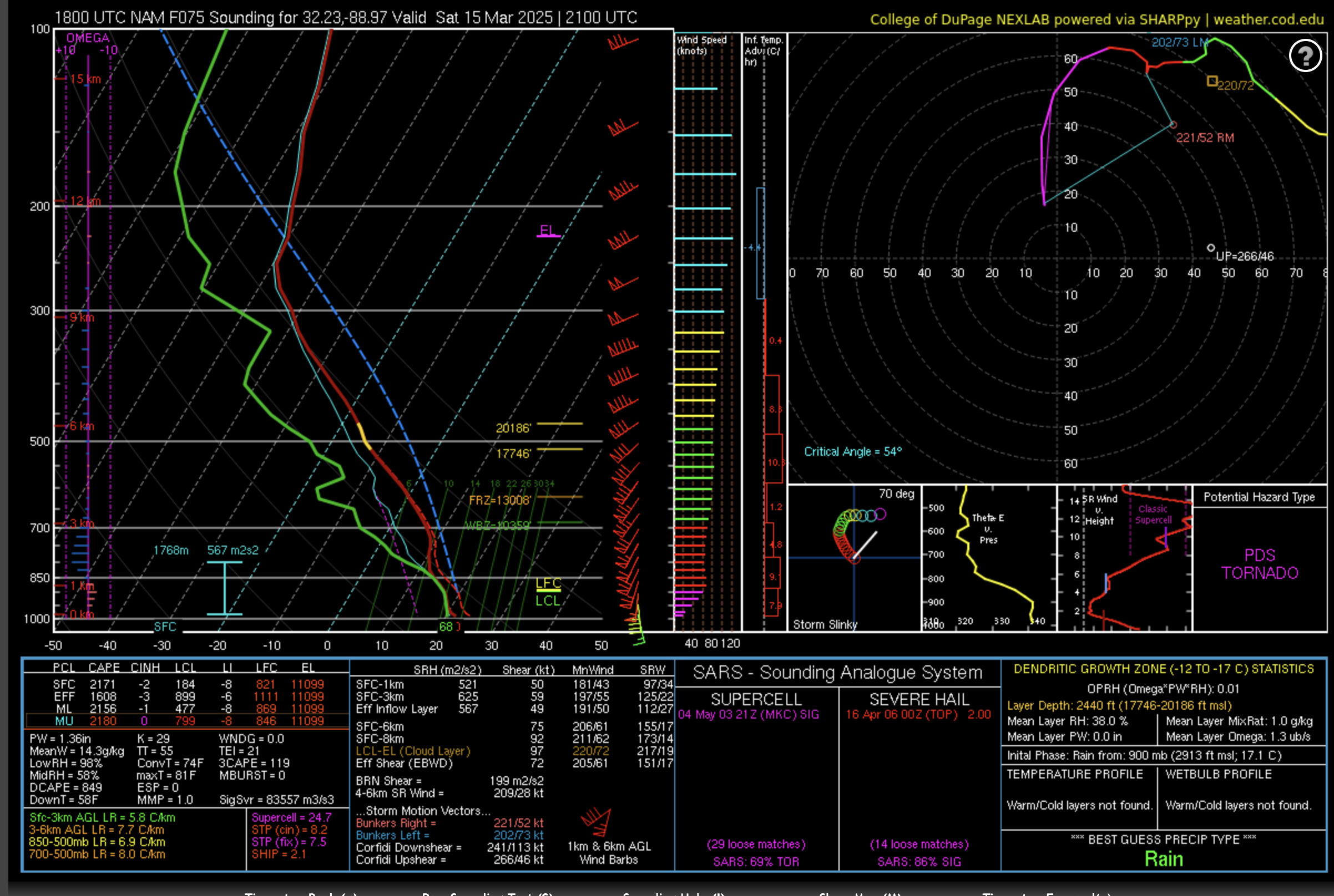
This is a forecast sounding from eastern MS from the 18Z NAM. Those are some scary parameters. Right now I would be surprised if there are not at least a couple of long-track strong tornadoes Saturday over MS and AL especially.

-
Since I got 3.5" with the last storm my .5" this time was just fine, a good trade for the incredible historic snows further south. Got down to 13F last night, lots of more road issues this morning. Atlanta always has a traffic nightmare in these types of scenarios, partly because a lot of people have no idea how to drive if the roads are slick at all, but also because any sort of hill was impossible to drive on. Should resolve soon.
-
Florida is going to destroy it's all time snow record which is either 4 or 5 inches, already close to 6. All time record in New Orleans. What a storm and I got some here also!
-
Total 1/2" of snow. Very unusual to get 2 accumulating events here in one winter. I'm very pleased. Of course the roads are a nightmare, accidents galore.
-
That's where I am. It was heavy for a while.
-
What's really ironic is that a lot of models said we would get .2 to .4 and that will be exactly correct.
-
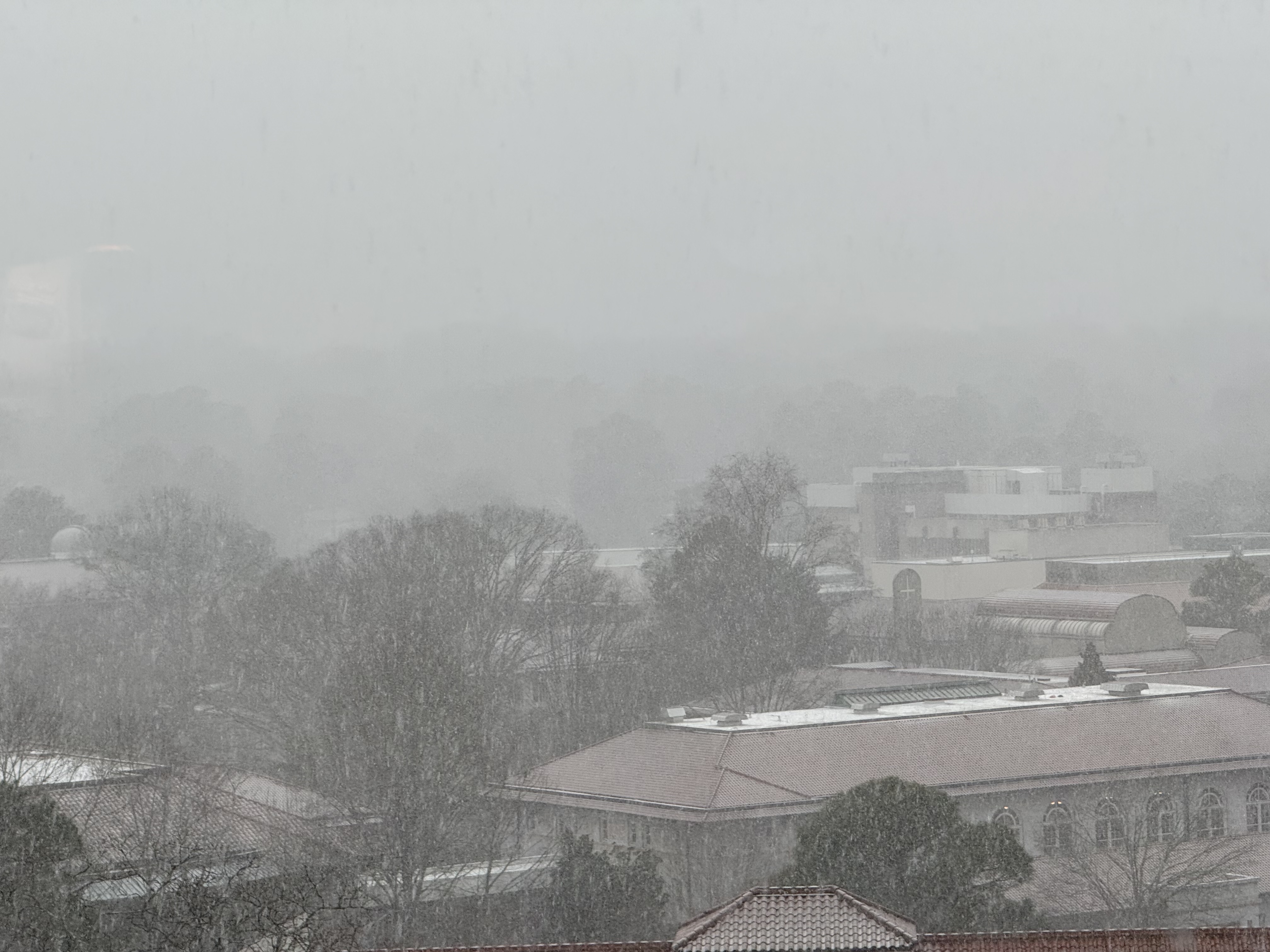
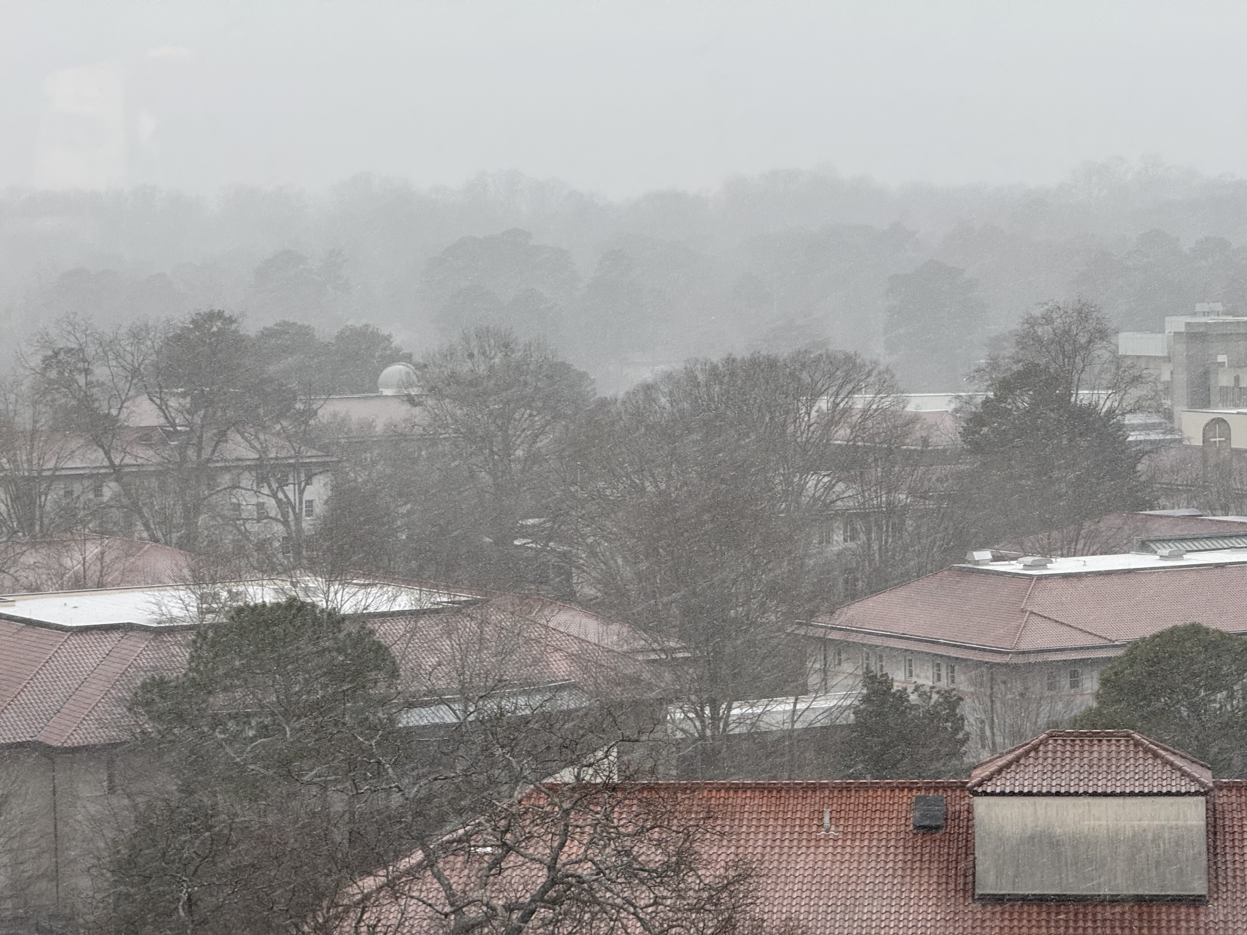
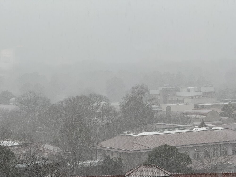
Heavy snow band in ATL, Looks like it is about to end, picked up the forecasted dusting, just never expected these kind of rates. EDIT: the back end was advancing, now it is not. We may get an ibnch or two. Amazing.
-
1/8 S+
-
UPDATE: visibility 1/2 mile. Wow, did not expect this.

-
Well i'll be hornswoggled. Out of nowhere an almost moderate snow band developed. Visibility 1 mile or so

-
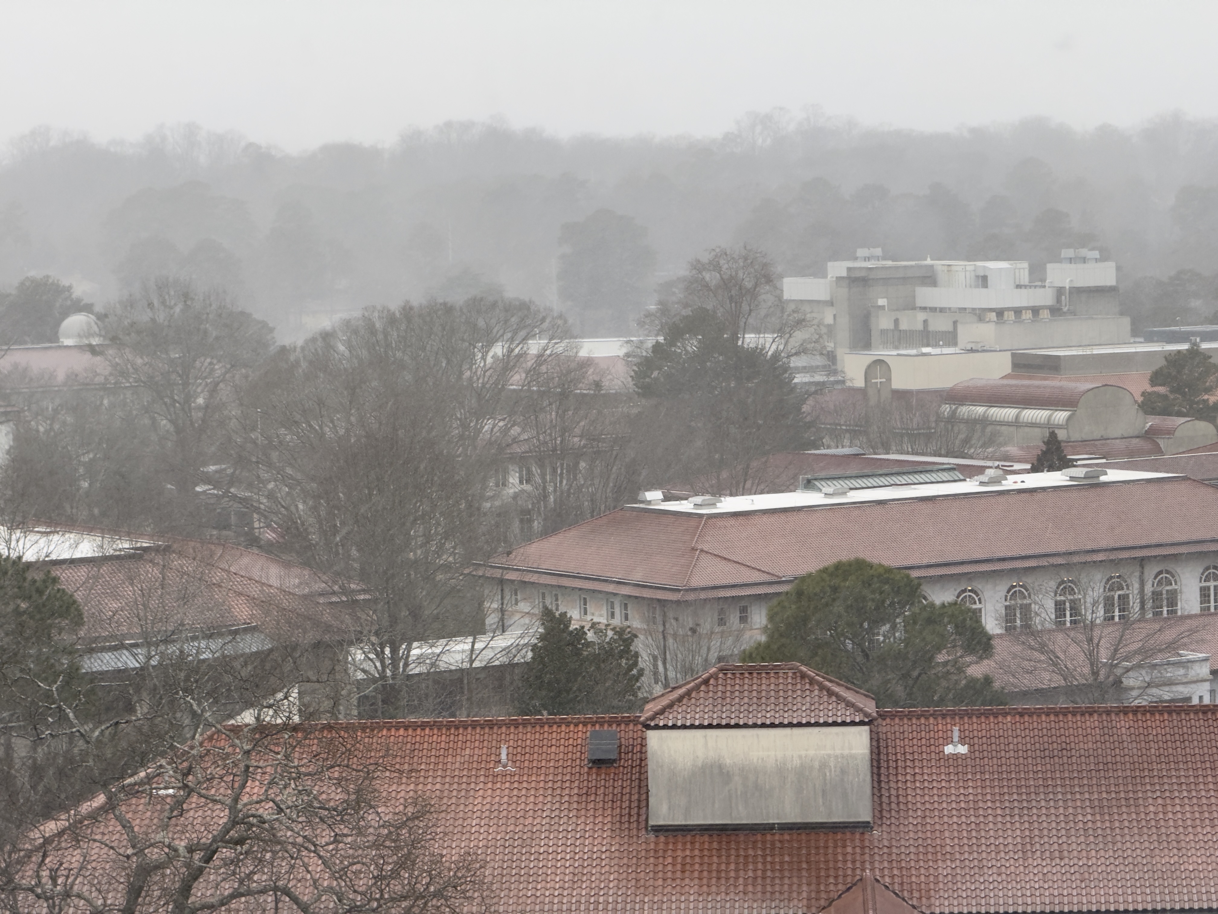
Very small snowflakes here now.
-
The low dew points are killing us, -1 in Cartersville, 9 at the airport.