wxsmwhrms Posted August 23, 2012 Share Posted August 23, 2012 So anyone want to make a guess as to where the "center" is with the last recon report showing ENE winds (unflagged SFMR 26 kt) at 15.2N, 61.8W? Link to comment Share on other sites More sharing options...
wxsmwhrms Posted August 23, 2012 Share Posted August 23, 2012 N42 in Isaac: The circulation does not extend over a deep layer. There is strong easterly flow at 4-5 km altitude. Yep, you can see that in the recon obs. The surface obs and satellite would make you guess that the center is somewhere around 15.5N. Link to comment Share on other sites More sharing options...
Amped Posted August 23, 2012 Share Posted August 23, 2012 Guadeloupe does have a 4800ft peak on the south end. Dominica has a 4750 footer. Of course there's a large space in between so the flow isn't totally jammed but this maybe part of the reason why the track was disrupted. The other part being the SW displaced H5 center. Link to comment Share on other sites More sharing options...
Derecho! Posted August 23, 2012 Share Posted August 23, 2012 Isn't that the 6z? Or am I missing something? That's the 06Z GFDL; 18Z GFDL is weaker and further west. Link to comment Share on other sites More sharing options...
U_Thant Posted August 23, 2012 Share Posted August 23, 2012 Isn't that the 6z? Or am I missing something? Yeah, it's the 06Z run; the 18Z takes it inland across SE FL, to just west of Lake O, then up the western peninsula. Link to comment Share on other sites More sharing options...
phil882 Posted August 23, 2012 Share Posted August 23, 2012 N42 in Isaac: The circulation does not extend over a deep layer. There is strong easterly flow at 4-5 km altitude. Yep, you can see that in the recon obs. The surface obs and satellite would make you guess that the center is somewhere around 15.5N. They had a nice dropsonde that illustrated this. The low-level circulation currently only extends to 750 hPa. The storm is certainly not intensifying at this time. Link to comment Share on other sites More sharing options...
wxsouth Posted August 23, 2012 Share Posted August 23, 2012 That dropsonde (and the twitter feed regarding the overall shallow nature of the circulation) is interesting. The 00Z Trinidad sounding actually shows the circulation is deeper well south of the center. Weird. Link to comment Share on other sites More sharing options...
Superstorm93 Posted August 23, 2012 Share Posted August 23, 2012 That dropsonde (and the twitter feed regarding the overall shallow nature of the circulation) is interesting. The 00Z Trinidad sounding actually shows the circulation is deeper well south of the center. Weird. Not surprising at all to me. This is very roughly "aligned" (in the vicinity of each other would be more fitting) south of the reported center. 500/700/850 MB vort comparison Link to comment Share on other sites More sharing options...
wxsmwhrms Posted August 23, 2012 Share Posted August 23, 2012 PIcking up a band of pretty stiff (for this system) NE winds of 35-40 kt FL around 16N, 63W. Would ordinarily think the "center" would be SE of there and that satellite would indicate solid convection near the center. But with this thing's structure, who knows? Link to comment Share on other sites More sharing options...
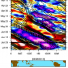
Wannabehippie Posted August 23, 2012 Share Posted August 23, 2012 Neat little history chart of past storms within proximity to Isaac, courtesy of our local news. Pretty amazing how few hit Florida. I think not too many hit Florida from the general area that Isaac is in, is because there is a lot of mountainous land to cross to hit florida, and those tend to shred hurricanes. The pros of course will know more than me, but I would think that in order to hit florida, it would have to be north of Hispaniola to avoid the shredder. Link to comment Share on other sites More sharing options...
wxmeddler Posted August 23, 2012 Share Posted August 23, 2012 From HRD Twitter: (The people in the NOAA P-3) HRD/AOML/NOAA @HRD_AOML_NOAA #N42: Most recent radar analysis shows broad, weak circulation at 2 km and possible circulation displaced at least 100 km to south at 7 km. Link to comment Share on other sites More sharing options...
CUmet Posted August 23, 2012 Share Posted August 23, 2012 That dropsonde (and the twitter feed regarding the overall shallow nature of the circulation) is interesting. The 00Z Trinidad sounding actually shows the circulation is deeper well south of the center. Weird. It's not so much that the overall circulation is shallow, but there are two distinct circulations. One is in the low levels below 800 mb (what they are referring to as shallow), and one is the mid levels at around 700 mb where the NOAA plane is flying. It could also be interpreted as vortex tilt towards the south with height, although the discontinuity here is more dramatic than I'm used to seeing. Link to comment Share on other sites More sharing options...
PSUBlizzicane2007 Posted August 23, 2012 Share Posted August 23, 2012 Ryan maue just posted same link on twitter, is the gfdl a good model? Sorry if it's a stupid ? I feel with each passing year, the GFDL gets less and less useful as a model... I wish they would upgrade it, but the HWRF is supposed to be a replacement even though I consider it a pretty herpy derp model at the moment as well. Link to comment Share on other sites More sharing options...
wxsouth Posted August 23, 2012 Share Posted August 23, 2012 It's not so much that the overall circulation is shallow, but there are two distinct circulations. One is in the low levels below 800 mb (what they are referring to as shallow), and one is the mid levels at around 700 mb where the NOAA plane is flying. It could also be interpreted as vortex tilt towards the south with height, although the discontinuity here is more dramatic than I'm used to seeing. That makes sense. Will be interesting to see if the low-level circulation is able to build upward with all of the deep convection. Link to comment Share on other sites More sharing options...
wxsmwhrms Posted August 23, 2012 Share Posted August 23, 2012 I feel with each passing year, the GFDL gets less and less useful as a model... I wish they would upgrade it, but the HWRF is supposed to be a replacement even though I consider it a pretty herpy derp model at the moment as well. Agreed. I put way more stock on the global models, particularly the EC and GFS. Plus, given their use of the GFS boundary conditions, you are not going to get much of track different from the GFS. I do find it a little interesting that the HWRF doesn't really get this system going until it is passing Cuba, and does have a track quite a bit W of the GFS. Does make one think that possibly the longer it takes to organize the farther W it could go (which is probably intuitive, but still seeing it in the model is interesting). Link to comment Share on other sites More sharing options...
CUmet Posted August 23, 2012 Share Posted August 23, 2012 Very interesting! From those products, one could certainly make the argument that the dry air north of the system is causing more trouble than the dry air to the west. In reality, it's almost certainly some combination of the two. What's caught my interest on the 00z soundings is the layer of dry air present between 400-500 mb at Guadeloupe, and between 350-600 mb at Saint Maarten. These locations are extremely close to Isaac's center, and given that the environmental wind vector above 600 mb is pointing in towards the TC inner core in the northeast quad based on the EnKF analysis posted earlier, it would seem that this is getting direct access to the inner core. My experience has been that getting such a defined dry air intrusion so close to the inner core is highly unusual except in strongly sheared storms (Claudette 2003 for instance). Link to comment Share on other sites More sharing options...
Dunkman Posted August 23, 2012 Share Posted August 23, 2012 Not sure how this thing would fair if it cuts across big H - It can't get much worse, it's barely a tropical cyclone right now. Link to comment Share on other sites More sharing options...
andyhb Posted August 23, 2012 Share Posted August 23, 2012 Not sure how this thing would fair if it cuts across big H - Probably better overall than a highly organized TC. Link to comment Share on other sites More sharing options...
HurricaneJosh Posted August 23, 2012 Share Posted August 23, 2012 Not sure how this thing would fair if it cuts across big H - We've only been discussing this topic for the last 48 hr. Like CUmet pointed out, it matters much less with weak, broad circulations. Link to comment Share on other sites More sharing options...
PSUBlizzicane2007 Posted August 23, 2012 Share Posted August 23, 2012 Agreed. I put way more stock on the global models, particularly the EC and GFS. Plus, given their use of the GFS boundary conditions, you are not going to get much of track different from the GFS. I do find it a little interesting that the HWRF doesn't really get this system going until it is passing Cuba, and does have a track quite a bit W of the GFS. Does make one think that possibly the longer it takes to organize the farther W it could go (which is probably intuitive, but still seeing it in the model is interesting). True. I find the most useful part of the two models is intensity forecasts... with the precondition that we have a well developed hurricane to monitor. That is interesting about the HWRF's handling of Isaac, and probably not too far off. Link to comment Share on other sites More sharing options...
CUmet Posted August 23, 2012 Share Posted August 23, 2012 Thanks Phil! I found that a bit puzzling as well. It could be that the dry air being advected in is also more unstable. I found this quite a bit looking at PREDICT soundings. Meaning we are getting stronger bursts of convection, but also lots of downdrafts killing convection further north. Just a guess I wonder if this is what's occurring right now with the big burst of convection. Perhaps the drier air that's perhaps being entrained from the NE is also more unstable, leading to the extremely intense convective burst currently observed. However, the convection may not necessarily be a good thing because the downdrafts may just transport (and in fact, be enhanced by) the drier air from the mid levels down to the low-levels, choking off convection in the inner core some hours from now. Link to comment Share on other sites More sharing options...
wi_fl_wx Posted August 23, 2012 Share Posted August 23, 2012 I wonder if this is what's occurring right now with the big burst of convection. Perhaps the drier air that's perhaps being entrained from the NE is also more unstable, leading to the extremely intense convective burst currently observed. However, the convection may not necessarily be a good thing because the downdrafts may just transport (and in fact, be enhanced by) the drier air from the mid levels down to the low-levels, choking off convection in the inner core some hours from now. Good discussion about the dry air, because it is in the 400-500 mb range the water vapor channel doesn't see some of it. It is nice to have those soundings available for analysis. Convection is still likely to wax and wane a few more times (the current flareup is already dying out) but the overall picture continues to slowly improve. The outflow especially is looking great in all quadrants which will help to keep the convection going and reduce the impact of any downdrafts from the dry air. The amount of convection on the northern side also suggests that the shear has diminished, meaning that less dry air will be wrapped in. The CIMSS shear product agrees that the shear is very low with an upper level anticyclone assisting the outflow. These signs point to continued strengthening in the next day. The radar/microwave imagery suggests Isaac still has some work left to organize its rain bands and get a well-defined LLC. But I am feeling more bullish on intensity now than I was earlier today when the presentation hadn't really improved since Monday. I don't like to give numbers but 60-70 kt by 11 PM tomorrow seems reasonable. Link to comment Share on other sites More sharing options...
yoda Posted August 23, 2012 Share Posted August 23, 2012 TROPICAL STORM ISAAC DISCUSSION NUMBER 8 NWS NATIONAL HURRICANE CENTER MIAMI FL AL092012 1100 PM AST WED AUG 22 2012 AN AIR FORCE HURRICANE HUNTER AIRCRAFT INVESTIGATED ISAAC SEVERAL HOURS AGO AND FOUND THAT THE CENTER WAS STILL NOT WELL-DEFINED AND THE INTENSITY ESTIMATE OF 40 KT WAS PROBABLY A LITTLE ON THE HIGH SIDE. HOWEVER...DROPSONDE DATA FROM A NOAA AIRCRAFT CURRENTLY INVESTIGATING THE STORM SUGGEST THAT THE CENTER HAS PROBABLY BECOME A LITTLE BETTER DEFINED AND THAT THE MINIMUM PRESSURE HAS DROPPED A BIT. THERE HAS ALSO BEEN AN INCREASE IN COLD-TOPPED CONVECTION NEAR AND OVER THE ESTIMATED CENTER SO THE CURRENT INTENSITY IS HELD AT 40 KT. ISAAC HAS DEVELOPED AN IMPRESSIVE UPPER-LEVEL OUTFLOW PATTERN AND DYNAMICAL GUIDANCE SHOWS THAT THE VERTICAL SHEAR SHOULD REMAIN WEAK DURING THE NEXT SEVERAL DAYS. THEREFORE THE PRIMARY IMPEDIMENT TO STRENGTHENING SHOULD BE THE INTERACTION WITH THE MOUNTAINOUS TERRAIN OF HISPANIOLA AND EASTERN CUBA. THE MOST RECENT RUNS OF THE HWRF AND GFDL SHOW SIMILAR AMOUNTS OF LAND INTERACTION BUT ARE NOT IN GOOD AGREEMENT ON THE INTENSITY FORECAST AS THE FORMER MODEL SHOWS MUCH LESS STRENGTHENING THAN THE LATTER. THE OFFICIAL WIND SPEED FORECAST IS IN REASONABLE AGREEMENT WITH THE LATEST STATISTICAL-DYNAMICAL GUIDANCE. AFTER A SLIGHT SOUTHWARD RELOCATION OF THE CENTER...THE INITIAL MOTION CONTINUES BASICALLY WESTWARD OR 270/17. ISAAC SHOULD CONTINUE TO MOVE WESTWARD TO WEST-NORTHWESTWARD FOR THE NEXT COUPLE OF DAYS ALONG THE SOUTHERN PERIPHERY OF THE SUBTROPICAL RIDGE. THE GLOBAL MODELS CONTINUE TO DEPICT A BREAK IN THE RIDGE IN THE VICINITY OF FLORIDA IN SEVERAL DAYS...WHICH SHOULD INDUCE A MORE NORTHWARD COMPONENT OF MOTION. THE ECMWF MODEL SHOWS LESS OF A BREAK IN THE RIDGE THAN THE GFS SOLUTION. CONSEQUENTLY...THE ECMWF TRACK IS SOMEWHAT TO THE SOUTHWEST OF MOST OF THE OTHER TRACK MODELS WHICH WOULD LESSEN THE THREAT TO FLORIDA. THE OFFICIAL TRACK FORECAST FOR THIS ADVISORY IS QUITE CLOSE TO THE PREVIOUS ONE AND ALSO VERY CLOSE TO THE DYNAMICAL MODEL CONSENSUS. FORECAST POSITIONS AND MAX WINDS INIT 23/0300Z 15.8N 63.0W 40 KT 45 MPH 12H 23/1200Z 16.2N 65.4W 45 KT 50 MPH 24H 24/0000Z 16.9N 68.1W 55 KT 65 MPH 36H 24/1200Z 17.5N 70.5W 65 KT 75 MPH 48H 25/0000Z 18.6N 72.7W 55 KT 65 MPH 72H 26/0000Z 21.5N 77.0W 60 KT 70 MPH...ON NORTH COAST OF CUBA 96H 27/0000Z 24.0N 80.5W 65 KT 75 MPH 120H 28/0000Z 27.0N 83.5W 70 KT 80 MPH $$ FORECASTER PASCH Link to comment Share on other sites More sharing options...
yoda Posted August 23, 2012 Share Posted August 23, 2012 I would gather because Isaac is so large that is the reason for the Bahamas to issue Tropical Storm Watches for the SE Bahamas and the Turks/Caicos? Link to comment Share on other sites More sharing options...
Amped Posted August 23, 2012 Share Posted August 23, 2012 Good discussion about the dry air, because it is in the 400-500 mb range the water vapor channel doesn't see some of it. It is nice to have those soundings available for analysis. Convection is still likely to wax and wane a few more times (the current flareup is already dying out) but the overall picture continues to slowly improve. The outflow especially is looking great in all quadrants which will help to keep the convection going and reduce the impact of any downdrafts from the dry air. The amount of convection on the northern side also suggests that the shear has diminished, meaning that less dry air will be wrapped in. The CIMSS shear product agrees that the shear is very low with an upper level anticyclone assisting the outflow. These signs point to continued strengthening in the next day. The radar/microwave imagery suggests Isaac still has some work left to organize its rain bands and get a well-defined LLC. But I am feeling more bullish on intensity now than I was earlier today when the presentation hadn't really improved since Monday. I don't like to give numbers but 60-70 kt by 11 PM tomorrow seems reasonable. 400-500mb dry air is not harmful to most storms. When it gets raincoold it increases the 700-500 temperature difference and enhances convection. There is not much convergence at the H5 level so it rarely penetrates into the core. However if the Low and Mid centers are displaced it might be able to. Link to comment Share on other sites More sharing options...
Ian Posted August 23, 2012 Share Posted August 23, 2012 I like the increased use of Twitter etc.. Dr. Rick Knabb @NHCDirector At any specific time next 5 days, #Isaac has highest chance of being tropical storm; major #hurricane unlikely http://ow.ly/daomh Link to comment Share on other sites More sharing options...
wi_fl_wx Posted August 23, 2012 Share Posted August 23, 2012 400-500mb dry air is not harmful to most storms. When it gets raincoold it increases the 700-500 temperature difference and enhances convection. There is not much convergence at the H5 level so it rarely penetrates into the core. However if the Low and Mid centers are displaced it might be able to. That makes some sense but there is still entrainment at that level and it will mix into any updraft. It seems to me that convergence is strongest near the surface, but there is never any dry air right at the surface in the tropics. So the dry air must be getting in at a higher level. Are you saying somewhere around 850-700 mb? Link to comment Share on other sites More sharing options...
AgeeWx Posted August 23, 2012 Share Posted August 23, 2012 Is it common for a TC to have its low-level and mid-level circulations displaced from one another during the TC stage? Looking at the topography of the Dominican Republic you can see that there are two different peaks above 10,000 feet with one on the southern end of the island and the other on the northern/central part. If the low-level circulation were to be disrupted by the terrain but the mid-level circulation left undisturbed or just disturbed less so, would it lead to a greater chance of rapid intensification once over water again as the mid-level circulation digs into the lower levels and the circulation strengthens with the conservation of angular momentum? Link to comment Share on other sites More sharing options...
andyhb Posted August 23, 2012 Share Posted August 23, 2012 Is it common for a TC to have its low-level and mid-level circulations displaced from one another during the TC stage? Looking at the topography of the Dominican Republic you can see that there are two different peaks above 10,000 feet with one on the southern end of the island and the other on the northern/central part. If the low-level circulation were to be disrupted by the terrain but the mid-level circulation left undisturbed or just disturbed less so, would it lead to a greater chance of rapid intensification once over water again as the mid-level circulation digs into the lower levels and the circulation strengthens with the conservation of angular momentum? Yes, developing TCs almost always go through a stage like this until they align vertically. Also, 00z GFS should be up and running as I type. Link to comment Share on other sites More sharing options...
AgeeWx Posted August 23, 2012 Share Posted August 23, 2012 Yes, developing TCs almost always go through a stage like this until they align vertically. Also, 00z GFS should be up and running as I type. Okay. Are these circulations both associated with the tropical wave or is it common for the mid-level circulations to be associated with other atmospheric features? The NHC update on TD10 mentioned that it was close to an upper low but I would find it hard to believe that both circulations resulted from the same wave. Link to comment Share on other sites More sharing options...

Recommended Posts
Archived
This topic is now archived and is closed to further replies.