Chinook
-
Posts
10,933 -
Joined
-
Last visited
Content Type
Profiles
Blogs
Forums
American Weather
Media Demo
Store
Gallery
Everything posted by Chinook
-
inspiring pic of the day
-
There's a winter storm warning for several counties in Michigan now.
-
bird beak on radar

-

Winter 2022/23 Short/Medium Range Discussion
Chinook replied to Chicago Storm's topic in Lakes/Ohio Valley
Got some decent size snowflakes and wet streets from 5:00-5:30 -
Winter 2022/23 Short/Medium Range Discussion
Chinook replied to Chicago Storm's topic in Lakes/Ohio Valley
anybody getting snow on the streets in N Indiana right now? -
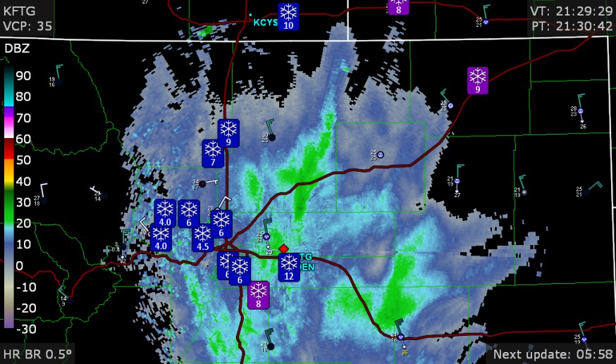
I got 4.0 to 4.5" with pretty high density snow, with less than 4.0" snow depth on pavement, for sure. I think Toledo Express Airport has gotten 0.55" of water equivalent, so that could have normally been 5.5" to 6.0" on grass. It does look like 6.0" at Napoleon or Defiance with also over 6" towards Ann Arbor. I wonder what the COCORAHS spotters will see for their water equivalent of snow for the 2-day period. My area certainly could be 0.55" like Toledo Express Airport.
-
Midwest/Ohio Valley/Great Lakes Snow January 24-26
Chinook replied to Baum's topic in Lakes/Ohio Valley
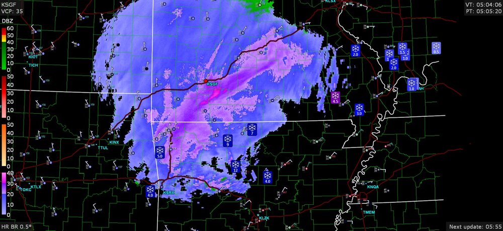
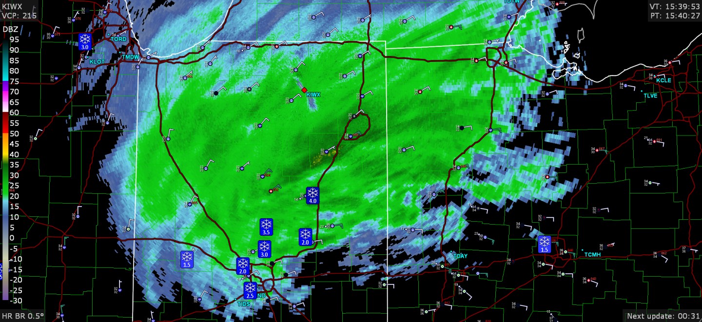
wow, 7.8" at Ann Arbor spotter report -
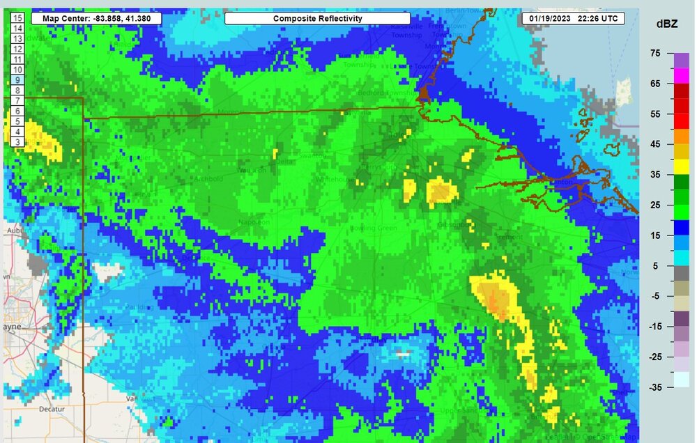
Midwest/Ohio Valley/Great Lakes Snow January 24-26
Chinook replied to Baum's topic in Lakes/Ohio Valley
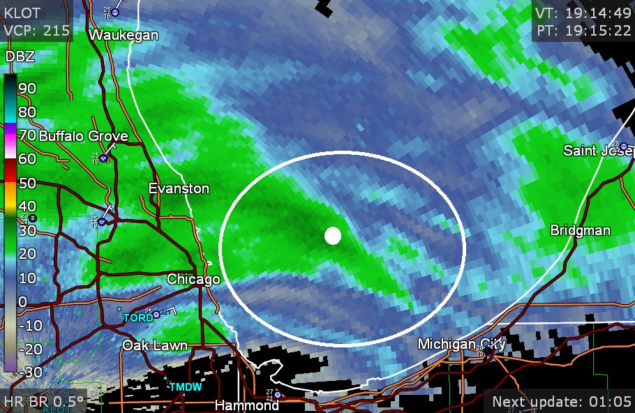
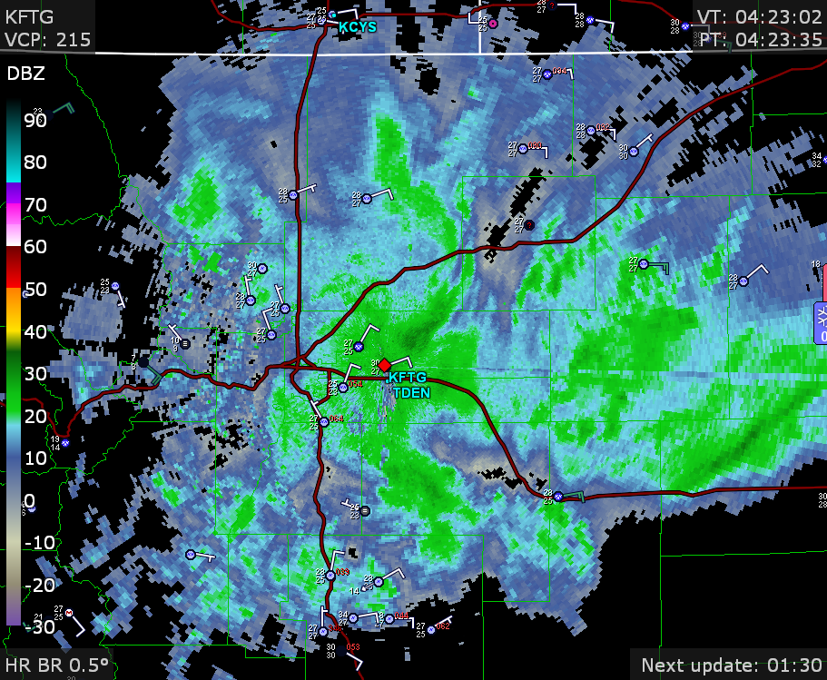
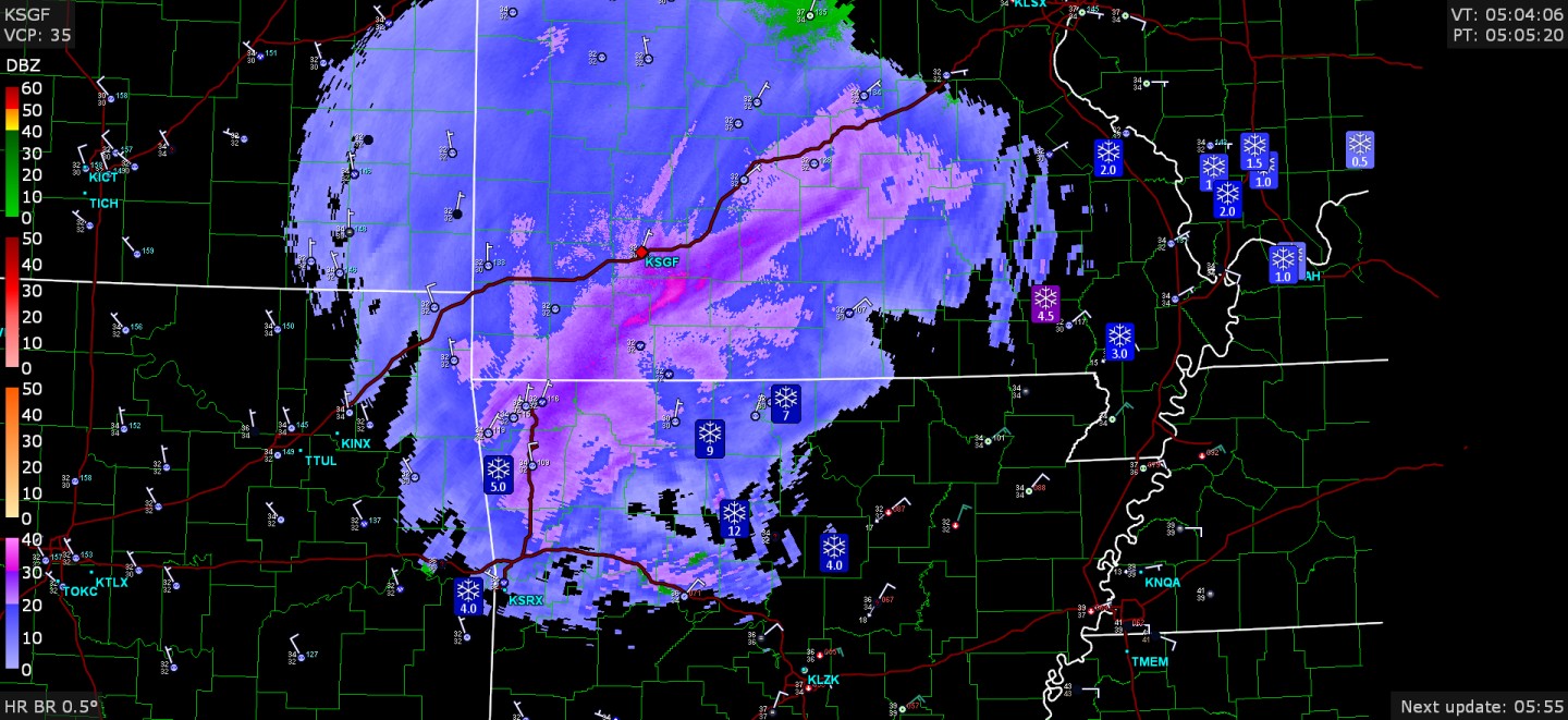
The radar is sort of maxing out at Fort Wayne -
Midwest/Ohio Valley/Great Lakes Snow January 24-26
Chinook replied to Baum's topic in Lakes/Ohio Valley
some IL snow reports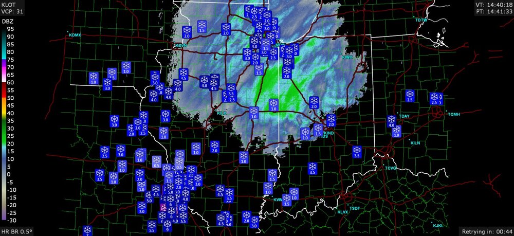
-
Midwest/Ohio Valley/Great Lakes Snow January 24-26
Chinook replied to Baum's topic in Lakes/Ohio Valley
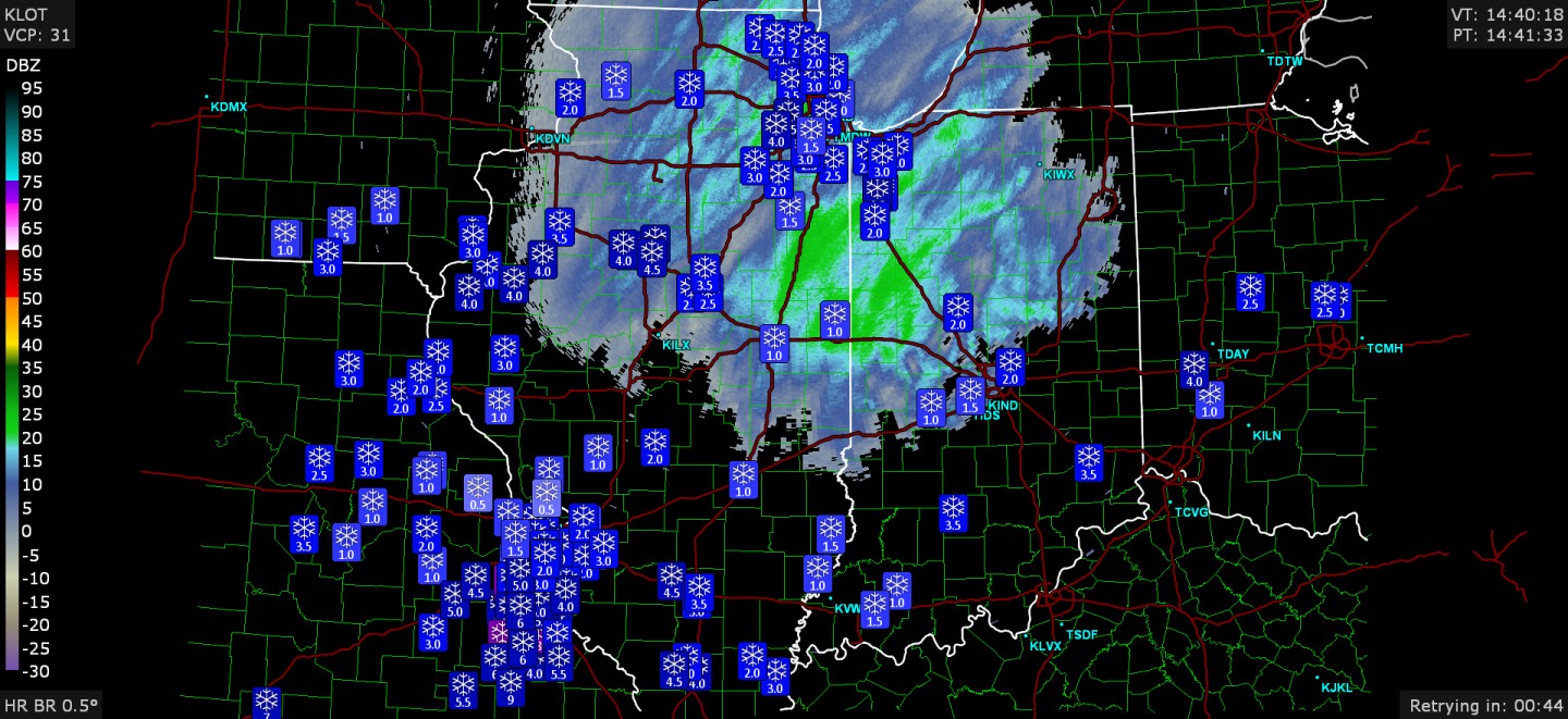
I just as I posted the SPC mesoscale discussion graphic, and now... the big snowflakes are here. There are aggregate snowflakes or whatever the term is, snowflakes sticking to snowflakes. It's going to be accumulating 1" per hour for a couple of hours at least.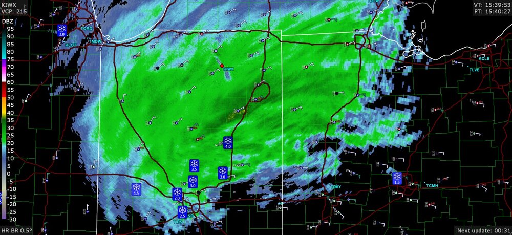
-
Midwest/Ohio Valley/Great Lakes Snow January 24-26
Chinook replied to Baum's topic in Lakes/Ohio Valley
At my place, snow is covering the grass, mainly. Below: this SPC mesoscale discussion for snow is probably the only time I'm going to get a mesoscale discussion at my location for quite some time.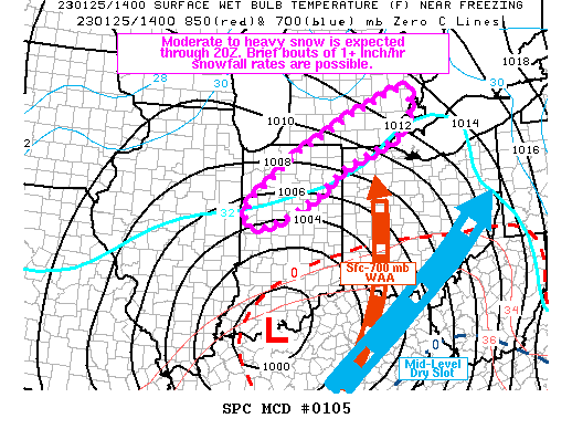
-
some spotter reports

-
Midwest/Ohio Valley/Great Lakes Snow January 24-26
Chinook replied to Baum's topic in Lakes/Ohio Valley
This is my favorite post ever. -
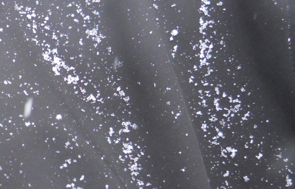
individual snowflakes
-
when have they not been in D2-D3 drought?
-
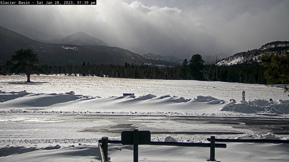
This was a snow storm for Colorado, just not where any of us live (or lived, in my case.)
.thumb.png.9766463f32e3f8440bcad7ed0eb7fc57.png)
-
This minor storm is centered around KC and the ongoing KC vs Jacksonville game, but not much to speak of at the stadium, and rain for you guys that are the main people in this thread.
-
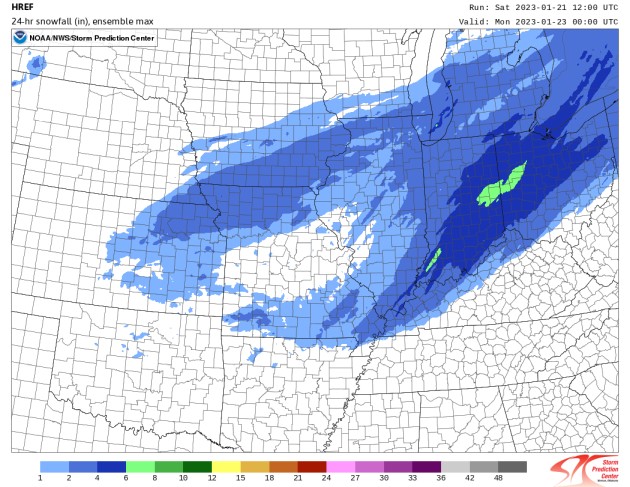
I didn't think this one would have much, but maybe I can take some nice pictures of snowflakes and snow cover. I didn't really take a picture of the outside with the Dec 23-24 ground blizzard, as there was some grass showing, and it was a wind chill of -29 and stuff like that. HREF says 4-6" in coming! ha ha ha. That's the max value of the CAM models, so yeah, it's too high. Honestly I think observations might be 1.5" or 2.0" by tomorrow night or Monday.
-
2023 Short/Medium Range Severe Weather Discussion
Chinook replied to Chicago Storm's topic in Lakes/Ohio Valley
I saw lightning at Toledo at 5:30PM, and it was not far away, as the thunder was quite soon. I really and truly haven't had a +RA in January since before I moved to the Western US. It's just so strange.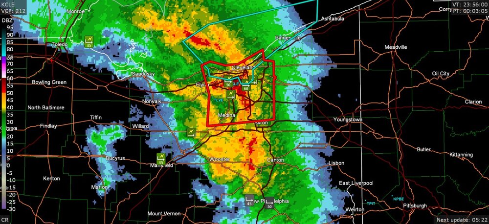
-
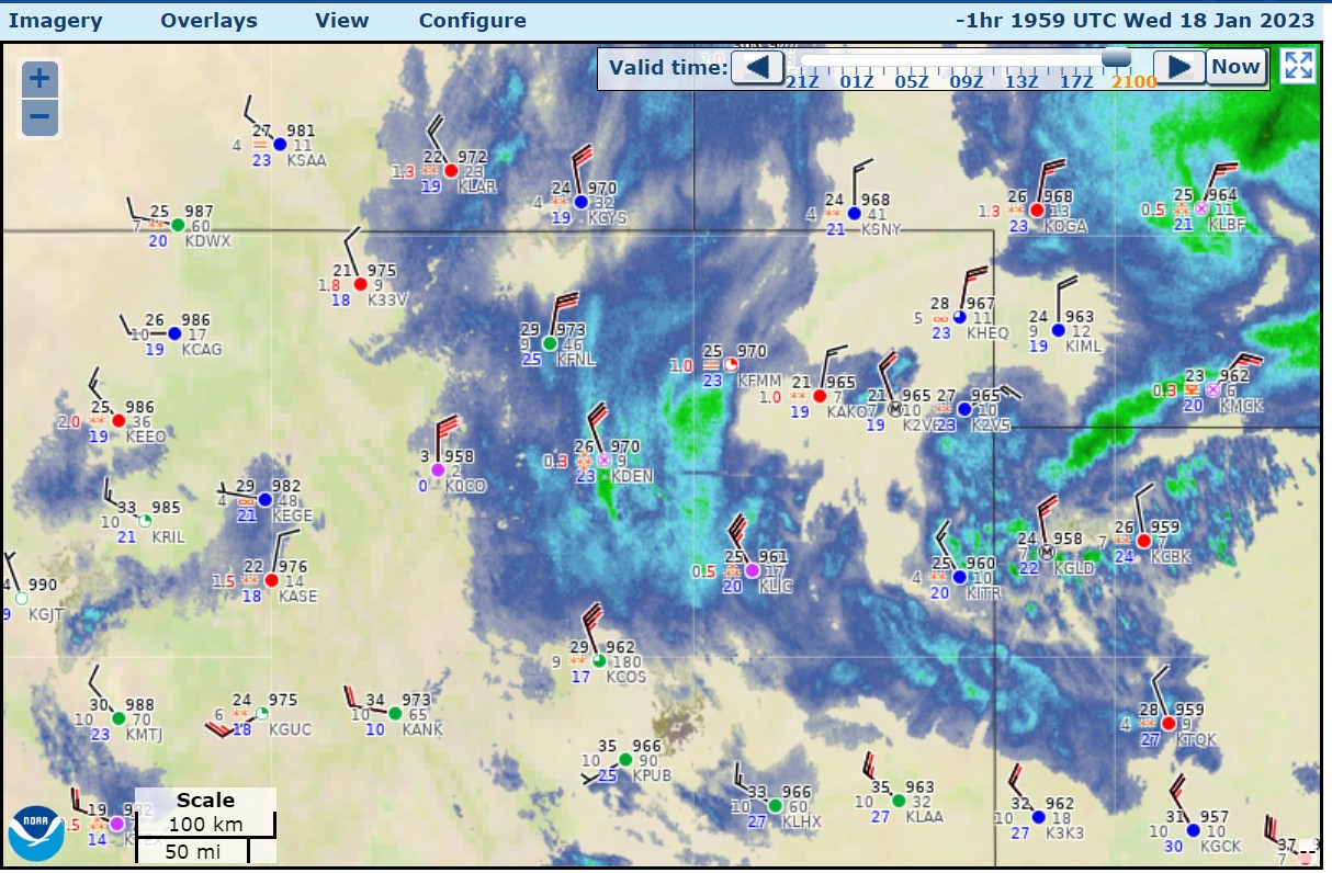
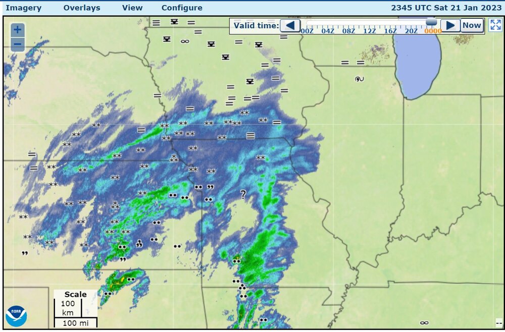
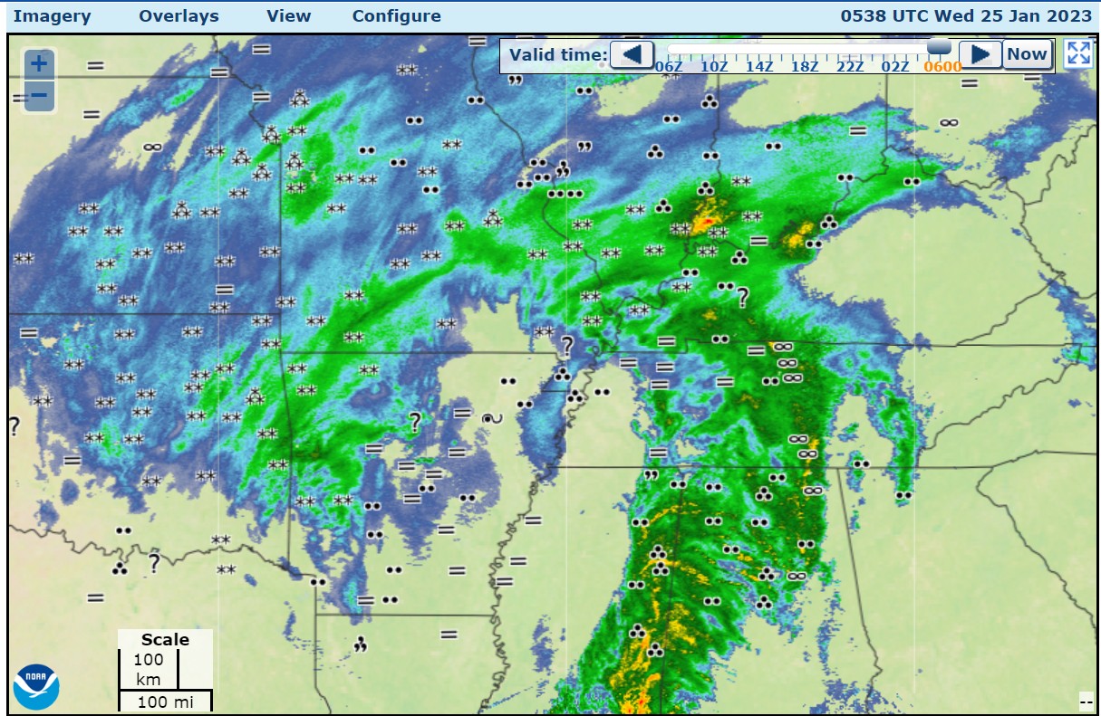
These images are from somewhat earlier. There have not been a lot of new storm reports

-
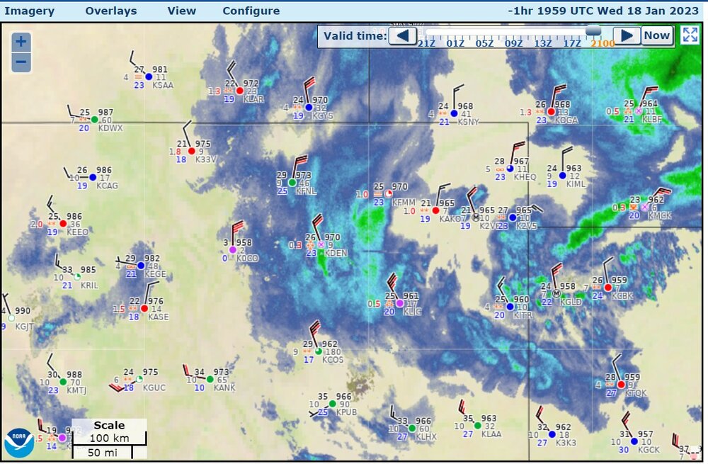
snapshot of higher winds that lasted for about 1 hour
-
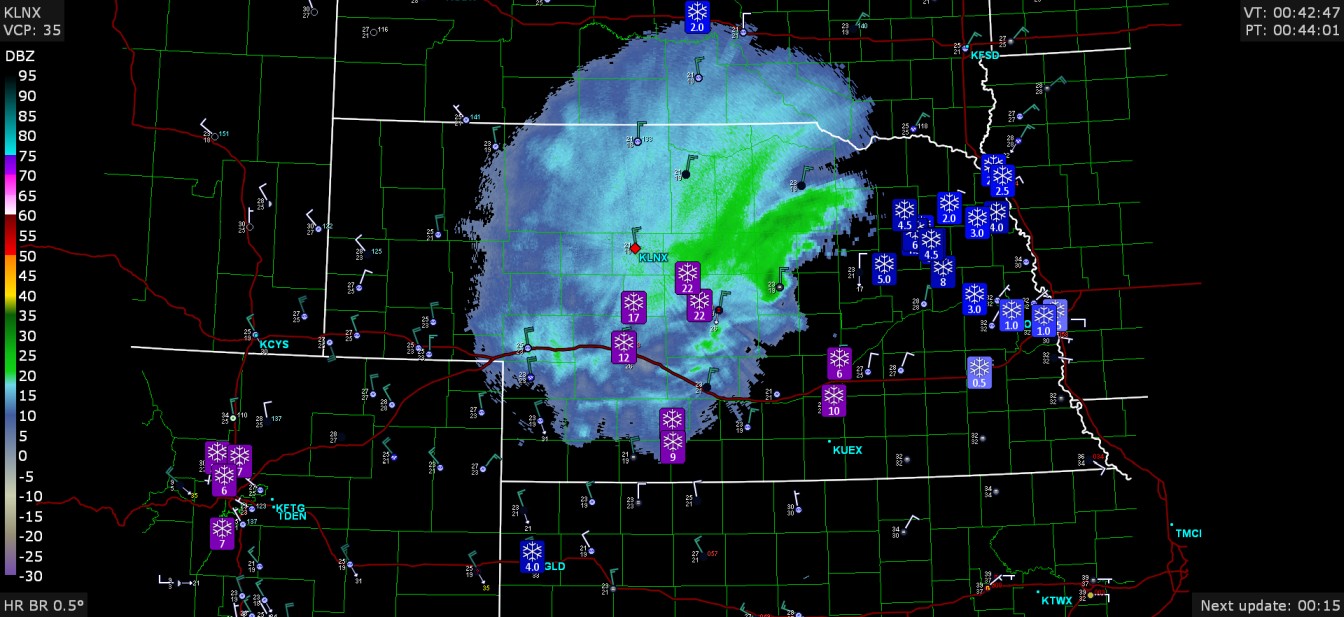
a lot more windy at DIA right now with wind gusts to 34kt (39mph), with almost all other airports less windy though.
-
They've got 7" in Loveland and 7-8" around DIA right now. Maybe other spotters will measure 7" soon.
-
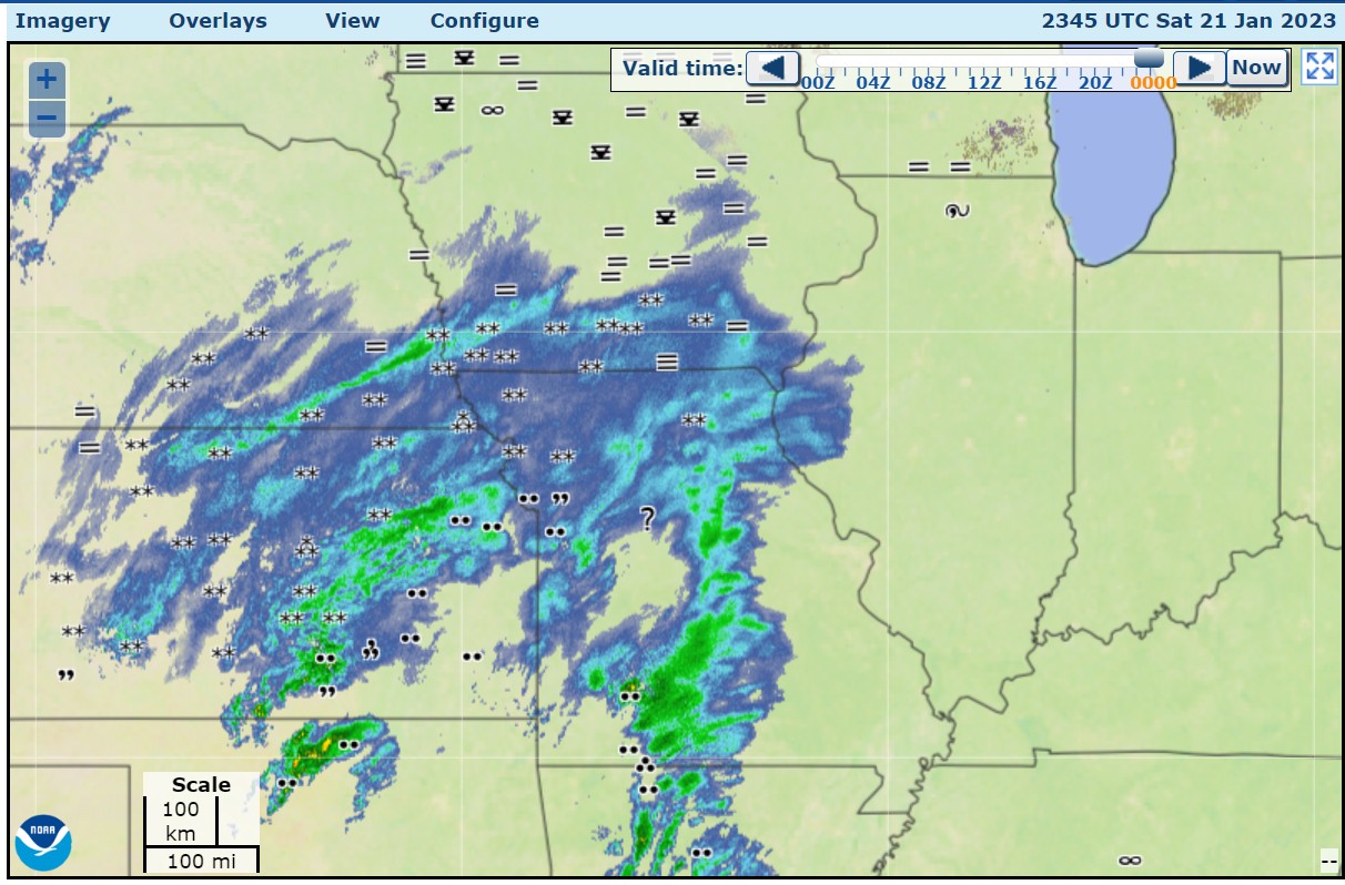
radar is a solid area

-
snow bands getting going around Denver


.png.e8ae3c787328798fa788dab3c1634a02.png)