Chinook
-
Posts
10,933 -
Joined
-
Last visited
Content Type
Profiles
Blogs
Forums
American Weather
Media Demo
Store
Gallery
Everything posted by Chinook
-
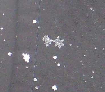
snowflake pic that I put on my web page
-
54 degrees warmer for Ontario
.thumb.png.0e655aaa450496dfabc9c936a0651b92.png)
-
My place had 4 sunny days in a row with snow on the ground. The last time my place had 4 sunny days within maybe a span of 5 days was probably November or October, with nearly summertime temperatures.
-
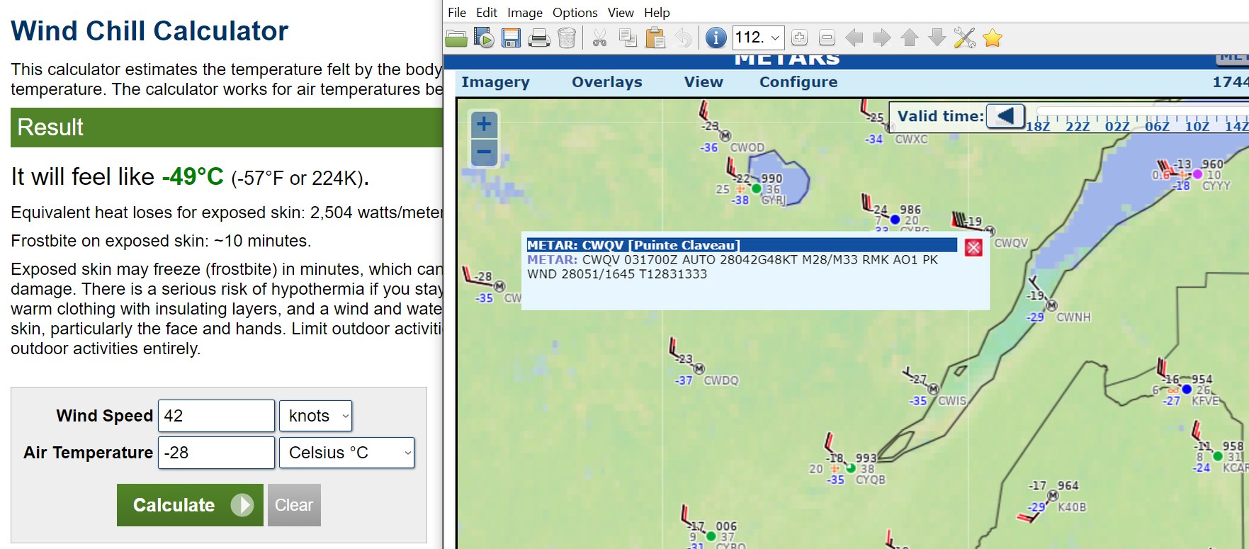
As I mentioned in the Lakes/Ohio Valley banter thread, I have a hard time imagining a -44 degree value without radiational cooling and a valley with lighter winds, or at least some localized low spot. It's truly a once-in-a-generation 850mb temperature up there and also the same for wind chills for some.
-
finally caught a good cloud

-
I can't imagine -44 without radiational cooling and mostly calm winds.
-
The wind gets faster over mountain peaks and some mountain passes. The air is forced into a smaller- volume space: the mountain, and other air above it. You get a faster wind by conservation of mass flow. And maybe extra turbulence.
-
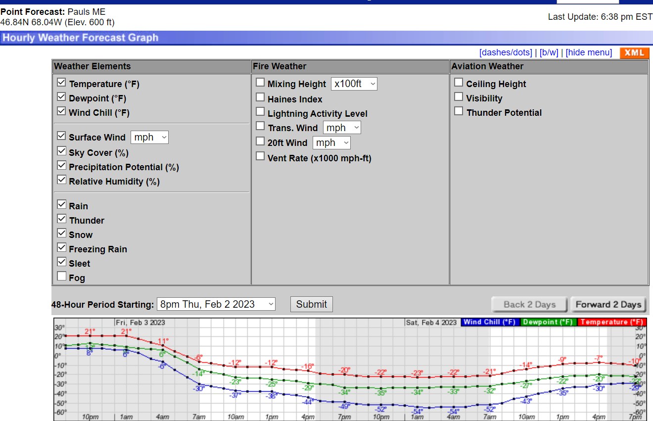
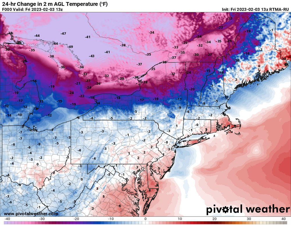
Here a note on the Northeast wind chill blast. The GFS has -40C temps at 850mb for the Caribou, Maine area. I think it will be very close to a record or record-breaking at Caribou. The record coldest 850mb temperature is -39.40 Celsius as per the SPC page that has this stuff. The "median" would be -11.7 Celsius.
.thumb.png.a6266f530a8396feef4c5731fbd786e0.png)
-
Here is other note on the Northeast wind chill blast. The GFS has -40C temps at 850mb for the Caribou, Maine area. I think it will be very close to a record or record-breaking at Caribou. The record coldest 850mb temperature is -39.40 Celsius as per the SPC page that has this stuff. The "median" would be -11.7 Celsius.
-
Part of Ontario near Sudbury is 49F degrees, or 27.2 C degrees, lower than yesterday. Sudbury went -4C to -33C in about 23 hours.
-

Texas/Oklahoma Discussion & Obs Thread 2022
Chinook replied to It's Always Sunny's topic in Central/Western States
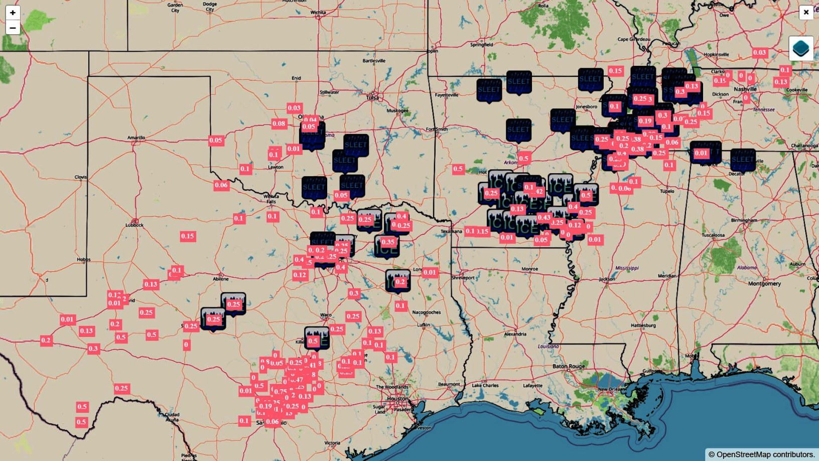
48 hrs of storm reports. I have changed the colors a bit so you can read the freezing rain reports.
-
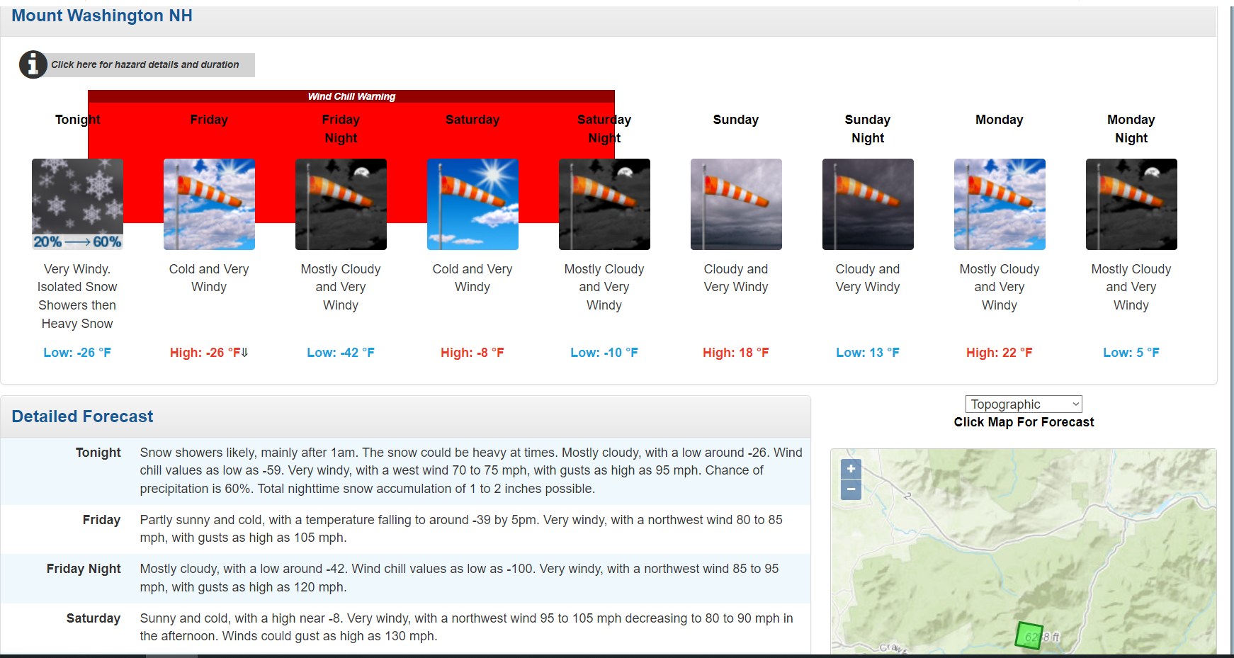
The world's windiest place

-
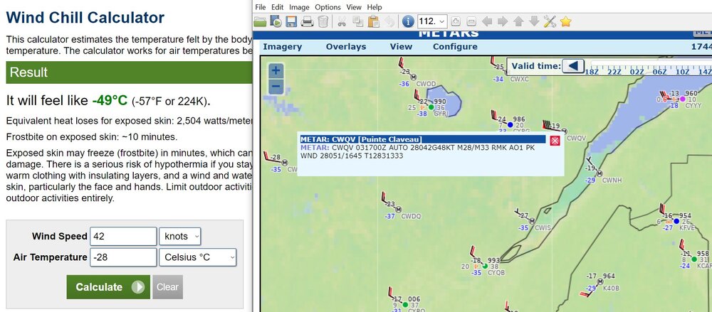
This is a rare wind chill index (Maine), also with winds of 30kt immediately above the surface.
-
Texas/Oklahoma Discussion & Obs Thread 2022
Chinook replied to It's Always Sunny's topic in Central/Western States
This would scare me
-
Now that a lot of the West is in a non-active pattern, I'll post this
-
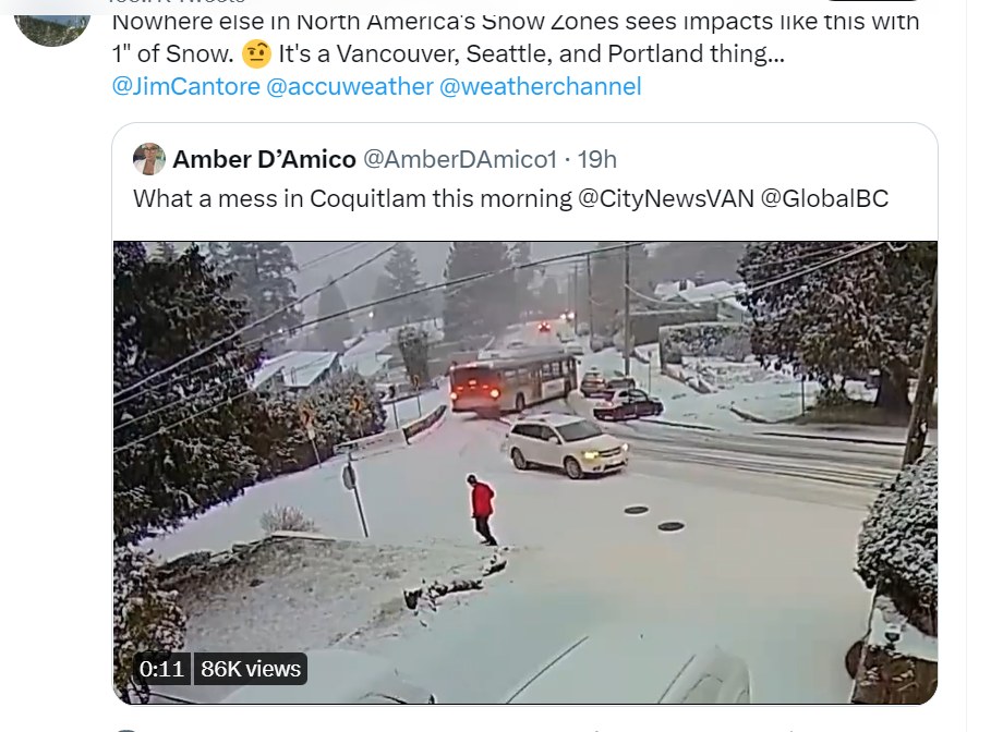
this bus went out of control at 5-10mph and swiped a car
-
Anybody from Toronto in here? The GFS says -14F (-26C) with a wind of 10 knots (19 km/h) on Friday morning. The NAM has some temperatures that are not quite so cold.
-
Texas/Oklahoma Discussion & Obs Thread 2022
Chinook replied to It's Always Sunny's topic in Central/Western States
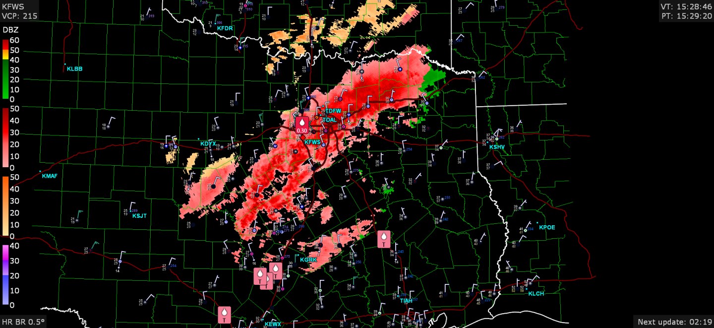
Fort Worth had 0.30" reported freezing rain. Other note: thunder recently reported at the Dallas area and also Poteau, OK (temps below freezing on both)

-
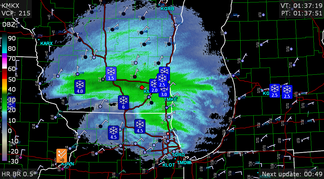
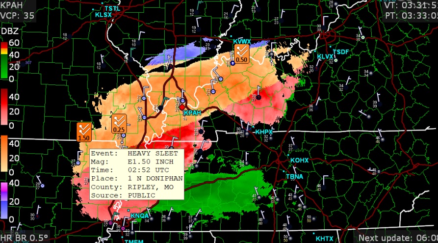
1.4" of sleet at Bentonville is an impressive storm report tonight when you've got 4 precip-type colors on radar
-
my place got about 1/2" (surprise!)
-
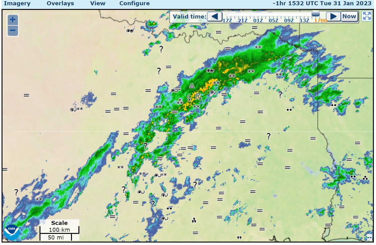
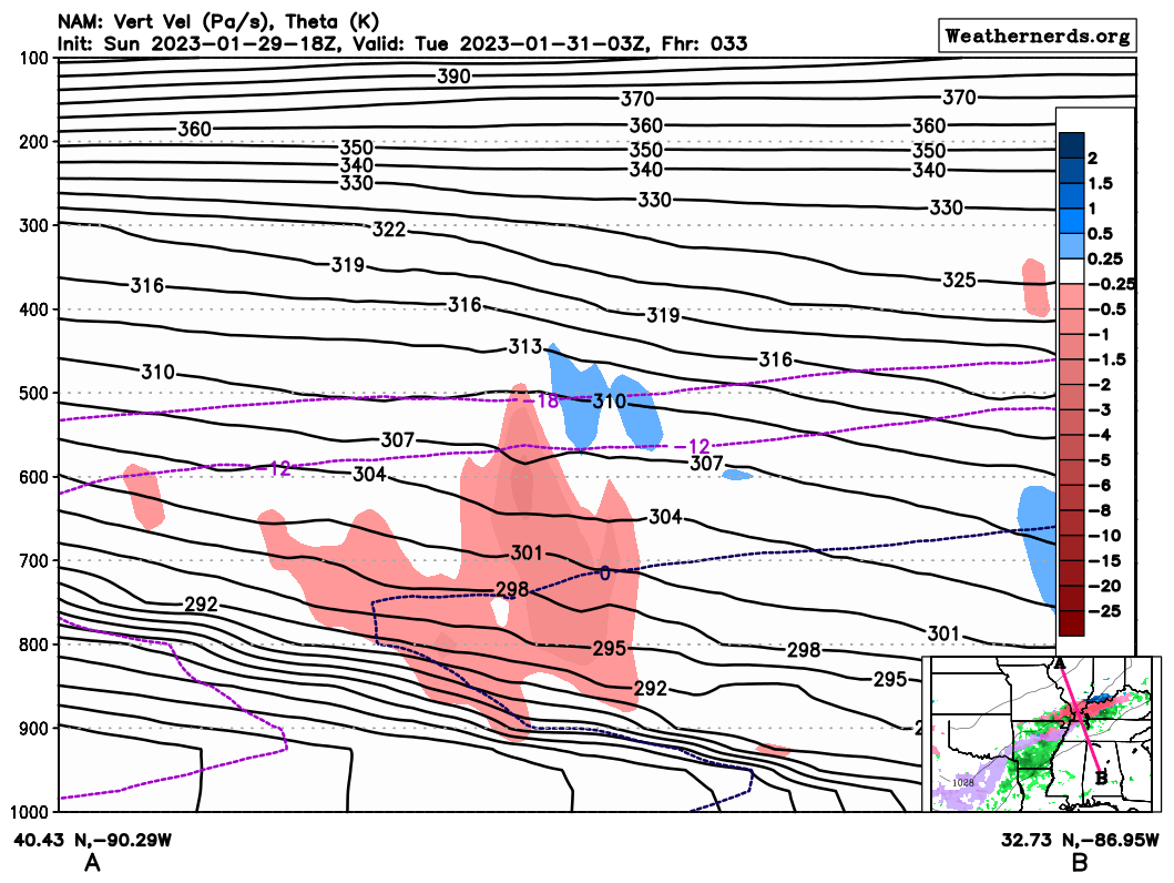
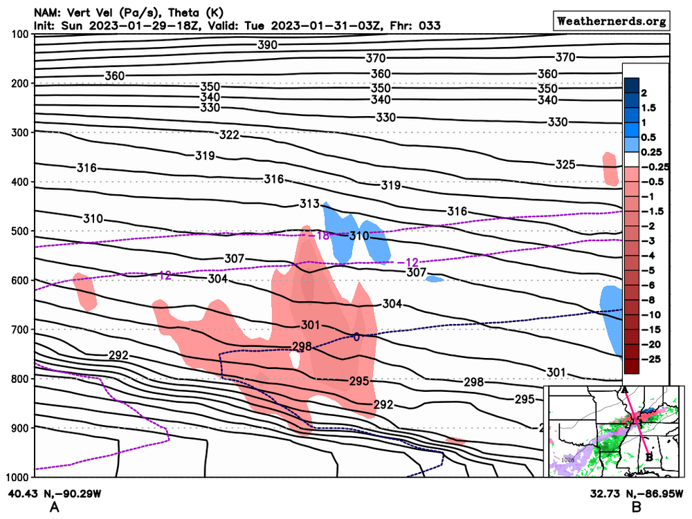
NAM-12km has sleet/freezing rain at 33 hrs, with this cross section showing the warm and cold layers that could cause this (see radar in the corner)
-
The bigger storms for Toledo that year
-
The recent storm on Wednesday reminded me of this event in terms of low pressure placement In other ways, the Dec 23-24 2022 was a lot more like 1/5/2014 in terms of true cold dumpage. As a general meteorological term, the polar vortex normally is in one or multiple 500mb lows in the far north, and contains the lowest 500mb heights and temperatures, and is also linked to the lowest 850mb temperatures of the Northern Hemisphere. Sometimes a distinguishable 500mb vortex can travel to mid Canada or lower Canada and dump the cold into the USA. In the case of 1/4/2014 to 1/8/2014, a very cold air mass, essentially a cut off polar vortex, converted its (maybe) -40C air at 500mb into a snowstorm and a dangerous wind chill scenario for the US and lower Canada. Some heavy snow came through Toledo, and I wasn't there for it, of course. But hey, I still have at least one picture from my parents. Pretty much everybody on this discussion board felt low wind chills on those days. As you can see from the observations, the low pressure went just south of Toledo.Thhere was 12.5" measured in NW Ohio, with winds of 15kt to 20kt in NW Ohio and northern Indiana. There were -40F to -46F wind chills at Toledo on the January 6th-7th. I believe there was a near record-breaking -30C temperatures at 850mb measured at Detroit DTX while there was decent wind. Some areas of the Midwest had -59F wind chills according to one of the maps below. my 500mb loop http://www.greatlakes.salsite.com/Jan_5_2014_storm_loop.html forecast: 232 Kelvin is -41 celsius
-
some storm reports and radar
-
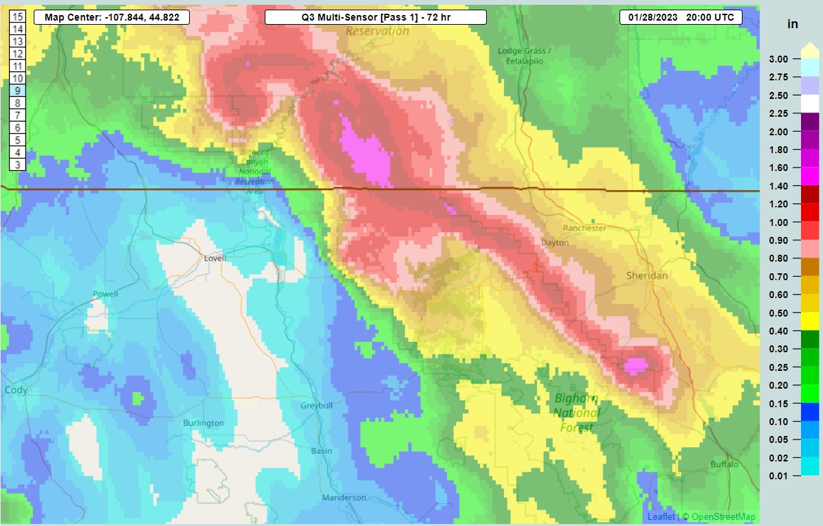
reasons why Greybull may have the driest soil in the northern US

.png.97ee624b3cc015687ad7747dcb6f950d.png)

.png.fa56544f0bfb3e88d88d468bedc05be7.png)