Chinook
-
Posts
10,933 -
Joined
-
Last visited
Content Type
Profiles
Blogs
Forums
American Weather
Media Demo
Store
Gallery
Everything posted by Chinook
-
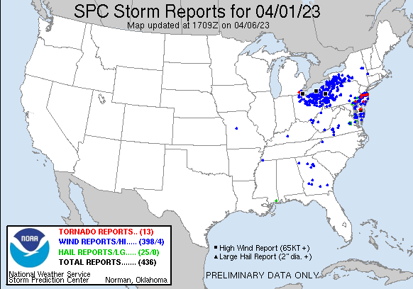
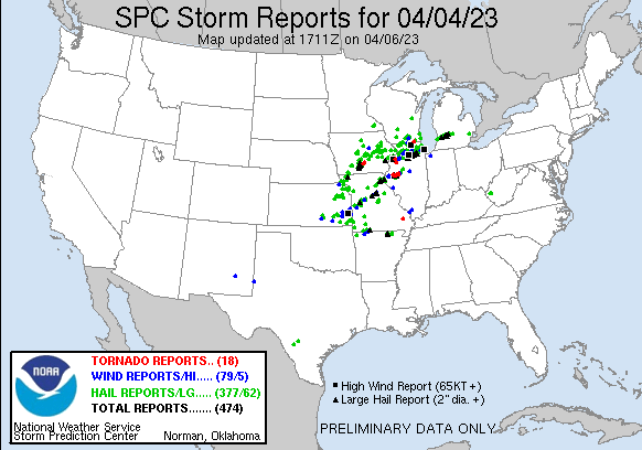
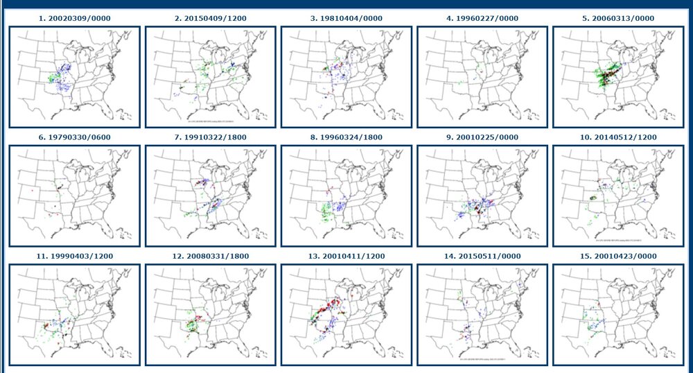
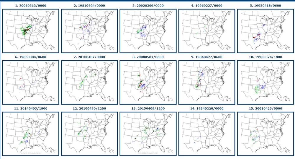
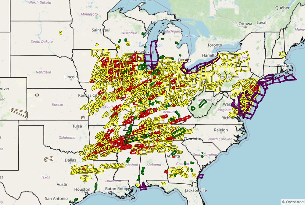
Unfiltered storm reports on three previous days. Up to 161/990 preliminary unfiltered reports on March 31st.
.gif.15a502b7c95e86324eefdbcf91071bb0.gif)
-
Now there are have peak winds gusts of 47mph at Defiance without thunderstorms
-
The radar is kind of a mess, with only 4 severe warnings in the country right now. I'm not used to temp of 77 with dew of 63. It's like insta-summer. I'm used to getting the first few 70 degree temps out West, not too long after snow, with a dew point of 20 and a view of the snowy mountains. The SPC really kind of busted with the Arkansas area yesterday, you know, like 100% bust when you look at this map.
-
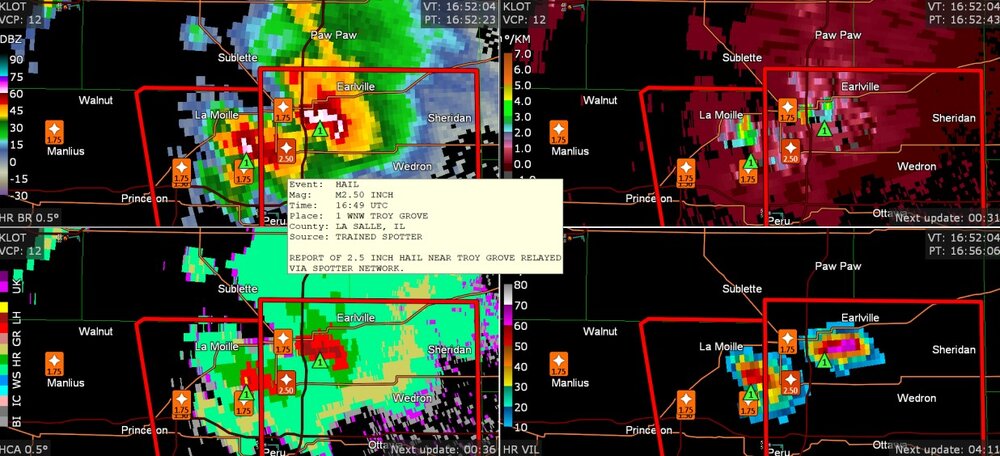
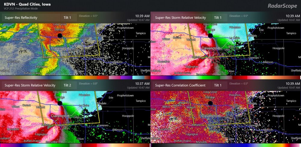
Almost baseball size hail north of the warm front near I-80. That's pretty nasty considering the storm doesn't even seem that big, and the surface based CAPE is 0. VIL and reflectivity maxed out near Princeton, so that must be the region where the large hail developed.
-
A little morning-time rear flank downdraft
-
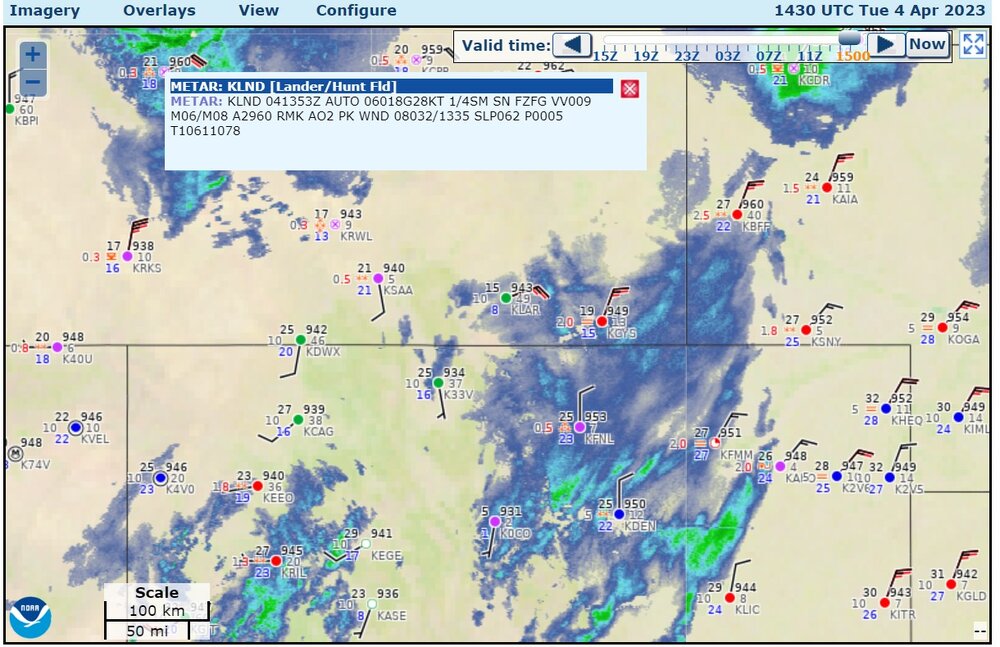
There is 1.5"-2.5" in Fort Collins and Loveland, some snow in Denver. A massive section of Wyoming and the Dakotas have a blizzard warning today.
-
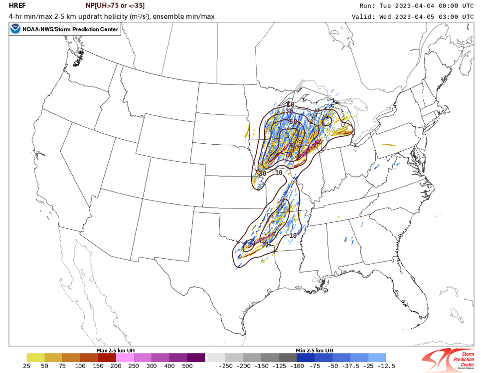
I don't think the CAMs have a lot of storms, if you exclude the FV3 monster storm near Chicago. (seriously, that's like a 10mile wide updraft helicity track. I mean, it could represent a realistic tornado threat that's not a super monster.)
-
Maybe this is just a case where the 12z CAM models see a cap of some strength. Then, none of the CAM models have much convection at 00z-04z tomorrow night. The SPC is essentially saying they're just really wrong.
-
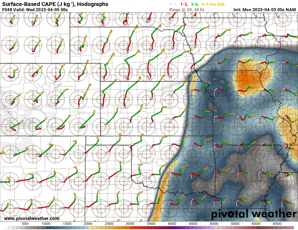
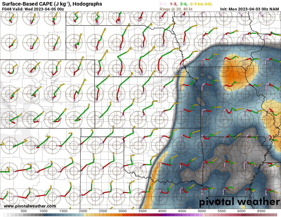
The newest rage in town: CAPE with embedded hodographs
-
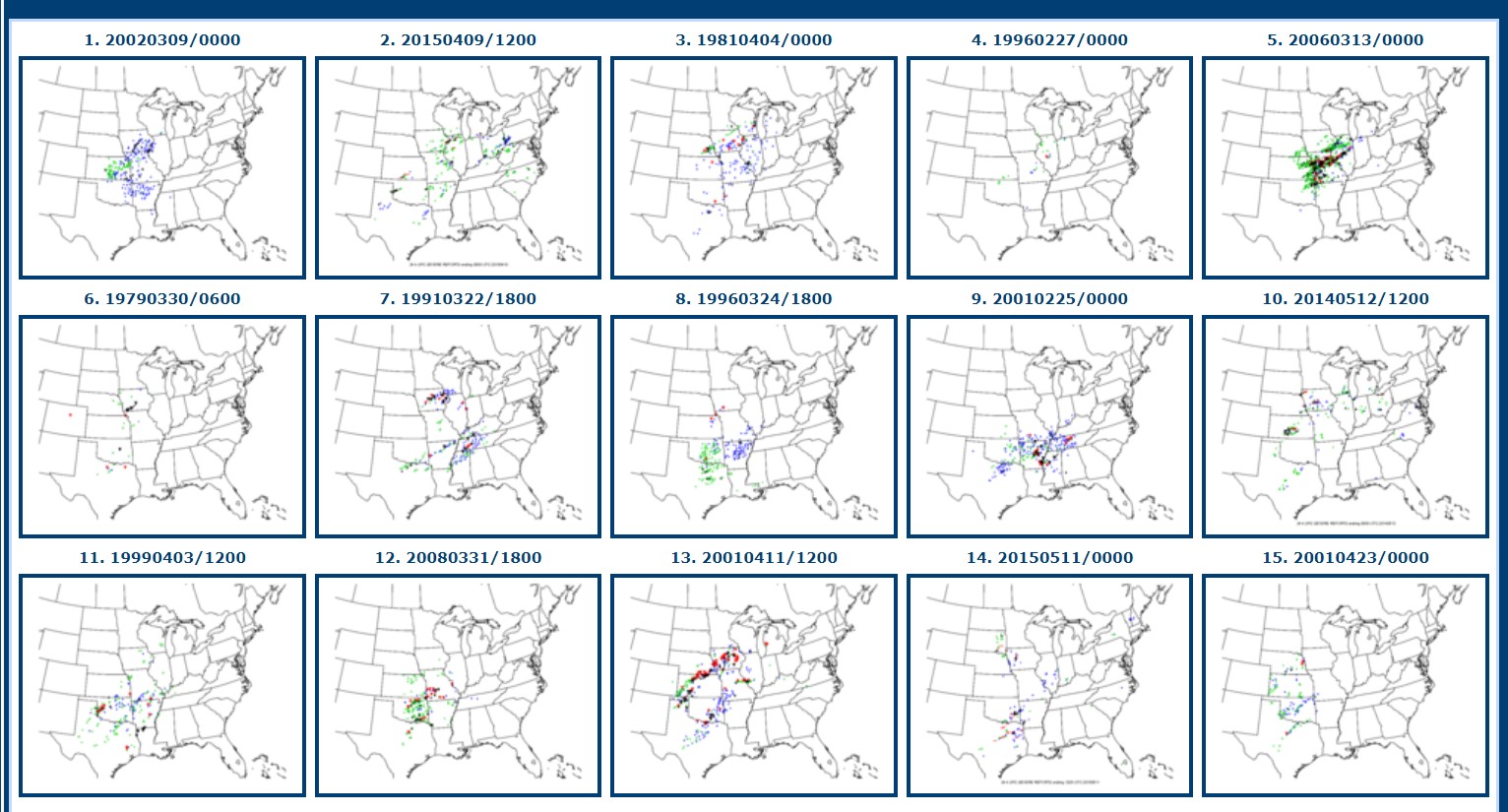
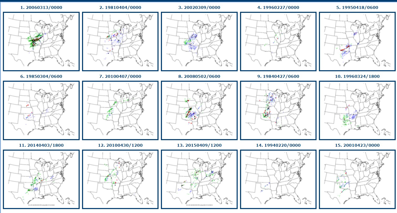
While we are waiting for this to get on the Day-2 type time frame, I'll post the CIPS analogs, with Apr. 2, 12z data, for two different sectors. The way the data goes into the sector of the analog system must make a significant difference as to which analogs are picked. And get this: None of these analogs are what Ryan Hall mentioned as the best analogs, 4/26/94 and 2/29/2012. Midwest sector Southern Plains sector.
-
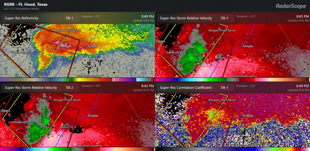
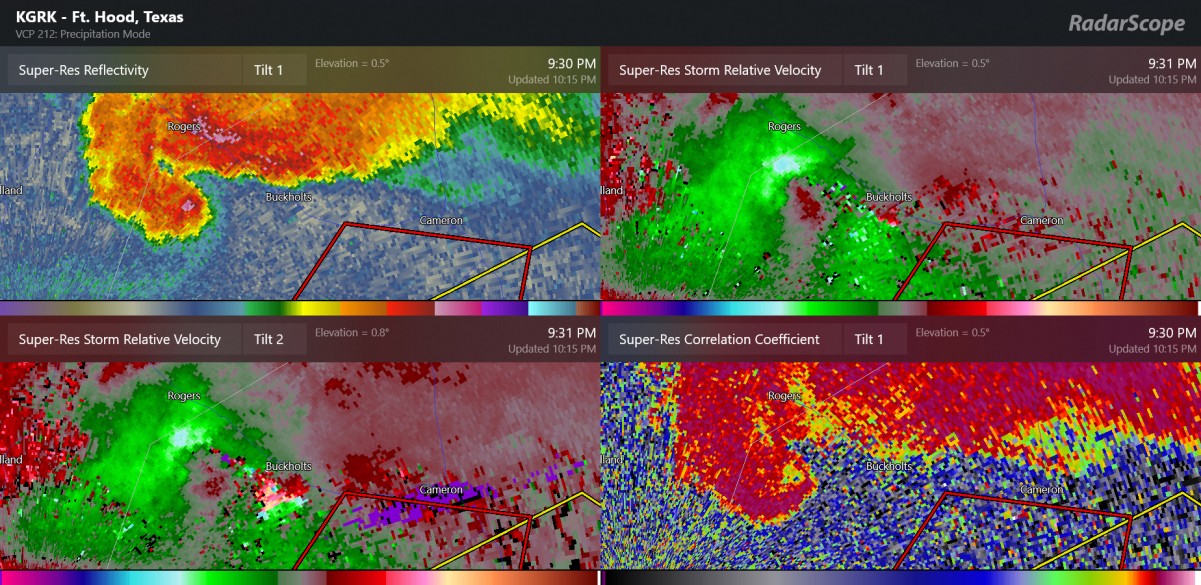
I think this is a sneaky non-TDS as the velocities aren't very high. Any thoughts?

-
Does this qualify as a derecho?

-
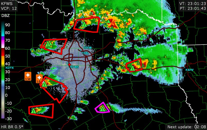
Here is definitely a bounded weak echo region with the supercell shape and tornado warning. It seems like the velocity data has just been showing convergence rather than an easy-to-view mesocylone
-
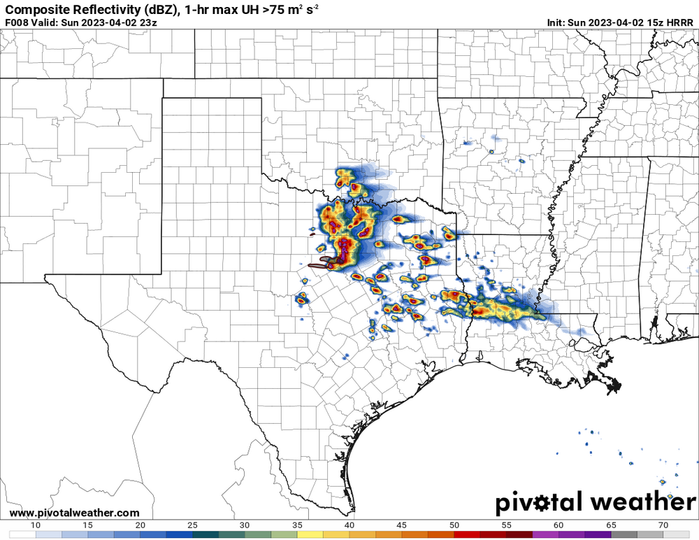
There are storms on every side of Dallas/Fort Worth. Several new small storms are popping as potentially a new group of supercells. Maybe one of those could become dominant.
-
I think the storm near Stephenville has transitioned from being mainly a hail storm to maybe getting a bunch of rotation right now.
-
some storm chaser probably has a good view of a wall cloud, or even a tornado (no direct evidence of a tornado yet.)
-
Dallas has a 64 dew point, up from a dew point of 17 yesterday (2:53AM on April 1st). It's just amazing how that works.
-
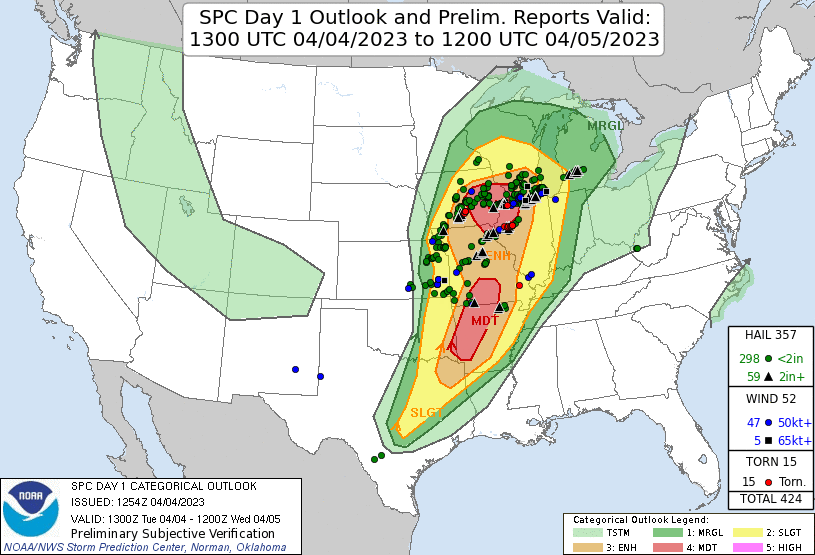
This one was a bit of a surprise as I thought maybe nothing would happen before the next large low pressure system. Things seem reasonably favorable for tornadoes. Some areas could be above 200m2/s2 of storm relative helicity (0-3km). Actually the NAM has up to 400 m2/s2 by the late day! The HRRR has some discrete storms and also a cluster of storms near/south of Fort Worth.
-
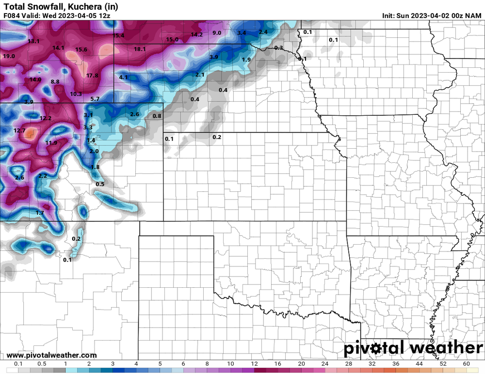
NWS now says 1-3" near Fort Collins, maybe 6" for Estes Park, and up to 20-24" at Casper/Casper Mountain, Wyoming
-
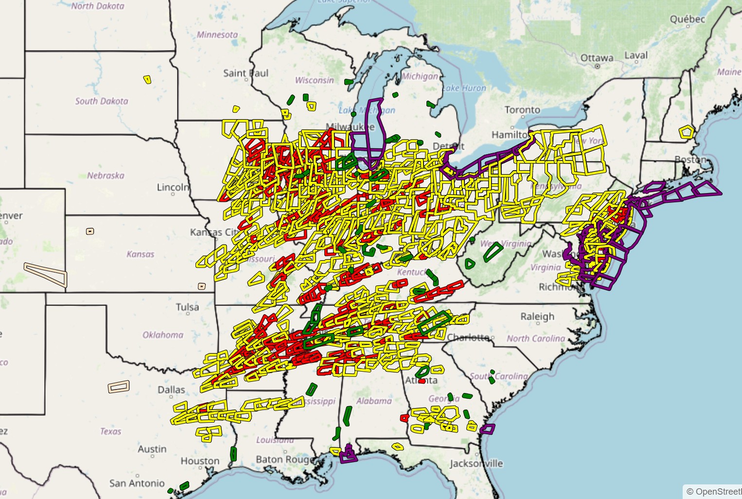
Severe weather polygons of all types from 3:00AM March 31 to April 2 (early)
-
A large storm system on Monday night will most likely be a close call for heavy snow at Fort Collins and Estes Park.
.thumb.png.a3e0df1dc4d2fc991cfd8088bead4157.png)
-
low-instability severe squall came though here around 11:00AM. At the time I didn't realize there would be this storm report of over 82mph over the Lake
-
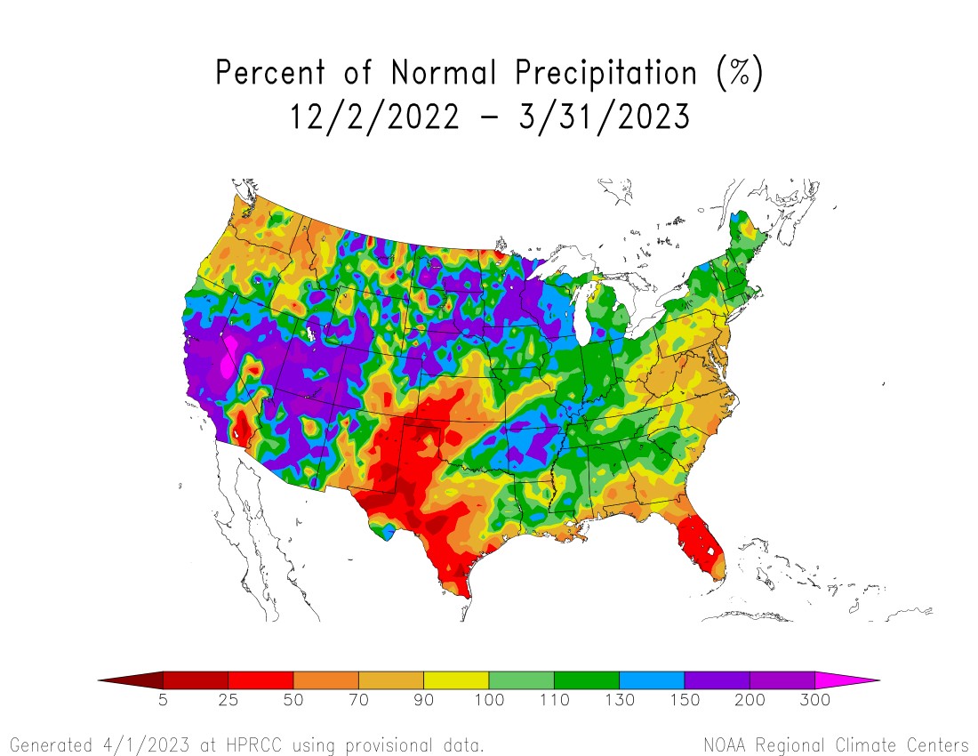
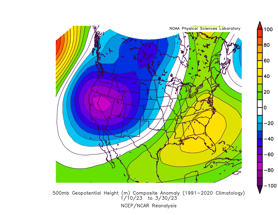
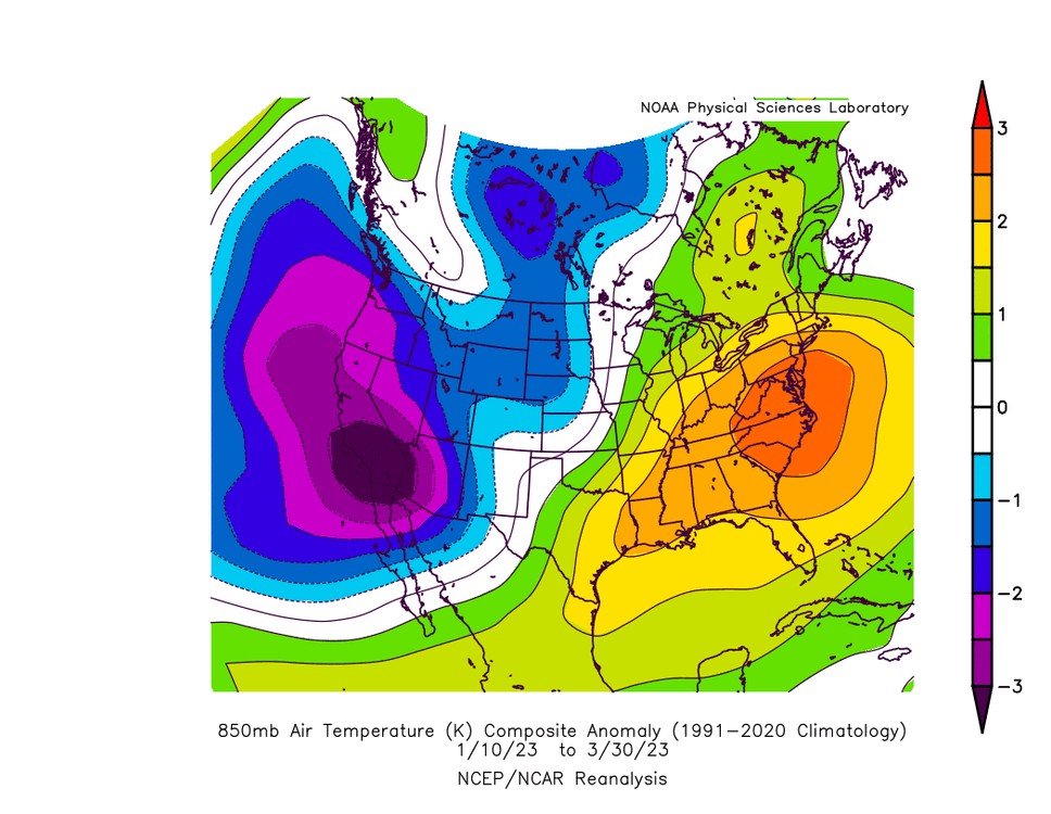
The 500mb anomaly, shown here with Jan 10th-Mar 30th, highlights the exact area with the most precipitation this year: mid-California


-

2023 Mid-Atlantic Severe Wx Thread (General Discussion)
Chinook replied to Kmlwx's topic in Mid Atlantic
Was that Upper Freehold, Pennsylvania? I'm not familiar with where this tornado warning took place.- 2,785 replies
-
- 1
-

-
- severe
- thunderstorms
- (and 3 more)
-
2023 Mid-Atlantic Severe Wx Thread (General Discussion)
Chinook replied to Kmlwx's topic in Mid Atlantic
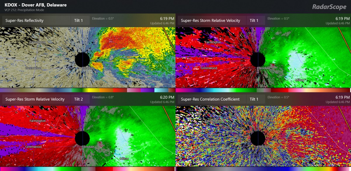
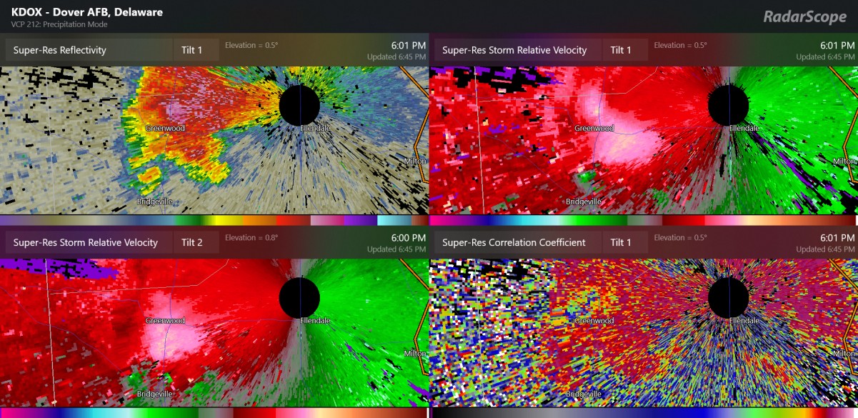
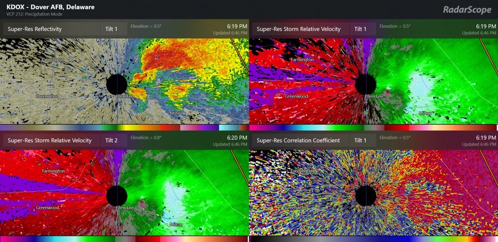
for those interested, this was a tornado reported by a spotter(s) at 6:01 and 6:06, Bridgeville. I am not sure if it was a tornado after 6:06PM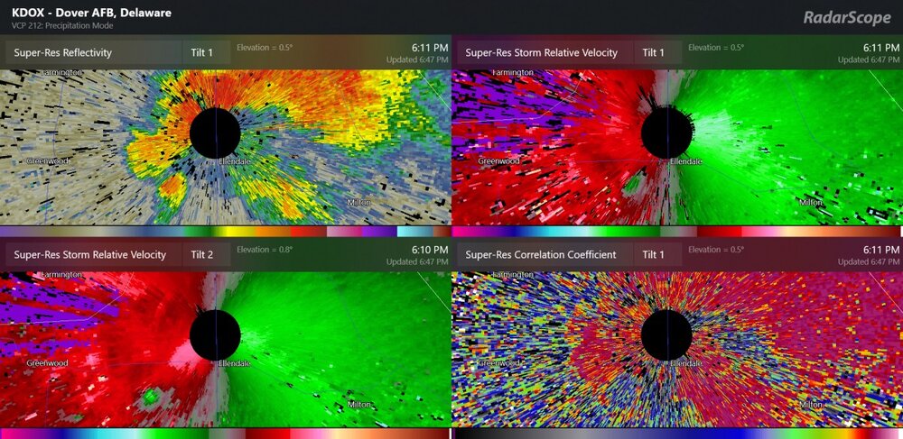


.png.c83bc42ccd16ffc9c65c1cce33c417ef.png)