Chinook
-
Posts
10,933 -
Joined
-
Last visited
Content Type
Profiles
Blogs
Forums
American Weather
Media Demo
Store
Gallery
Everything posted by Chinook
-

-
-12.4 at Fort Collins is pretty darn cold for in town
-
My place just got up to 50 degrees with sunshine after narrowly missing the SE Michigan ice storm of last night. Really, it was 33 degrees with an accumulation of about 2" of rain here. It's strange how warm it is You would typically think it would be below freezing after a cold front.
-
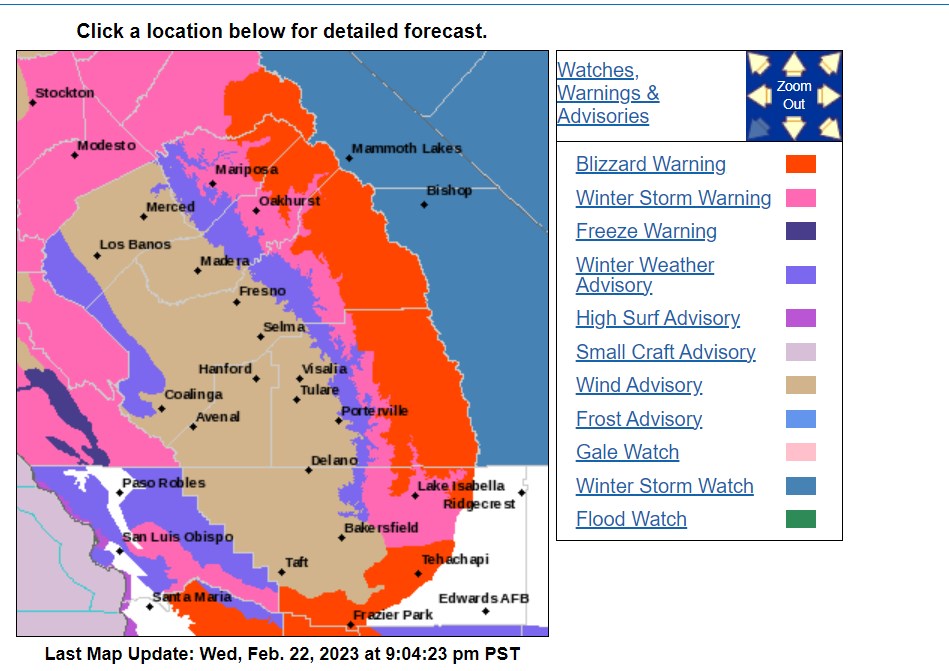
Not to drive you guys nuts, but I want to commemorate one of the first times I've seen a blizzard warning for southern California, even the San Gabriel Mountains north of Burbank.
-
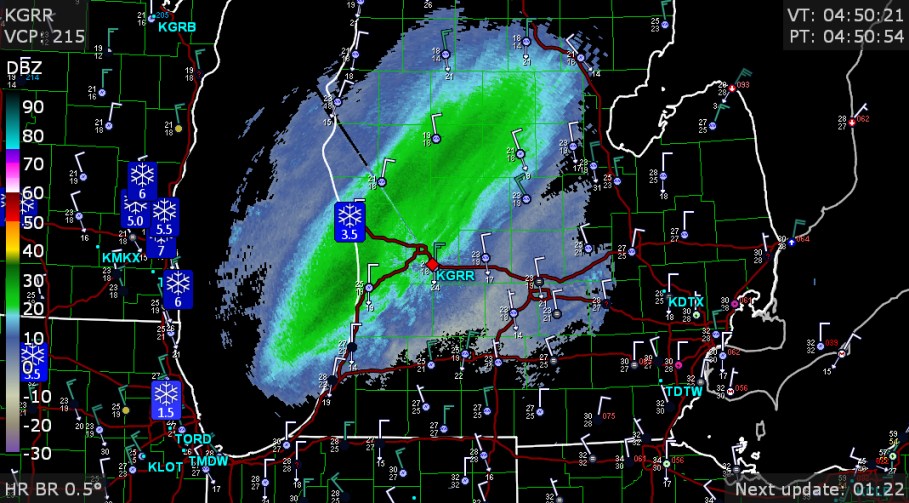
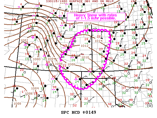
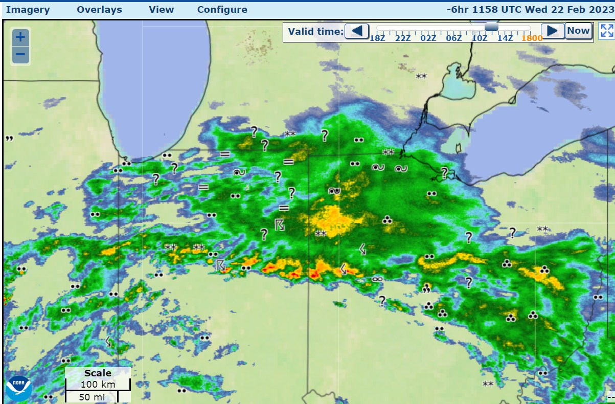
Here are the observations from 6 hr ago. At Toledo we had ice build up a bit on maybe grass or elevated surfaces, but not roads I don't think. It was 32-34 degrees. It is still 34 but I don't think there's much more chance of ice accumulation. This map shows how close it was to being a thunder ice storm, which is exactly what you don't want.

-
big picture of radar/ observations

-
So amazing to the the coast-to-coast snow forecast within just 48 hours, as snow is expected next to the Oregon and Washington coasts, and now the snow will be in Maine within 48 hours.
-
today's NWS winter storm briefing
-
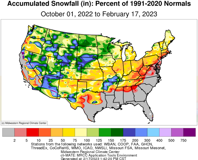
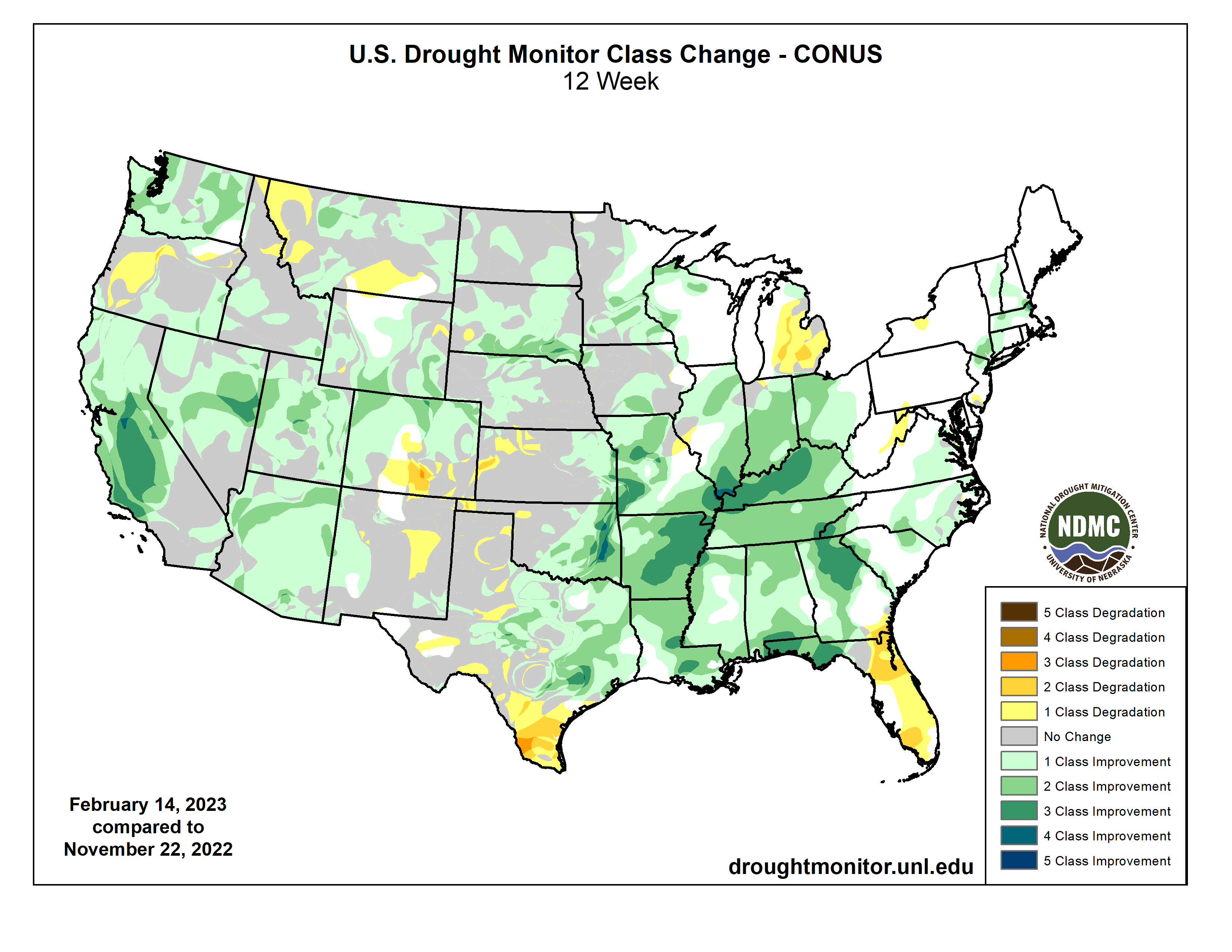
3-month drought change

-
It's a curious coincidence that this value, in rotational degrees, also corresponds with 33 Fahrenheit degrees for melting, which is just above the freezing point.
-
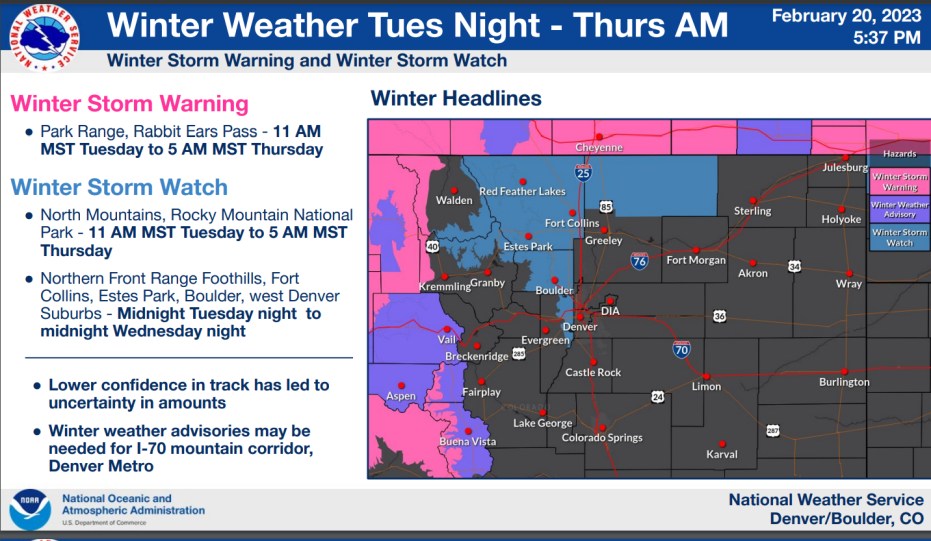
The ECMWF today shows some snow on Wednesday for northern Colorado, with the large weather system. That maybe something to watch.
-
follow up to that with a less hi-resolution source, with percentage vs departure (subtraction)
-
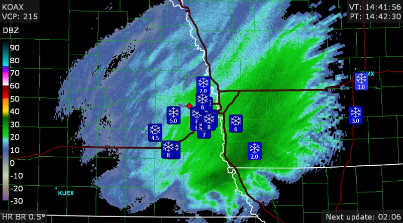
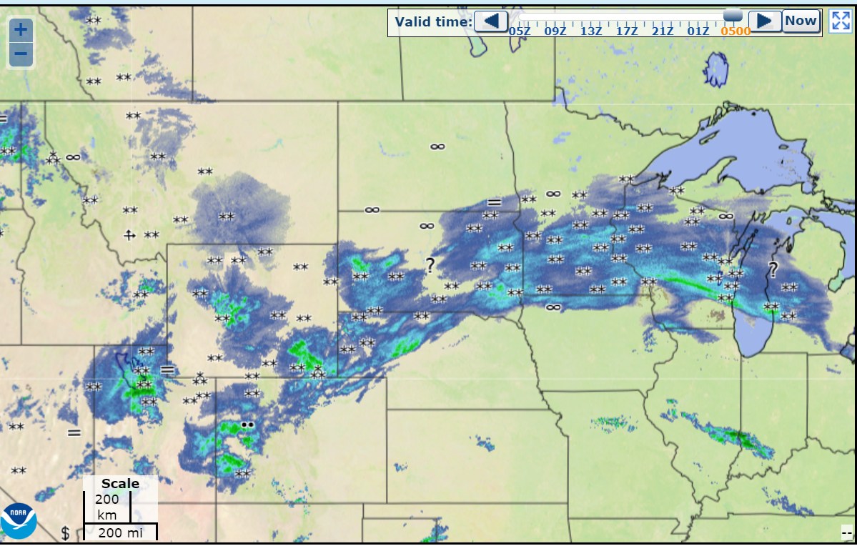
so smooth with the radar
-
DuPage has 34 degrees and report of freezing rain at the airport. Any person from this board there that can confirm ice is forming onto trees or sidewalks? Just wondering.
-
I know you guys don't normally talk about Omaha, but there is 5"-9" spotter reports there right now.
-
not quite in Denver
-

February 15-16 potential severe weather events
Chinook replied to DanLarsen34's topic in Central/Western States
These cells on the HRRR are in the 10% tornado risk zone, near Memphis, late at night. The soundings on the HRRR show STP (effective) of 2.7-3.4 right next to those near Memphis..thumb.png.9ea5e64e8e9368e1b8870e77f974f8e0.png)
-
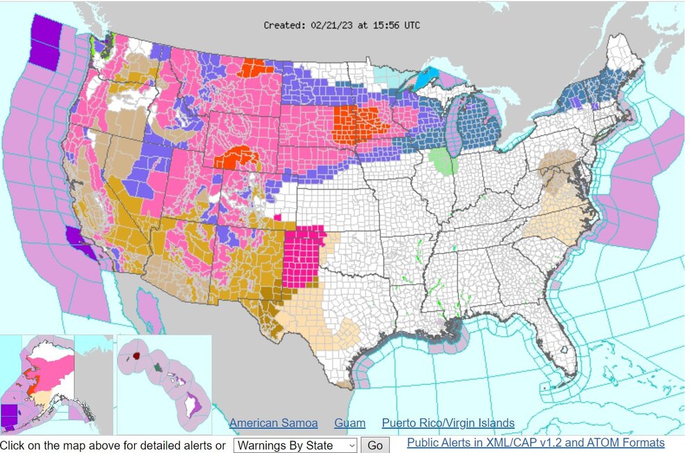
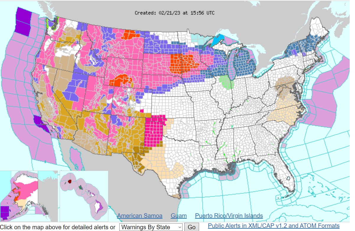
What will the NWS web page, and really, the entire weather enterprise, look like without ADVISORIES, which I believe will not exist as of 2024? It would be so strange not to see any winter weather advisory on the map.
-
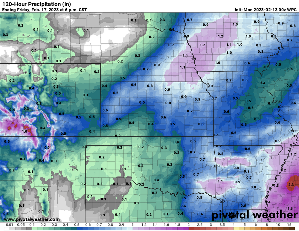
WPC values really only support the 6"-11" for Pueblo to the Raton Mesa, 5" -7" for the Palmer Divide, possibly 5"-9" for Colorado Springs
-
I'm glad I didn't have to fly before and after Christmas. The cold wave blizzard plus 17000 flights cancelled by Southwest Airlines! There's probably a low chance I would have been on Southwest, but I have had flights with them before. From what I have heard, the problems with Southwest started in Denver, where the significant temperature drop caused them to start cancelling or delaying flights, I believe. Then their scheduling problems became so much larger. Also, I would have probably scheduled a Denver to Detroit flight close to that cold wave day(s).
-
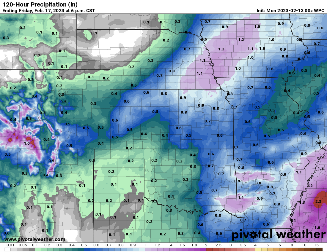
Models generally have Larimer/Weld counties with pretty low amounts of snow. I believe it is due to mainly downsloping from the north at the surface. Also I think a lot of the lift will be towards southern Colorado.
-
The models predict a significant snow storm next Wednesday. As usual the GFS is loving the 11.8 to 18.1" near Denver, as it always loves forecasting high amounts of snow for the roughly 5-day forecast. Lots could change before the NWS issues a winter storm watch, but I do expect a winter storm watch at some time.
-
February 8-9 Should There Be a Thread For This Storm
Chinook replied to Hoosier's topic in Lakes/Ohio Valley
This 500mb chart makes me think of tornadoes in March. As for now, SPC has 10% enhanced outlook for tornadoes today (-not- enhanced for wind/hail)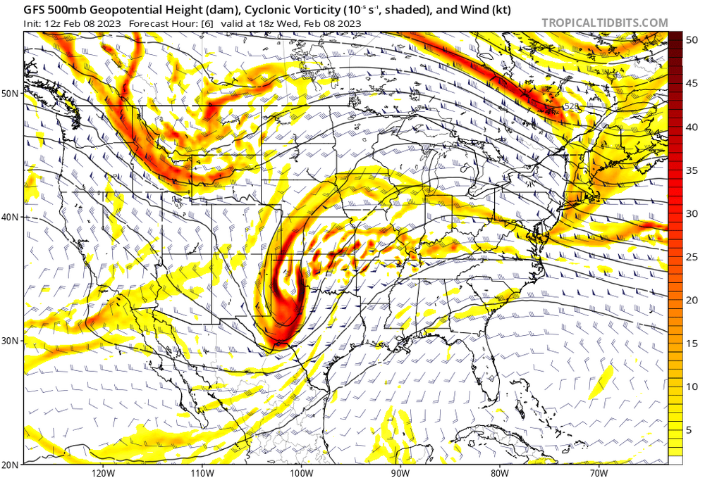
-
Under "Anatomy and Physiology of Frosty the Snowman"
-
It's so snowy, you can't even see the prediction


.png.e66e241bf4c8abbe9840815a943e9554.png)