Chinook
-
Posts
10,933 -
Joined
-
Last visited
Content Type
Profiles
Blogs
Forums
American Weather
Media Demo
Store
Gallery
Everything posted by Chinook
-
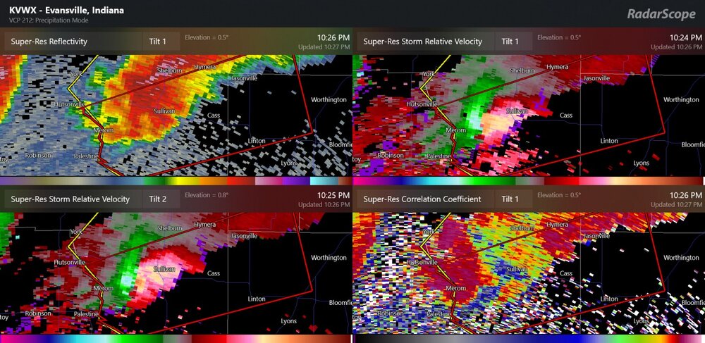
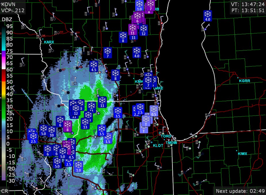
It looks like this is it... the debris may be recent or perhaps wafting north into the storm
-
Debris is directly over I-65, probably large tornado
-
I wonder if we will have a significant tornado get going in western Illinois as per the 03z HRRR updraft helicity (hour 17-18)
-
12z HRRR significant tornado parameter. The 12z 3km NAM has this entire field of instability farther west into Missouri and Iowa.
-
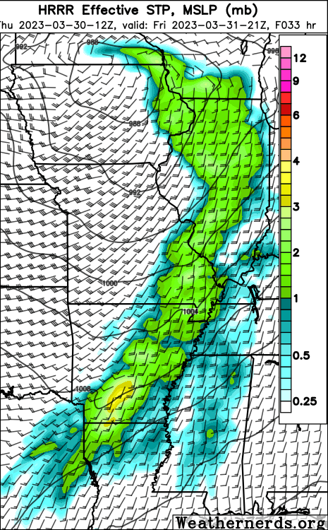
With the GFS right now, it seems like this would be a northern threat somewhat removed from a southern threat. The 00Z ECMWF doesn't really have the same exact setup. The low pressure placement at 00z (Apr. 1, or, 8:00PM eastern on the evening of Mar. 31) is kind of different from the GFS. Along with this, the surface winds to perhaps 850mb winds much more in the realm of southwesterly rather than southerly. I think there is certainly some disagreement as to the synoptic features.
-
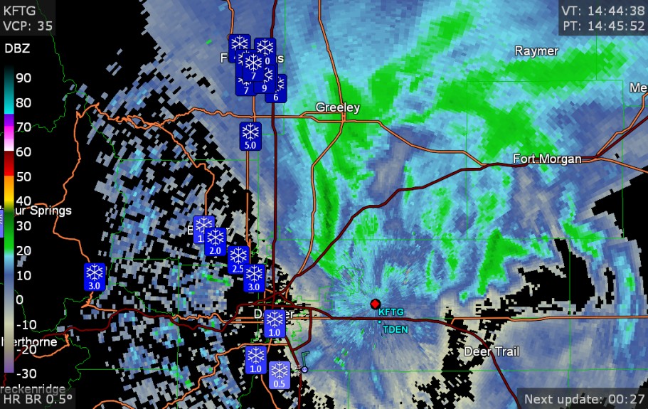
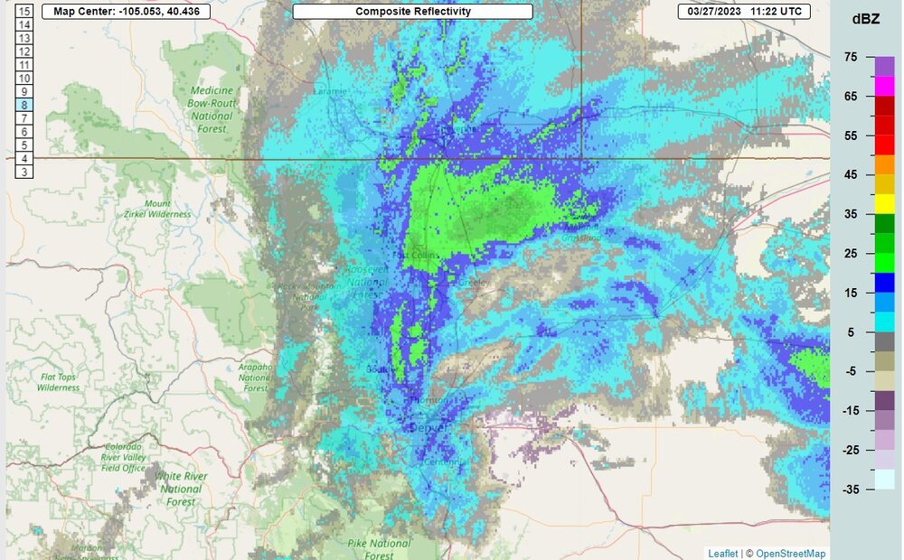
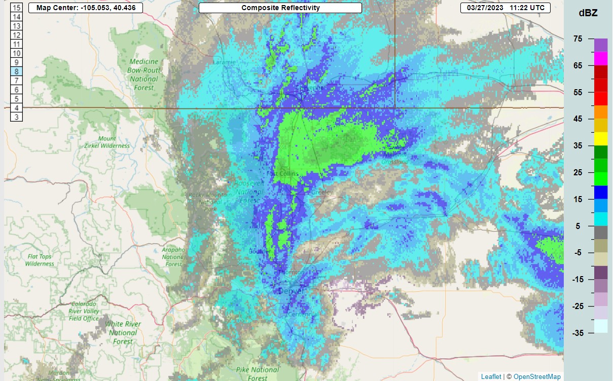
I think this was Fort Collins' largest snowstorm of the year, (11" at Windsor, not shown) and apparently this was a surprise snow band
-
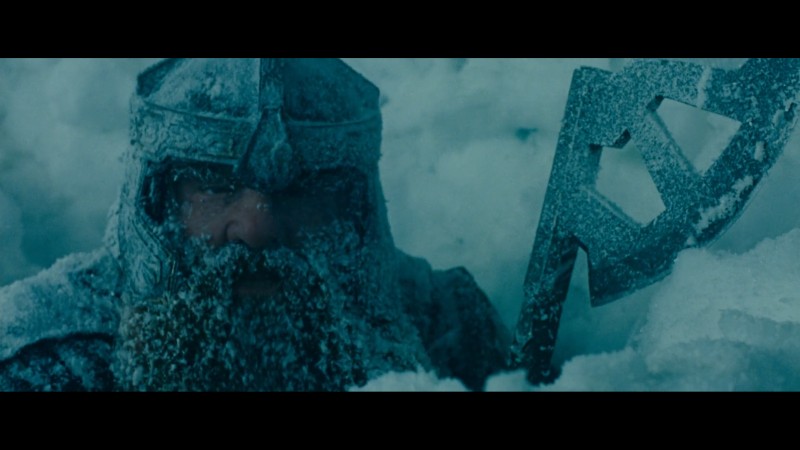
This is a picture of me on March 14, 2021. Sometimes I trim my beard back a little bit.
-
Mayjawintastawm probably liking this for Boston
-

Severe Weather 3-23-23 through 3-26-23
Chinook replied to cheese007's topic in Central/Western States
It looks like the 0-1km SRH will be increasing a lot from +2hr to +6hr on the SPC mesoanalysis (23z to 03z). I must say that the current STP is very high at a value of 4, and that same value will shift eastward. -
Severe Weather 3-23-23 through 3-26-23
Chinook replied to cheese007's topic in Central/Western States
I didn't really expect this to go to MODERATE at mid-day, but certainly the deep-layer shear is there 6-hr mesoanalysis (RAP) forecast of STP with the radar from (I believe) the HRRR 6hr forecast
-
17" at Neenah (near Appleton)
-
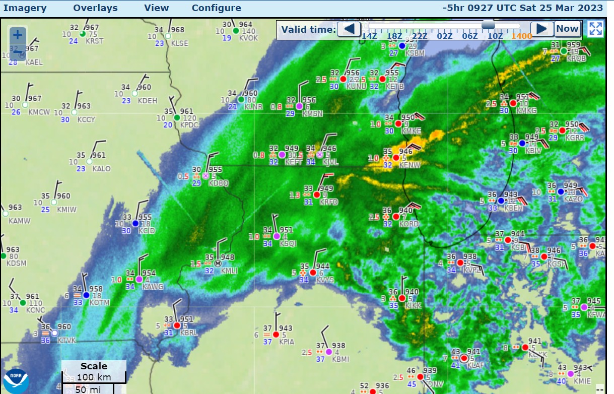
observations from 0927z, 4:27 AM Central

-
some snow reports of 7-13" in NW Illinois
-
Severe Weather 3-23-23 through 3-26-23
Chinook replied to cheese007's topic in Central/Western States
basically that would convert to 131.1mph one way and 131.1mph the other way. But hey. that's like Cat-4 tornado (113kt-137kt) -
Severe Weather 3-23-23 through 3-26-23
Chinook replied to cheese007's topic in Central/Western States
Yes, I got the same thing, it's 262.8mph, and effectively I haven't ever been able to see the data is this high of quality for this type of delta-v in my life. -
Severe Weather 3-23-23 through 3-26-23
Chinook replied to cheese007's topic in Central/Western States
tornado may have tracked for 31-32 miles already -
Severe Weather 3-23-23 through 3-26-23
Chinook replied to cheese007's topic in Central/Western States
Here's some hype for you. I think there's a high chance of EF1+ tornadoes and significant wind reports after sunset tomorrow. The nighttime severe is always more concerning, as people aren't ready for it..thumb.png.2ee33f2744d2c39f97e394936e749a8f.png)
-
Severe Weather 3-23-23 through 3-26-23
Chinook replied to cheese007's topic in Central/Western States
interesting that CIPS analog #3 lines up almost perfectly with the calendar date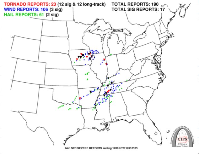
-
Severe Weather 3-23-23 through 3-26-23
Chinook replied to cheese007's topic in Central/Western States
You could check annual graphics from the SPC going back several years to see the tornadoes in California. example: https://www.spc.noaa.gov/climo/online/monthly/2022_annual_summary.html -
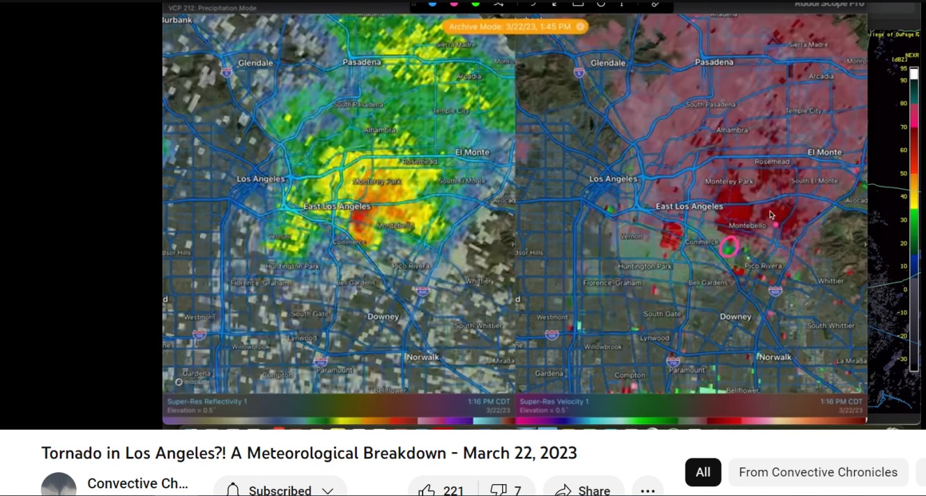
Severe Weather 3-23-23 through 3-26-23
Chinook replied to cheese007's topic in Central/Western States
This radar image from Montebello/Los Angeles tornado from a youtube video from channel "Convective Chronicles" (I recently found this excellent channel)
-
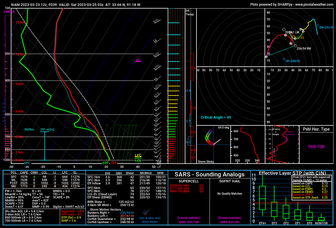
Severe Weather 3-23-23 through 3-26-23
Chinook replied to cheese007's topic in Central/Western States
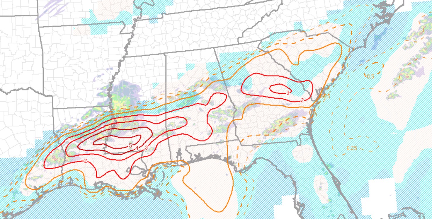
Here is the NAM forecast sounding for eastern Arkansas for 03z (tomorrow night), with effective STP of 4.3. Some odd things going on in the hodograph at 3km above ground, but I'm not sure too much to talk about, given the fact that the rest of the hodograph is excellent for tornadoes. The 3km NAM (not shown here) has up to 490 m2/s2 of 3km SRH at the Arkansas/Louisiana border. HRRR for 03z tomorrow night
.thumb.png.f60fea6880e62583c5994e8934b1293d.png)
-
new loop http://www.greatlakes.salsite.com/Jan_5_2014_SfcRadar_loop.html
-
Texas/Oklahoma Discussion & Obs Thread 2022
Chinook replied to It's Always Sunny's topic in Central/Western States
I think this a new product by College of Dupage, Ensemble CAPE for the event that's now 96hr+ in the future, so it's not on the 3-day outlook.png.ef49ea494dcaa80e4e30cc75bcc5d17d.png)
-
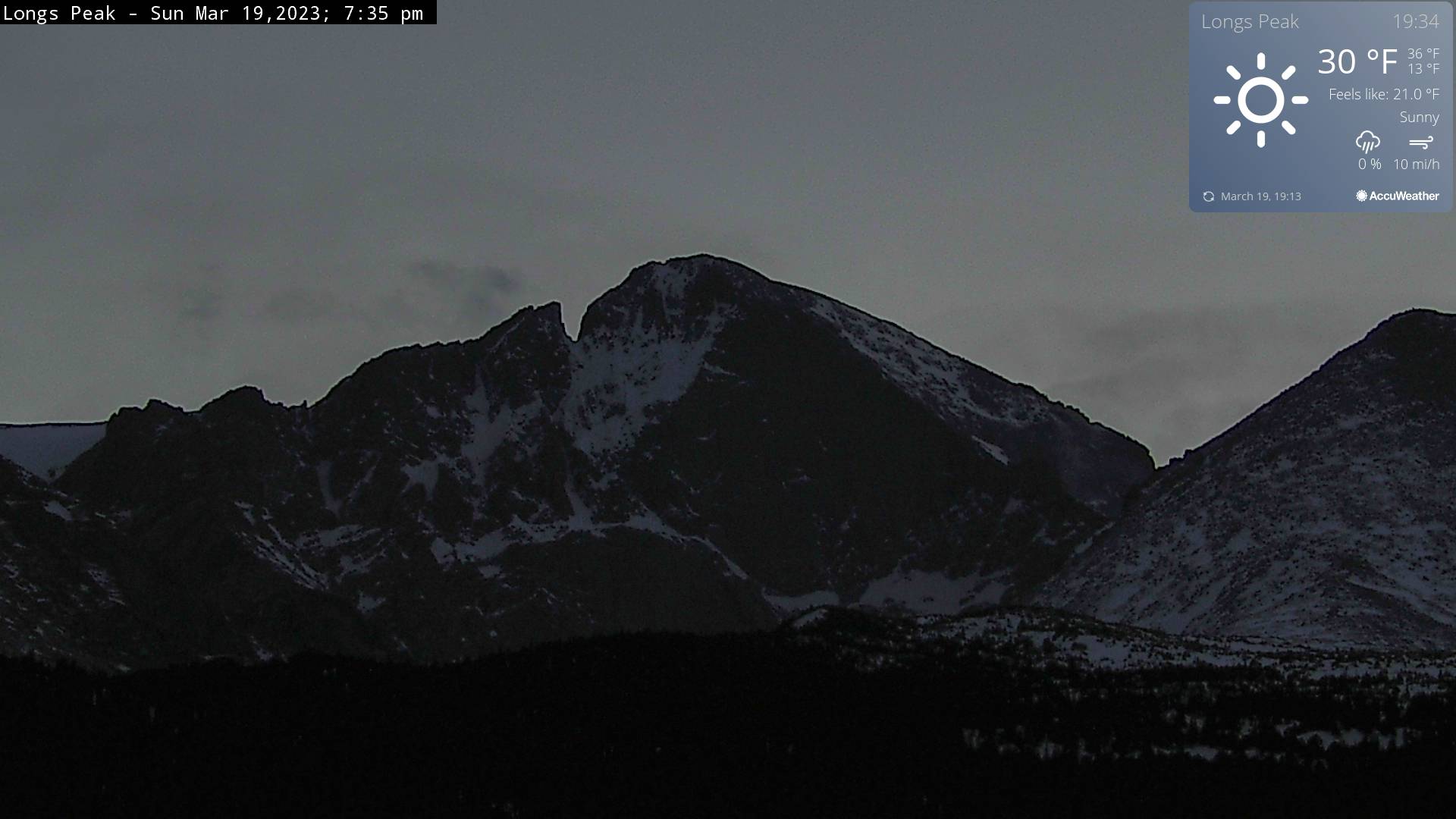
near sunset

-
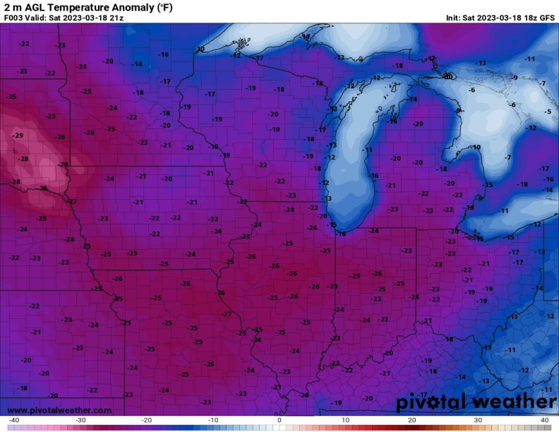
Yesterday (Saturday) Toledo was 22 degrees with a wind chill of 8 degrees before midnight. It's kind of rough considering there had been a lot of warmer temperatures in February and so many days without snow. Toledo had a high of 33 and a low 22 which was -16 for the high and -8 for the low.


.png.59a736679b9c0a81dcfd8584e0a62b31.png)
.png.aebce121bd63233d4168aae8eddf8bf2.png)