

Chinook
-
Posts
10,933 -
Joined
-
Last visited
Content Type
Profiles
Blogs
Forums
American Weather
Media Demo
Store
Gallery
Everything posted by Chinook
-
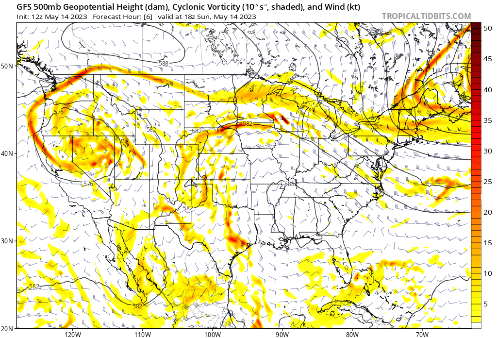
Today: down to a temperature of 63 with a dew point of 39 here. I sometimes forget that the more dry air, like I was used to feeling out in Fort Collins, does exist as we get closer and closer to summer. The 500mb pattern is a complete mess

-
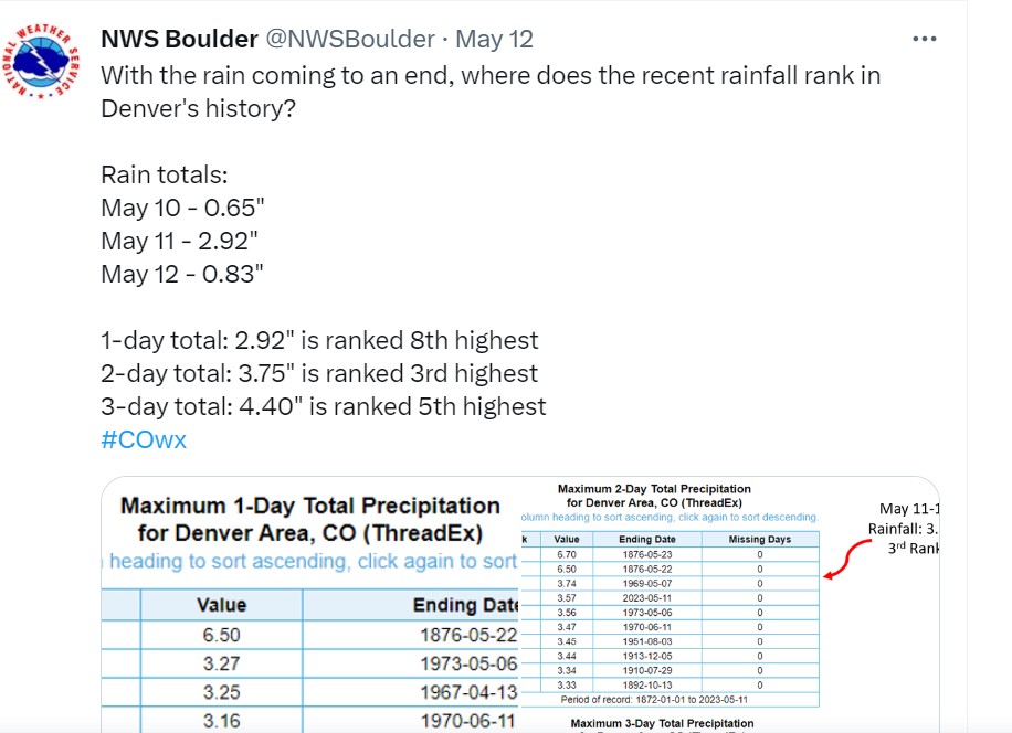
Some info from the NWS at Boulder
-
 CoCoRAHS spotters measured as low as 1.05 to and as high as 3.65" within a couple of miles in the San Antonio vicinity
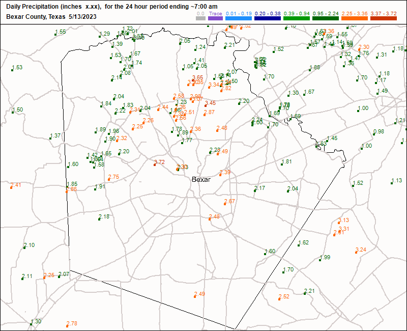
-
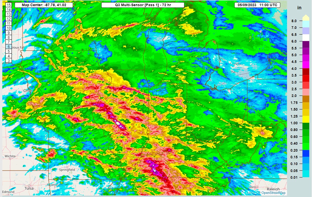
I guess this continues the sort-of trend of wet Mays, going back several years. I probably just remember this trend because most of the months in my recent personal memories of Colorado haven't been rainy at all.
-
This is massive debris

-
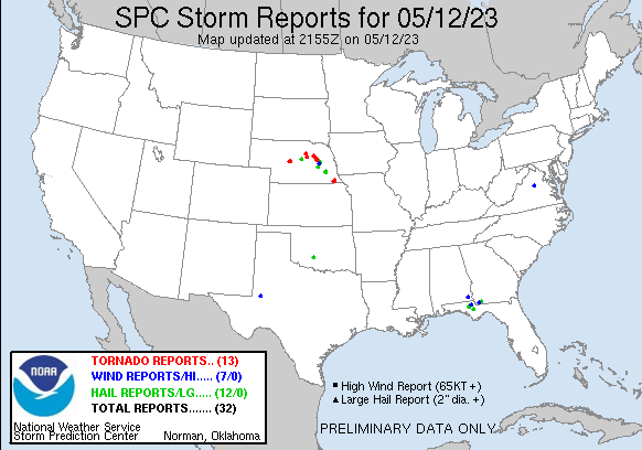
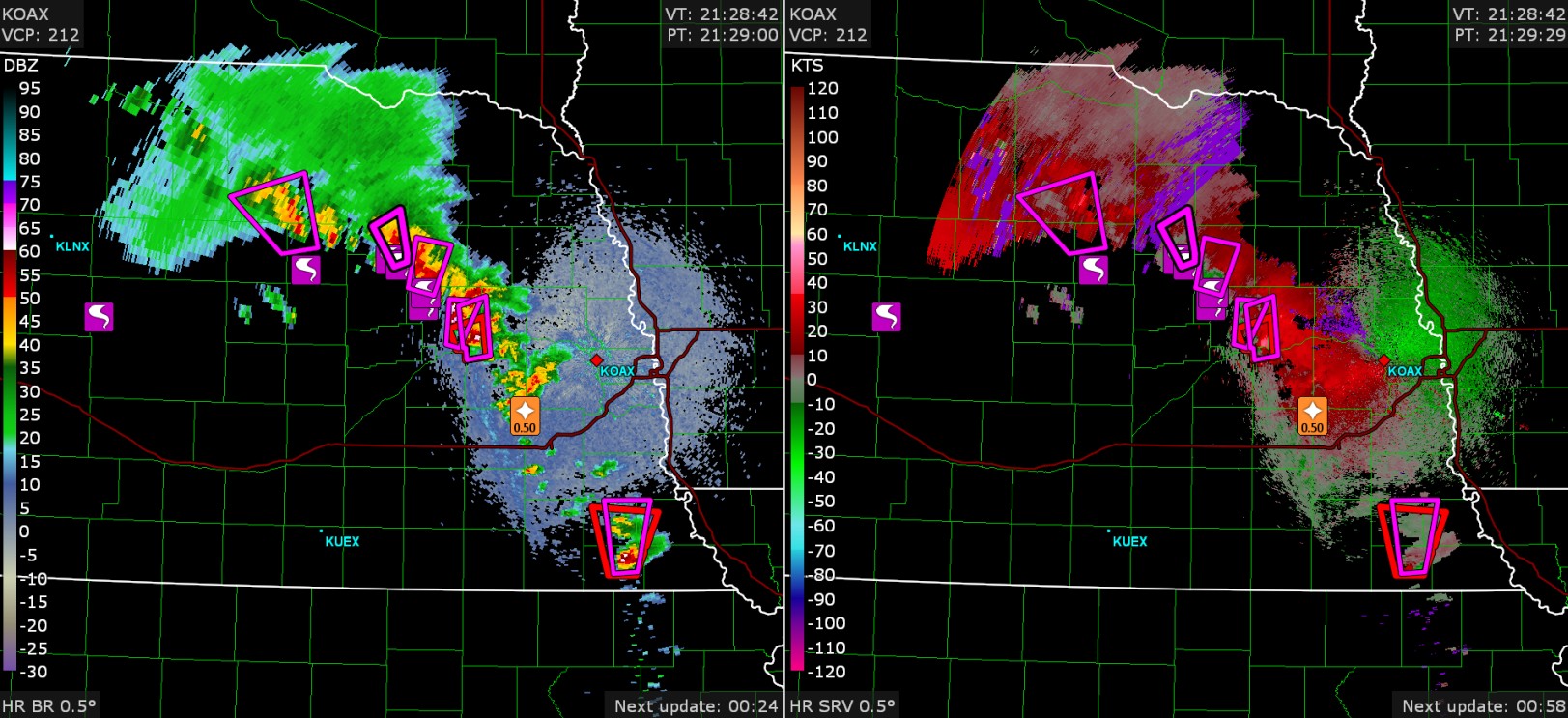
Tornadoes in Nebraska

-
The only time Fort Collins got close to 5" was the flood of 2013. Fort Collins had 5" in a week, Horsetooth Mountain had about 9".
-
That's crazy
-
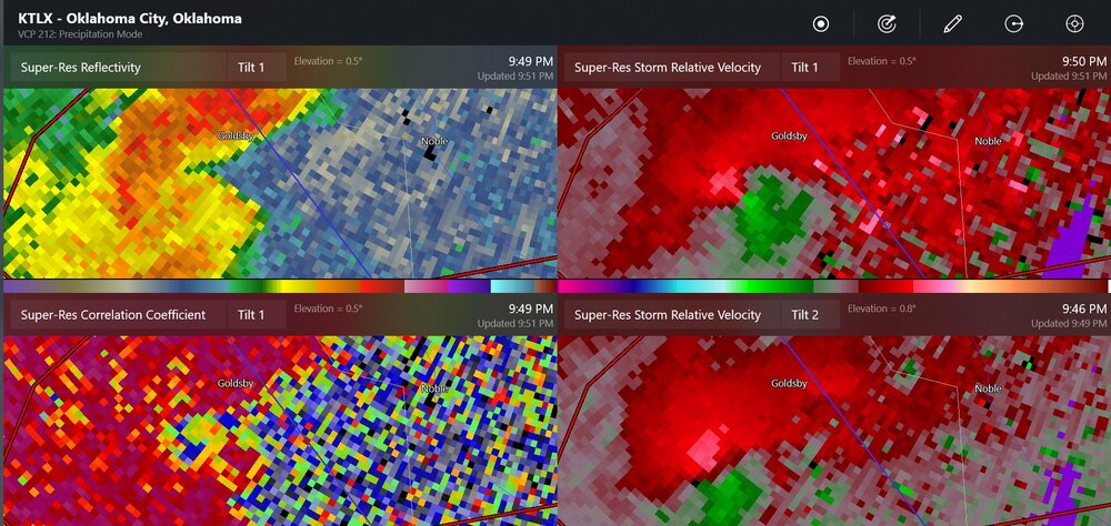
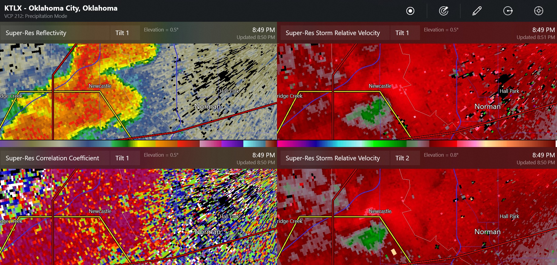
Cole-Goldsby Oklahoma tornado debris signature
-
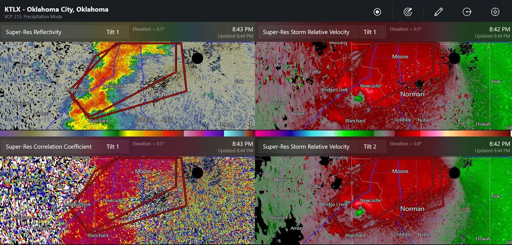
this was the Newcastle area tornado

-
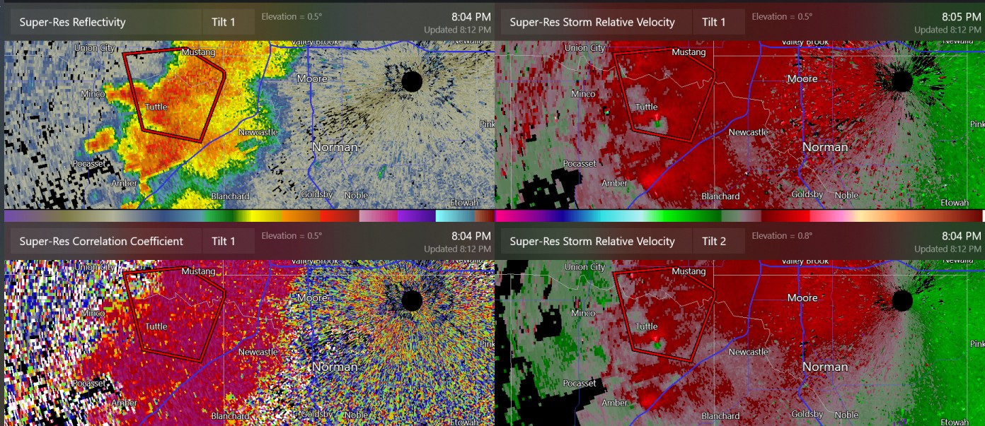
I believe this was a confirmed brief tornado in the rain at Tuttle/Bridge Creek. It did not necessarily look like it was at a hook echo/RFD at all. Maybe you could use your imagination to see a hook echo in there.

-
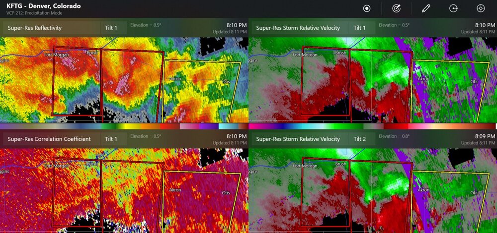
confirmed tornado 14 miles SW of Akron
-
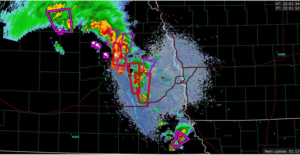
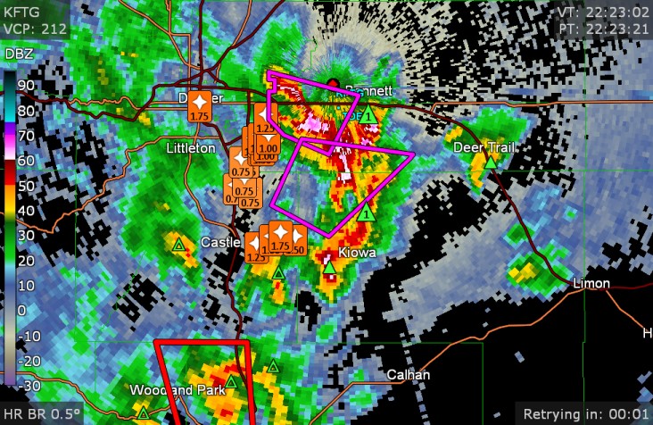
Denver storm reports as of 22:23z
-
new tornado warning/severe warning for a storm(s) heading down the mountains toward Denver
-
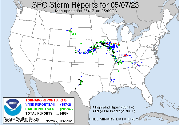
Illinois had all the fun. You know, the Midwest should really share. All I've ever seen since March is non-thunder. Non-thunder. Cold rain and non-thunder. I heard some thunder at 4:00 AM on 5/7. That's it. I was asleep.
-
2023 Short/Medium Range Severe Weather Discussion
Chinook replied to Chicago Storm's topic in Lakes/Ohio Valley
The convection-allowing models have several solutions of supercells and/or clusters of cells forming in Iowa, eastern Nebraska, and western Illinois tomorrow. The conditions near the warm front will promote higher wind shear, lift, and chance of tornadoes. Severe thunderstorms may get going in southern Illinois also. It looks like a higher wind area at 700mb will be a main factor in increased storm relative helicity.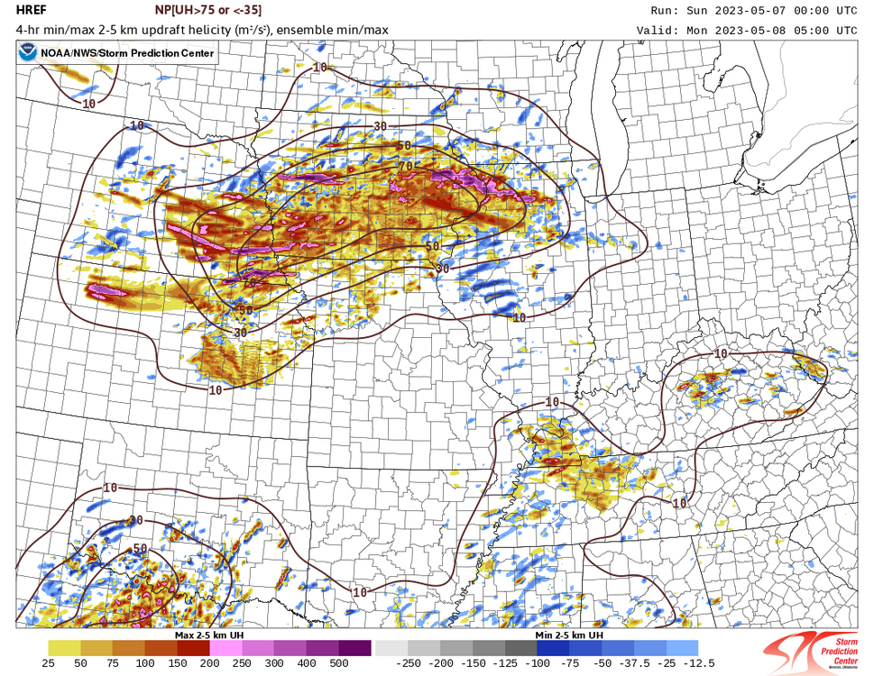
-
2023 Short/Medium Range Severe Weather Discussion
Chinook replied to Chicago Storm's topic in Lakes/Ohio Valley
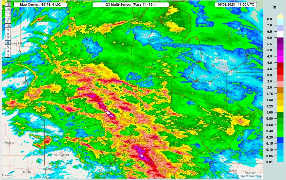
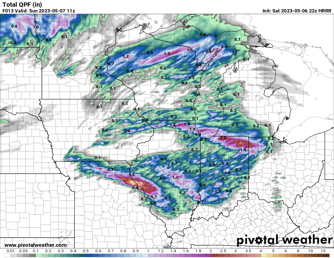
Here is the HRRR rainfall up to 11z. An MCS will hit a lot of places with heavier rain well after 11:00PM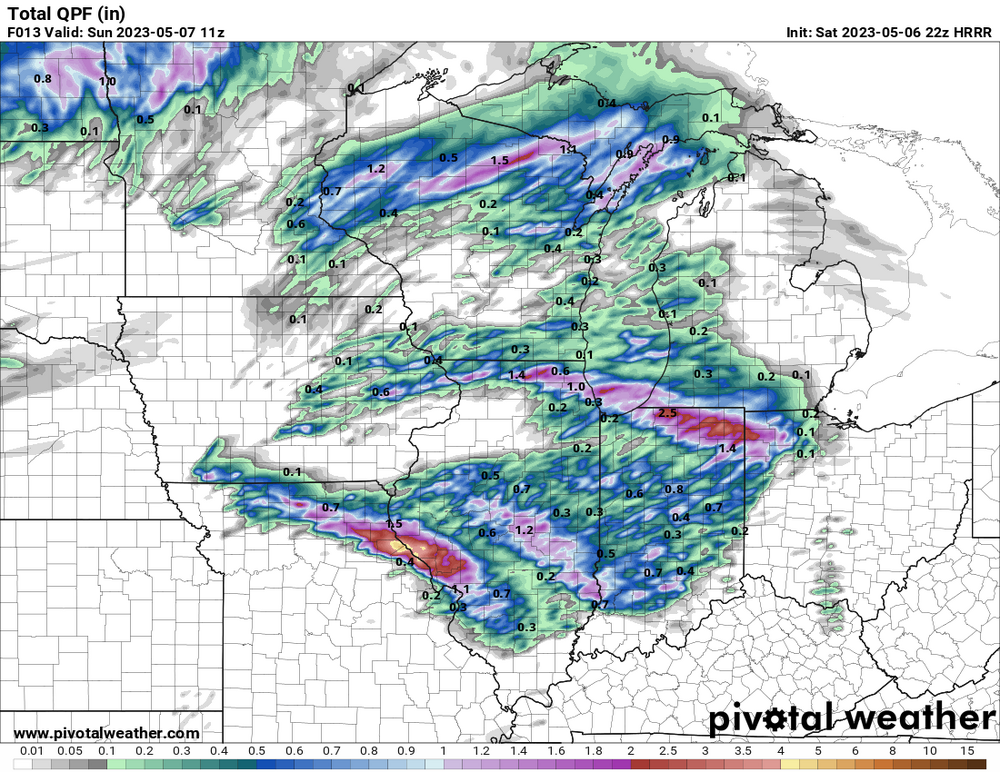
-
Here is a cluster of storms developing now in the enhanced risk section in Texas (30% hail and wind). They look like they are all developing into supercells. The 0-6km shear of 30 kt means the really should be struggling to develop into supercells, but the 300mb wind is a pretty reasonable 50 kt. It already looks like we could be seeing dozens of hail reports in the next few hours.

-
2023 Short/Medium Range Severe Weather Discussion
Chinook replied to Chicago Storm's topic in Lakes/Ohio Valley
There is a tornado watch for northern Missouri/ southern Iowa. This is a pretty big surprise based off yesterday's 1730z outlook which only had a small area of slight risk in Missouri. Tomorrow: (5/7) the latest update says enhanced risk for Iowa. -
where's the warmth? Northwest Territories

-
The Blizzard of '93 started off with a squall line in the Gulf tied in to a strong 500mb shortwave, and also combined with a northern trough. But this isn't that. It's a bit of an analog as the GFS says the combination of systems results in a 981mb low in New York State.
.thumb.png.3042052cbf1d78fd3820883143c415ec.png)
-
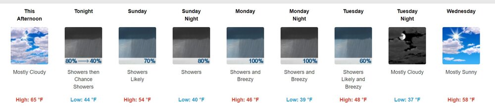
It was wet all day yesterday. And the forecast calls for just more rain. This brings a poem to mind: From January up to May The rain, it raineth every day From May again until July There's not a dry cloud in the sky as far as I know, this web site contains the whole correct poem, which is called "Dirty Days Hath September." But I'm not sure. https://www.workhouses.org.uk/lit/dirtydays.shtml
-
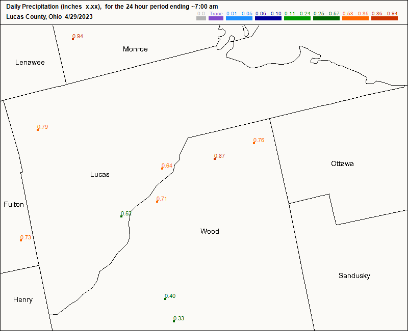
what a strange arrangement of precipitation
.thumb.png.1b314ec37a59d49907421c4bffeb1a43.png)
-
It looks like the northern supercell has tried to redevelop rotation near Hearne. This might not really lead to anything, as this system seems to be dominated by the linear features. The larger cell by San Antonio could track into town with large hail.
-
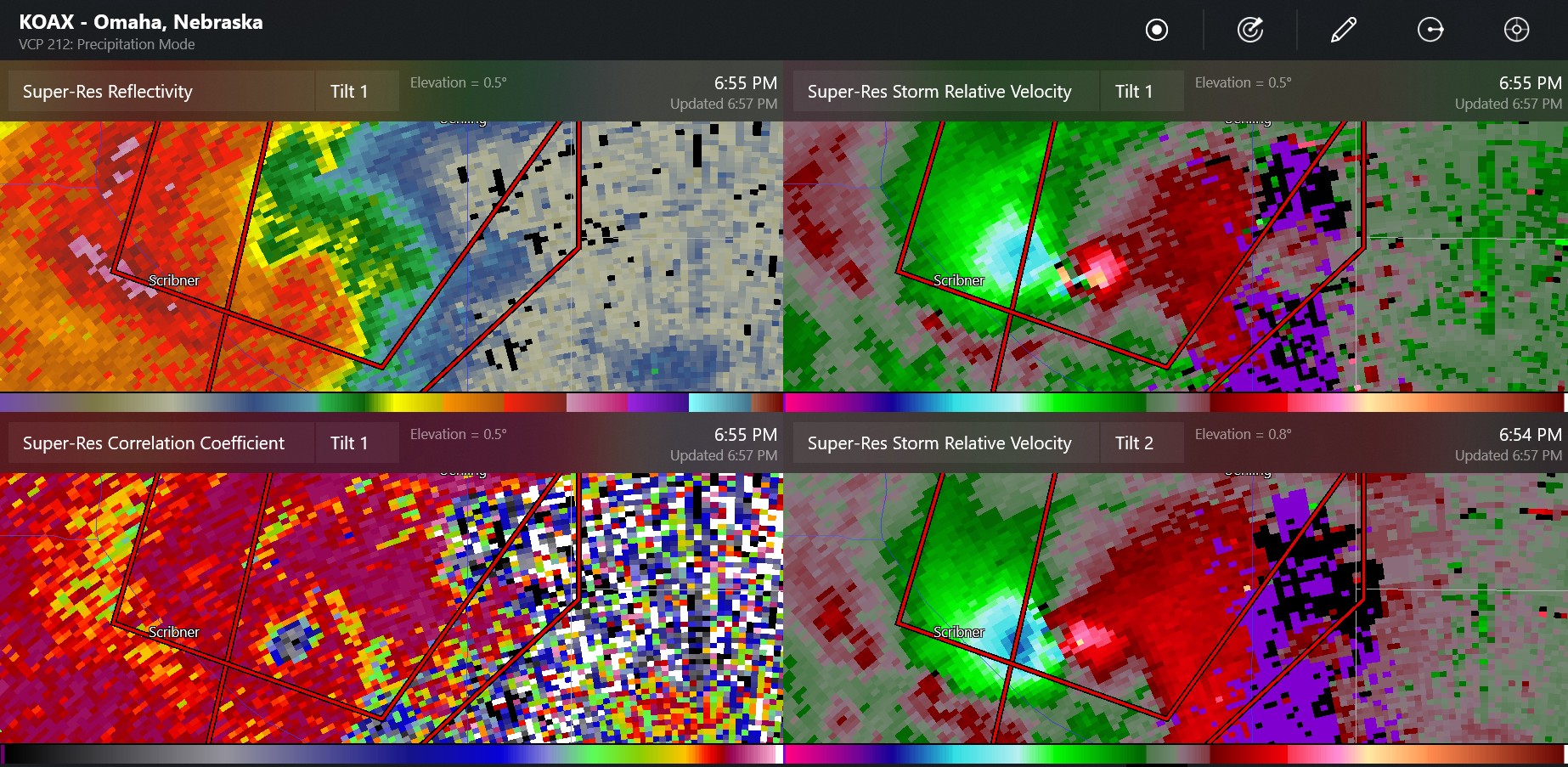
Looks like the RFD may be taking over. The velocity was pretty classic for the last few minutes.


.png.aaf25939f2ee0ed85a77d89d6a4da900.png)

.png.31235bd944b3c3346a6cfcf3954bcfe1.png)