Chinook
-
Posts
10,933 -
Joined
-
Last visited
Content Type
Profiles
Blogs
Forums
American Weather
Media Demo
Store
Gallery
Everything posted by Chinook
-
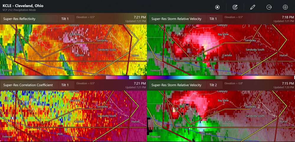
as of yet, no tornado damage that I know of near Sandusky or Norwalk
-
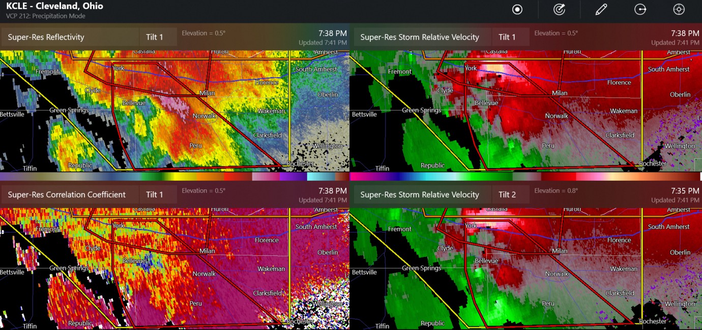
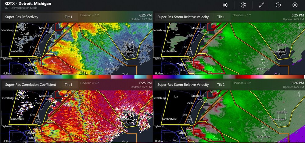
possible large tornado near Norwalk, Ohio
-
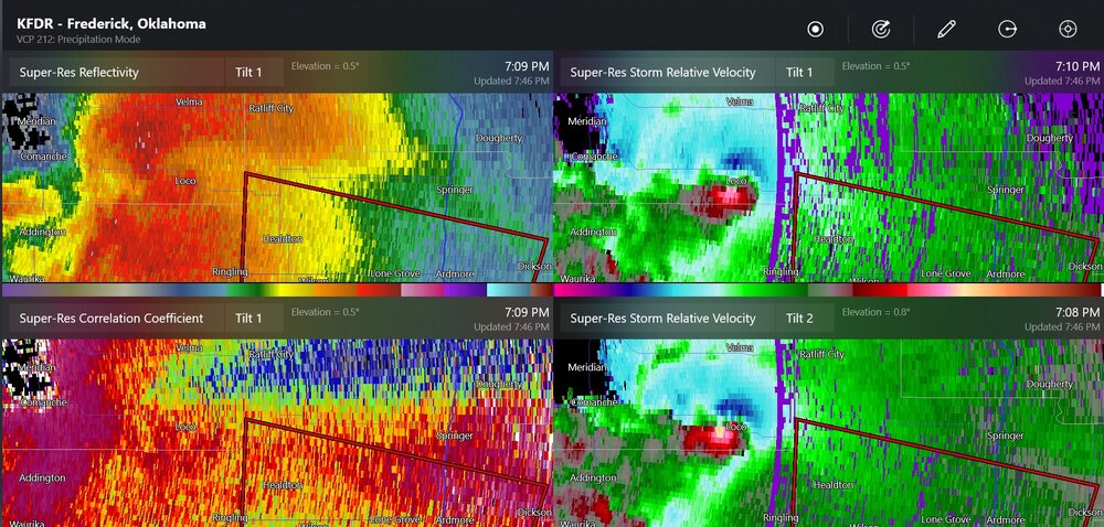
this was the radar for the Loco tornado
-
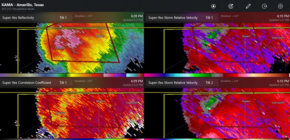
perryton radar at 6:10 (5:10 central)
-
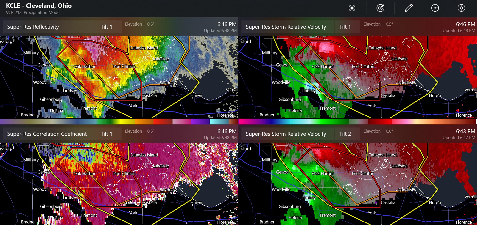
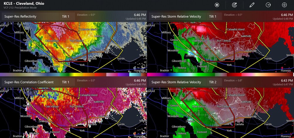
multiple rotations south of Sandusky

-
I can see large towering clouds to the east of me, but no anvil. I'm for sure just looking at general cumulo(nimbus) to the west of the huge storm. the forest fire smoke is back and the sun looks orange, the western sky looks white, and the air smells like a campfire.
-
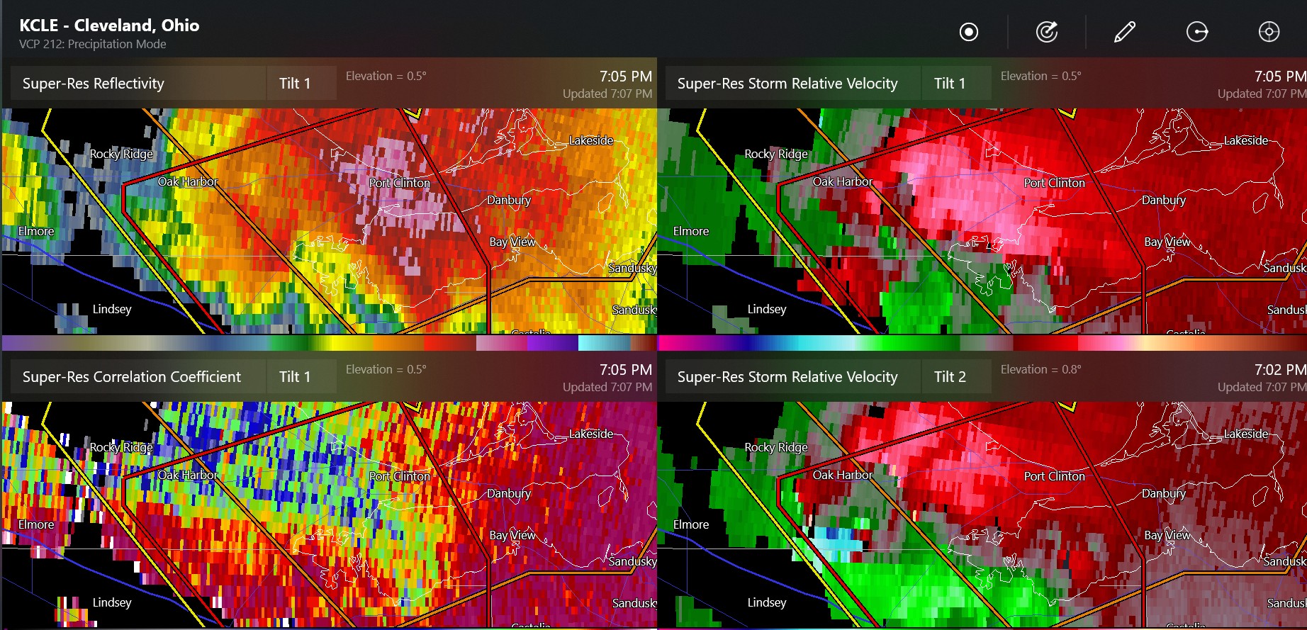
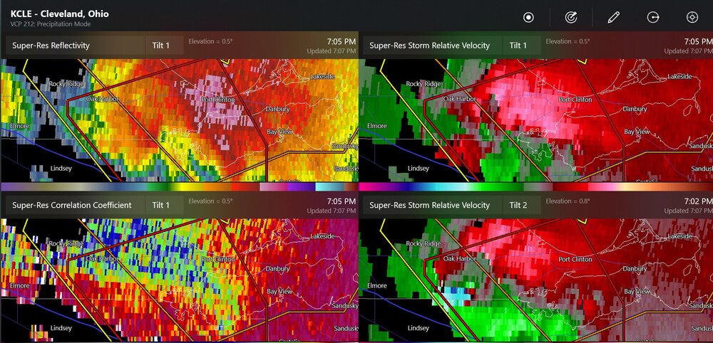
this may be large and near Castalia and Sandusky
-
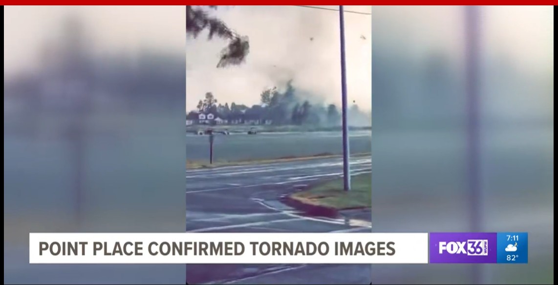
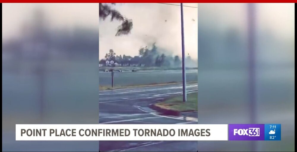
northeast Toledo is called Point Place
-
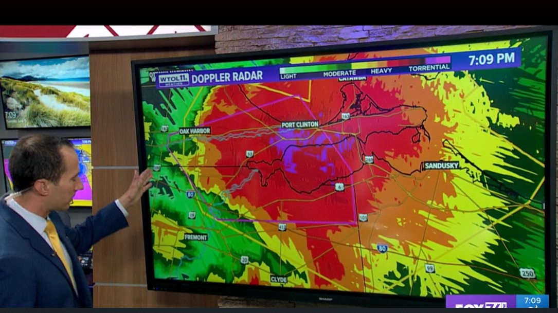
my local TV

-
confirmed tornado at the Sandusky Bay
-
new tornado warning for some, perhaps confusing velocity signatures near me, near Oak Harbor
-
double tornado warnings
-
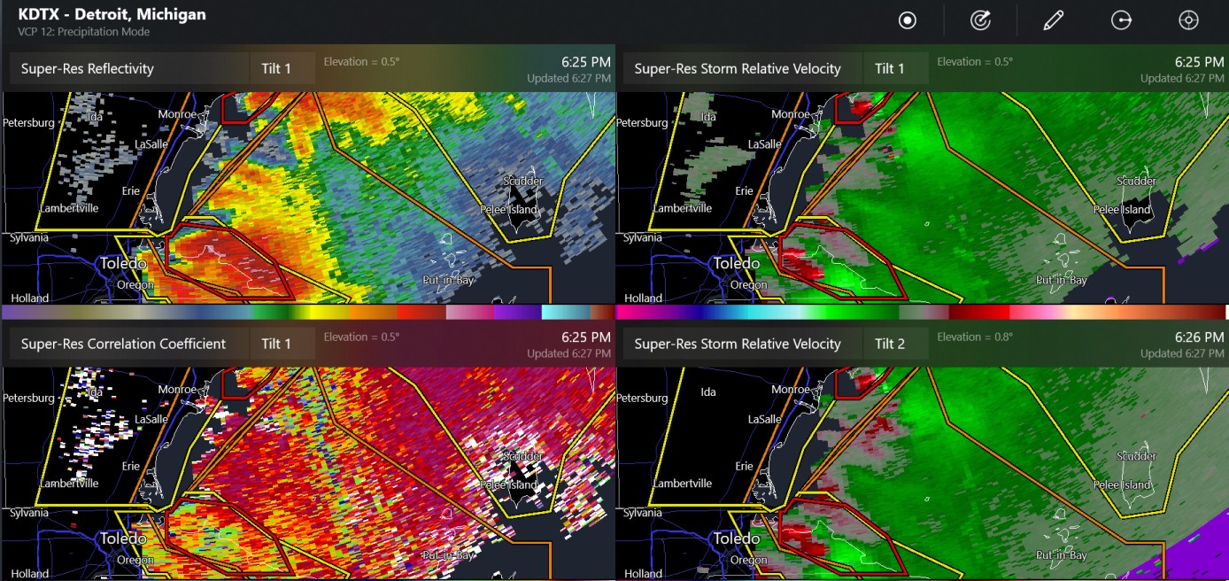
tornado warning north of Monroe and south of Michsnowfreak (if he lives at the same place)
-
looks like it is a tornado
-
Perryton TX, funnel cloud on live youtube feed
-
oh man, GRLevel3 has a 1" hail indicator and 61 dbz just north of Toledo , but nothing here. We could use the rain!
-
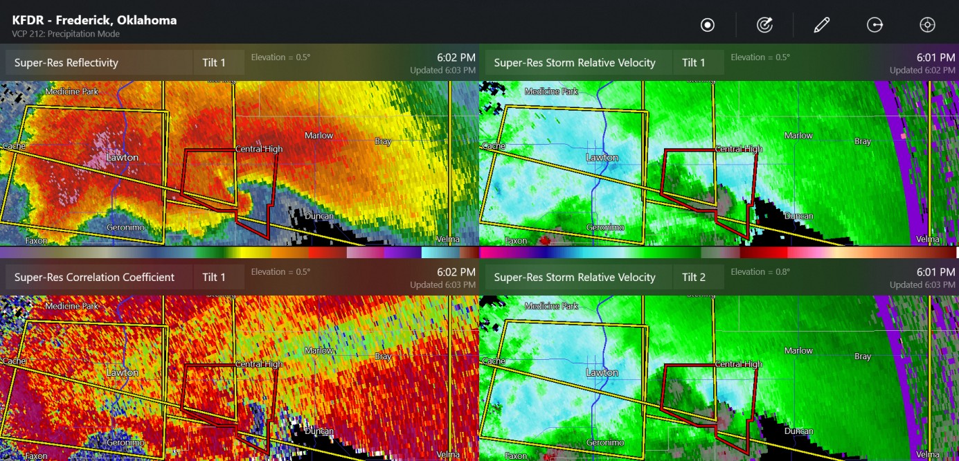
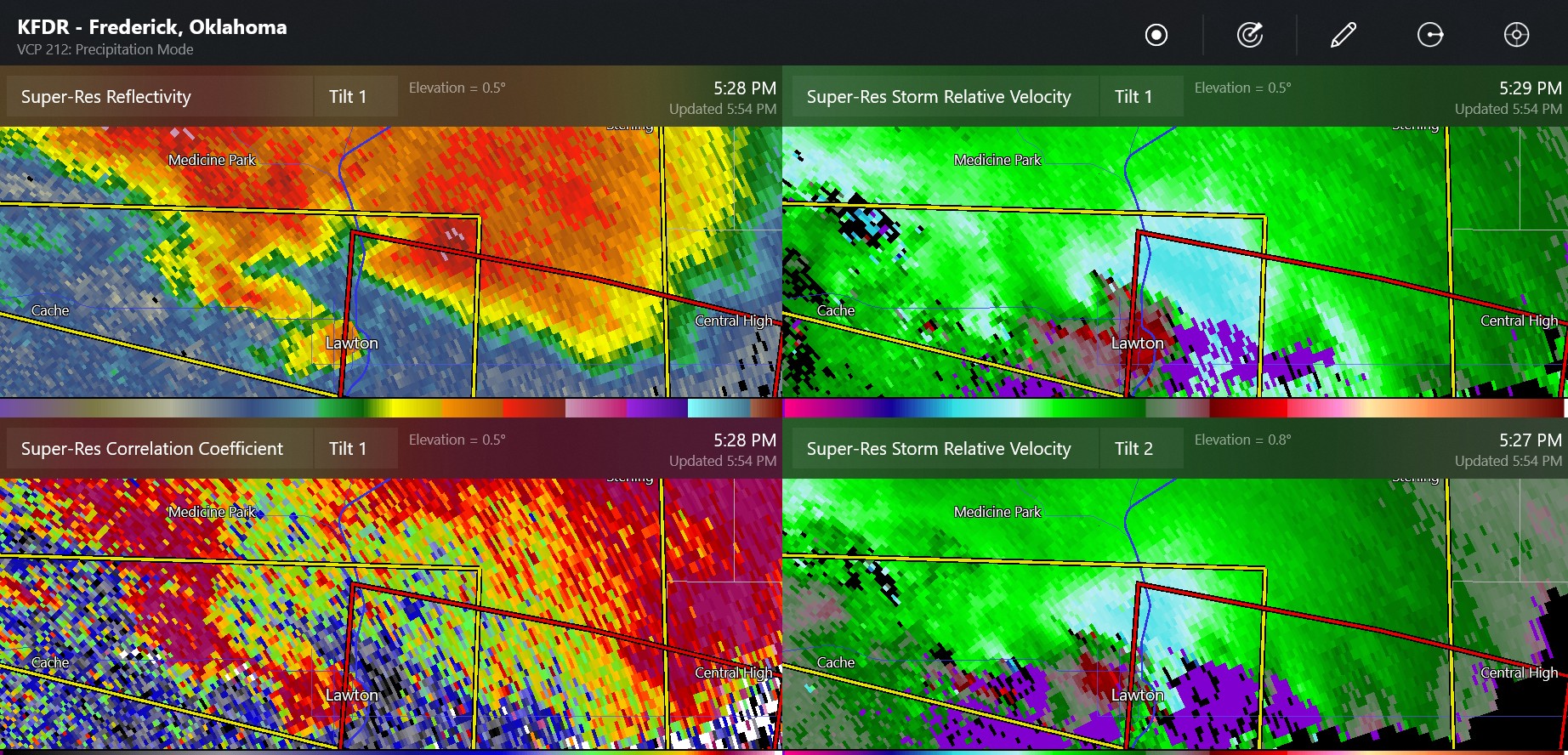
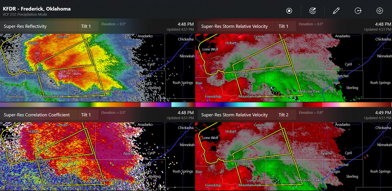
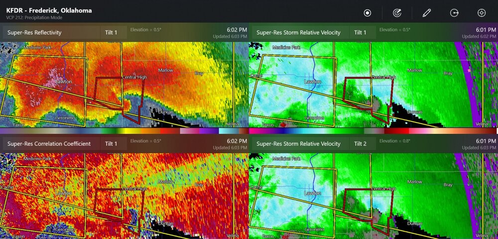
Lawton tornado several minutes ago. Also, new possible tornado about 20 miles east of Lawton

-
Ryan Hall stream says chasers/spotters saw a tornado in Lawton with some buildings damaged
-
DTW/ Willow Run might have some interesting observations, and rerouted planes
-
this one is going to keep going for a while with hail near I-96/I-696 in Detroit
-
and so it starts with a couple of supercells jammed together

-
Wow, big upgrade from slight risk as of 1730z yesterday
-
and last night in the eastern Texas panhandle
-
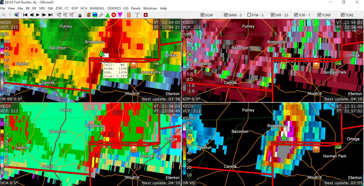
Extreme hail report at this area in Alabama: 4" (report is at Doerun, which is right in the middle of the image)

-
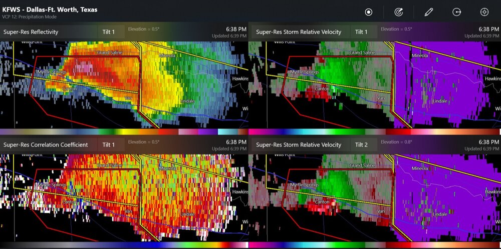
possible tornado