Chinook
-
Posts
10,934 -
Joined
-
Last visited
Content Type
Profiles
Blogs
Forums
American Weather
Media Demo
Store
Gallery
Everything posted by Chinook
-

2023 Mid-Atlantic Severe Wx Thread (General Discussion)
Chinook replied to Kmlwx's topic in Mid Atlantic
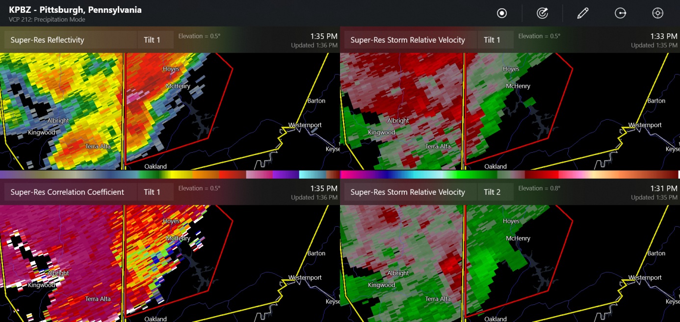
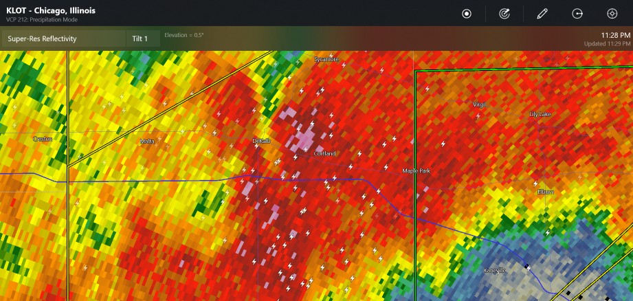
This is a really blue sector the CC. It's probably a false indicator of tornado damage. Rotation seems to be notable at the same spot. This is the Maryland/ WV border. (farthest west Maryland)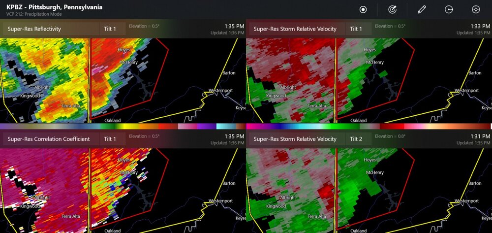
- 2,785 replies
-
- 1
-

-
- severe
- thunderstorms
- (and 3 more)
-
The convection allowing models favor the idea of several storms near St. Louis and into the southern half of Illinois tomorrow. The NAM-12km says the CAPE could be up to 2000-3000 J/kg late in the day at 00z. The 500mb winds will be pretty strong, increasing into the nighttime, with over 40 kt of 0-6km shear, so I think there could be supercells. I would think tornado chances will be low due to weaker 850mb winds. The storms could move to southern Indiana and northern Kentucky, while riding along the faster 500mb-700mb winds.
-
two tornado warnings near Lafayette IN
-
And yet another severe thunderstorm watch for SE Colorado, with probably a few supercells getting going soon. This is pretty late in the season for wind shear.
-
New outlook. wow, slight risk in Kentucky. so exciting. Maybe Illinois will get a few storms.
-
My thinking is usually global models have a better handle on upper level winds, which is a huge part of forecasting.
-
The severe weather events in the recent 1-2 weeks have had a lot of storm reports, so don't give up on it just yet.
-
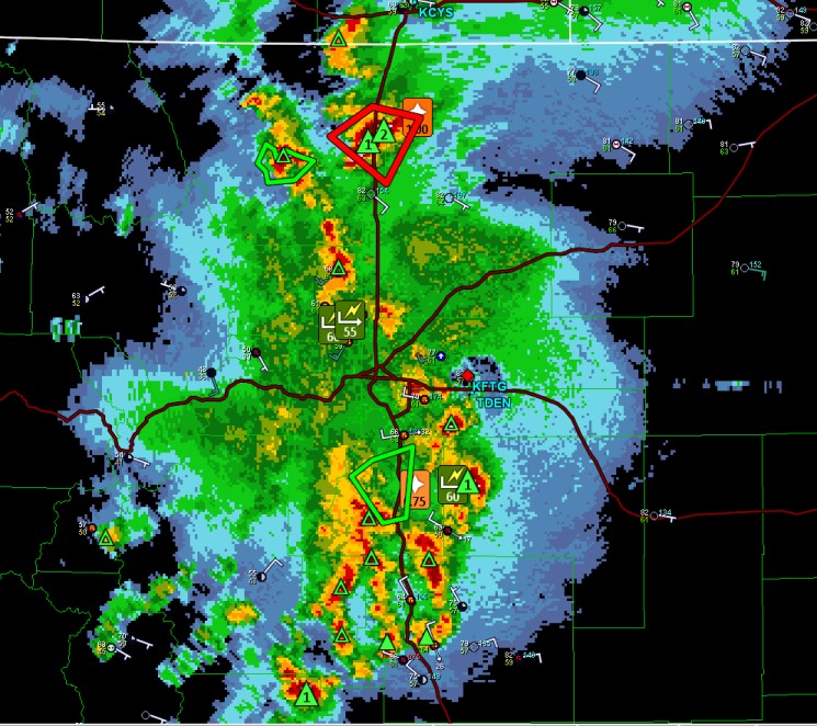
New flash flood warning for west of Loveland (Masonville.) I kind of liked going over to Bobcat Ridge park over there, but there's not a lot of trails. Severe storm watch for eastern Colorado.
-
2023 Atlantic Hurricane season
Chinook replied to Stormchaserchuck1's topic in Tropical Headquarters
The 00z, 06z and 12z GFS all have storms being the Gulf of Mexico, but it's a long way out. This is, of course, the time when you'd like to see the models have a couple of developing systems in the central Atlantic if you were expecting kind of a normal start to the season. -
My place had a red sun before sunset tonight due to the forest fire smoke. It probably won't surprise any of you. There were no shadows before sunset.
-
The storms today are starting to look like a repeat of last night.
-
Already one flash flood warning issued today (Jefferson County)
-
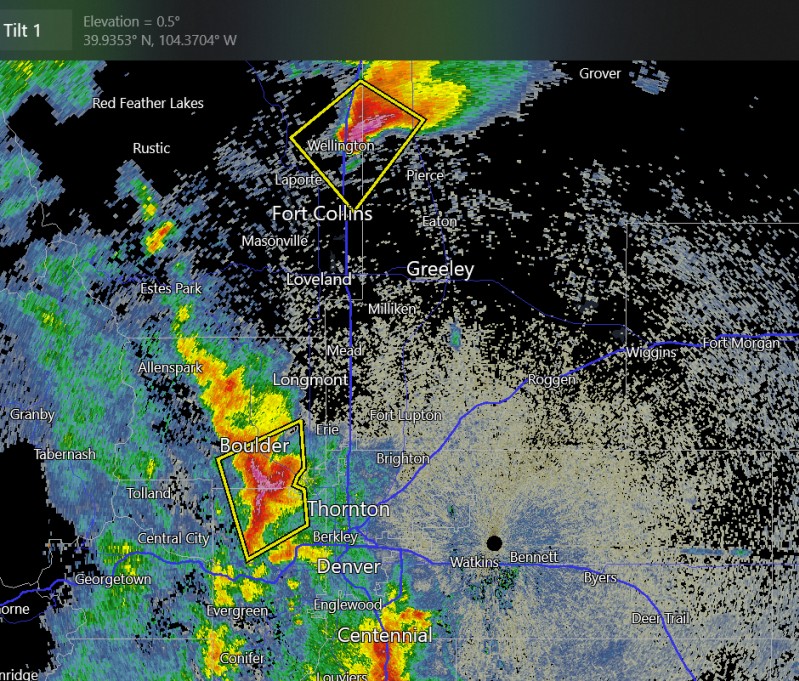
Yes, the storm that started by Wellington propagated southwestward and sat over Fort Collins. My Radarscope program said there were about 150 lightning strikes near north Fort Collins in the recent time frame. That's one of the things that can happen with the non-westerly flow that powers up the monsoon surges. There are slow upper level winds, and the tendency to pop new storms at the foothills and the cities and they can move so slow that it becomes a flash flood. I'm assuming there were street flooding problems at Fort Collins.
-
-
It's the most predictable thing about northern Colorado weather in most years: the rainy monsoon nights about the beginning of August. And the dew point there is higher than my dew point in Ohio.
-
I guess you guys are in a normal monsoon pattern with moisture coming out of the desert, storms developing over the mountains, and better than average dew points over the plains. At this moment, possible 2" hail at Boulder, Wellington
-
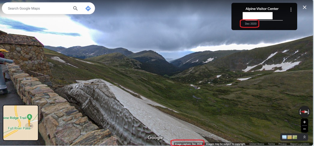
Google maps panorama of RMNP's Alpine Visitor Center, with date-tag in December . In December, you couldn't drive on Trail Ridge Road, you would be freezing to death with 5 ft snow depth!!!

-
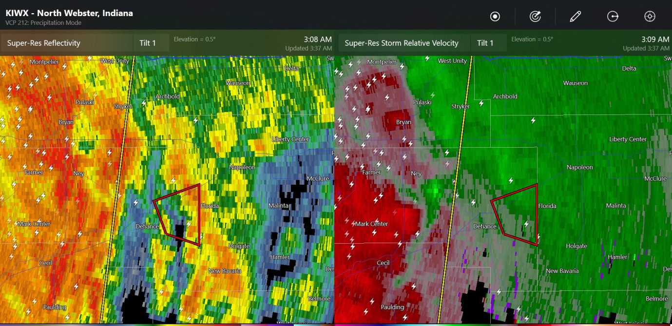
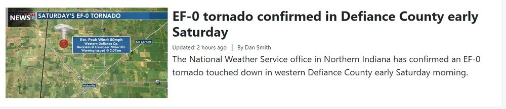
I actually saved this radar at 4:00AM, and it turned out to be a tornado

-
Right now, the SPC storm report graphic says 786 storm reports yesterday (unfiltered), with 600 being wind.
-
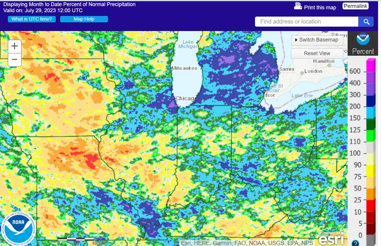
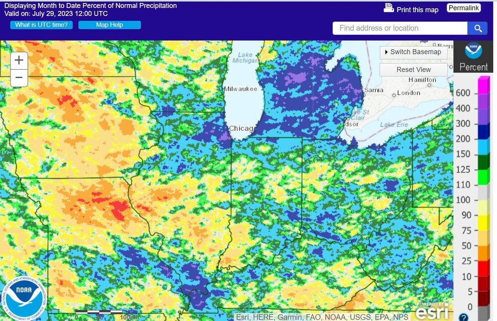
Drought to 200% rain describes Michigan, Chicago, parts of Ohio
-
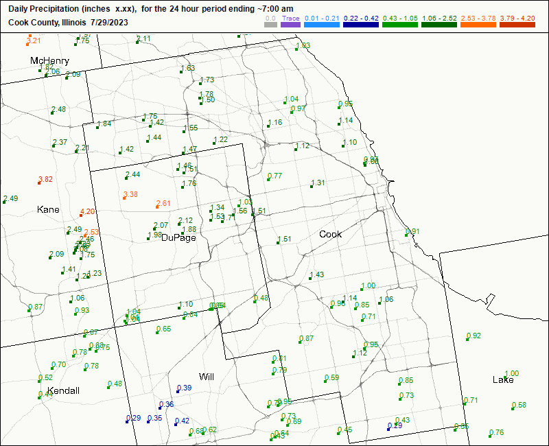
Chicago's precip
-
My place had it a little different. At 4:00, more bolts than Amelie Arena during a Stanley Cup playoff game.
-
I have a storm. A lot of flashes in the sky. the rain is coming in
-
there's about 60 or 70 CG strikes shown
-
I can see the lightning from the new thunderstorm that is between Lima and Columbus Grove OH from 50 miles away