Chinook
-
Posts
10,934 -
Joined
-
Last visited
Content Type
Profiles
Blogs
Forums
American Weather
Media Demo
Store
Gallery
Everything posted by Chinook
-
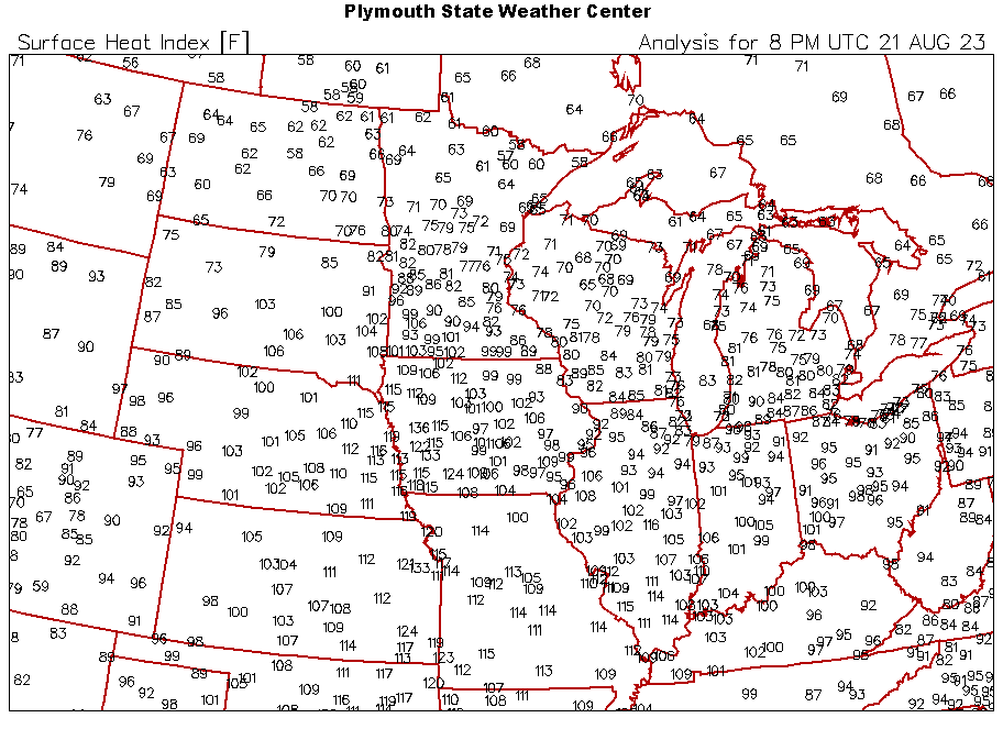
Today was another day of dangerous heat indices for some millions of people in the Midwest to the southern Plains
-
There are some very high heat indices today in the Midwest. I am not sure if the values over 121 are believable (121 at St Joseph Missouri.) Lawrence Kansas has 103/84/134, but it sounds suspicious. (dew points of 75-80 on mesonet sites in town.)
-
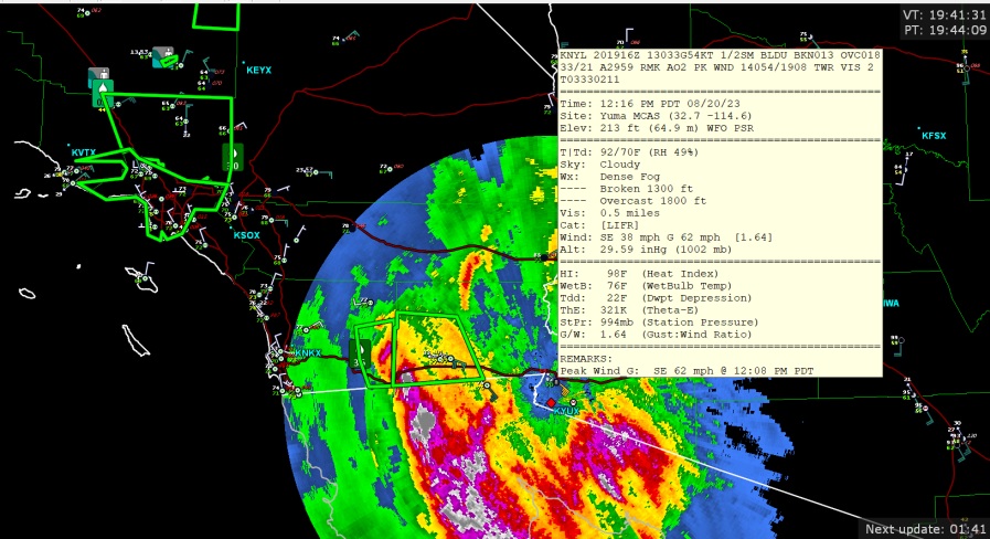
Here are a few flash flood warnings and measured 62mph wind gust
-
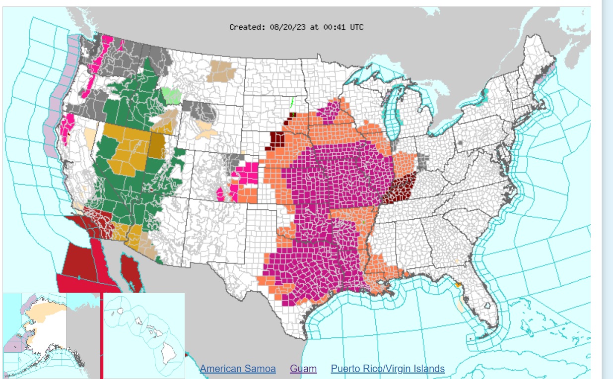
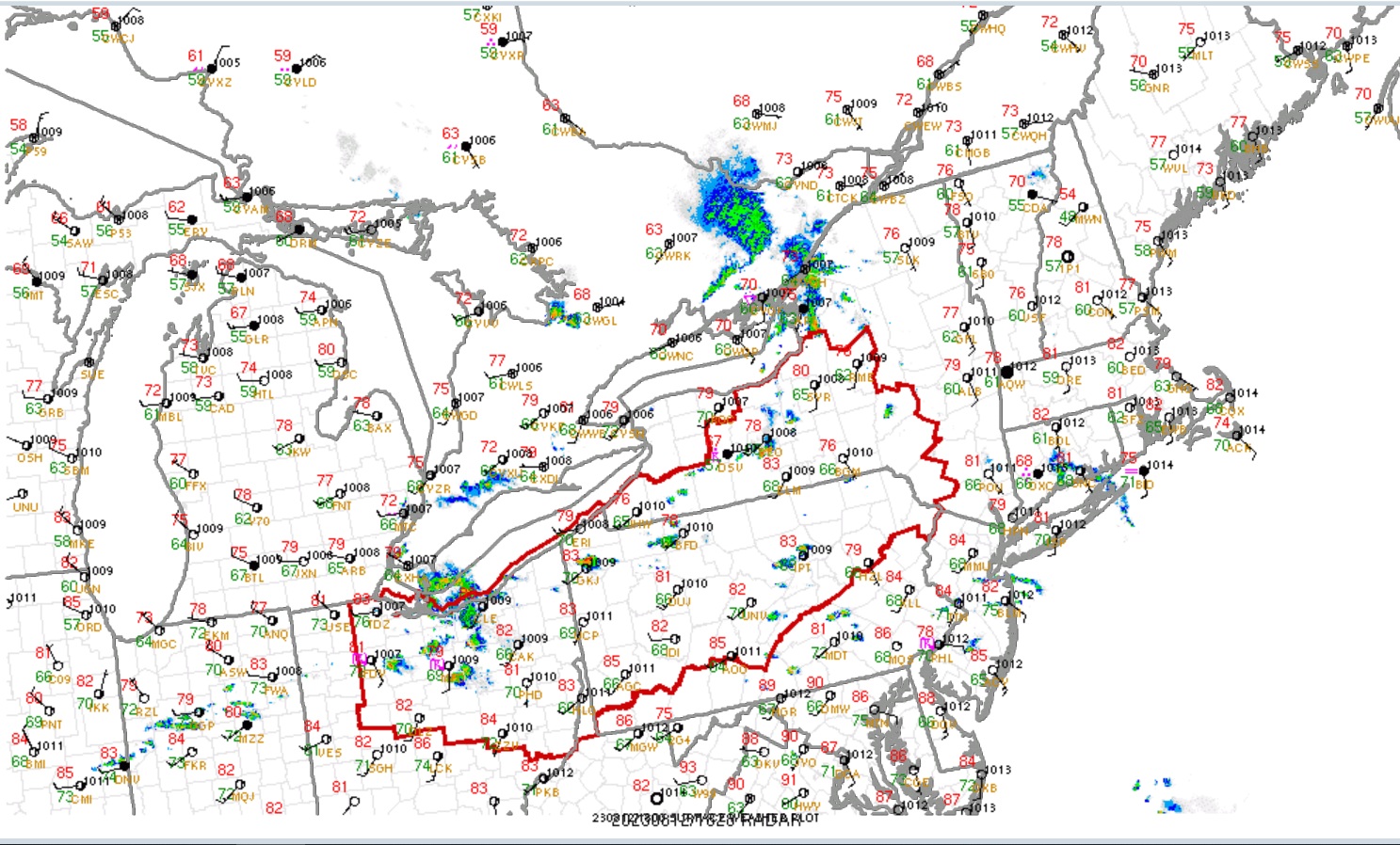
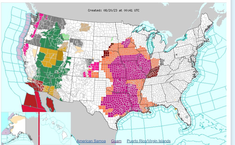
There are some crazy colors for watches/warnings/advisories on this map due to the hurricane impacts, as well as the Midwest heat.
-
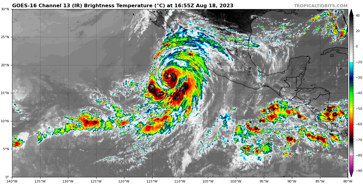
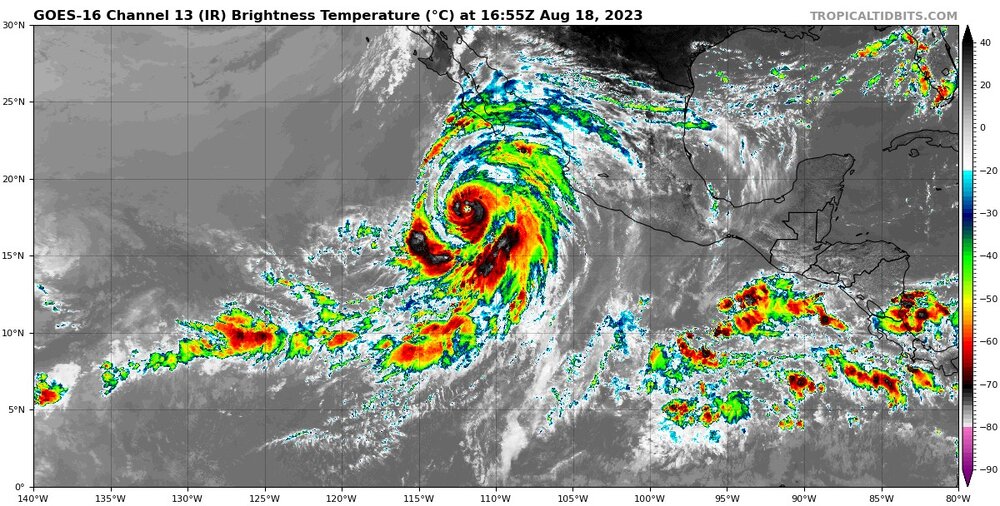
Look at this huge cloud field! There are new things that happen in weather every day, but a tropical storm getting to San Diego and Los Angeles is something I have not seen.
-
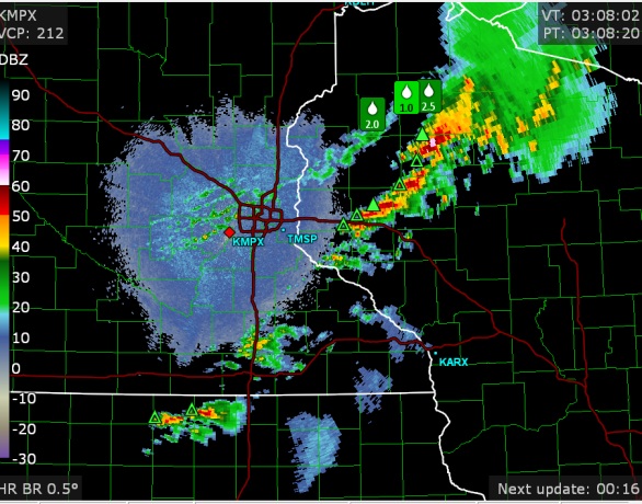
Some storms were severe in Minnesota/Wisconsin tonight. These storms are struggling with the cap and weakening of the daytime heat. They aren't struggling with shear, as that's pretty darn good for this time of year.
-

2023 Mid-Atlantic Severe Wx Thread (General Discussion)
Chinook replied to Kmlwx's topic in Mid Atlantic
severe storms scattered from Delaware/Maryland to Florida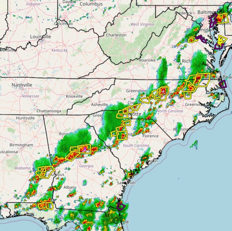
-
2023 Mid-Atlantic Severe Wx Thread (General Discussion)
Chinook replied to Kmlwx's topic in Mid Atlantic
There two tornado warnings near DC a few minutes ago. Now, mostly 50dBz over the area with a lot of lightning in some areas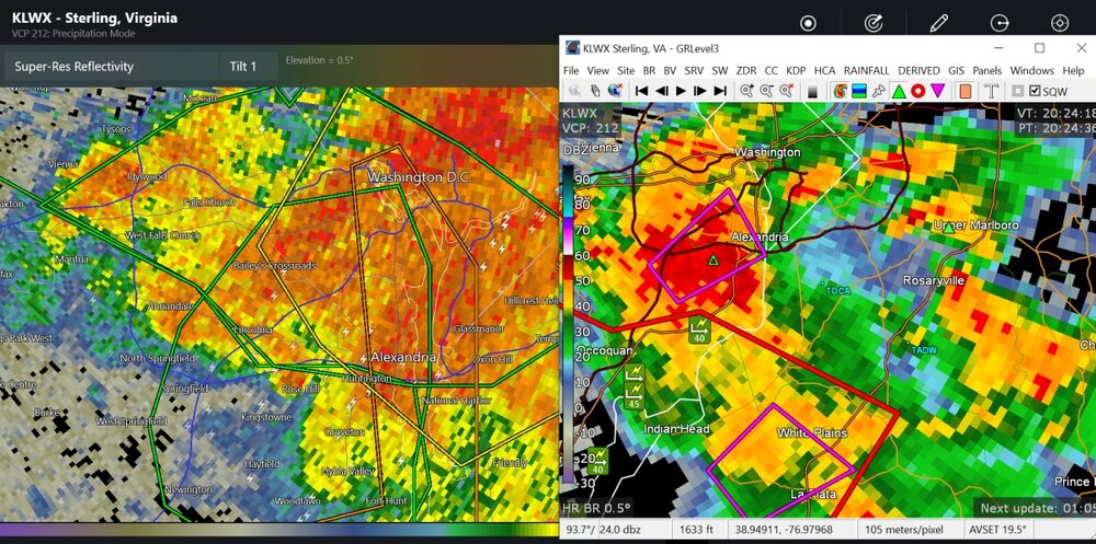
-
Did Minneapolis even hit 113 degrees in the year 1934 or 1936?
-
2023 Short/Medium Range Severe Weather Discussion
Chinook replied to Chicago Storm's topic in Lakes/Ohio Valley
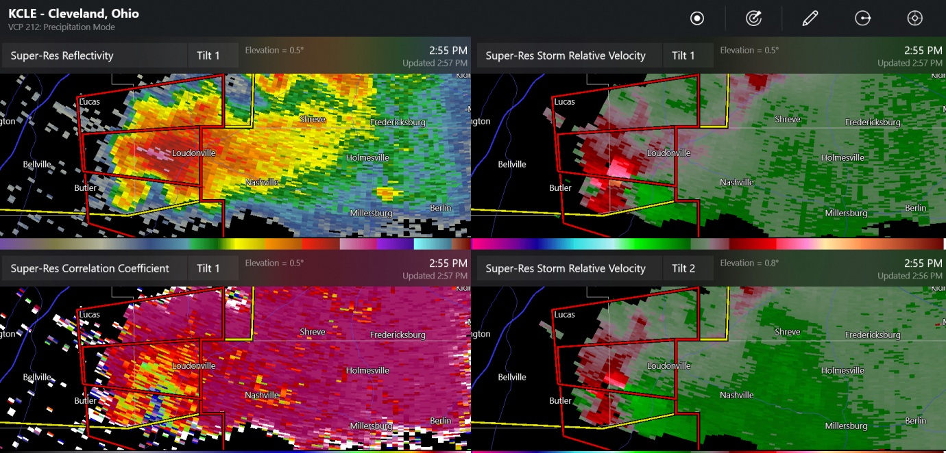
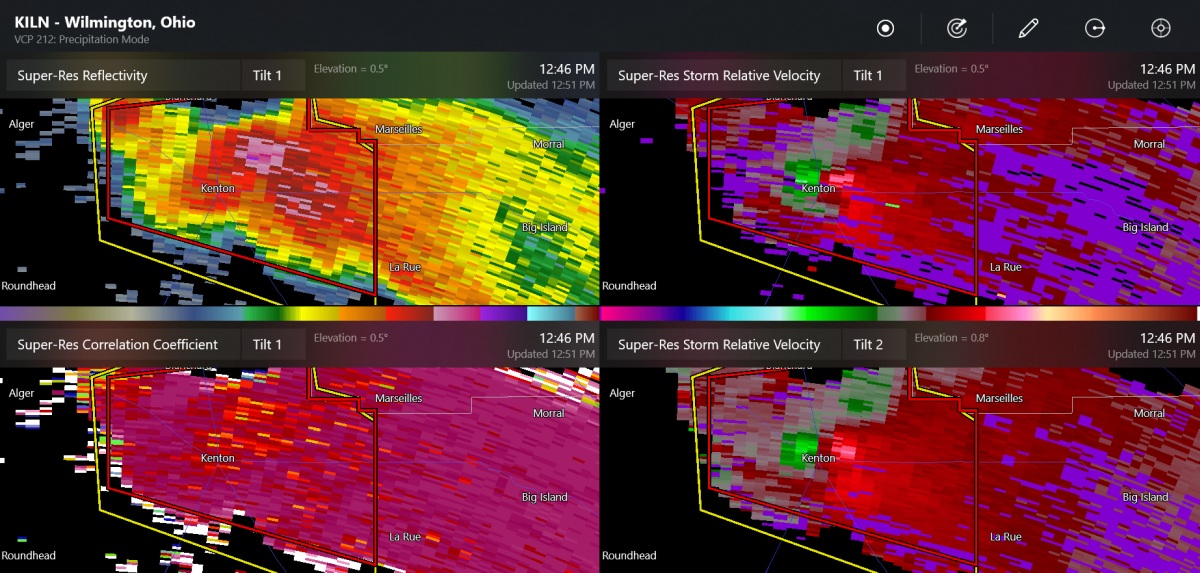
This is by Akron/Kent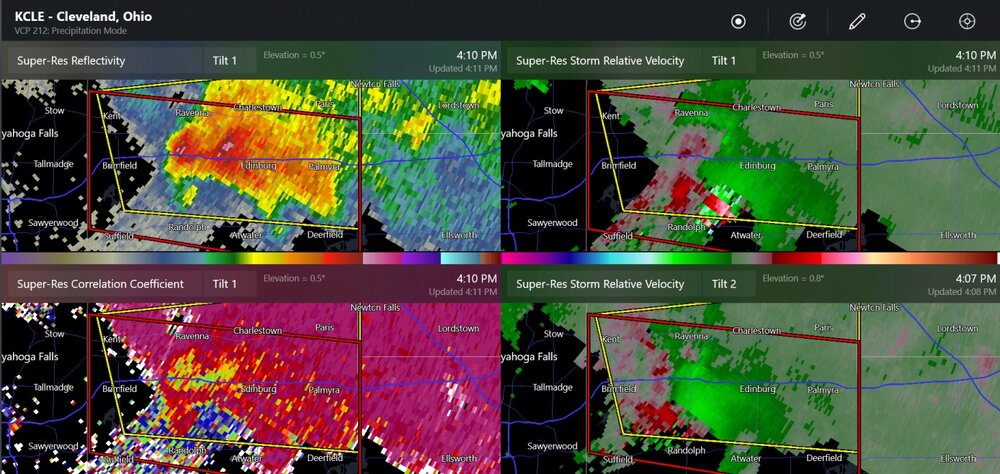
-
2023 Short/Medium Range Severe Weather Discussion
Chinook replied to Chicago Storm's topic in Lakes/Ohio Valley
same tornado warning
-
2023 Short/Medium Range Severe Weather Discussion
Chinook replied to Chicago Storm's topic in Lakes/Ohio Valley
another tornado warning in northern Ohio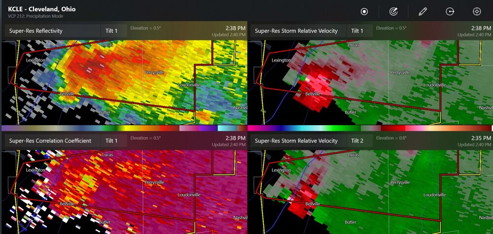
-
2023 Short/Medium Range Severe Weather Discussion
Chinook replied to Chicago Storm's topic in Lakes/Ohio Valley
tornado watch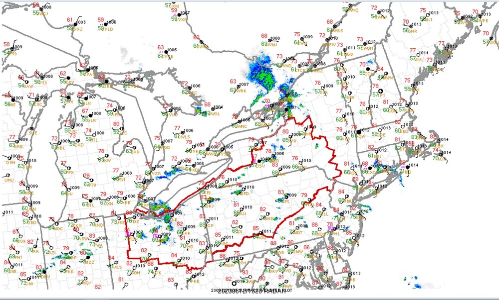
-
2023 Short/Medium Range Severe Weather Discussion
Chinook replied to Chicago Storm's topic in Lakes/Ohio Valley
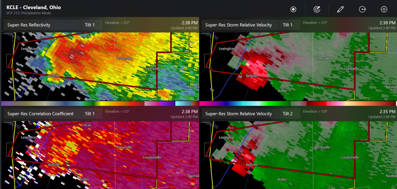
so this is a confirmed tornado. I actually have to drive through that town sometimes
-
I heard that Phoenix just had the warmest average month of any large American city, in history.
-
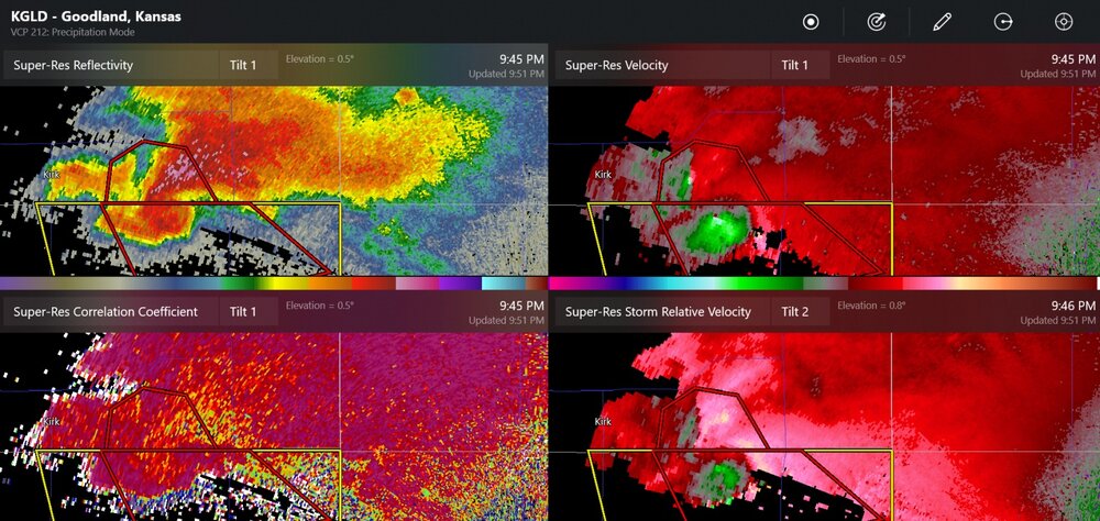
Maybe a double tornado, closer to Goodland
-
Tonight, the low clouds finally dissipated and there were some nice high clouds of a couple of types close to sunset. The temp is down to 70 now, with, thankfully dew points down to 61. During this weekend's storm and earlier today, my place had light rain, drizzle, low clouds, with dew points up to 72 on Saturday. It feels like this whole region wasted a chance for good thunderstorms. Mostly steady rains went from Indiana to Michigan and killed the instability that could have been. I think my place got 0.3" of rain and I could barely even tell it happened.
-
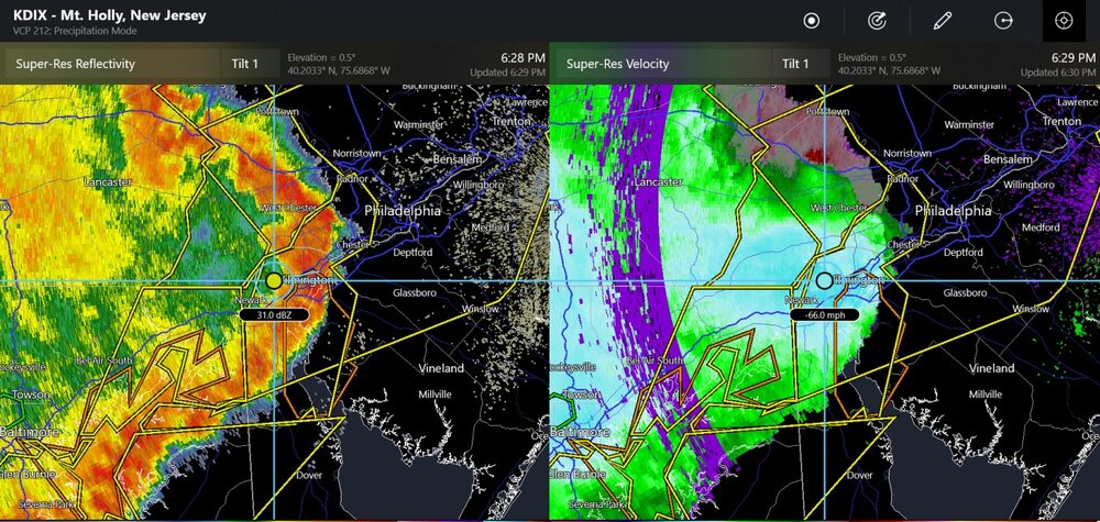
high winds of 65-70mph detected by radar above ground
-
2023 Mid-Atlantic Severe Wx Thread (General Discussion)
Chinook replied to Kmlwx's topic in Mid Atlantic
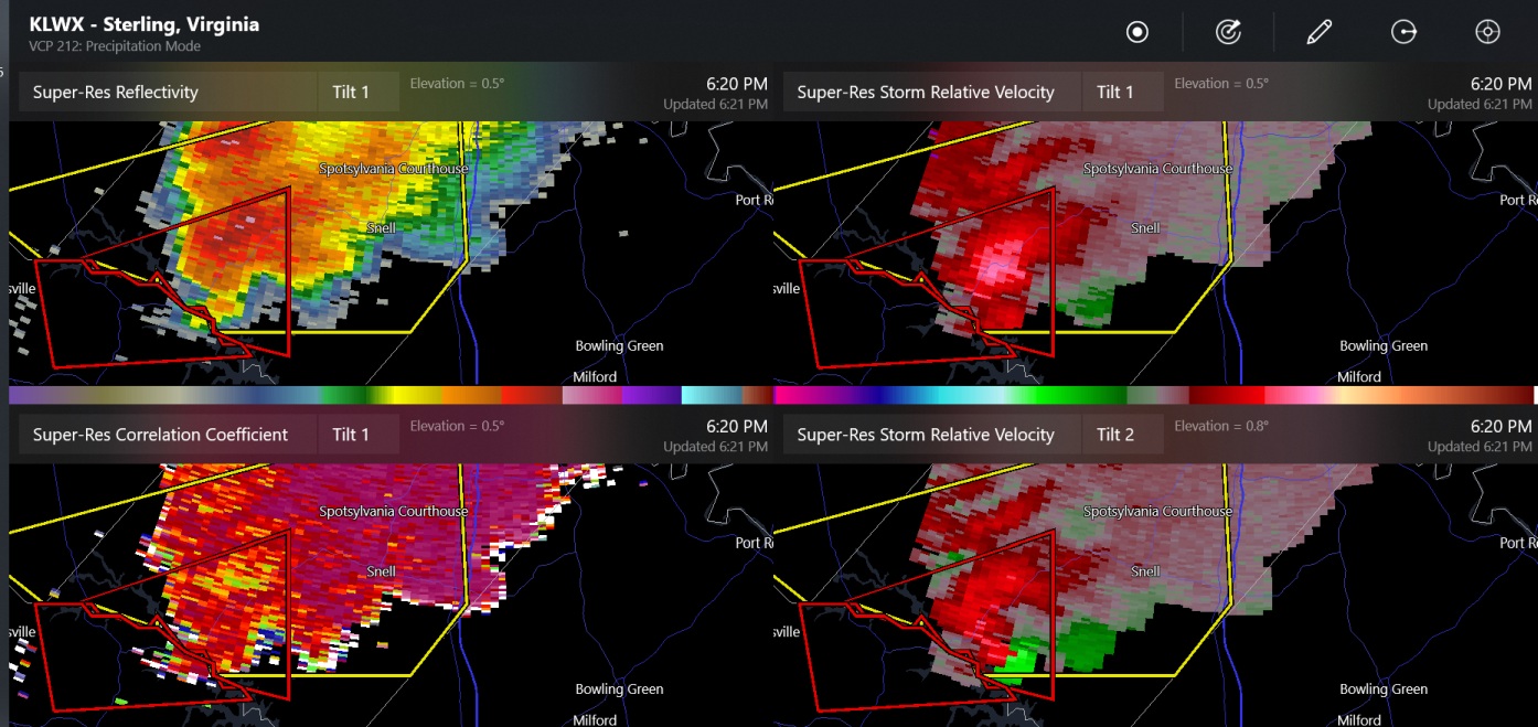
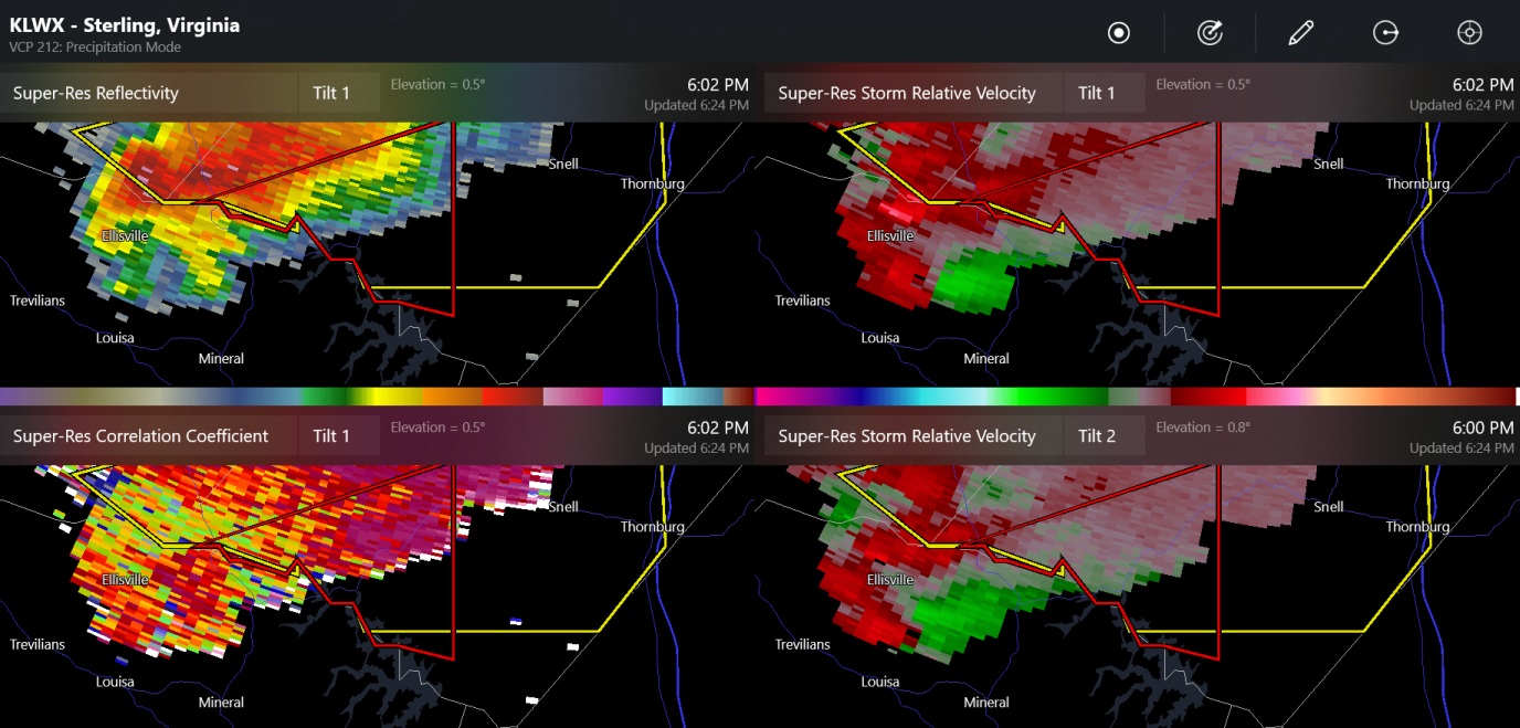
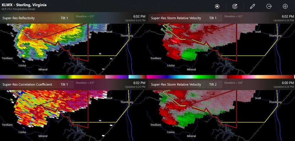
possible tornado near Snell Virginia
- 2,785 replies
-
- 2
-

-
- severe
- thunderstorms
- (and 3 more)
-
2023 Mid-Atlantic Severe Wx Thread (General Discussion)
Chinook replied to Kmlwx's topic in Mid Atlantic
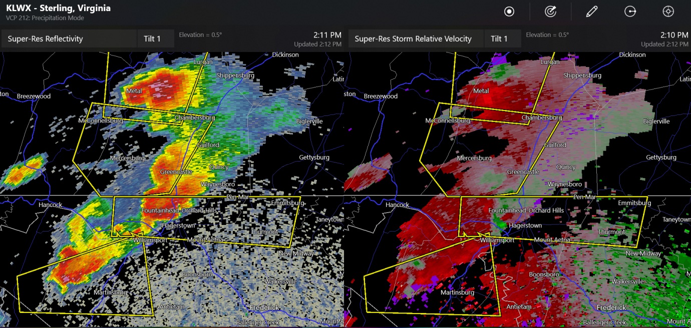
I'm still amazed at how long the Hagerstown supercell has stayed together. It's almost about to be crushed by the squall line.- 2,785 replies
-
- 1
-
-
- severe
- thunderstorms
- (and 3 more)
-
2023 Mid-Atlantic Severe Wx Thread (General Discussion)
Chinook replied to Kmlwx's topic in Mid Atlantic
Currently there is one new tornado warning in the mountain corridor of the WV/VA state line. One note on an amazing event in years past, in the 1974 super outbreak I believe there was an F-3 tornado climbed up and down one or more mountain ridges in West Virginia. So there's that.- 2,785 replies
-
- 1
-
-
- severe
- thunderstorms
- (and 3 more)
-
2023 Mid-Atlantic Severe Wx Thread (General Discussion)
Chinook replied to Kmlwx's topic in Mid Atlantic
triple severe storm threat northwest of Washington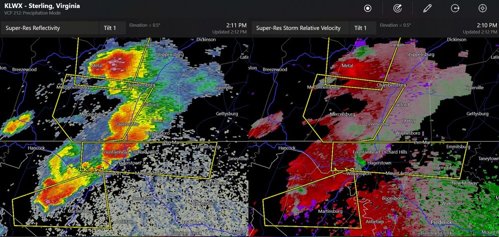
- 2,785 replies
-
- 1
-
-
- severe
- thunderstorms
- (and 3 more)
-
2023 Mid-Atlantic Severe Wx Thread (General Discussion)
Chinook replied to Kmlwx's topic in Mid Atlantic
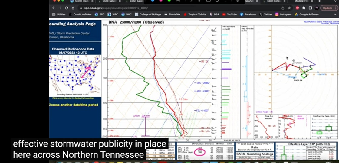
I was watching the Convective Chronicles youtube video (expert forecast) with the sound off and the closed captioning on. Better watch out for that high effective stormwater publicity!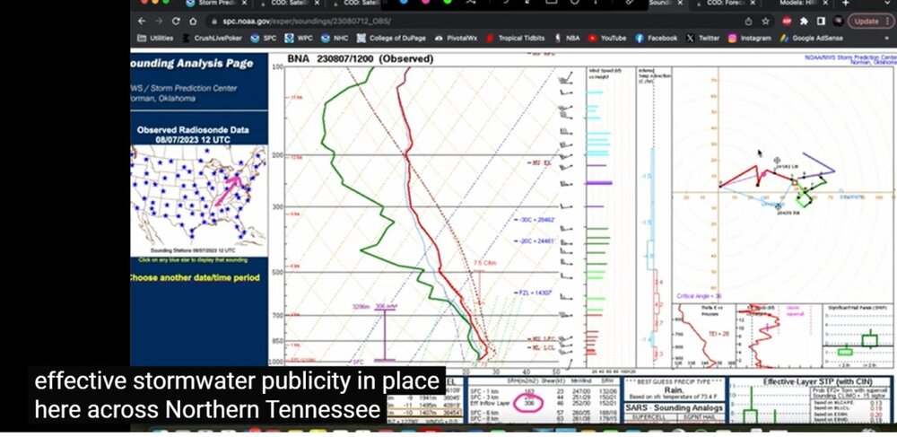
- 2,785 replies
-
- 4
-

-
- severe
- thunderstorms
- (and 3 more)
-
2023 Mid-Atlantic Severe Wx Thread (General Discussion)
Chinook replied to Kmlwx's topic in Mid Atlantic
Already 1.25" hail reported west of Hagerstown.- 2,785 replies
-
- 2
-
-
- severe
- thunderstorms
- (and 3 more)