Chinook
-
Posts
10,934 -
Joined
-
Last visited
Content Type
Profiles
Blogs
Forums
American Weather
Media Demo
Store
Gallery
Everything posted by Chinook
-
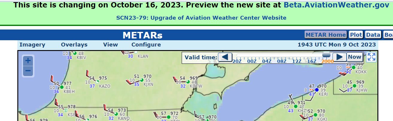
Now this Aviationweather dot gov web site is changing, allowing a more complicated interface for the METARs. I kind of liked the ease of use.

-
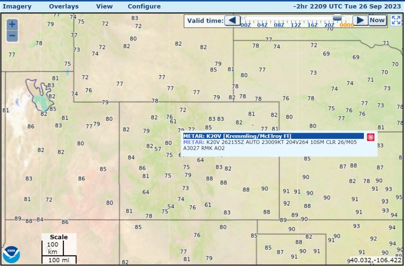
The NCAR/UCAR web site has had the same useful surface-observations interface for, I believe, over 20 years. The models part of the web site hasn't changed either. Of course, weather enthusiasts have moved on to much better model web sites. It's one of those things that's kind of a constant in the universe. The CoD weather web site has existed for over 20 years, but of course, they pretty much upgraded everything. They have kept some of the color-bars used for model maps. So that's kind of neat. Not a whole lot stays the same on the internet. Another thing that's stayed the same a long time: NCEP/NCAR reanalysis on NOAA-PSD, exact same color-bars and interface for selecting plot parameters.
-
I've been kind of messing around with Tornadoarchive dot com recently, clicking the "random tornado day" feature. Along the way, I rediscovered some interesting days July 1-3, 1997: a total of 52 tornadoes hit the upper Midwest and into the Northeast, including one in Canada near Detroit. Apparently this was the largest continuous outbreak of tornadoes in the month of July. There was an F2 tornado in the city of Detroit. Not directly associated with a tornado, 5 deaths due to straight line wind at Grosse Pointe Shores MI. Two F3 tornadoes were in Michigan, one was in Minnesota, and one was in Ohio. June 24, 2003: a total of 67 tornadoes occurred in one day in the "Great South Dakota Tornado Outbreak." Also, a total of 125 tornadoes occurred within a 3-day time span (June 21-24). A single F4 tornado occurred on June 24 and hit the small town of Manchester SD. The residents never rebuilt the city. There were a large number of F0 tornadoes in South Dakota in a couple of counties. November 22-24 2004: Wikipedia says this was the largest number of tornadoes (104) in one continuous outbreak in the month of November. The worst ones were just three F3 tornadoes in Louisiana and Mississippi. 61 tornadoes were rated F0
-
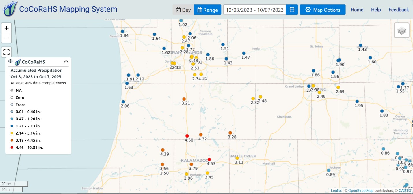
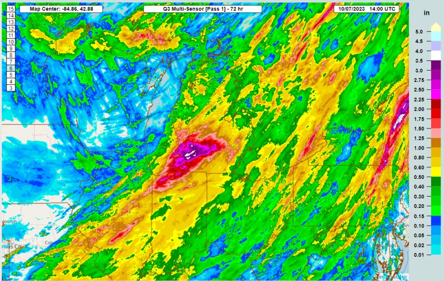
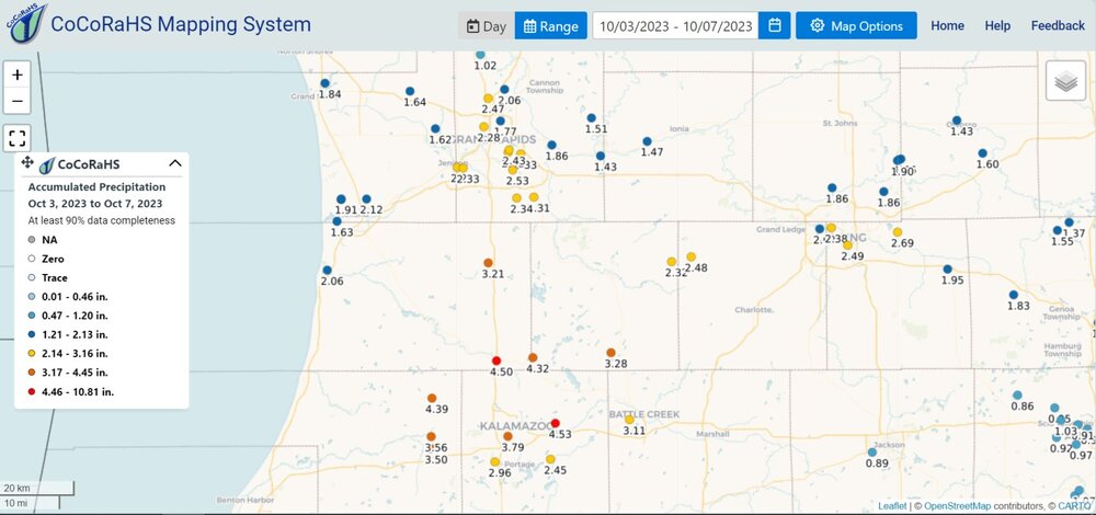
Rain totals shown here are over 3.0" for western Michigan near Kalamazoo. My place got about 0.70" and then 0.05". You can already see the enhanced precipitation in the central Upper Peninsula from the instability.
-
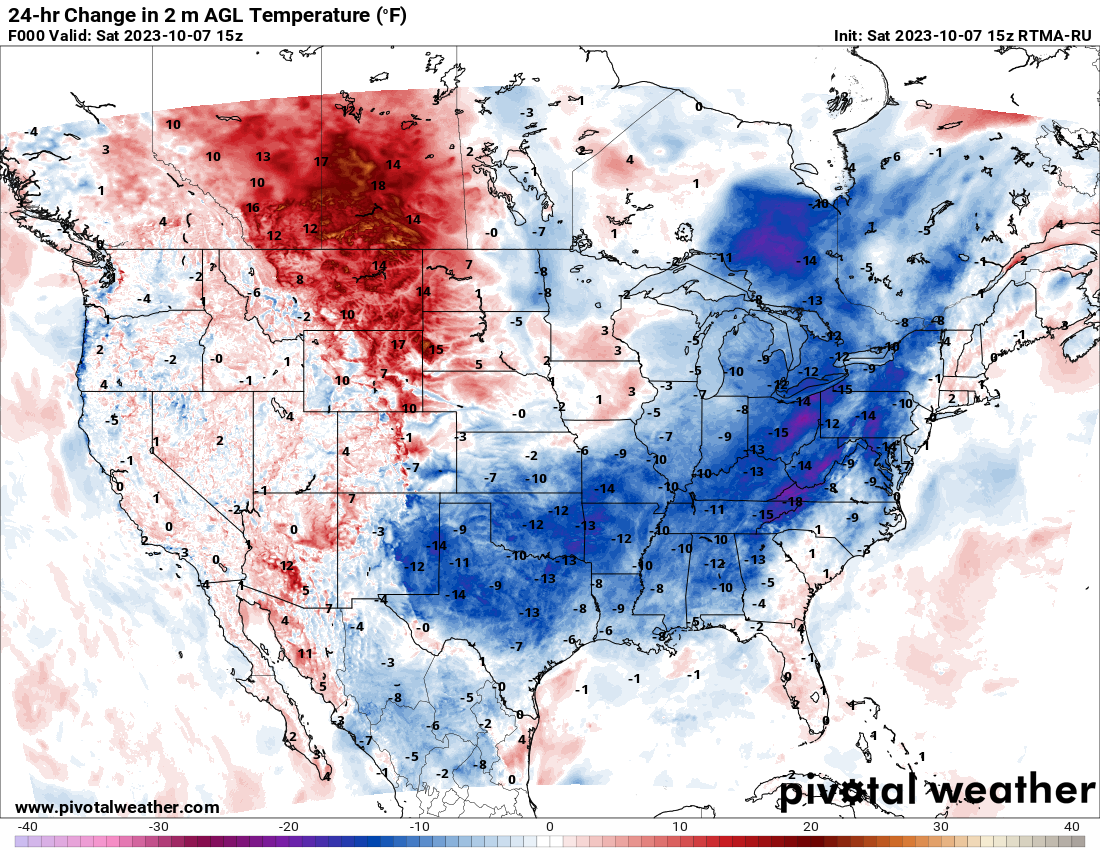
Toledo was 87 degrees on Wednesday Oct 4th, , now it's 55, so a 32 degree drop in 3 days.

-

Texas/Oklahoma 2023 Obs and Discussion
Chinook replied to Ed, snow and hurricane fan's topic in Central/Western States
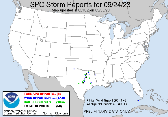
The Dallas Fort Worth area got some hail/wind reports. I'm sure you guys will be happy to see some of the drought-busting rains and some cooler weather, like 71 for Saturday. I guess in the long run, the drought might go away for the South but remain in the North due to El Nino. -
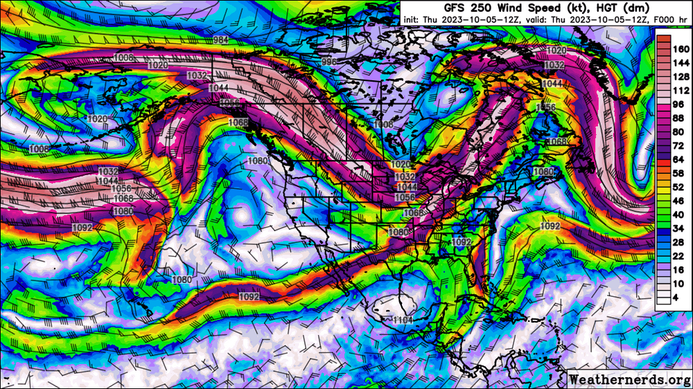
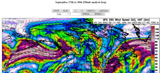
For me, it's not usual to check the connection with this USA cold front and associated 500mb trough, and the 250mb wind stream. The 500mb chart does not easily show this. The subtropical connection to our sort-of merging jet stream goes all the way from the mid-Pacific near Hawaii up and then up to the Great Lakes. That's why I decided to save the 250mb North America charts of last month, post the loop and perhaps keep up with the whole thing. The El Nino's effects on the atmosphere are going to pop up in force, and the subtropical jet is the major player for North America. That's the thing. I don't know what conclusions I will get from looking at the jet streams way out in the Pacific every day.
-
Texas/Oklahoma 2023 Obs and Discussion
Chinook replied to Ed, snow and hurricane fan's topic in Central/Western States
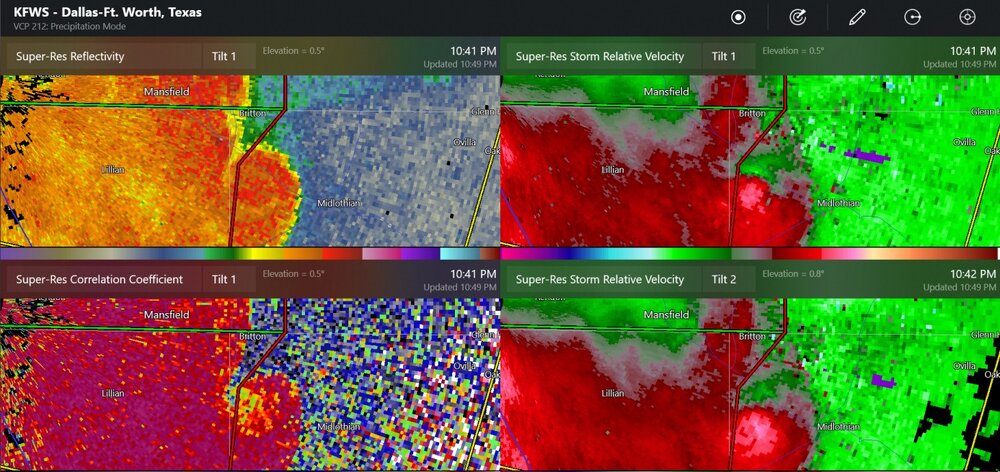
The northeast side of Dallas may have gotten 2.5"-3" at this point in time. I have not seen a report of a tornado. -
wow, it's 11:00PM in October
-
Texas/Oklahoma 2023 Obs and Discussion
Chinook replied to Ed, snow and hurricane fan's topic in Central/Western States
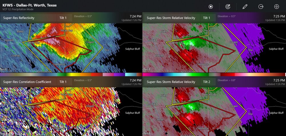
Wow! That might be a TDS confirmed tornado at Britton Texas, near Midlothian. I thought this severe event might be over.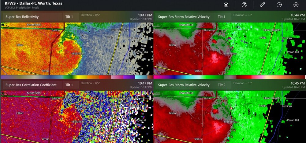
-
I sort of wish we had a few days of 70 rather than 85. Actually, 89 yesterday was, as mentioned, only 3 degrees lower than the all-time maximum temperature for the month for Toledo.
-
I think this is about 1"-2"
-
I overstated that. Toledo's monthly record is 92 on Oct 4 and Oct 8.
-
I am thinking that Toledo may be breaking a monthly temperature record for October.
-
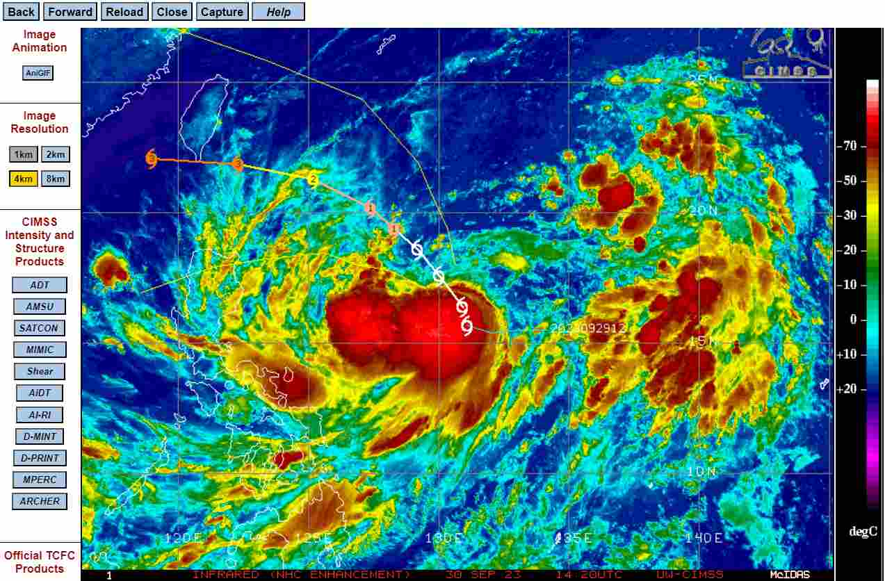
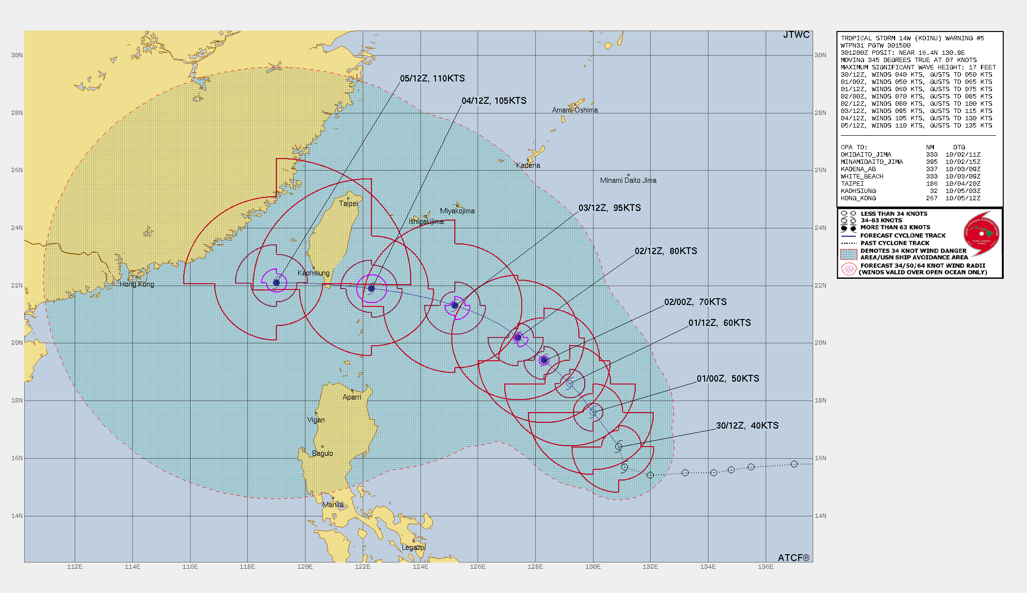
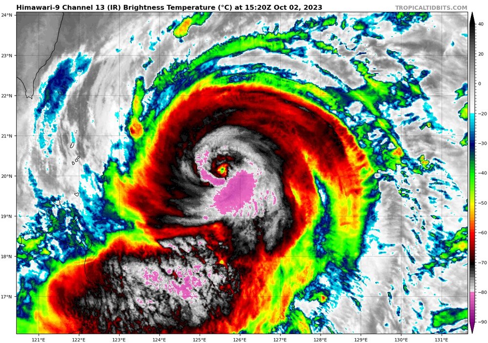
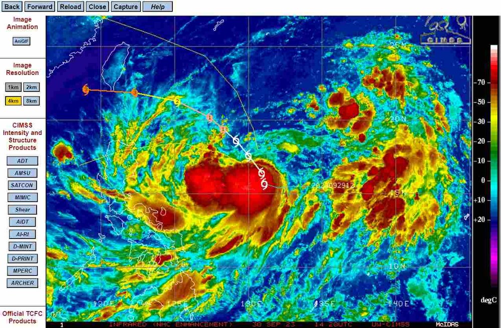
Koinu looking absolutely nuts. It is maxing out at 105 knots now, but will weaken to 85 knots while it is east of Taiwan, and approach southern Taiwan. The landfall forecast has not changed much, except for a few miles. If you check the most recent HWRF, the model might not have been initialized correctly, and then the forecast is completely wrong for some awful reason.

-
my loops of September 2023, 250mb, covering all of last month. I am going to try to keep up with these, monthly (maybe) but no promises. https://great-lakes-salsite.web.app/Sep_1_18_2023_250mb_loop.html https://great-lakes-salsite.web.app/Sep_17_30_2023_250mb_loop.html sample:
-
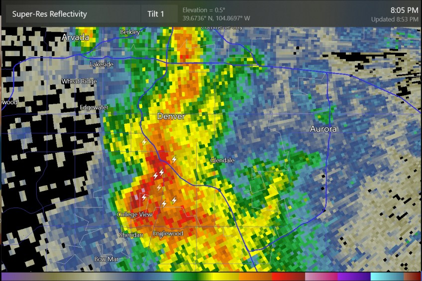
some thunder at south Denver and south of Loveland tonight
-
I was thinking of posting a loop of 250mb analysis, North America view. I am saving them just to study the jet stream over the El Nino winter. It's kind of because I almost always look at the 500mb map for the USA but ignore what's happening at 250mb in the Pacific. Does anybody want me to post a 14-day loop of this?
-
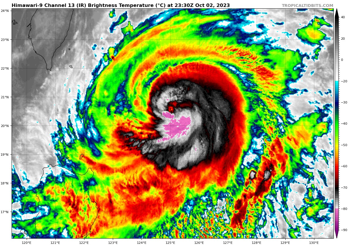
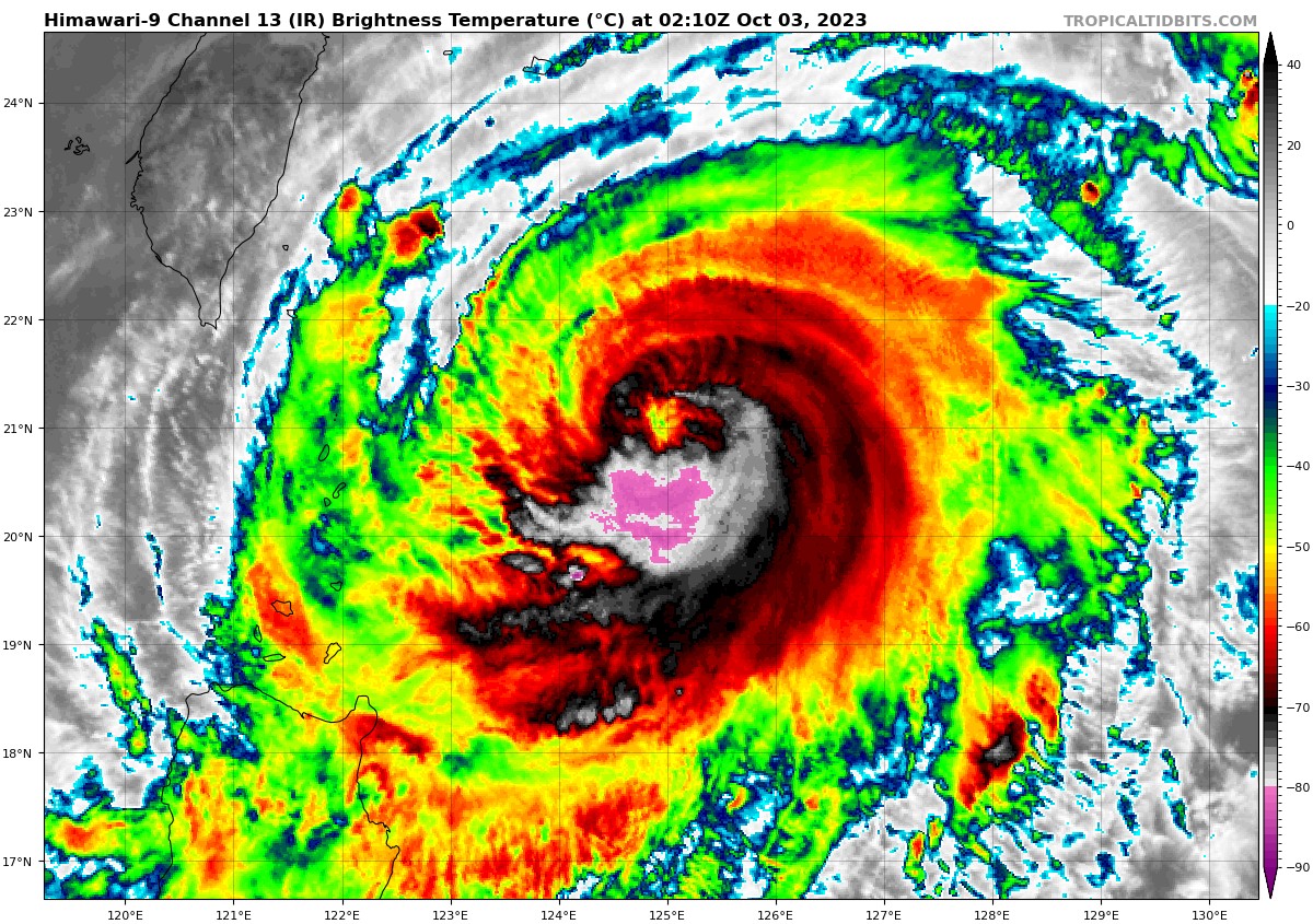
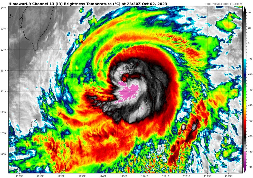
Typhoon Koinu now is an 80kts typhoon as per JTWC advisory, so it getting up there into Cat-2 type strength. Most of the rest of the JTWC forecast is similar to what I posted yesterday. JTWC now has 105 knots before a likely landfall at southern Taiwan. It is always interesting to see the -90 C cloud tops for the West Pacific tropical storms/typhoons due to the high tropopause or just simply the high topped convection over those warm waters.
-
Tropical Storm Koinu could intensify to 110 knots as it approaches Taiwan, as per JTWC

-
Summertime temps of 81-82 at Denver, 85 at Salt Lake City, Wyoming, and even Montana, with the mountains getting also summertime values with no clouds.
-
Texas/Oklahoma 2023 Obs and Discussion
Chinook replied to Ed, snow and hurricane fan's topic in Central/Western States
There have been several large hail reports of 1.5" + today in northern Texas. As for this, I do not know if there was a confirmed tornado at Commerce, TX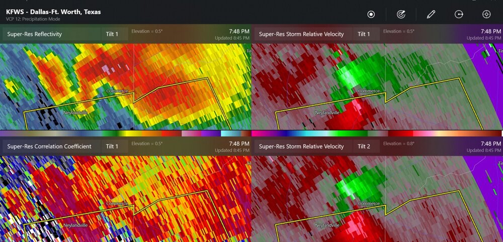
-
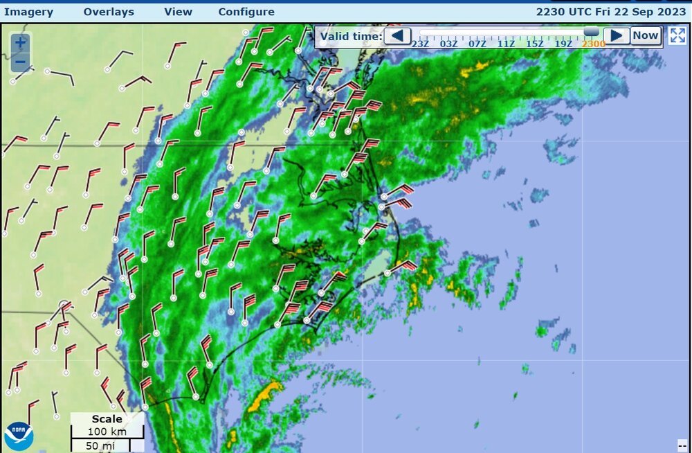
Mid-Atlantic winds are picking up a lot. Virginia Beach has 26 knots gusting to 41 knots now
-
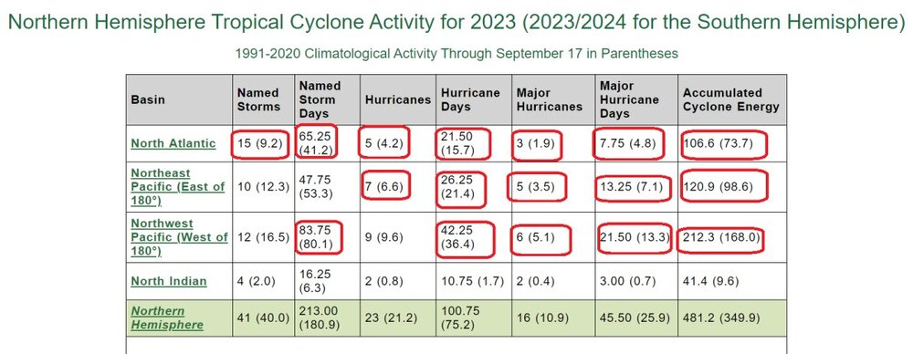
Values above average for the main three areas are circled in red
-
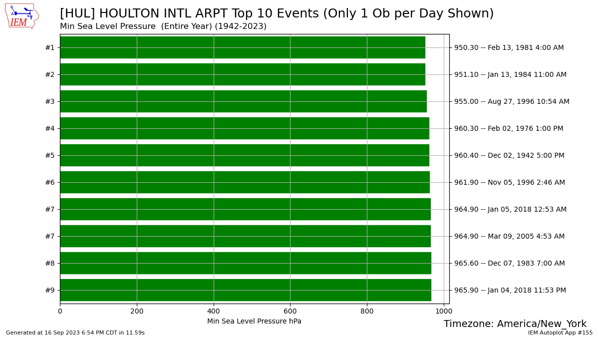
Houlton all time pressure records (not sure if any of these are in error)