Chinook
-
Posts
10,935 -
Joined
-
Last visited
Content Type
Profiles
Blogs
Forums
American Weather
Media Demo
Store
Gallery
Everything posted by Chinook
-
You know, this is just past the 49-year anniversary of the slow-moving storm that brought Detroit its snowiest snowstorm (Dec 1-2 1974). Key factor: pulling in moisture from the Atlantic.
-
Cameron is at 10276 and accumulates a lot of snow since it's in the north. I've seen two moose there and have heard others tell me they've seen moose. Some of the highest passes are 12000 like Independence. Monarch is 11300, Rocky Mountain Natl Park has 12108 but that's not a high-volume US highway for shipping and commerce. Berthoud pass is at 11300 on US 40, a main commerce road. If you've got a well-built SUV, and a lot of experience, you can drive an old mining road nearly all the way to Mt. Antero where the road stops at 13800. Then I-70 and US-6 almost go in the same spot but I-70 tunnels through Loveland Mountain (not to be confused with Loveland city.) If you like weather observations from METARS, K0CO (yes, that's right, mixed numbers and letters) is above Berthoud pass and pretty much just has a freezing blizzard all the time.
-

Mountain West Discussion- cool season '23-24
Chinook replied to mayjawintastawm's topic in Central/Western States
Along with the massive Pacific storm going on, a warm air mass. The unusually warm Pacific air mass created some chinook winds for the north country, with 60 degrees in Alberta. That area might average. Areas in Montana had the 60's, while their climatological average highs are just in the 30's. Helena was 26F above normal according to 4:00PM climate summary, which counts the morning low and high temperature up to that time in the day.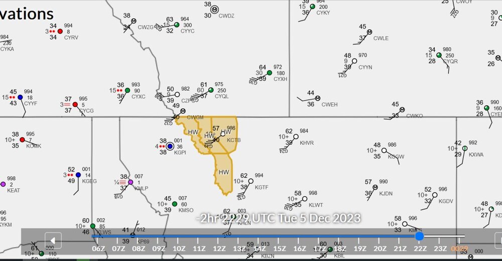
-
Dude I saw so much snow out in Colorado, I don't even care. It's possible I'm still shoveling from 2021. I went to say goodbye to Cameron Pass in June 2022 and I made a couple of snowballs. But then again, Toledo had verifiable ground blizzard conditions a year ago... in one of the least snowy years ever. Actually it's nice to see green grass in every neighborhood without dozens of sprinklers on every lawn.
-
Winter 2023/24 Medium/Long Range Discussion
Chinook replied to Chicago Storm's topic in Lakes/Ohio Valley
I'm just going to jinx all you guys in Indiana and Michigan by posting this
-
Mountain West Discussion- cool season '23-24
Chinook replied to mayjawintastawm's topic in Central/Western States
Pac storm takes up 2300 miles
-
Mountain West Discussion- cool season '23-24
Chinook replied to mayjawintastawm's topic in Central/Western States
I don't check the model wind gusts forecasts a whole lot, since they are hard to find. I wonder if this particular HRRR will provide useful information for tomorrow. Wind gusts of 30+ knots with 65+ knots at about 9000 ft. The short-term forecast from the HRRR has 20kt to 65kt wind gusts over the mountains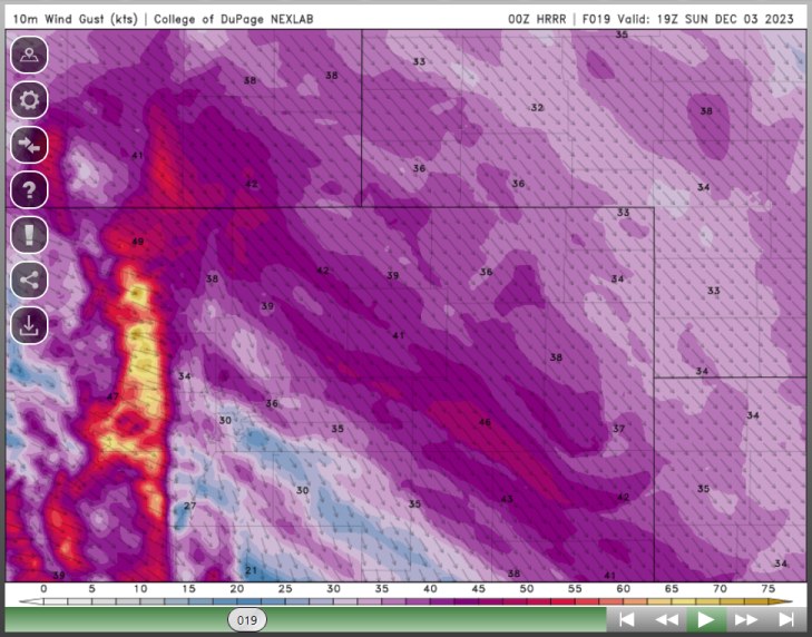
-
Here are the last 30 days of 250mb winds for North America. I am taking a look at this every day. I've spent so much time looking at USA-only maps, I have tended to forget to look at what's happening way out in the Pacific. I'm looking for the increase in the subtropical jet and maybe some supercharged El Nino storms at some point in the future. I say this because El Nino is a huge factor for Denver. We really do want this El Nino winter to end some of the drought areas in the US with some winter rains and mountain snows. And I'm posting this here because there's like 2 people reading the Mountain West discussion. https://great-lakes-salsite.web.app/Nov_1_15_2023_250mb_loop.html https://great-lakes-salsite.web.app/Nov_16_30_2023_250mb_loop.html
-
Mountain West Discussion- cool season '23-24
Chinook replied to mayjawintastawm's topic in Central/Western States
The Northwest is getting kind of blitzed with heavy precipitation with westerly-flow-only. The Seattle and Portland areas will get much higher snowpack values in all mountain basins. They will have soggy and flooded valleys. Closer to Colorado: the local NWS offices are saying high winds above 6000 ft and also at Cheyenne vicinity. -
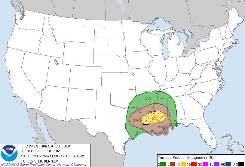
for what it's worth- some convection allowing models bring some distinctive updraft helicity tracks to the region
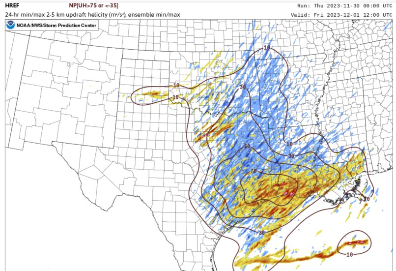
-
the 12km NAM has just ripping 0-3km SRH values like a hurricane
-
The models forecast many storms tomorrow. I like to see this, as I think it correlates with many storm reports in the real world. On the other hand, there could be many interfering storms and few tornadoes tomorrow. That's a possibility.
-
SPC has a day-3 outlook, that is now valid for just 48 hours in the future on Thursday night. There should be a good amount of convection down around Houston on Thursday. I don't know if this will be much more than a slight risk.
-
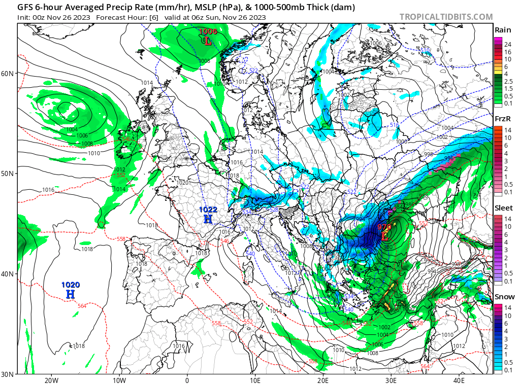
interesting note. I was checking Europe maps and found this highly unusual blizzard that ended up affecting Ukraine. Conditions of 50mph wind gusts and snow existed at the Romanian coast.

-
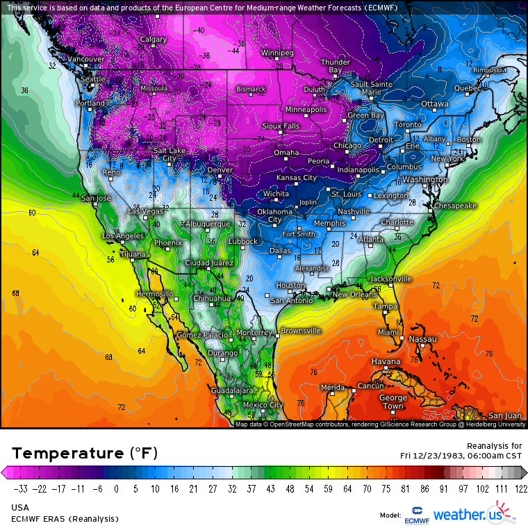
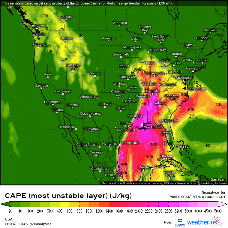
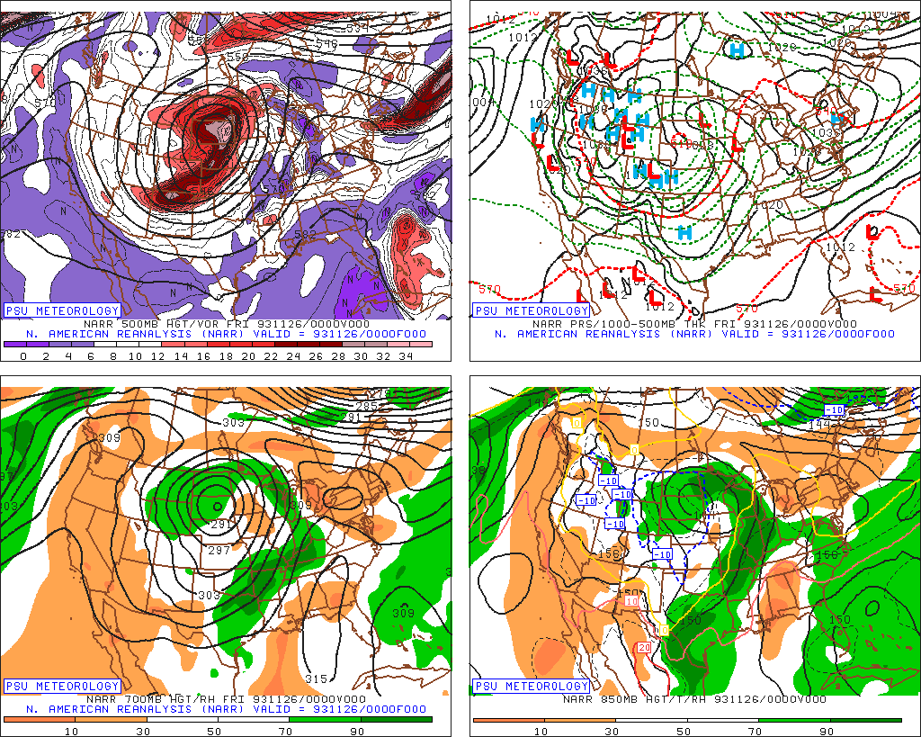
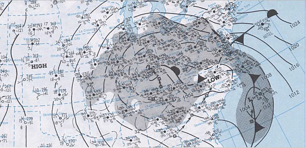
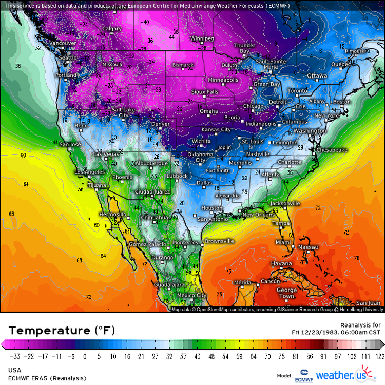
I messed around with the ECMWF ERA reanalysis on weather dot us. Here are maps from two of the most striking events in Midwest history- The cold wave of 1983 is shown here and two days later, the lower Great Lakes had the coldest Christmas day in history. (Detroit had 4/-10 on Christmas) As it shows, -40 degrees was in North Dakota (verifiable if you check stations like Williston North Dakota which was -50). Interesting note: this may also be some of the highest sea level pressure of all time in the Americas. Next is the CAPE for the Super Outbreak of 1974 which had a huge impact in the Midwest and South. The NCEP reanalysis does worse with hi-res properties such as this (NARR might be comparable). I wonder what might happen if you had something like a RAP analysis of 1974.

-
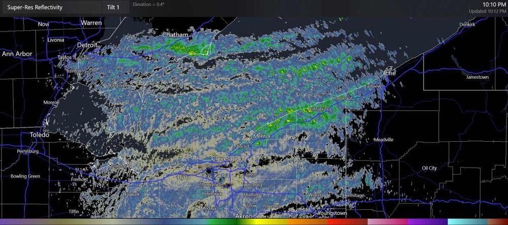
surprise snow
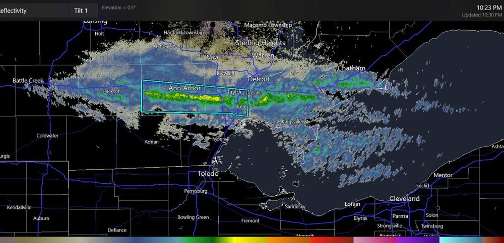
-
This might be the beginning of higher reflectivity for some areas near Cleveland over to Erie.
-
Mountain West Discussion- cool season '23-24
Chinook replied to mayjawintastawm's topic in Central/Western States
There are currently some storm reports of (just) 3" to 3.5" along I-25 with 5-6" at Cheyenne. I'm not sure if some final storm reports will show values a lot different than that. The radar was impressive early in the storm, that is, 0500z to 0700z. Fort Collins had the more impressive snow rates and/or low visibility at 0600z and for a few hours past that point. I seems as though Denver got decent snow rates. -
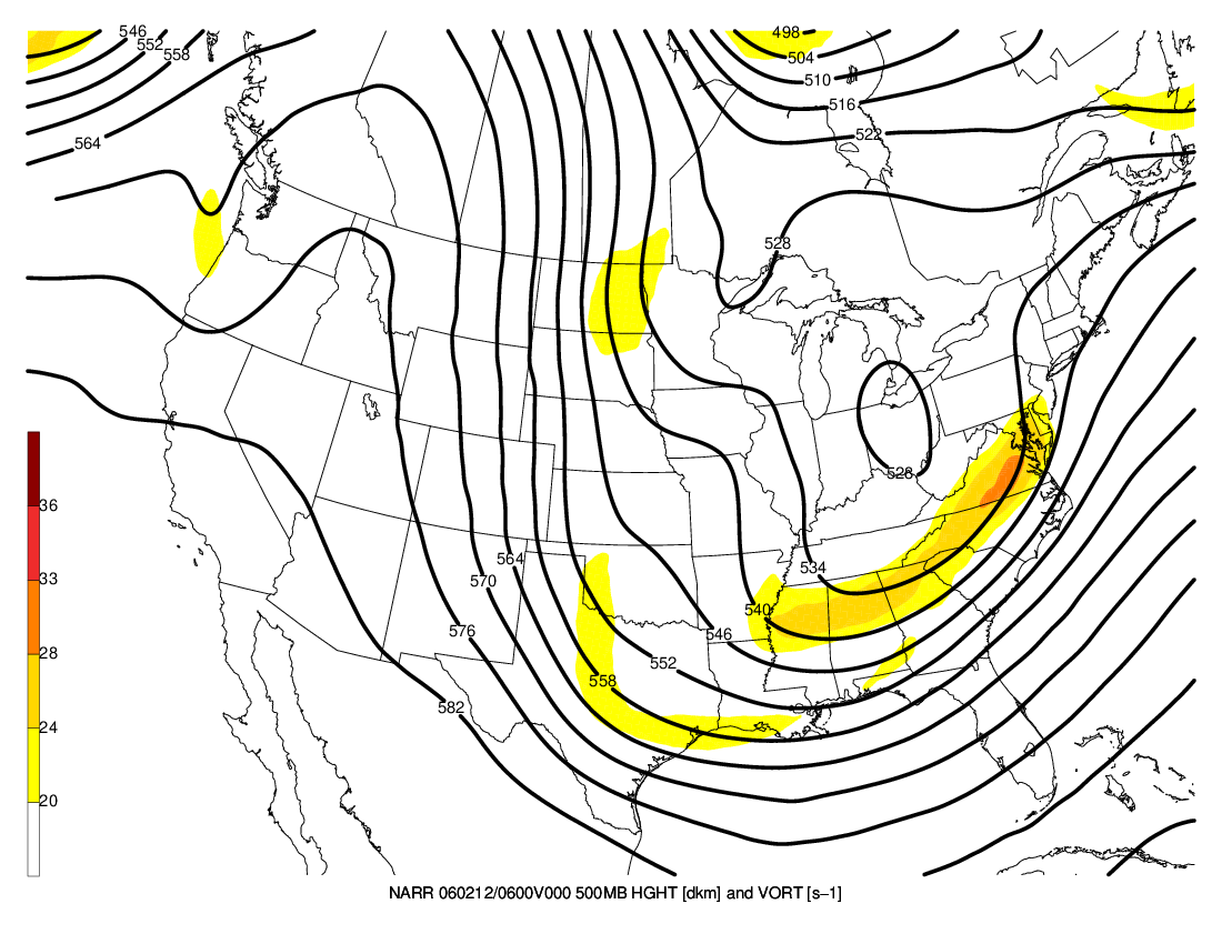
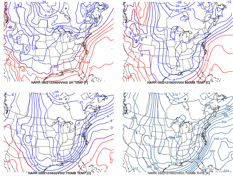
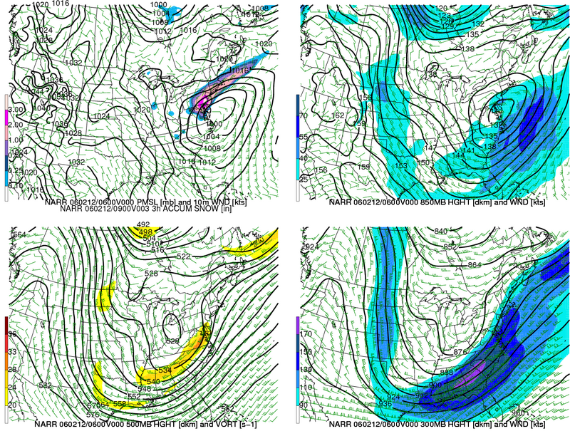
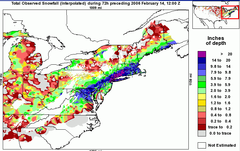
Here is a storm that is listed as the #34 biggest NOAA-calculated NESIS storm. The Blizzard of 2006. It was quite impactful, and seemingly did not have an extremely low pressure at the time shown here on these charts. It didn't have a very high pressure north of the storm. It didn't seem to follow the rules as far as the blocking or convergent jet structure. I think it just kind of hit the frontogenesis factors right, for a long time.

-
Mountain West Discussion- cool season '23-24
Chinook replied to mayjawintastawm's topic in Central/Western States
Winter storm warning for most of Larimer and Boulder Counties now, also note this was issued this afternoon, as you see this winter storm warning existed while it was 66-67 degrees
-
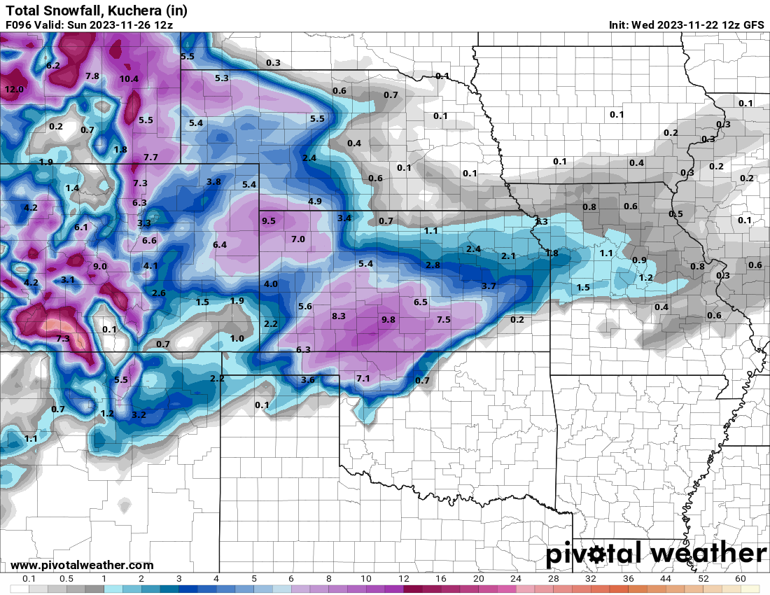
Mountain West Discussion- cool season '23-24
Chinook replied to mayjawintastawm's topic in Central/Western States
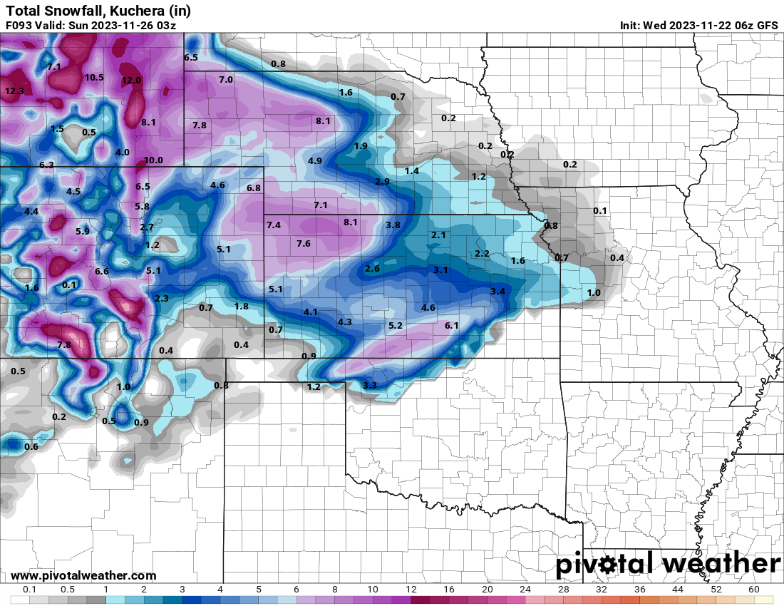
New GFS. I wonder if there's much of a chance for the 9" stuff in Kansas. But anyway, probably a very reasonable ill-timed holiday weekend storm to pump up the snowpack for the winter.
-
Mountain West Discussion- cool season '23-24
Chinook replied to mayjawintastawm's topic in Central/Western States
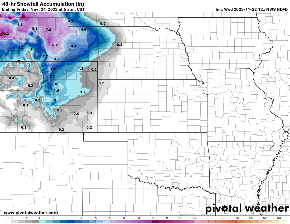
Models have been showing a fairly standard sort of snow system with upslope enhancement. It's now close enough to be in the NWS 48-hour official gridded forecast
-
Texas/Oklahoma 2023 Obs and Discussion
Chinook replied to Ed, snow and hurricane fan's topic in Central/Western States
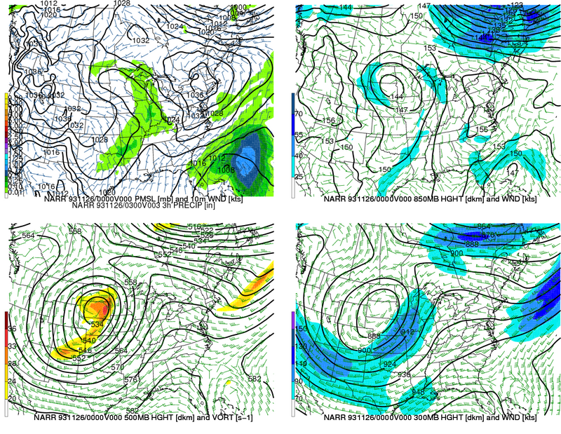
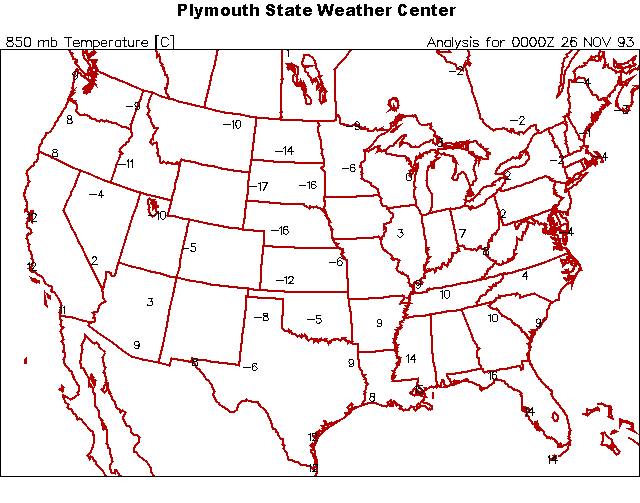
I recently watched a video on Youtube, today, about the Cowboys vs. Dolphins memorable sleet-game of 1993, Thanksgiving Day, which was 11/25/93. Players were slipping on the sleet. Let's take a look at the weather system. The cold front seems like it moved well southeast of Dallas by game time. There was precipitation in a band from SW to NE across the Southern Plains. Apparently this system gave all sleet to Dallas for before/during this game. The 850mb temperatures were above freezing according to this NARR reanalysis, and the 1000-500mb thicknesses well above the typical value 5400m for snow. Surface analysis by the NWS said Dallas had 31 degrees with a dew point of 15 degrees at 12z (6:00AM). By my guess, the surface temperature was just below freezing with sleet falling, and 850mb temperatures just above freezing to possibly 2 degrees C.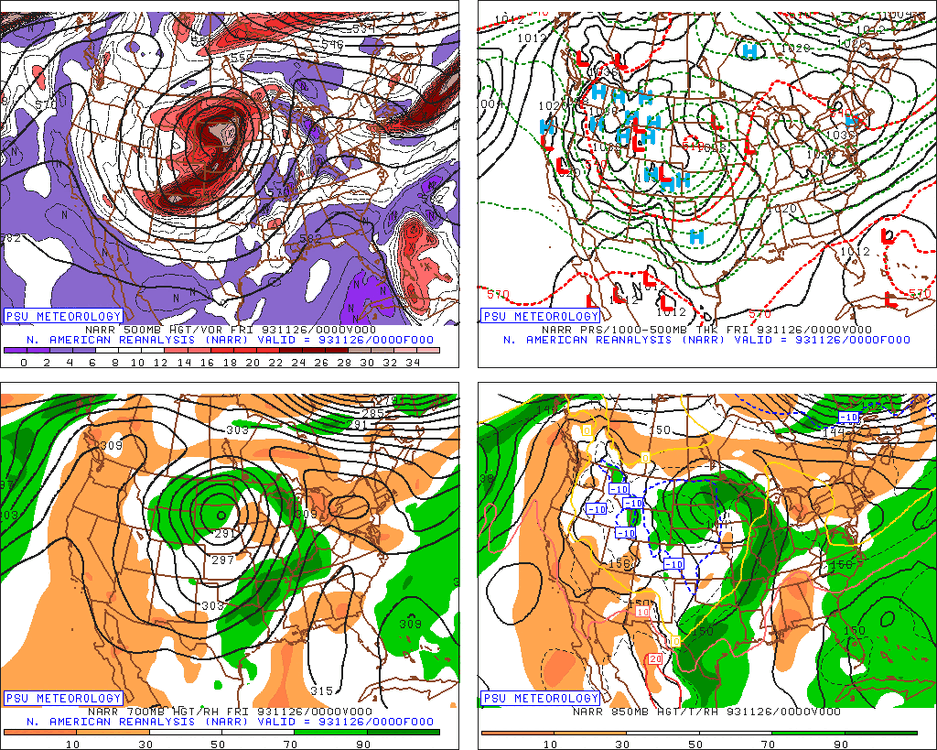
-
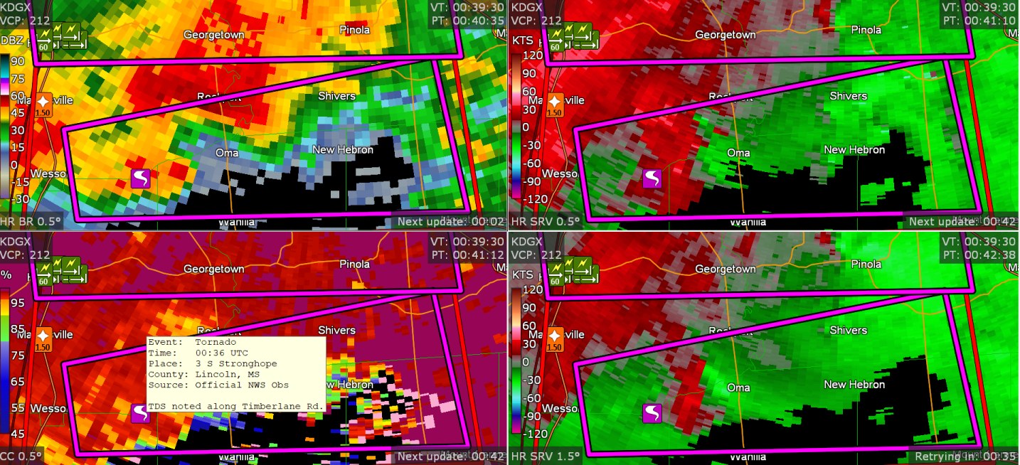
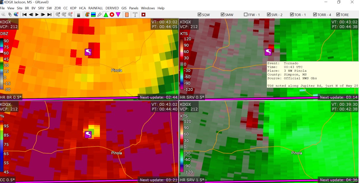
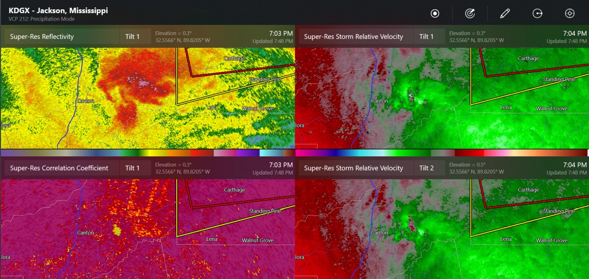
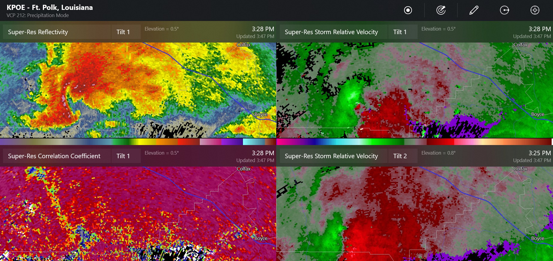
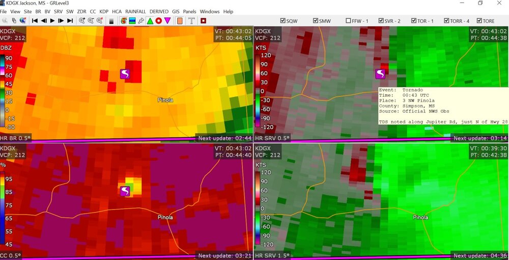
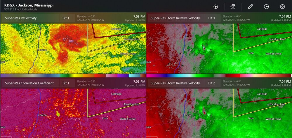
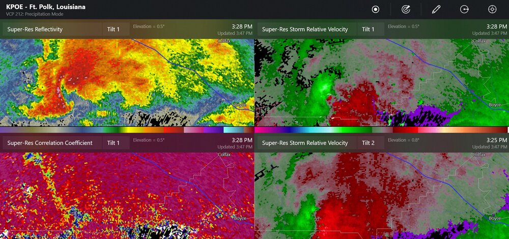
these are, I believe, the confirmed tornadoes today

-
SPC update today, at 1730z, with 10% hatched for tornadoes and 30% for a small area for severe winds, 15% for hail.