Chinook
-
Posts
10,935 -
Joined
-
Last visited
Content Type
Profiles
Blogs
Forums
American Weather
Media Demo
Store
Gallery
Everything posted by Chinook
-
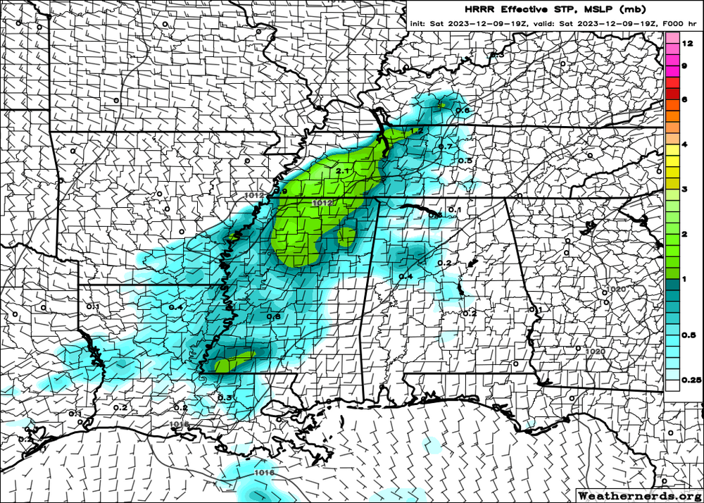
STP around the start of the event
-
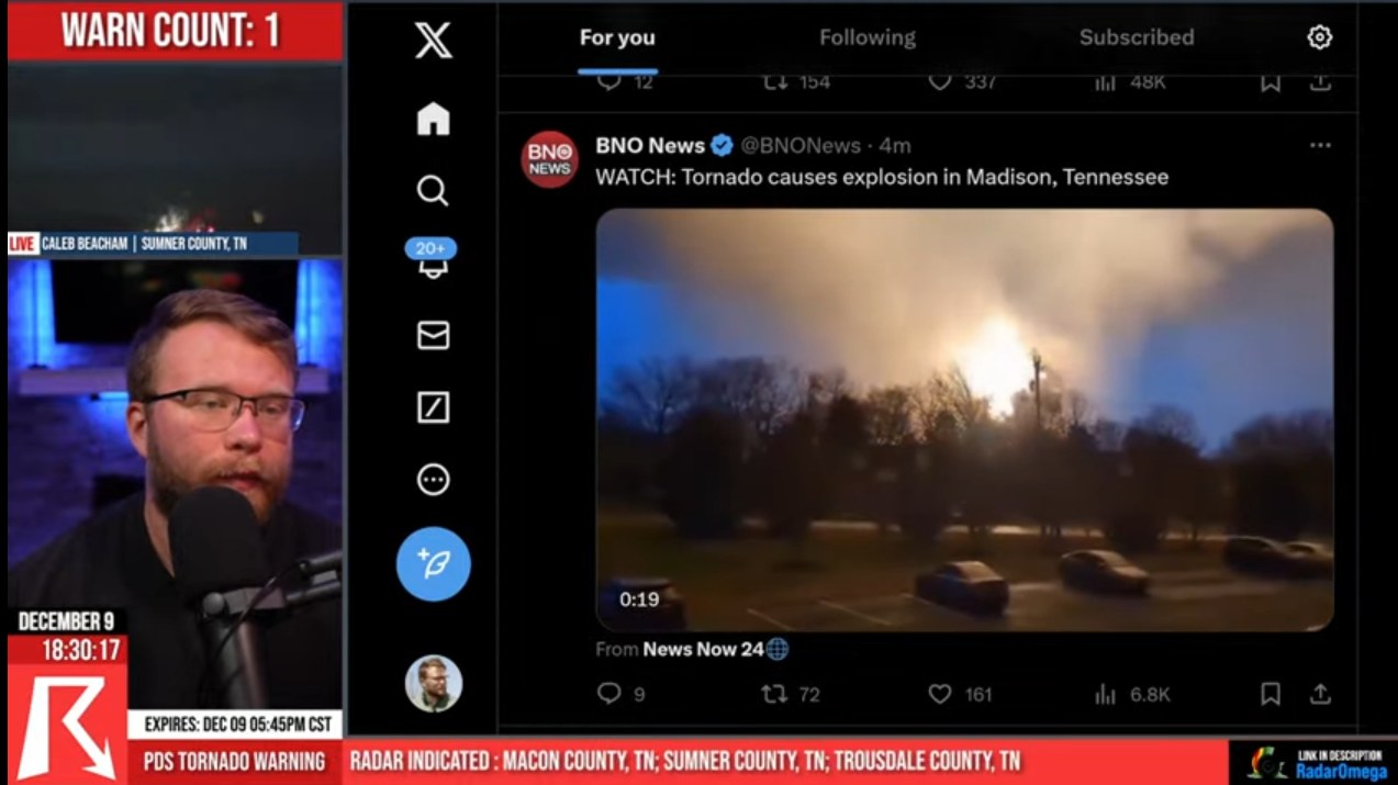
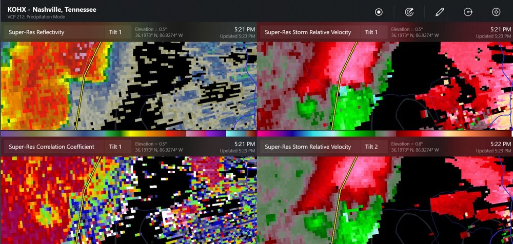
tornado hit something that exploded with fire. It's most likely the start of the Hendersonville-Gallatin tornado, before Hendersonville near I-65 in the Nashville metro area.

-
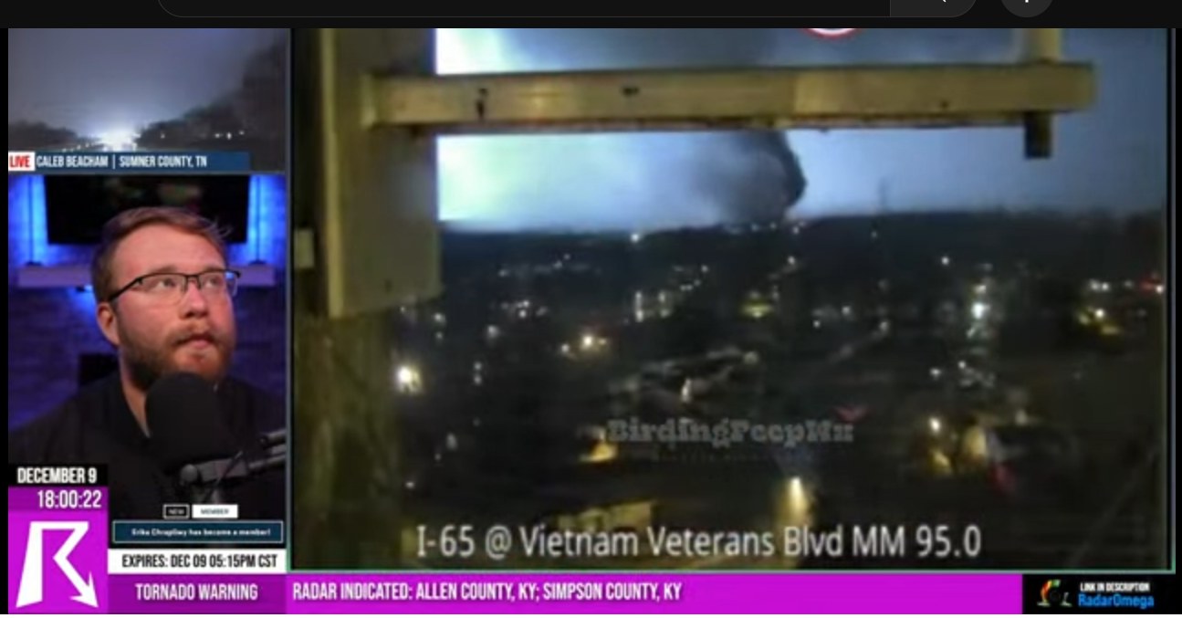
tornado video from Hendersonville

-
I think we have big debris at Hendersonville
-
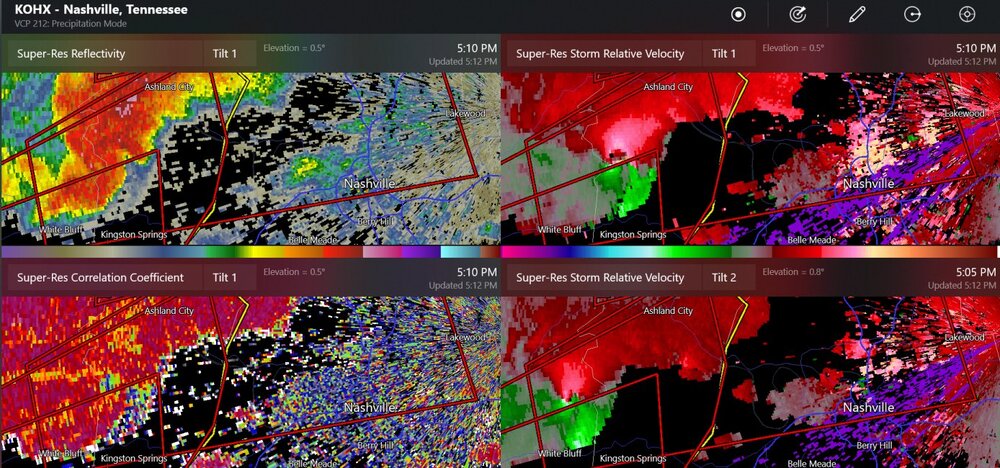
significant debris shown south and east of Springfield Tennessee
-
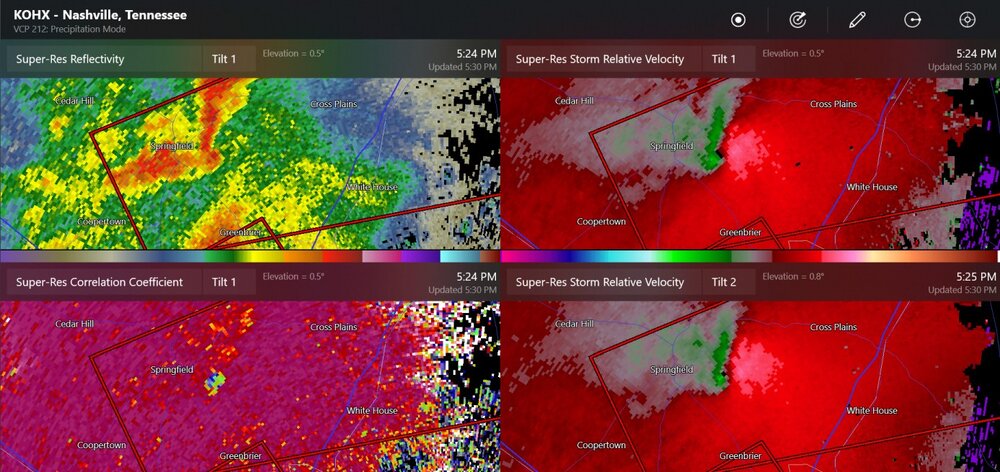
double rotation
-
tornado reported near Springfield, Tennessee
-
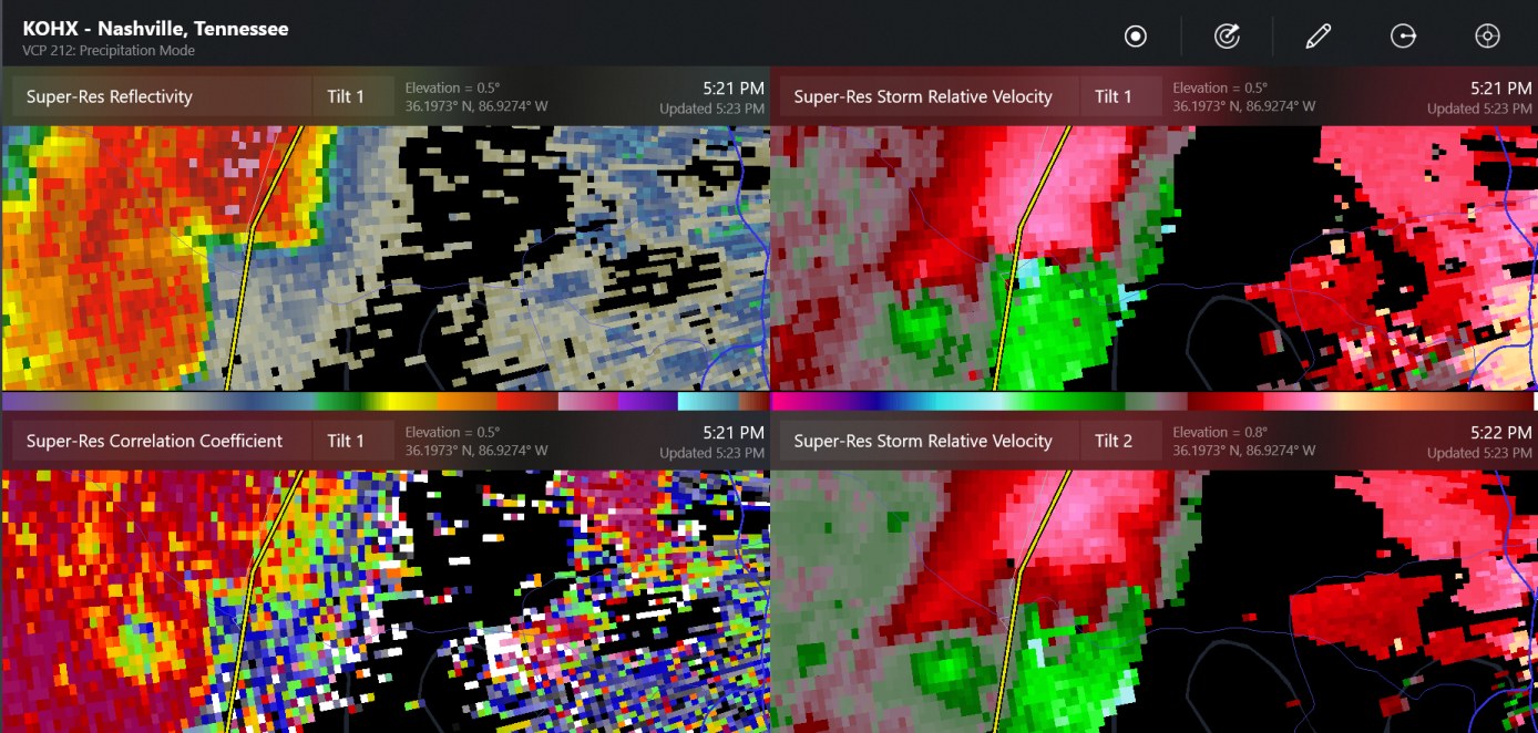
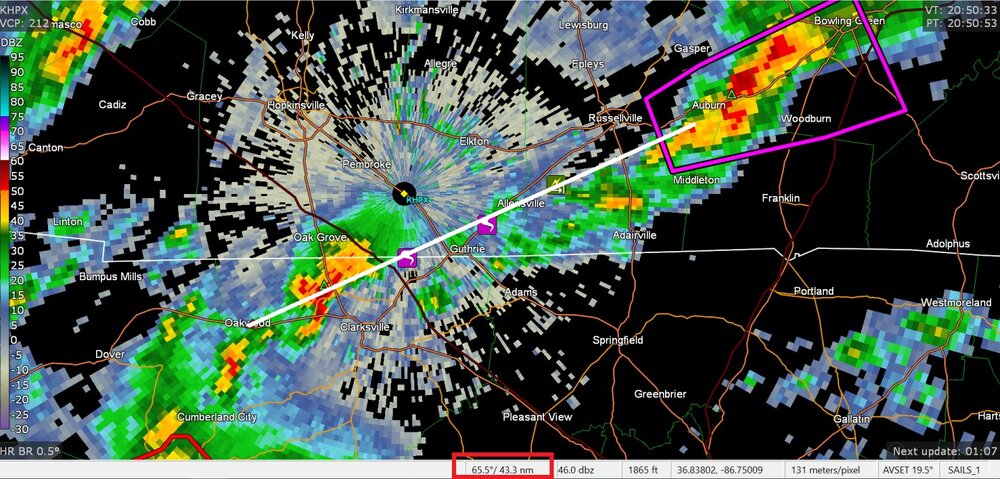
tornado debris for sure south of Ashland City now
-
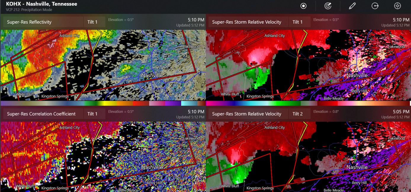
new confirmed tornado here, about 24 miles west of Nashville
-
50 mile mesocylone track - how long was the tornado?
-
The debris signature isn't showing up anymore
-
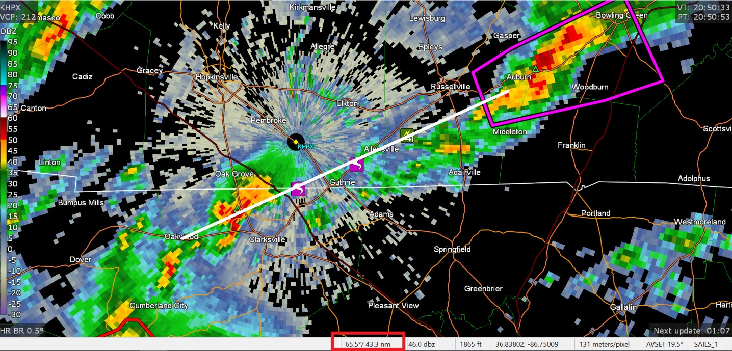
I have made some posts in Central/Western subforum. The tornadic storm has likely gone from Oakwood Tennessee to Auburn Kentucky almost.
-
it keeps going
-
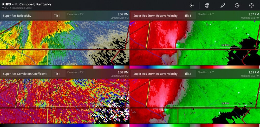
large debris signature near Guthrie Kentucky, probably in a rural area right now
-
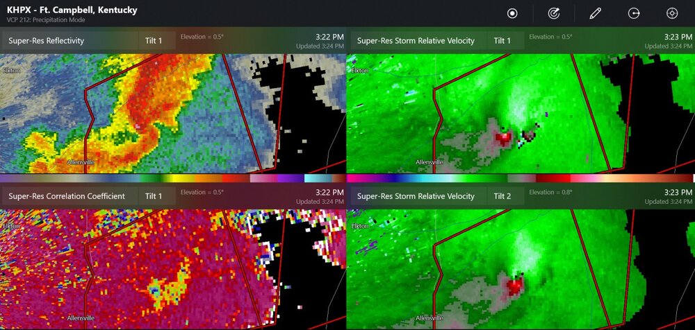
possible tornado path is 12 miles already
-
ongoing tornado
-
tornadoes reported close to the Hopkinsville Kentucky radar site
-
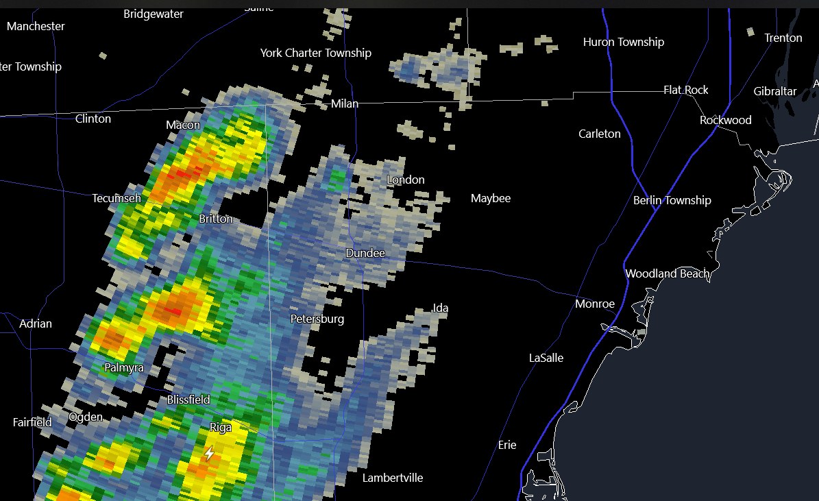
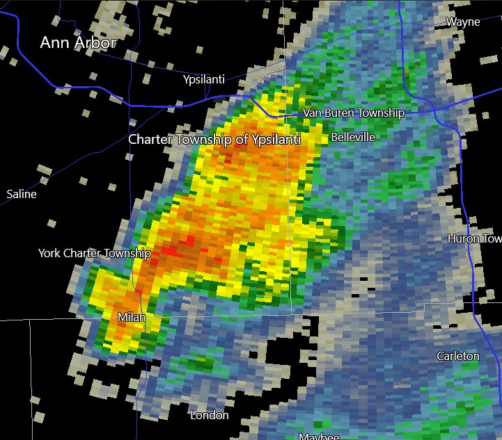
50dbz coming in towards Detroit Metro Airport
-
It's like it's trying to be a supercell. Oh well, not that much CAPE. Some c-g lightning in Ohio!
-
It's 60 degrees in December, before noon. Of course the cold front will be coming soon, but we may be still in the 50's up to 7:00PM. Models say winds are 47kt at 925mb. Toledo has measured max wind gusts to 33knots/38mph
-

Mountain West Discussion- cool season '23-24
Chinook replied to mayjawintastawm's topic in Central/Western States
I think there are just a few buildings and the weather station on Colorado Mines Peak, which might be 500ft above the Berthoud Pass parking lot and a few hundred feet east of it. It seems like this would be difficult to see from all angles. And how do they shovel snow at these things?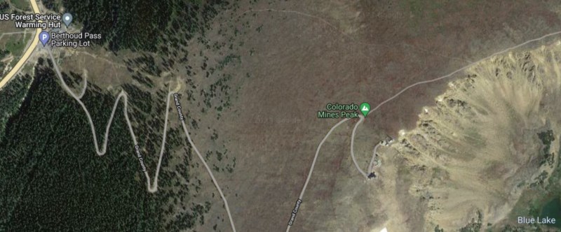
-
Mountain West Discussion- cool season '23-24
Chinook replied to mayjawintastawm's topic in Central/Western States
this what I posted on Great Lakes/Ohio Valley a couple of days ago. It's after I was explaining how I made a snowball in June 2022 at Cameron Pass before I left. -
Mountain West Discussion- cool season '23-24
Chinook replied to mayjawintastawm's topic in Central/Western States
This is not a way to transport in the cold air
-
The models kind of suck. Look back at the 18z GFS from Monday, hour 126-132, high snow rates near Chicago.. then.. now. Even the ECMWF from 00z Tuesday (almost the same data) had snow for Chicago at 132hr.
-
Mountain West Discussion- cool season '23-24
Chinook replied to mayjawintastawm's topic in Central/Western States
It looks like it was in the 50's to even the 70's on the mid to northern plains.