

Chinook
-
Posts
10,934 -
Joined
-
Last visited
Content Type
Profiles
Blogs
Forums
American Weather
Media Demo
Store
Gallery
Everything posted by Chinook
-
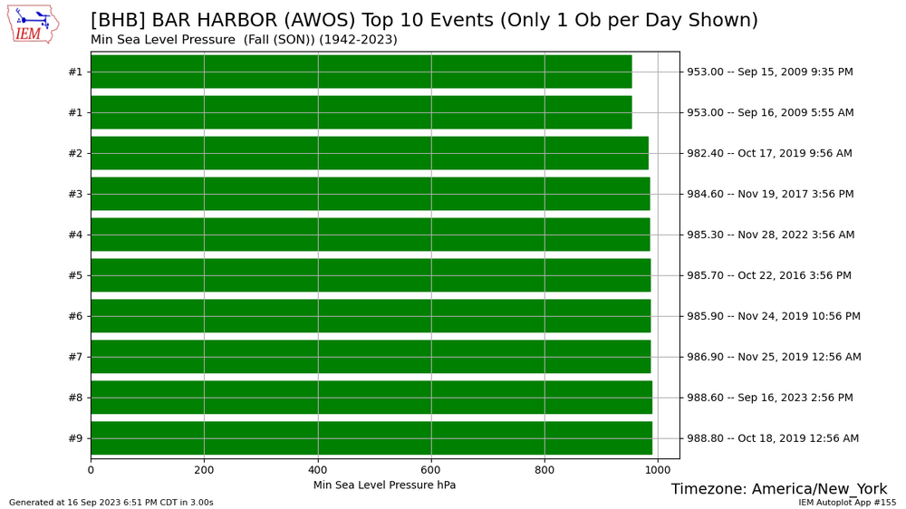
lowest pressures in the fall season, Bar Harbor. Sep 15-16 2009 is not correct data, as the pressure was about 1010mb.
-
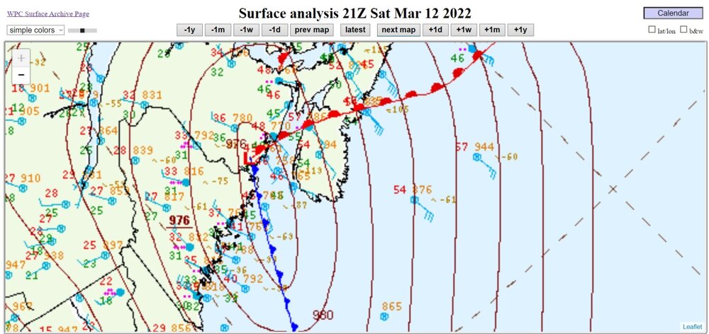
Did you know? January 5, 2018 had a lower pressure at the same spot at TS Lee right now. It was a blizzard with 949mb at the mouth of the Bay of Fundy, January 5, 2018, 03z. Also, February 8, 2020, 00z had 966mb with rain/snow. how about 968mb with rain/snow in April? non-occluded low at 976mb last year, March

-
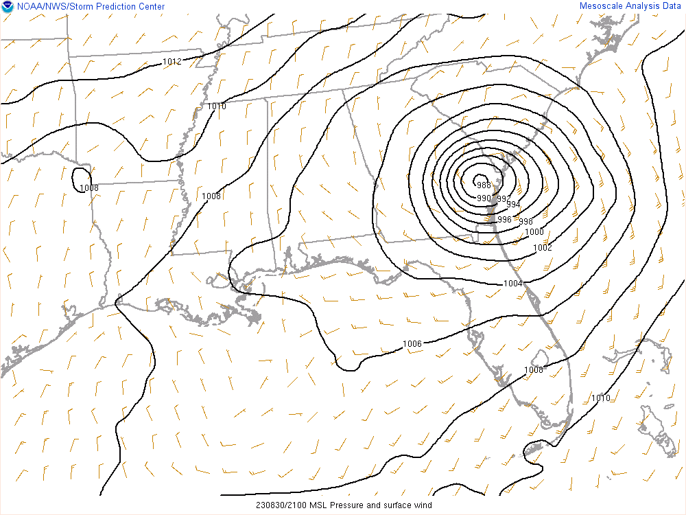
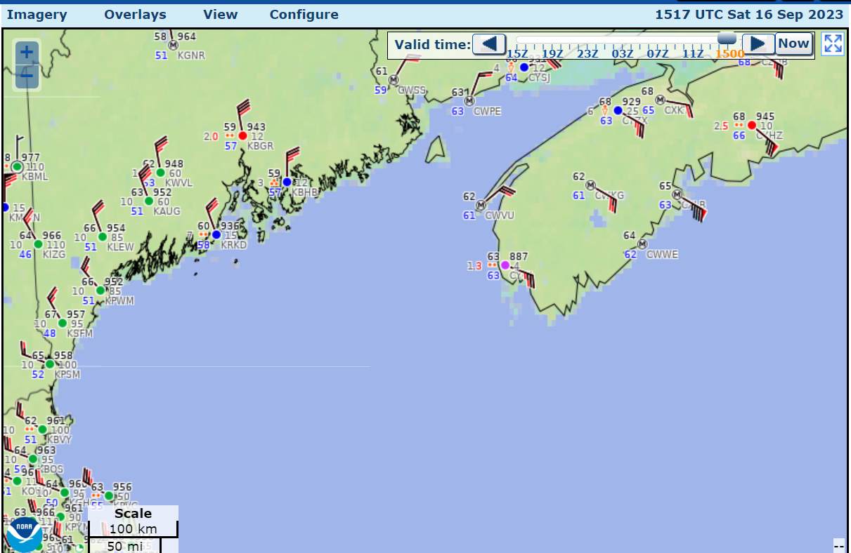
It would appear that the low is at the mouth of the Bay of Fundy


-
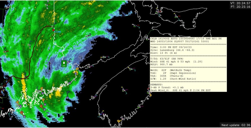
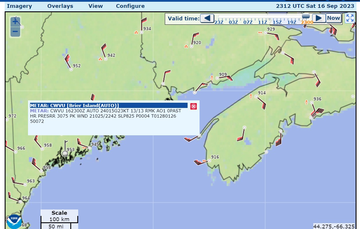
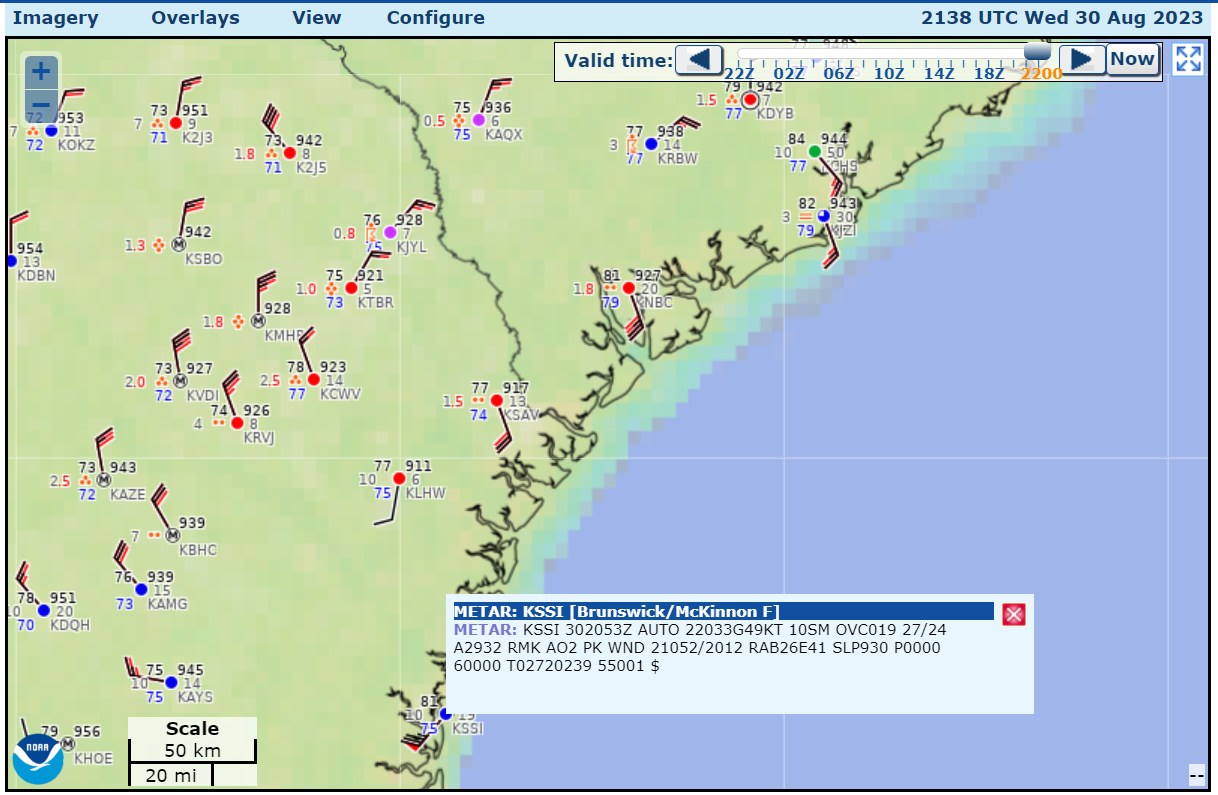
wind gusts to 61mph (53 kt)
-
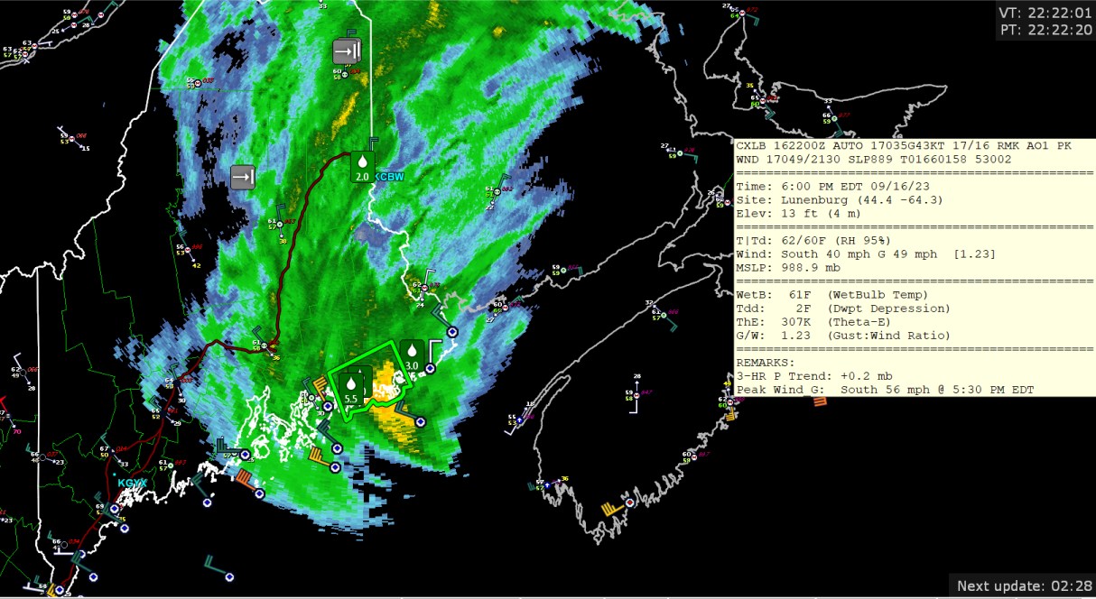
974.2 mb at Yarmouth Nova Scotia, so probably bottoming out what that airport will measure.
-
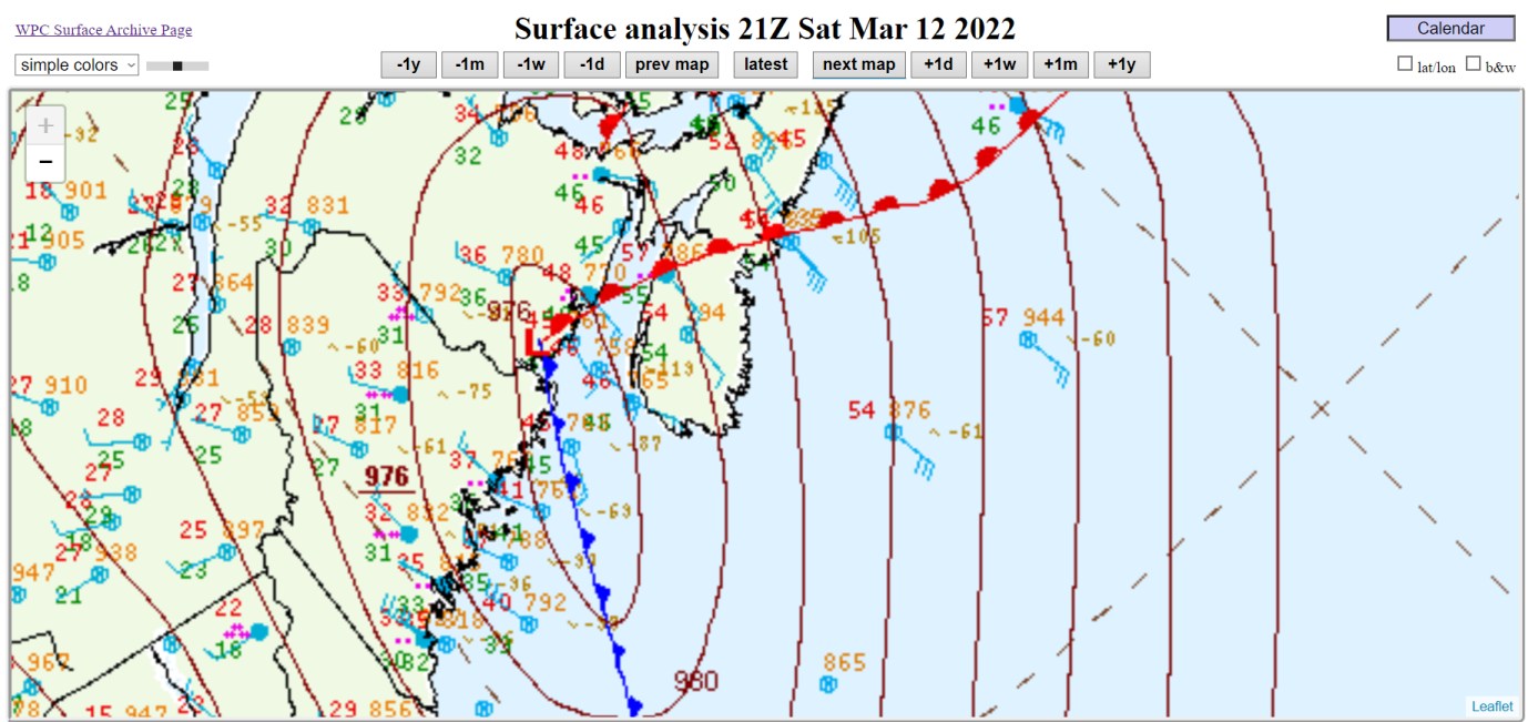
976 mb
-
gusting to 49 knot at Mitinicus Island Maine (part of the buoy system, CMAN observation)
-
Here are current observations. 43 knots gusting to 53 knots at Lunenberg Nova Scotia, gust to 58 knot at Halifax

-
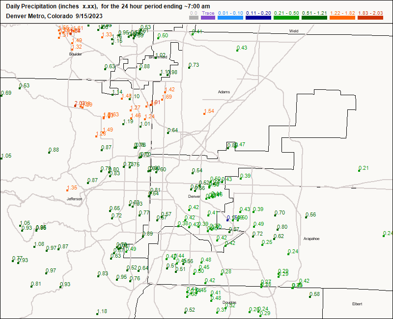
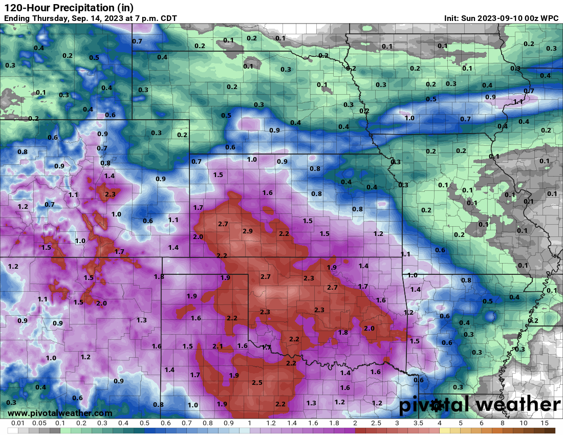
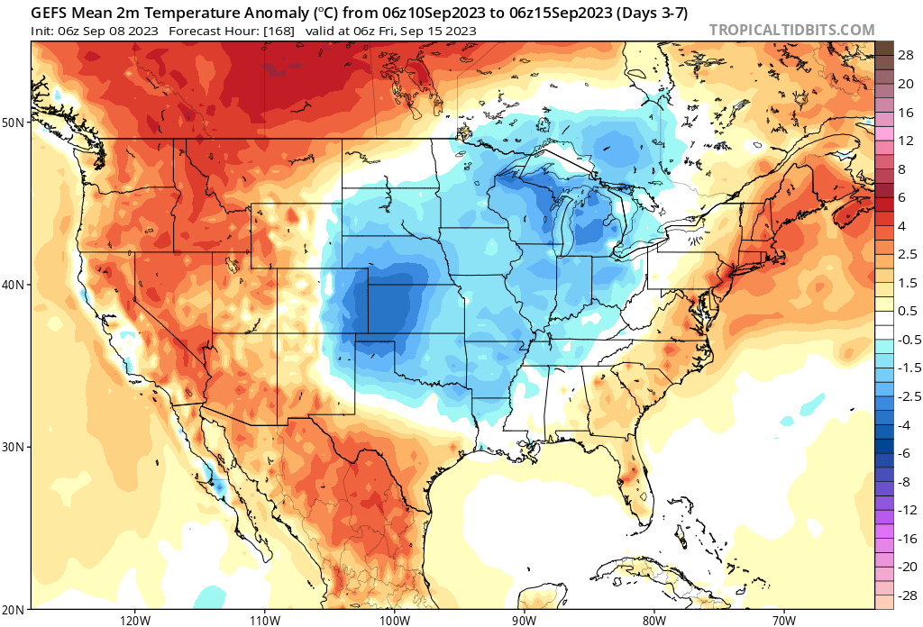
Rainfall in the Denver area maxed out where there was a narrow area of thunderstorms across the north metro, maybe with hail. Mayjawintastawm, so you are saying the first snow is in September? I would think you are thinking of October.
-
Denver: chance of rain, all days
-
A long time ago, I remember a "weather weenie" run of the ECMWF that said that Hurricane Sandy would come into the coast. Then, a week later, it was a $70 billion disaster. And the WPC invented the term "Frankenstorm" but then regretted it! Note: Hurricane Lee recent recon says 962mb and maybe 80 kt at the surface, so the NHC value of 95 kt is generous.
-
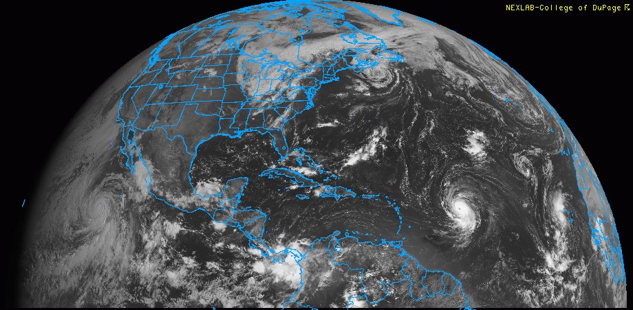
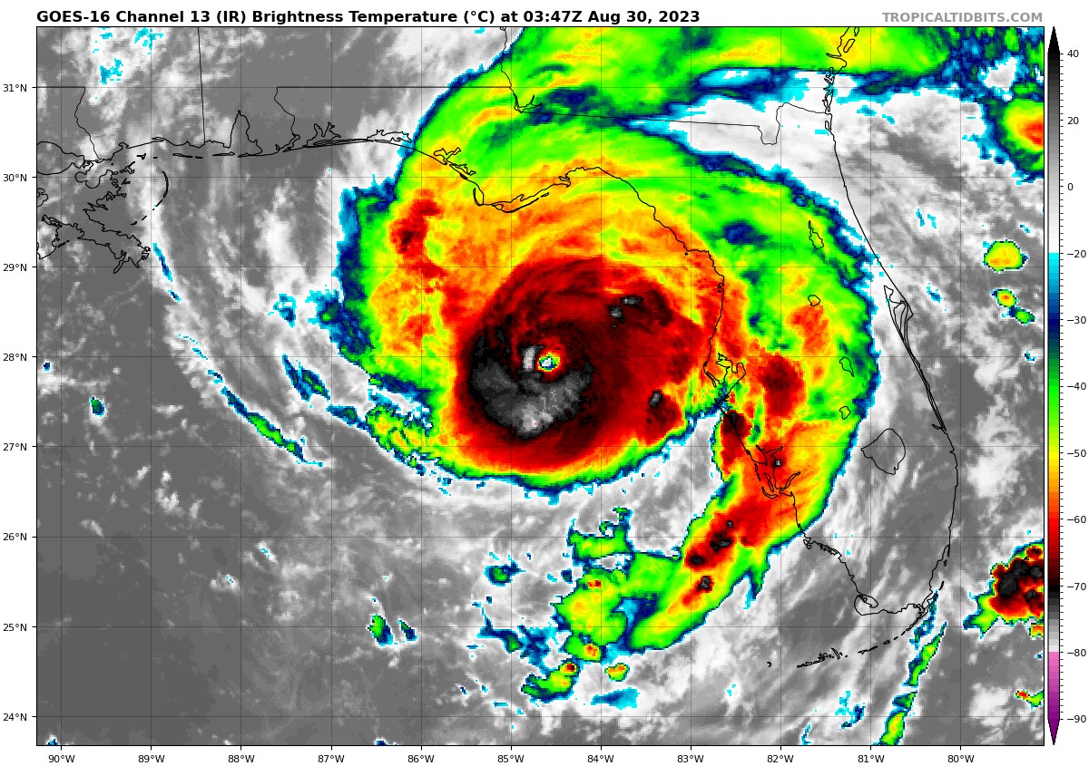
Here's a great full-disk satellite view of major hurricanes Lee and Jova (1500z on September 7th)
-
There's not a whole lot of storms that ever reach 140 knots. I guess we will see if it can truly recover to the 120kt as forecast by the NHC at this time. I would say that the current ongoing recon pass has about 95-97kt of flight level winds, and 960 mb. It honestly it may be about 87 knots for the surface winds, and the 960 is impressive, but obviously not the 930mb and such. So yeah, a long way downward form Thursday night.
-
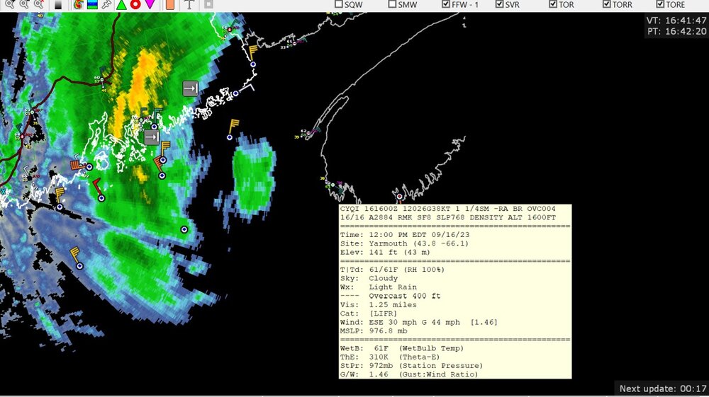
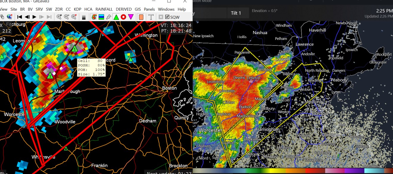
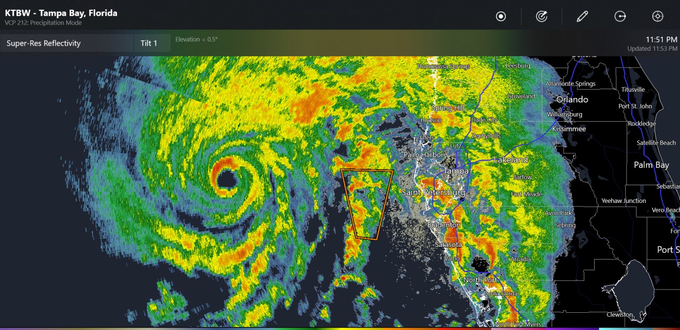
large hail/heavy rain detected by radar west of Boston

-

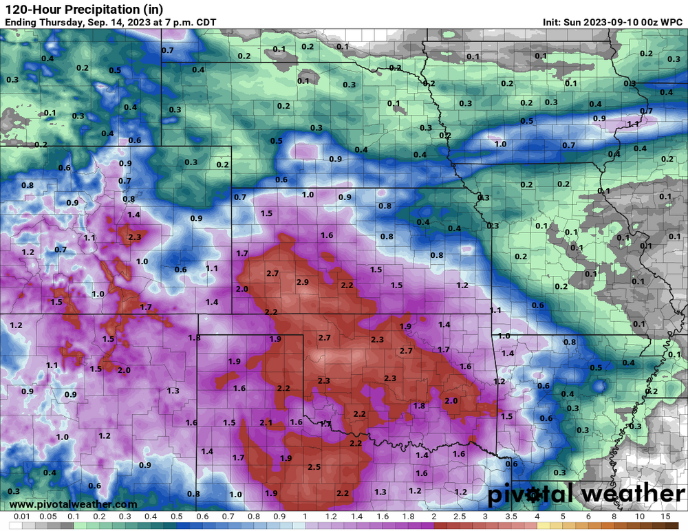
Texas/Oklahoma 2023 Obs and Discussion
Chinook replied to Ed, snow and hurricane fan's topic in Central/Western States
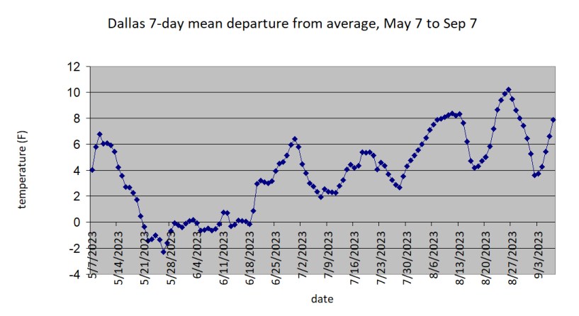
Some of our days this week will be the first below-normal five-day period for Oklahoma and Arkansas for a long time. Dallas hasn't had a week below normal since June 18th, considering all running 7-day periods
-
2023 Mid-Atlantic Severe Wx Thread (General Discussion)
Chinook replied to Kmlwx's topic in Mid Atlantic
There were 426 storm reports from the slight risk! Did all of you guys in the Mid Atlantic Discussion thread do a spotter report or something? Because I know several of you live in Maryland. And it would appear there will be more severe reports in the Northeast corridor today.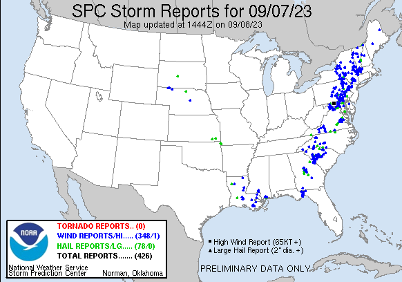
-
wow, 70 kt at 5:00AM 90 kt at 11:00AM and 140 kt at 11:00PM. So, yeah, I think your comment is about accurate. that's a +70 kt in 18 hr. I can't think of anything like that. I think Hurricane Andrew did something crazy like this in 1992 but it may very well have been many more hours. (Edit: just read the post about Hurricane Wilma.)
-
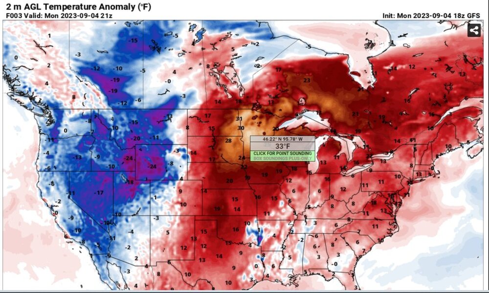
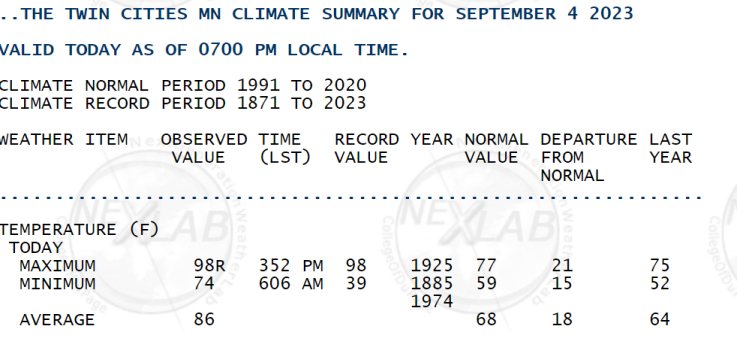
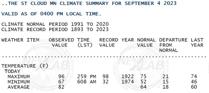
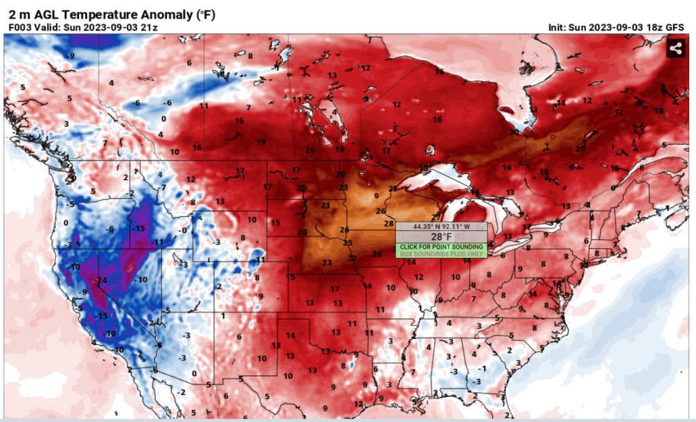
record-tying heat wave for Minneapolis

-
wow, I didn't even think of it, but you can barely make out a supercell shape, even though the yellow/orange/red kind of dominates the image
-
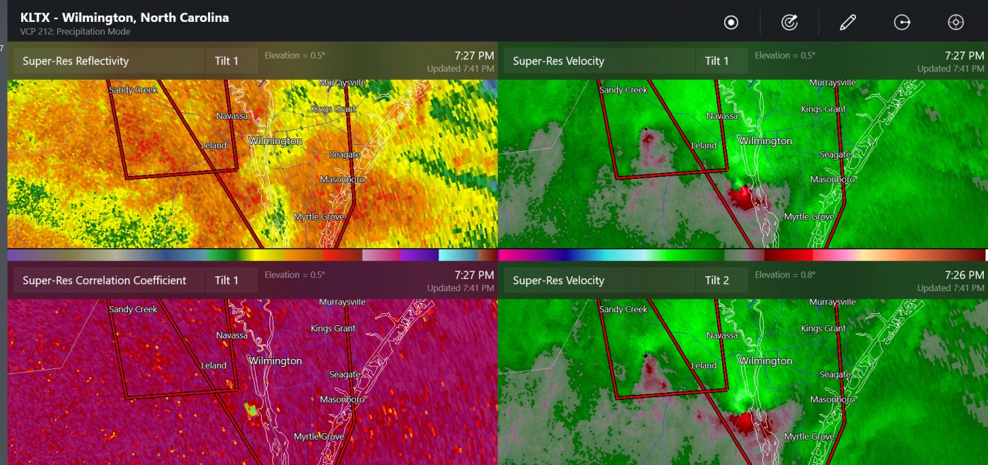
confirmed tornado near Wilmington NC

-
This isn't very circular very more. Rectangular hurricane. Honestly I said that because the gap in the observations is a long rectangle. Well anyway, 988mb is still pretty low but believable as it has gone up about 48mb as a result of landfall and convergence.
-
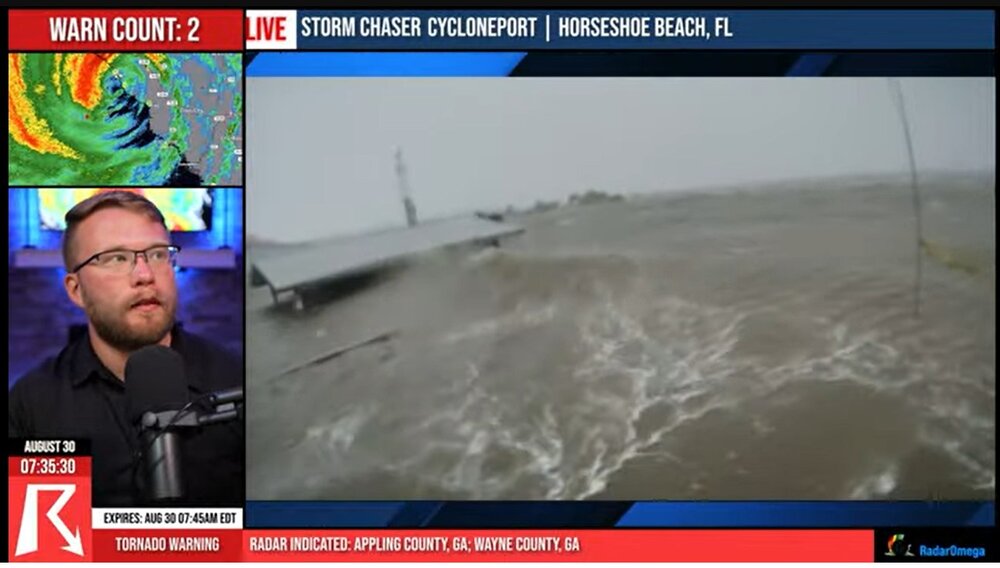
screen capture from Ryan Hall, with this wave at the roof of a small pavilion
-
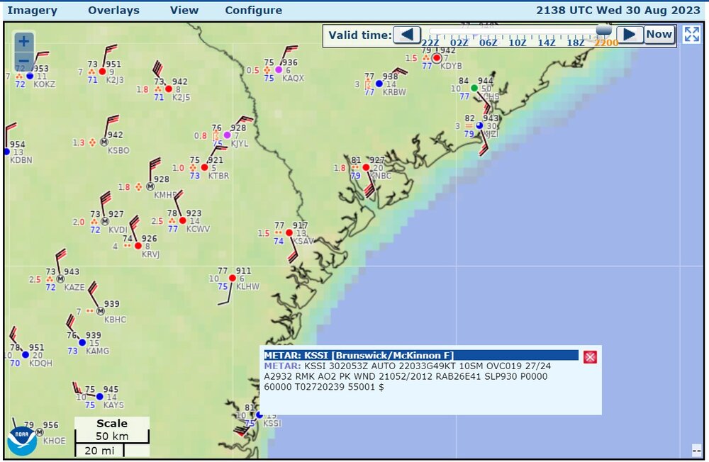
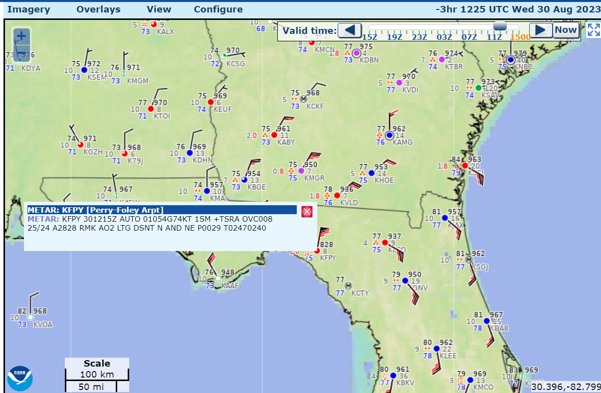
957.6mb measured, as the conversion of 28.28" on the altimeter
-
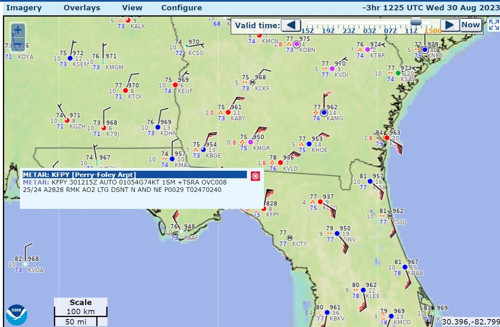
The hurricane must have gone very close to this buoy, but maybe not right on. Quick calculation says that this measured 972.5 mb.
.png.fe6158b475fa893b1464f3120e6a043e.png)
-
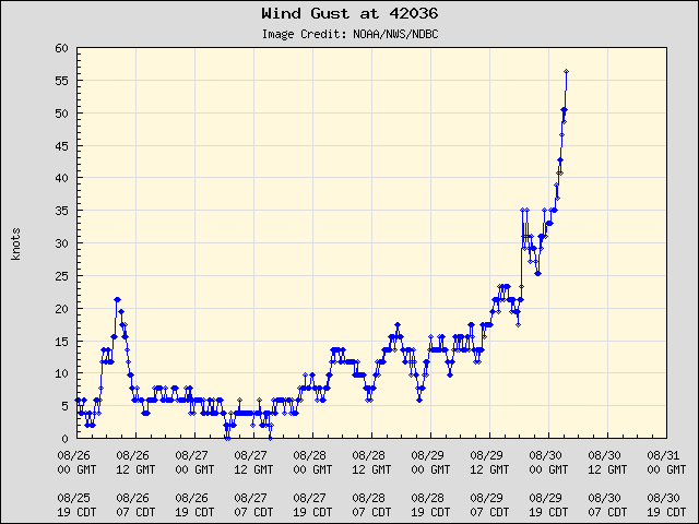
I wanted to post these before I fall asleep. The recon got over 101 kt at flight level, for three passes as shown on the time series. The last two passes show some asymmetry. One buoy north of the storm says (39 kt) 45mph gusting to (56 kt) 65mph (that's buoy 42036). So you might check this in about 1-2 hours to see if the buoy picks out the highest wind speeds or lowest pressures.


.thumb.png.1c1fd2b4ce00fcc24f88a7ebc1c7f5c1.png)
.png.58c72740e3086834ff90a8a0e785a73f.png)


.png.d06184e871b76a224cbd7eebcaebc587.png)