Chinook
-
Posts
10,935 -
Joined
-
Last visited
Content Type
Profiles
Blogs
Forums
American Weather
Media Demo
Store
Gallery
Everything posted by Chinook
-
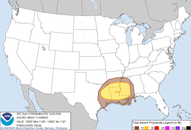
On Monday, 11/20, we will have our first tornado threat for the late fall/winter of 2023-2024. The SPC has a slight risk for 11/20, and a marginal for tomorrow (11/19). I expect a fairly high level of convection late in the day on 11/20, possibly around 00z. I'm sure weather forecasters will monitoring the weather much earlier than 00z. 500mb winds will be about 65 knots in Louisiana.

-
I am watching Washington Vs Oregon State at Corvallis right now. There is quite a bit of rain. There were two fumbles within about a minute, if I remember correctly.
-
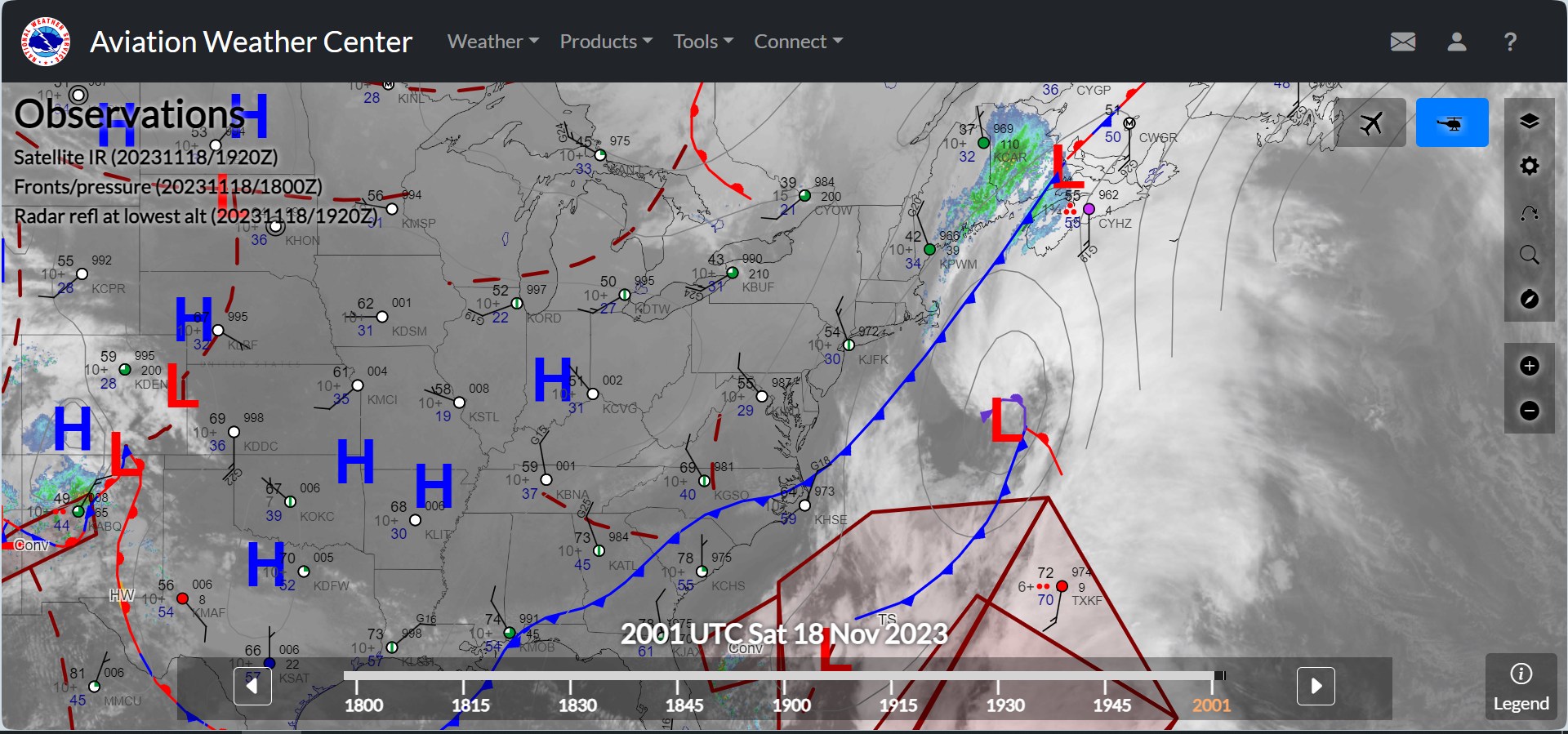
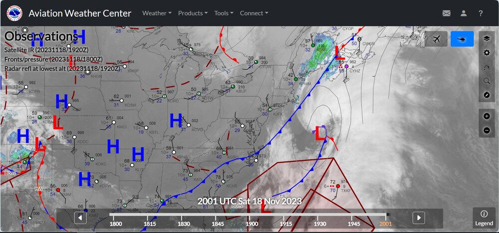
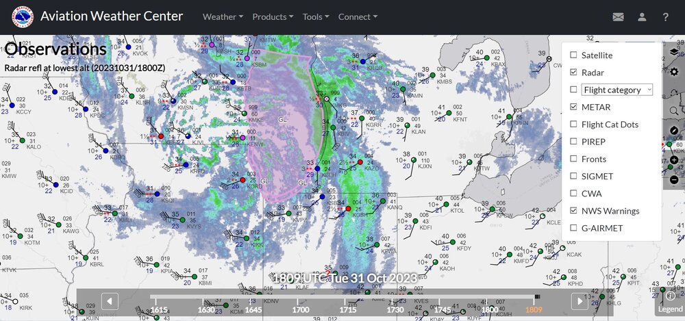
For those who like to track the weather with surface observations: The Aviation Weather Center has upgraded its interface for showing surface observations, with fronts, SLP, radar, satellite, and other related overlays
-
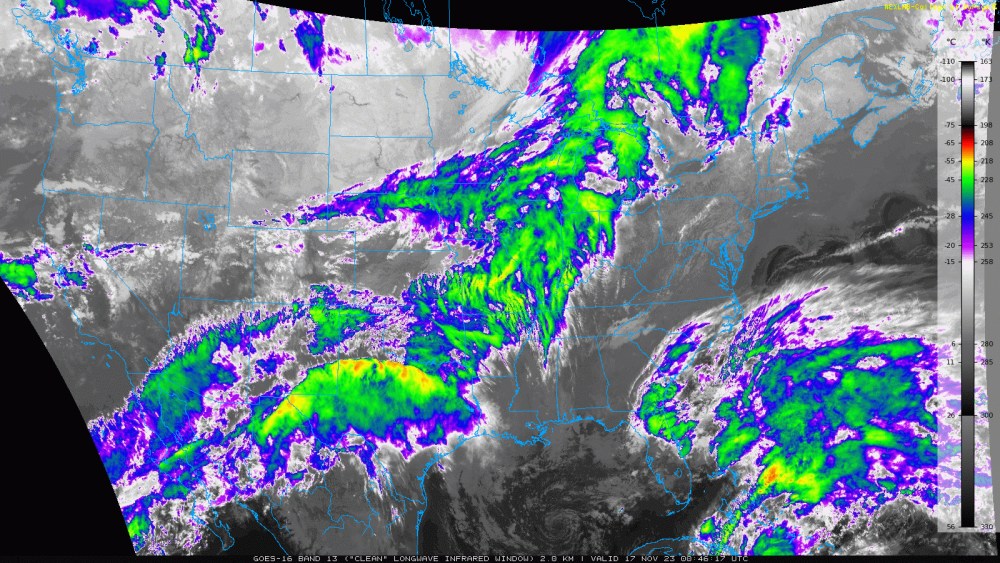
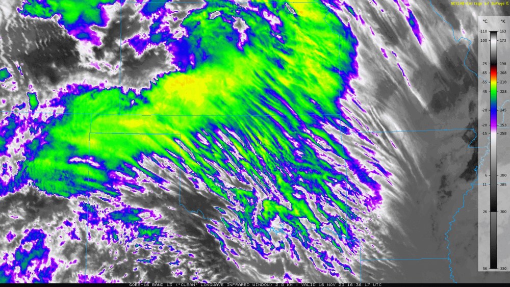
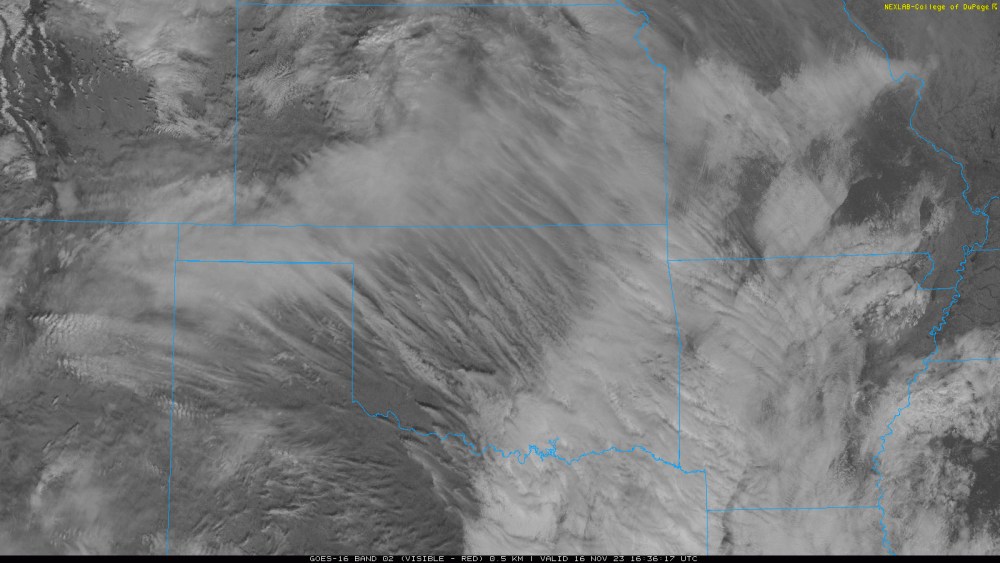
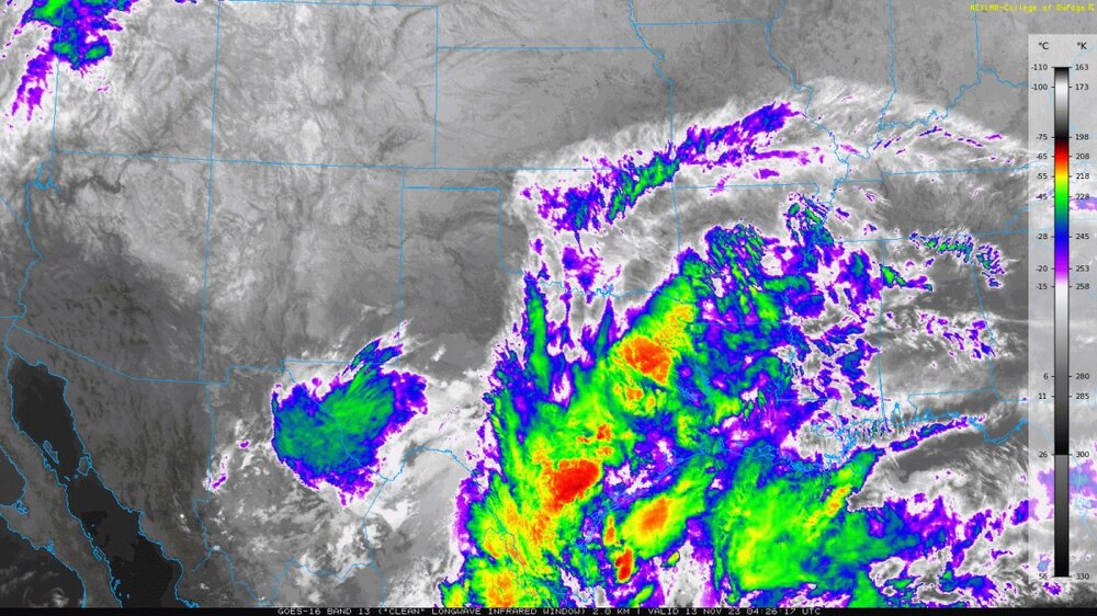
Here are two satellite pictures of the southern Plains today. I think this is called transverse banding of cirrus clouds. There have been a lot of new cloud developments today across the country today. A complex jet stream pattern and cold front are pushing into the Plains
-
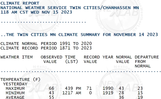
Today was quite warm in the mid to northern Plains, up to 23 degrees above average. Many of the recent days have been 60-70 in the mid-Plains. Cheyenne at 6100 feet above sea level was not far from daily high temperature records recently. Rapid City SD had a high 71 today, and a low of 27. The 71 was only 3 degrees lower than the daily record, 74 degrees. As you can imagine, very low moisture allowed the temperature to fall to 27. Yesterday, Minneapolis had a high of 66, compared to a record daily high of 71.
-
Detroit Metro was high 62, low 31. So Ann Arbor had a quick dip in temperatures below 30 that many areas didn't exactly get. I got used to this sort of weather out West with fairly typical temperature swings with dew points in the 20's and many ideal radiational conditions. From areas of Loveland I could see a smaller mountain north of Fort Collins over 21 miles away, down to the far-off Indian Peaks, well south of Long's Peak, 35-50 miles

-
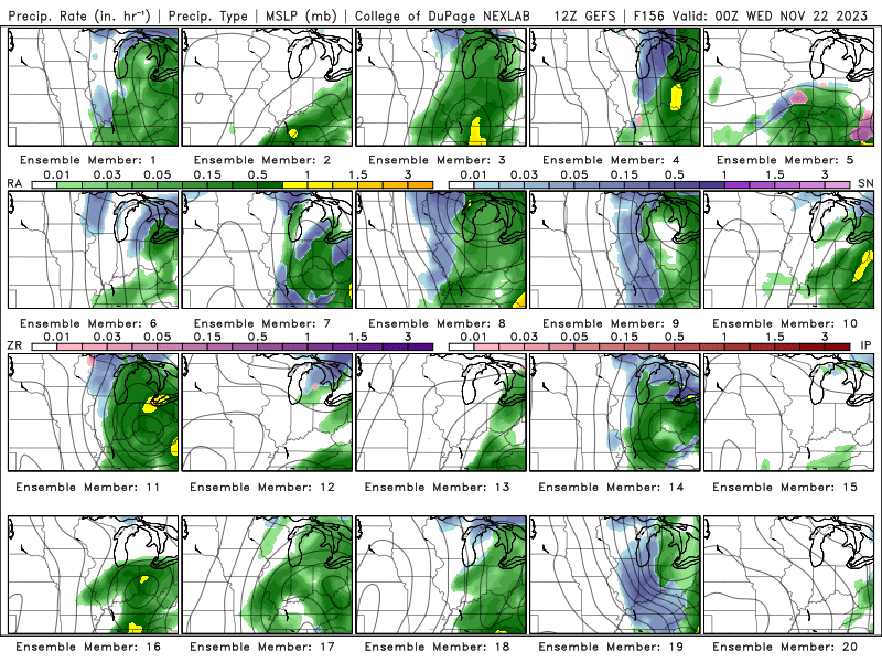
Shown below are GFS ensemble members SLP/precip for two different hours well into the future. A strong jet stream will dive through the Rockies. There will be new trough and surface low in the southern Plains. The low pressure will lift northward to the GL/OV, but details on the SLP or rain coverage could change a lot. A few ensembles have snow for Chicago. At this time, almost no GFS ensemble members have over 2" for Chicago, and of course there's not much agreement on snow for the Upper Midwest. In my recent experiences, the surface temperature here is usually about 5 degrees above what the NWS forecasts a few days out. Maybe it's just the drought and warmer airmasses are a little stronger than the GFS thinks.
.png.985ed92e9a5e8f269aec970caf96250f.png)
-
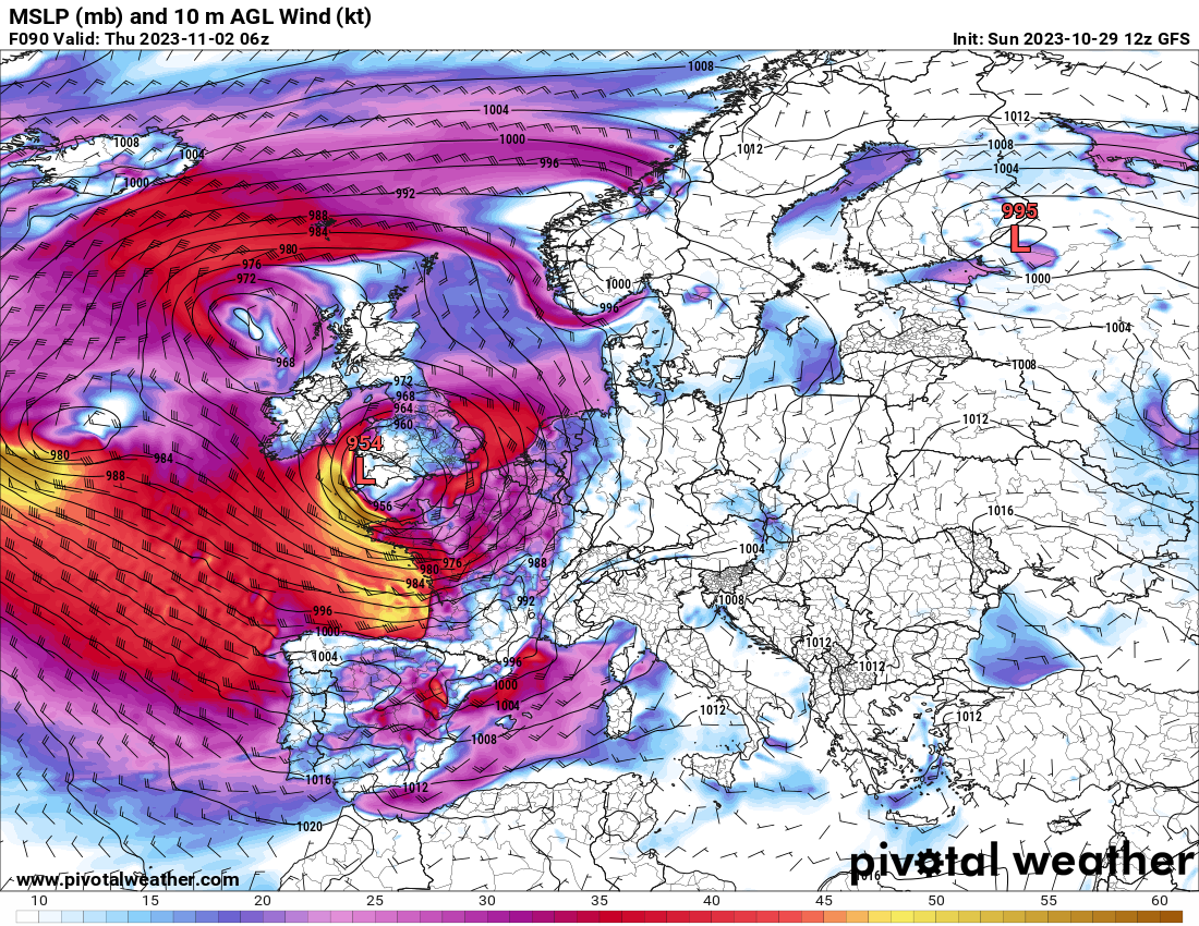
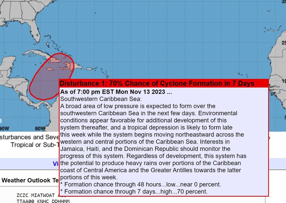
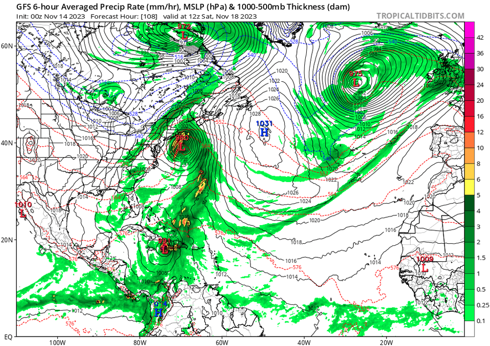
I am going to post this here because I don't know if the East Coasters are even discussing this. Look at this crazy weather pattern off the coast in a few days. There will be a possible hurricane or tropical storm moving into Haiti and moving northeastward. Currently there is subtropical jet based disturbance in the south. The low hangs around near Mobile Alabama, but weakens. Then the 500mb trough redevelops a low near Miami. This will ride northwards with the mild air and heavy rain and thunderstorms offshore. It goes to Cape Cod and New Brunswick. The cold air will phase into the system in Quebec for perhaps a heavy snow storm.
-
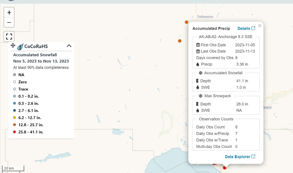
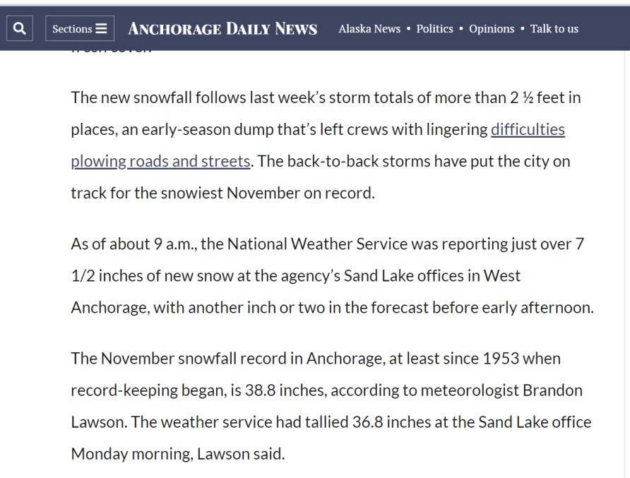
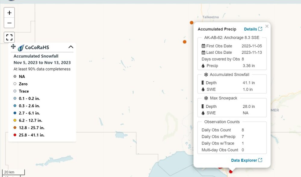
Unusually snowy weather hammered Anchorage. A strong low pressure hit the area from the south last week, and more snowy weather occurred after that low. As it says in the article, Anchorage reported 2.5 ft of snow last week. The CoCoRAHS plot says 41.1" in 8 days in SE Anchorage city.
-

Texas/Oklahoma 2023 Obs and Discussion
Chinook replied to Ed, snow and hurricane fan's topic in Central/Western States
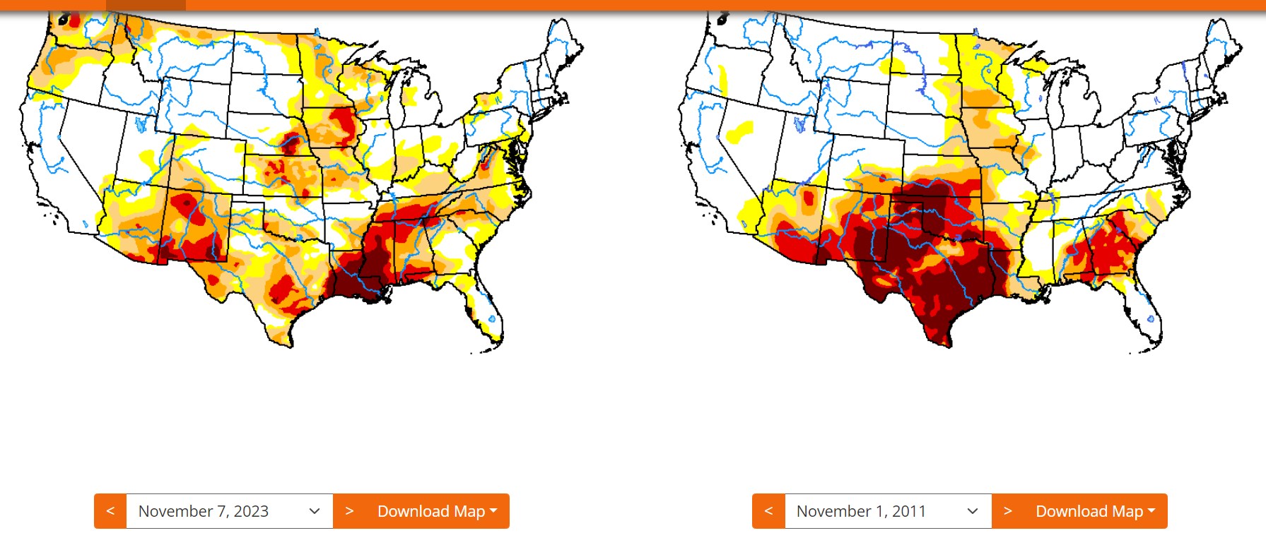
Finally the subtropical jet is starting to look like a real subtropical jet. There is a rain storm in the southern half of Texas and areas of the Mexican plateau tonight. This is the sort of thing that we are looking for to pick up with the El Nino. Really, this is the first incidence of an El Nino type storm for the southern USA. Obviously we are trying to break free from the grip of La Nina-based droughts in the South. Final posted image: compare this Drought Monitor to one from November 2011, after the La Nina of 2010-2011 (and continuing onward in 2011). In our current state, a minor La Nina held on for a long time, but it wasn't as strong as 2010-2011 winter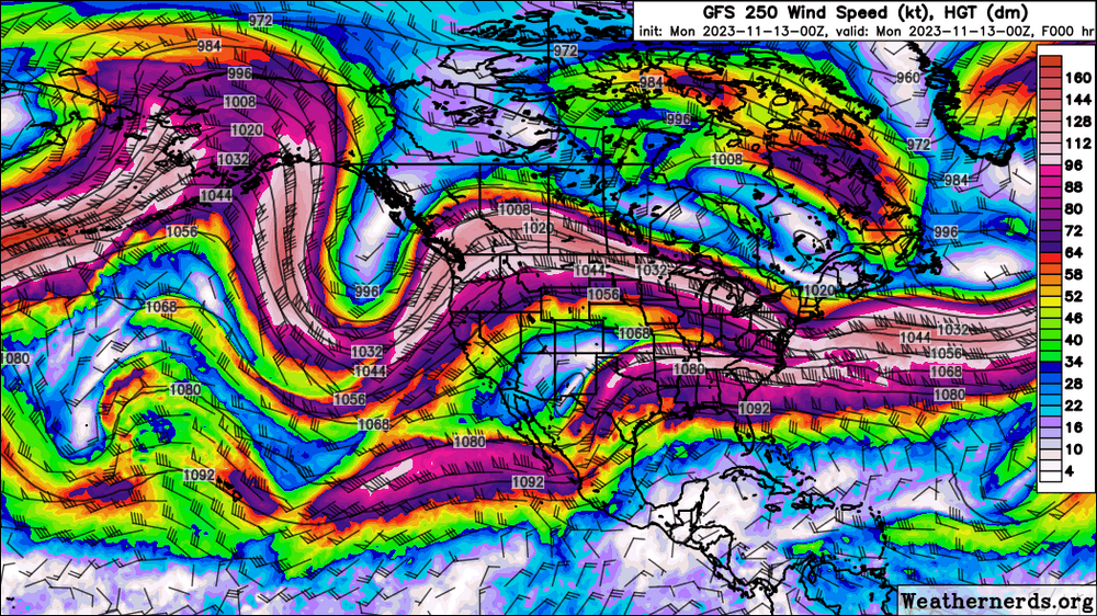

-
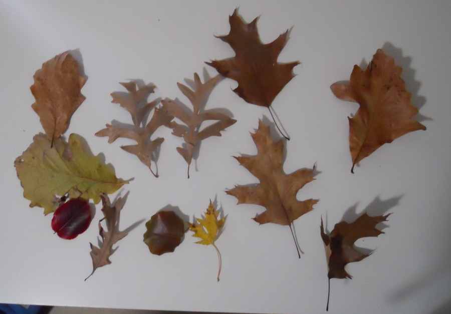
some types of oak leaves I never saw in Colorado, plus some others
-
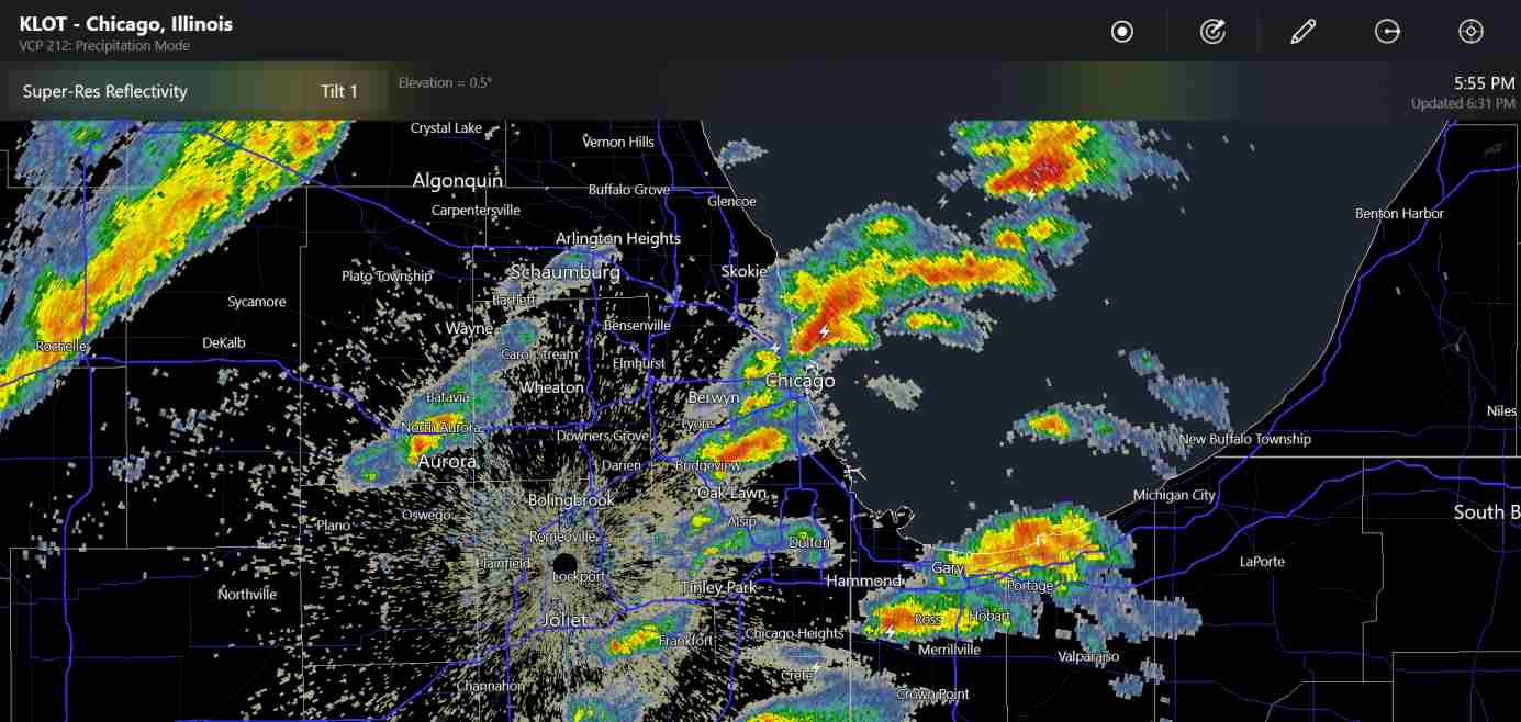
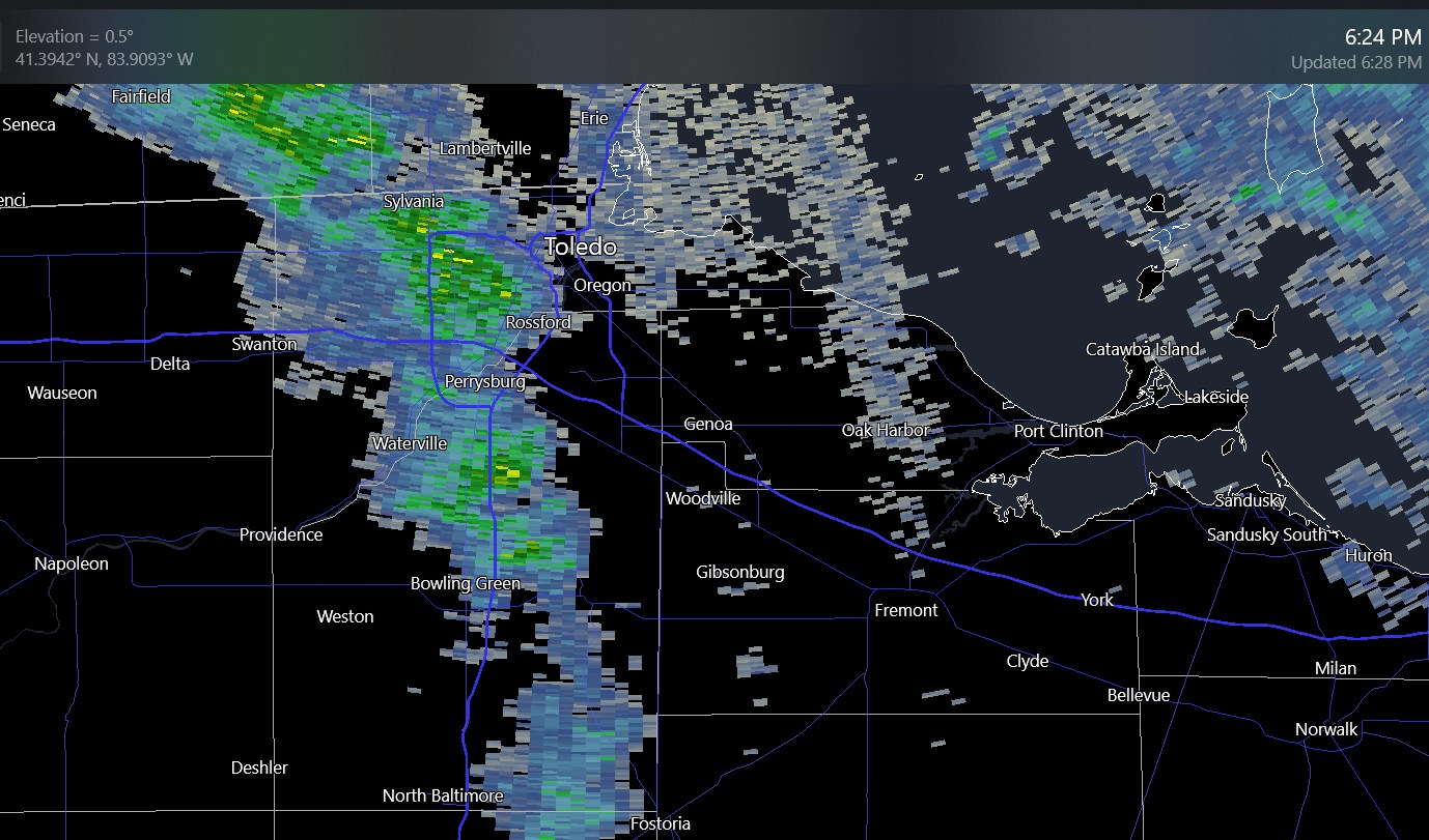
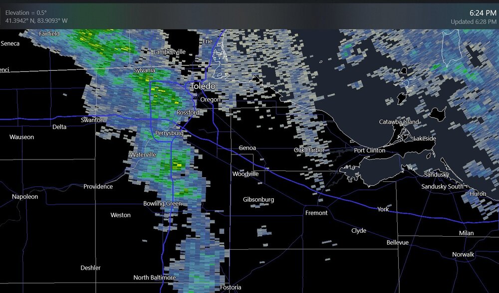
There have been scattered of rain showers with a couple of lightning bolts in Chicagoland. (you can see 5 bolt symbols on here if you look closely) It seems like they have the shape of supercells at times, but don't really have noticeable rotation on the SRV radar screen.

-
Mountain West Discussion- cool season '23-24
Chinook replied to mayjawintastawm's topic in Central/Western States
Today, temperatures in Colorado are like summer, but sunset at Fort Collins is at 4:52PM, considering the calculation expects a completely flat landscape. Here at my place in Ohio, sunset is at 5:23 Eastern. That feels different, as the solar noon time is pretty much a half hour later at all times. I think it's almost completely based off how the longitude lines up with your time zone. Keep checking the models for a light snow event later this week.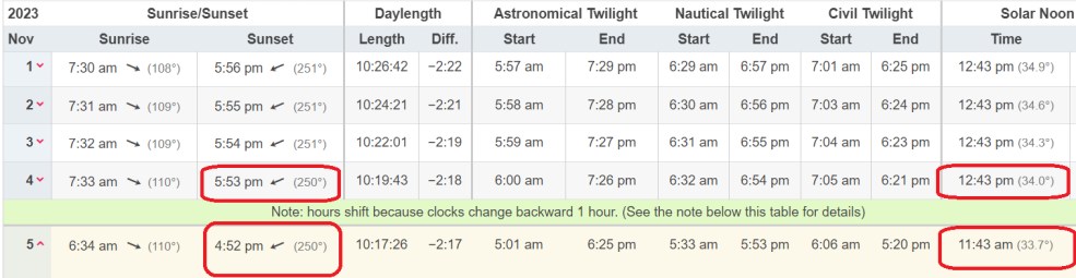
-
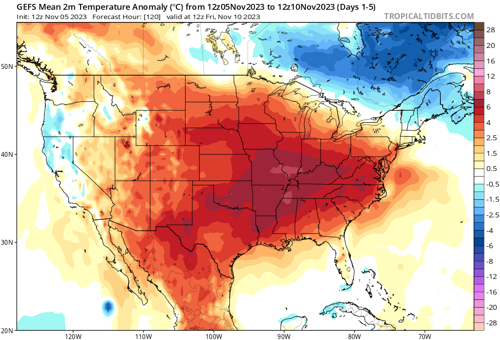
Where are the fantasy snowstorms now? For the GEFS temperature anomalies, there are very few 6-hour periods below normal for me, in the next 384 hours!

-
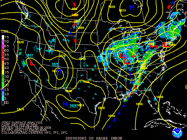
Anybody remember this snow storm? It sort of maxed out in and near Cedar Rapids to Madison Milwaukee on 2/6/2008

-
Mountain West Discussion- cool season '23-24
Chinook replied to mayjawintastawm's topic in Central/Western States
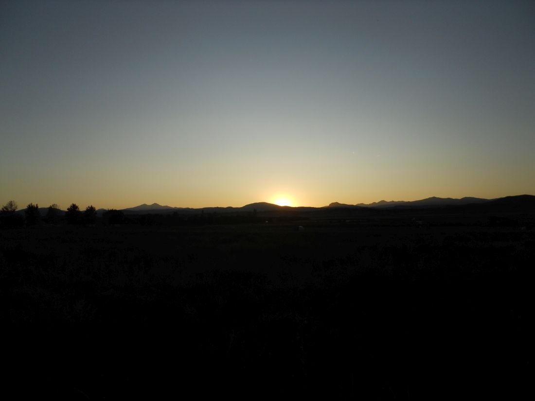
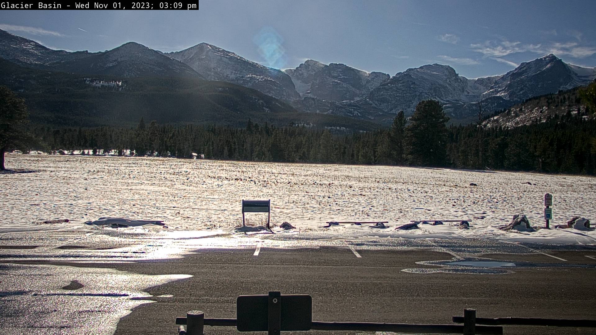
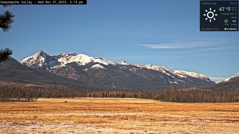
a good bit of snow has melted at 8000 ft as the RMNP pictures show. I guess the Alpine Visitor Center one hasn't updated in the afternoon. here are some beautiful RMNP pics today with lenticulars east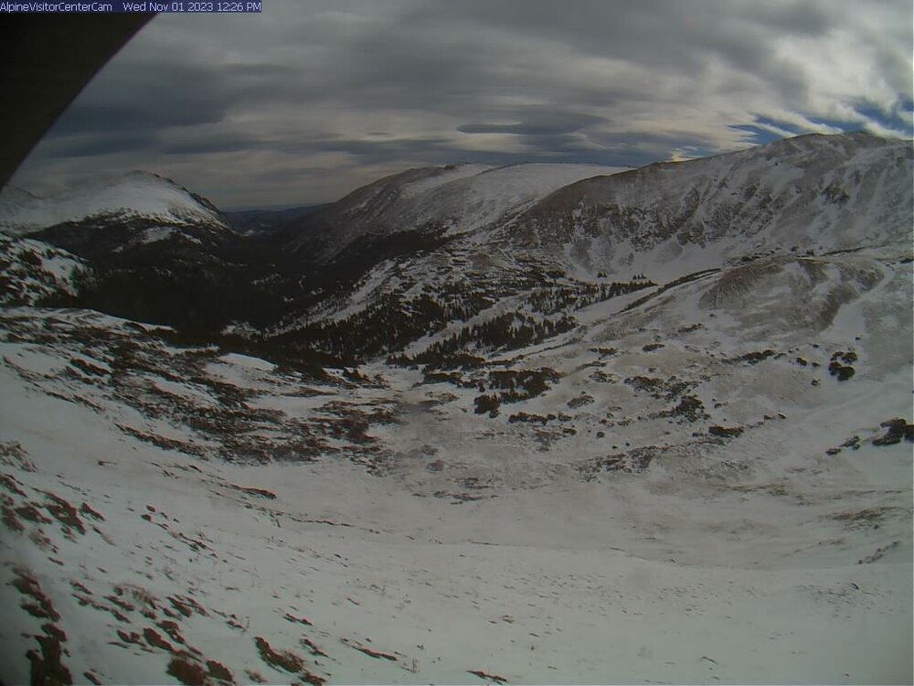

-
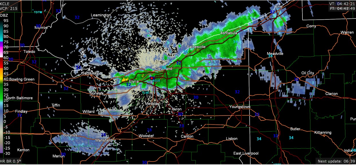
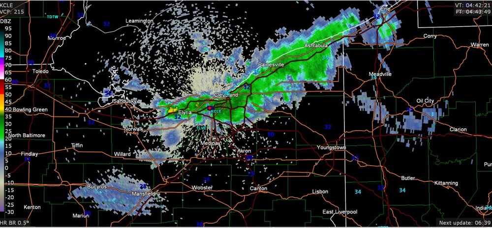
Some radar images from last night, including the much heavier snow in and around Cleveland. As for me, got about 0.1" or better on grass that stayed until the morning.
-
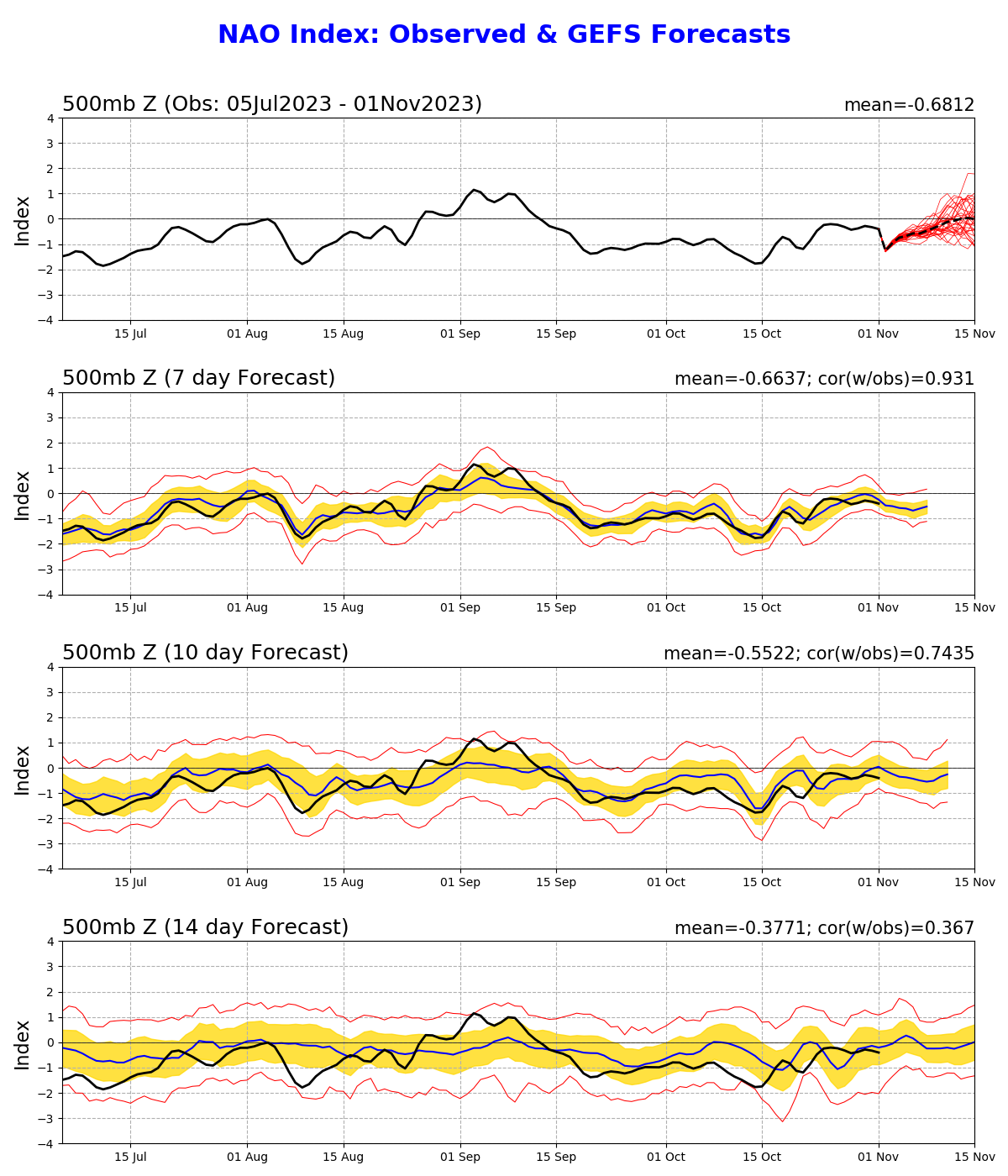
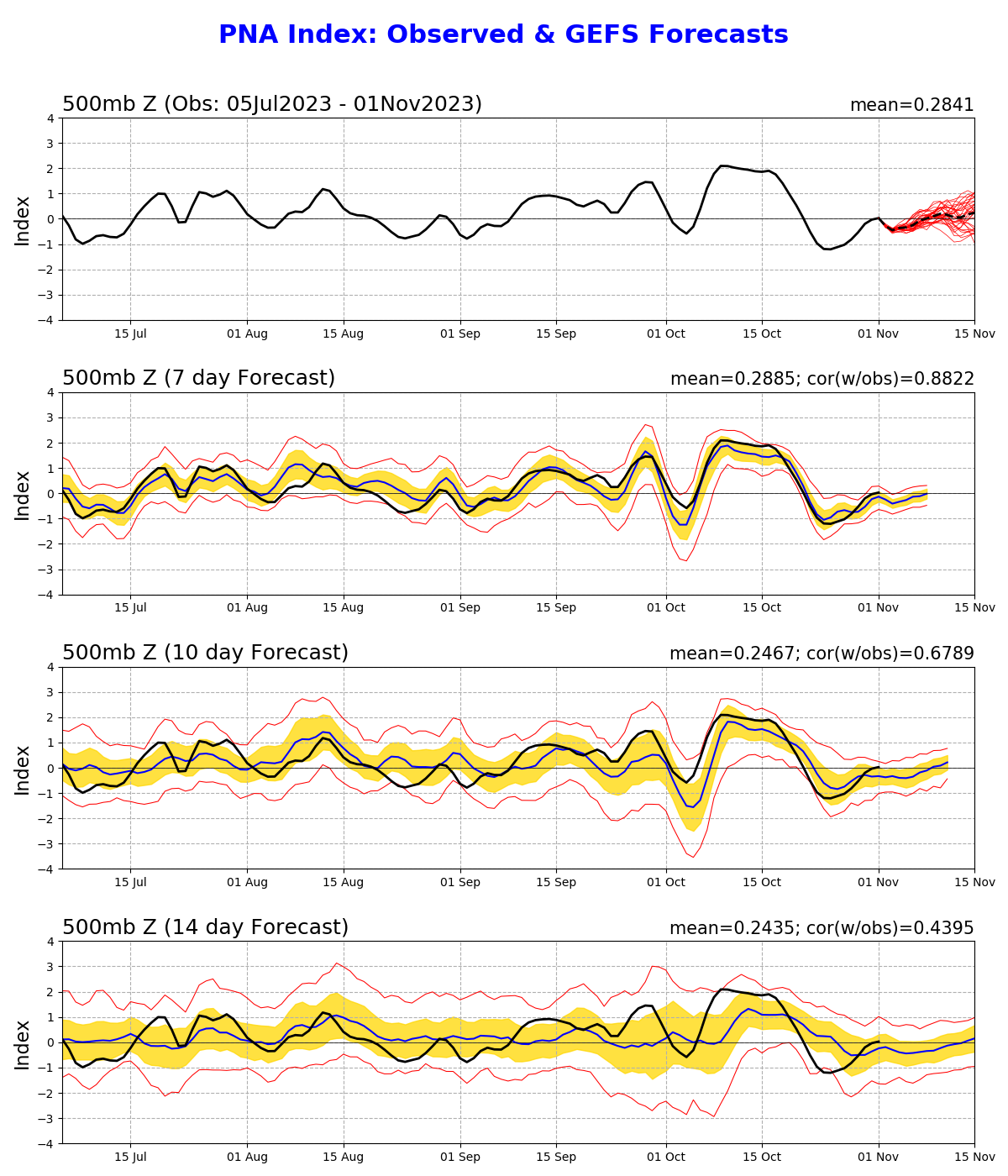
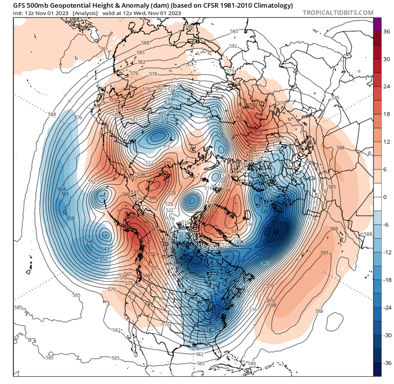
How is this not a huge -NAO and huge +PNA

-
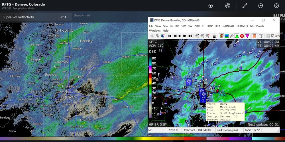
Got the first flakes here, with the radar reflectivy of about 5-10dBz. It kind of proves that radar is pretty bad at picking up snow rates if you are sort of far from the radar. I always called this M.O.C. snow.
-
Mountain West Discussion- cool season '23-24
Chinook replied to mayjawintastawm's topic in Central/Western States
This pretty much is the summary of the overall rockies snowstorm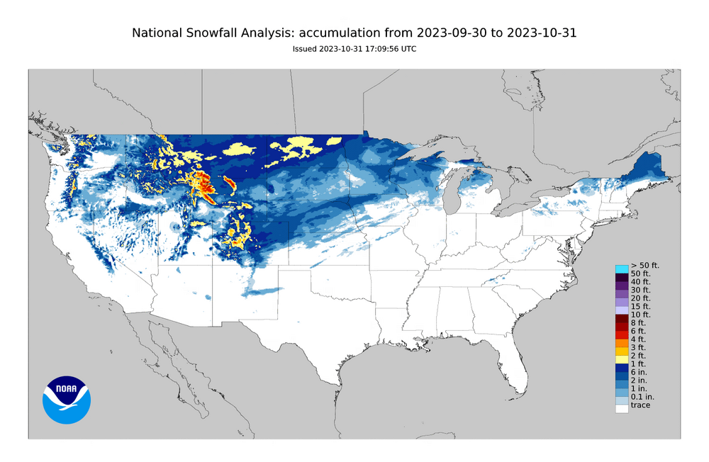
-
+SN with 1/8 mile measured visibility in western Michigan with this, perhaps, Manitoba Mauler (even though it's not really doing much in terms of winter storm development like the winter)
-
Mountain West Discussion- cool season '23-24
Chinook replied to mayjawintastawm's topic in Central/Western States
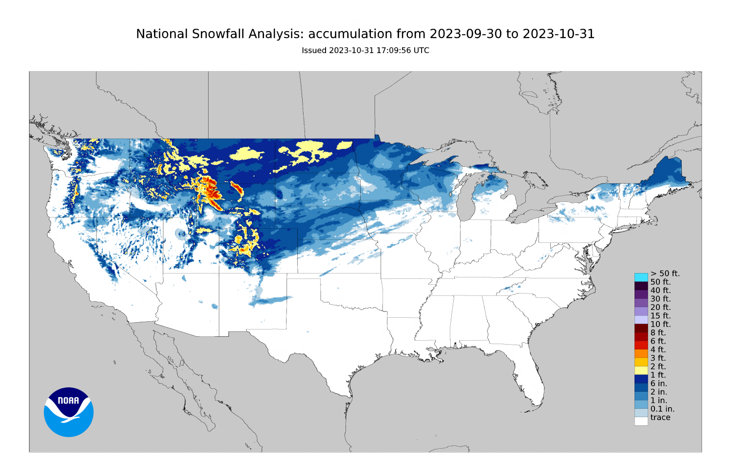
basically three or four waves of snow hit the Rockies with this upper level trough https://great-lakes-salsite.web.app/Oct_29_2023_loop.html -
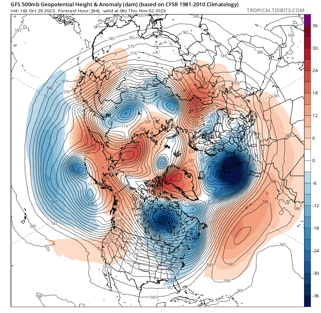
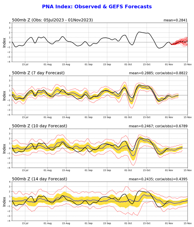
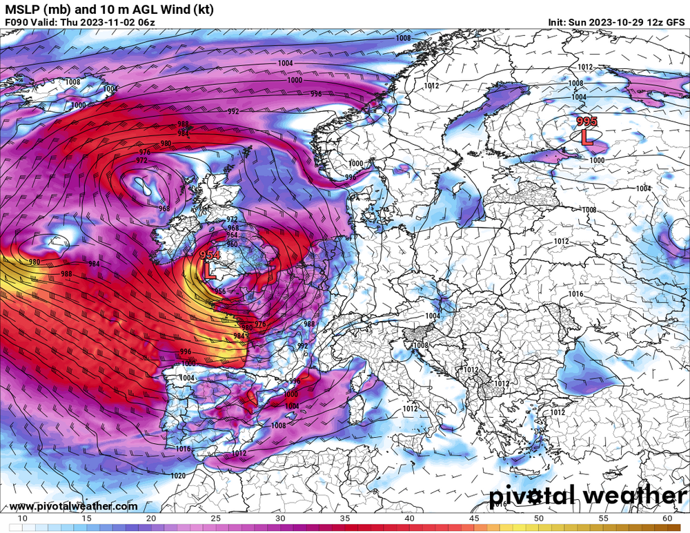
This upcoming storm is like a vacuum for Europe. This will be a highly negative NAO but the CPC web site says it will only be -1

-
Mountain West Discussion- cool season '23-24
Chinook replied to mayjawintastawm's topic in Central/Western States
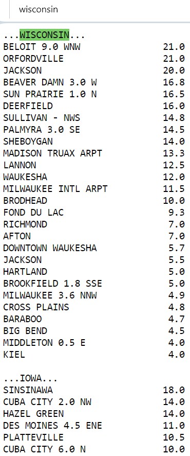
This should be a good representation of final snow reports. (there are dozens more reports not shown). Values of 5.0-5.5 seem to be at downtown Denver.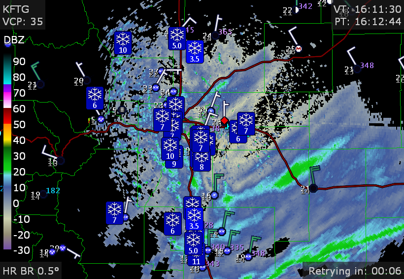
-
Mountain West Discussion- cool season '23-24
Chinook replied to mayjawintastawm's topic in Central/Western States
Snow bands have shifted around the area all day. I think Fort Collins may have gotten a lot as the snow started early