Chinook
-
Posts
10,935 -
Joined
-
Last visited
Content Type
Profiles
Blogs
Forums
American Weather
Media Demo
Store
Gallery
Everything posted by Chinook
-
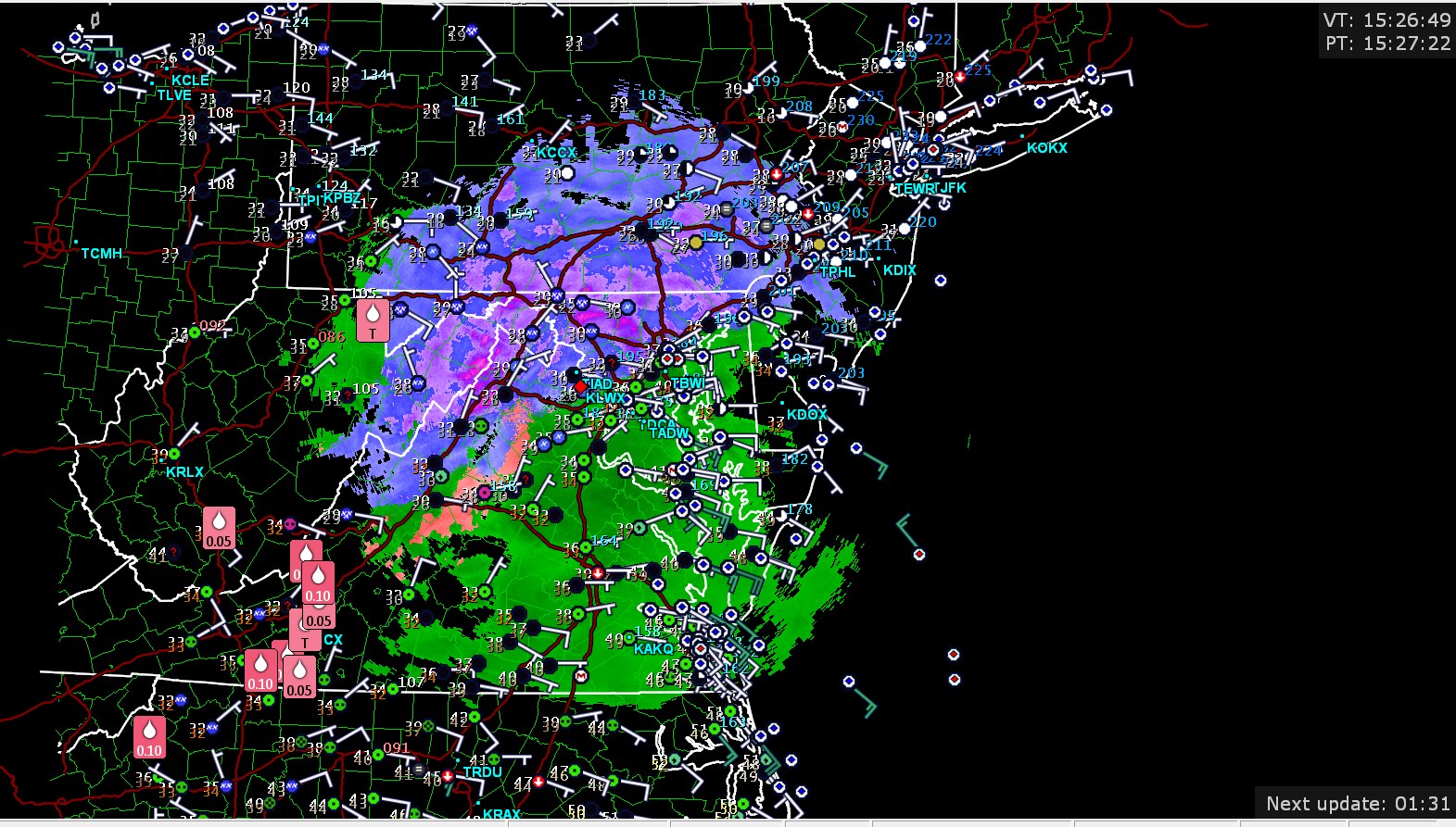
Best of luck to Mid-Atlantic people. Notably, already a reasonably dangerous ice accumulation in SW Virginia.

-
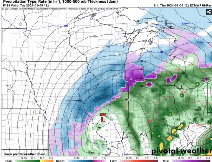
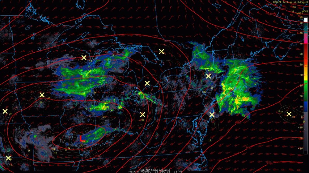
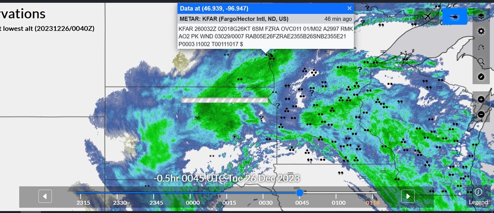
Another depiction of the ECMWF precip type just shows rain for SE Mich at that time frame
-
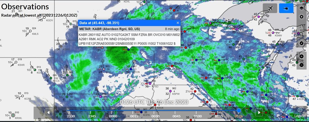
What is this purple and pink rectangle at Detroit? A car for the Motor City?
-

Mountain West Discussion- cool season '23-24
Chinook replied to mayjawintastawm's topic in Central/Western States
we haven't seen a lot of these colors on the map when the temperature is 50 degrees, coast to coast
-
Mountain West Discussion- cool season '23-24
Chinook replied to mayjawintastawm's topic in Central/Western States
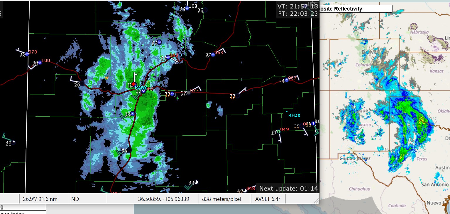
Storm in Albuquerque with briefly 1/2 mile visibility snow in ABQ airport, and some light snow amounts in Colorado Springs right now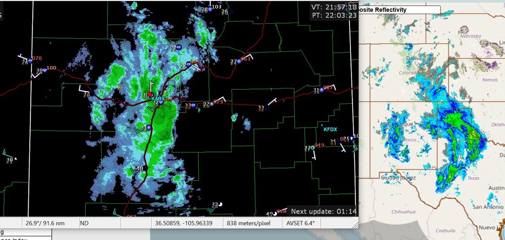
-
It's actually sunny. I spent a long time with a lot of sunny days in Colorado, and I guarantee you, it has been dreary since Christmas here.
-
The subtropical jet(s) have taken over the North America in the last 10 days with El Nino (my new loop.) https://great-lakes-salsite.web.app/Dec_21_31_2023_250mb_loop.html
-
Mountain West Discussion- cool season '23-24
Chinook replied to mayjawintastawm's topic in Central/Western States
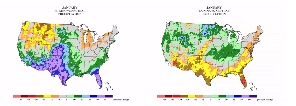
El Nino please help. Maybe we will see a big improvement in snow pack values (including the Sierra Nevada in the short term.) Upcoming storms will surely help the drought conditions in the Southeast. But that's not this forum.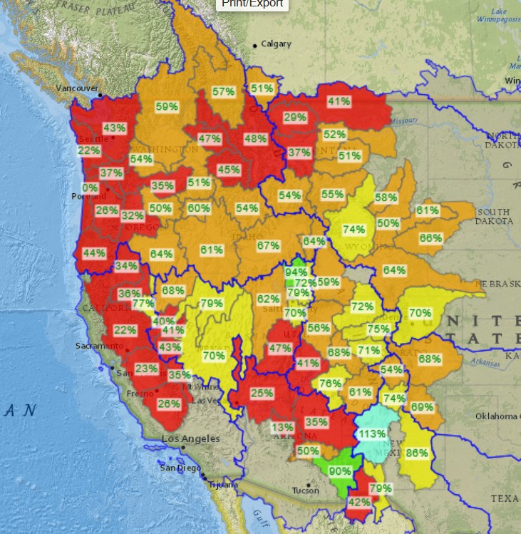
-
Winter 2023/24 Medium/Long Range Discussion
Chinook replied to Chicago Storm's topic in Lakes/Ohio Valley
There is some snow in various areas in the Ohio Valley on the ensembles for the FIRST storm. A lot of the ensemble members have this snow accumulation at about hour 120, that is 00z January 7.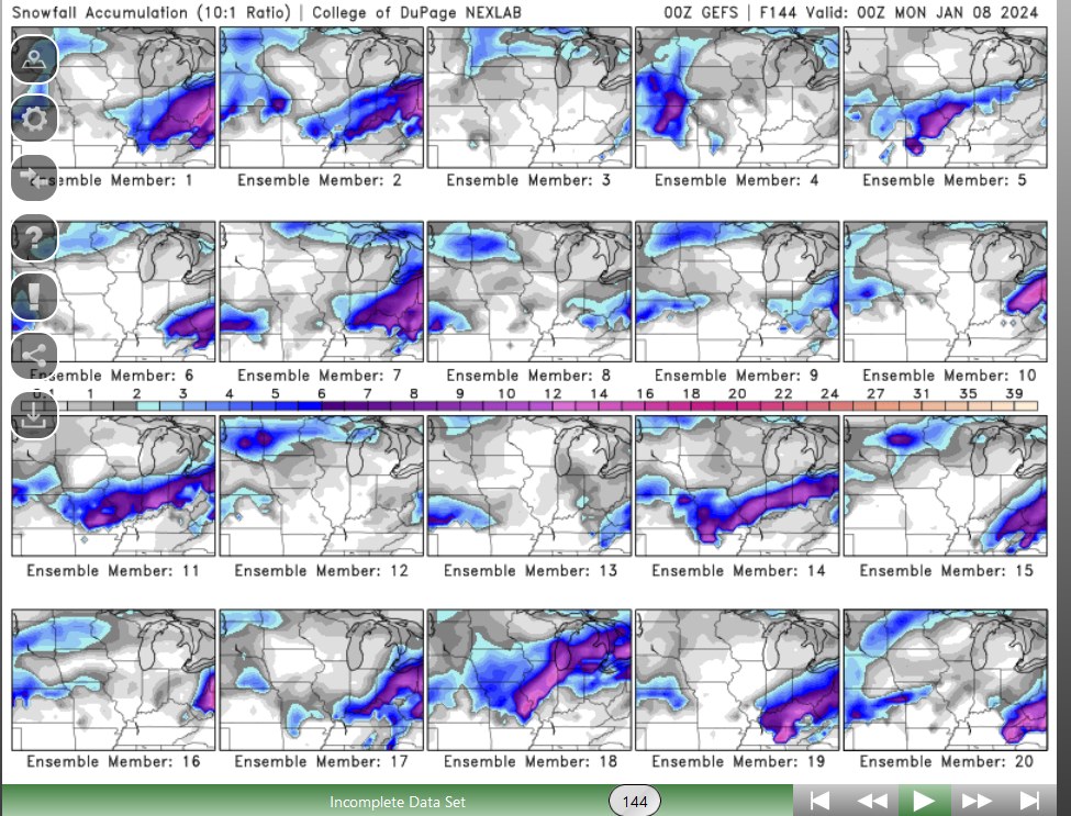
-
Winter 2023/24 Medium/Long Range Discussion
Chinook replied to Chicago Storm's topic in Lakes/Ohio Valley
Something to consider for the Ohio Valley. As you very well know, lots of models changes will happen in the next 6 days, so don't be surprised if these "big snow" ensembles don't work out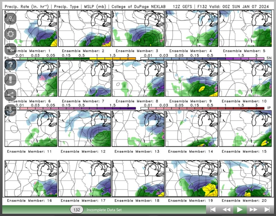
-
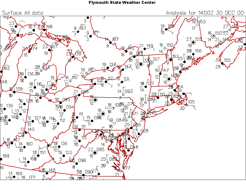
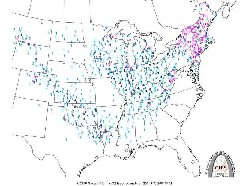
hey everybody. somebody from another part of the country here. Anybody remember a very special storm called the "Millennium Snowstorm." It happened on 12/30 to 12/31 in 2000 and rolled into New England but screwed Pennsylvania. Shown here is the co-op snow totals to 1/1/2001. Technically 1/1/2001 is the true changeover of the millennium. It's a bit of a debate, really. But that's not important. What was important: if you're old enough, everybody was worried their computer or technological systems based on computers would crash on 1/1/2000 at midnight. Anyway, this huge snowstorm for NYC had some similarities to the 1888 snowstorm of NYC. Actually, I'm not sure about that, as I might have to actually get Kocin and Uccellini (2004) out of my storage boxes to confirm anything about the evolution of the 1888 storm.

-
Mountain West Discussion- cool season '23-24
Chinook replied to mayjawintastawm's topic in Central/Western States
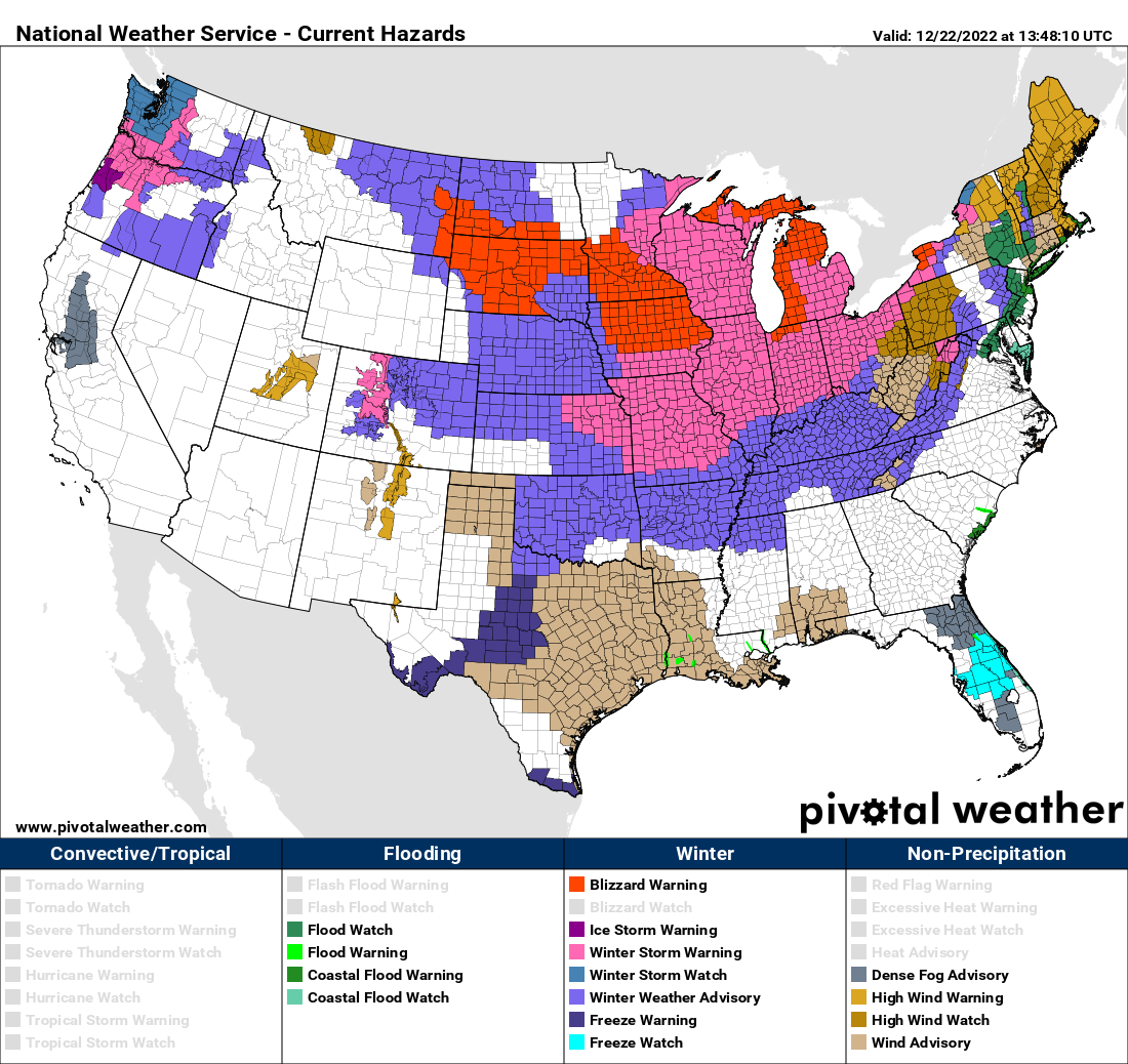
last year on 12/21/2022. Last year had a cold air mass that has not yet existed this winter. Were you ready for the drop to -9 degrees and snowing? Wind chill was -28 at Cheyenne and Denver for the evening hours on 12/22/2022.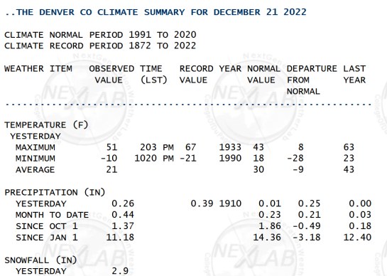
-
a year ago


-
when the wind goes backwards in December and it's not even snow
-
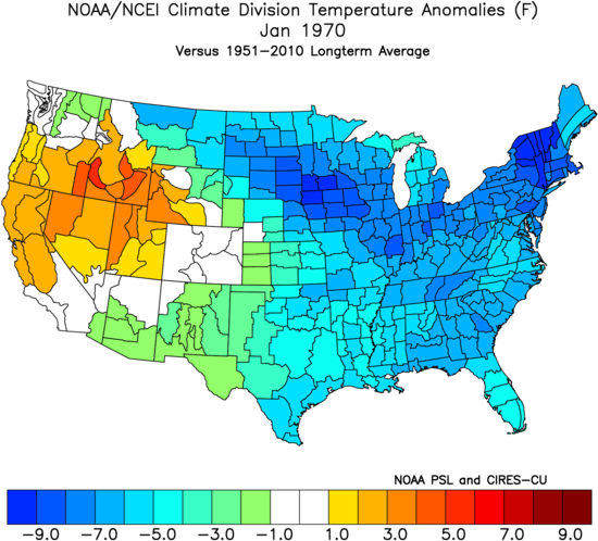
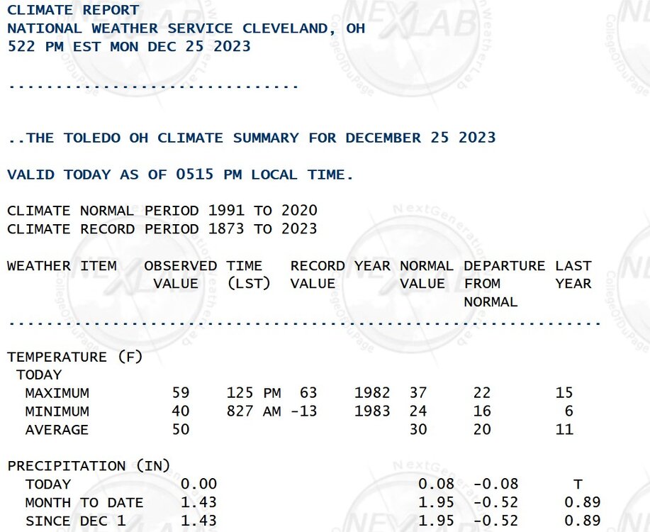
while we're all bored, I ranked all of Toledo's coldest monthly temperatures (Not sorting by month.) https://great-lakes-salsite.web.app/ToledosColdestMonths.html an example of one of the cold ones, as per NOAA climate divisions, anomalies
-
Mountain West Discussion- cool season '23-24
Chinook replied to mayjawintastawm's topic in Central/Western States
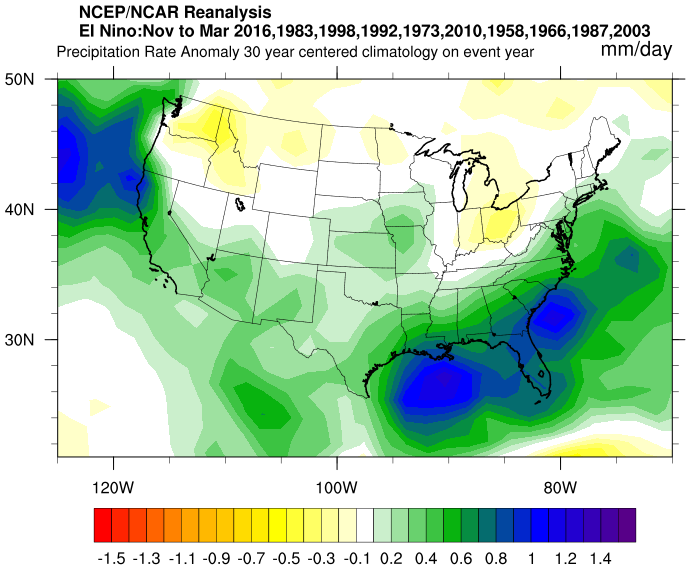
just to remind you of what should happen with El Nino, but I'm sure won't be exact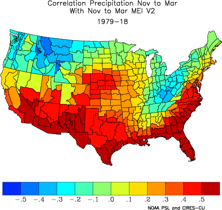
-
Mountain West Discussion- cool season '23-24
Chinook replied to mayjawintastawm's topic in Central/Western States
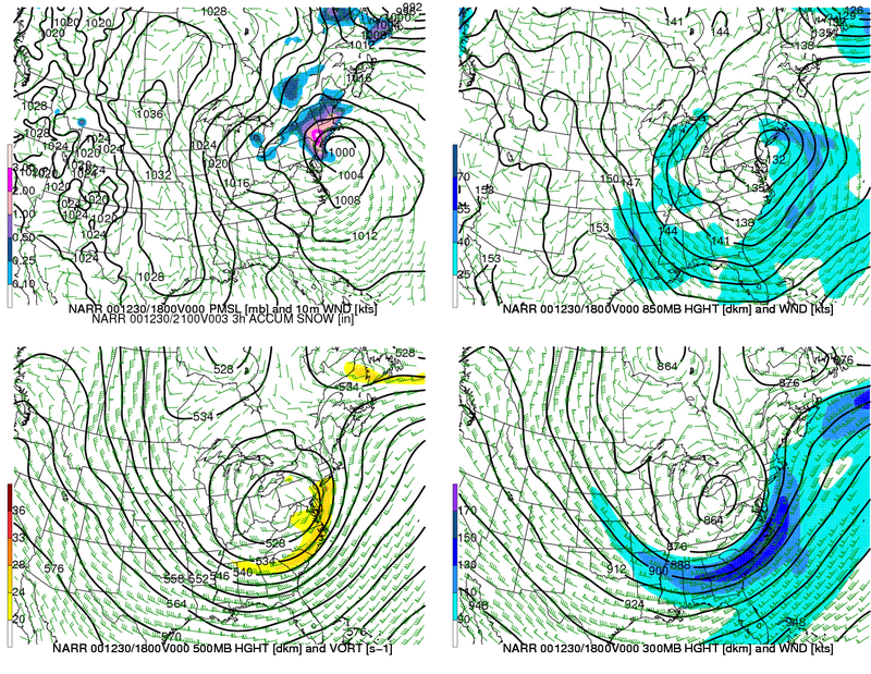
Here is my new surface loop of our northern Plains storm. The storm was kind of a combination of upper level troughs. Now, it's stuck between the northern and southern jet streams and there's not a very cold air mass. Because there's never a very cold air mass. But there was a blizzard for some. https://great-lakes-salsite.web.app/Dec_24_27_2023_surface_loop.html -
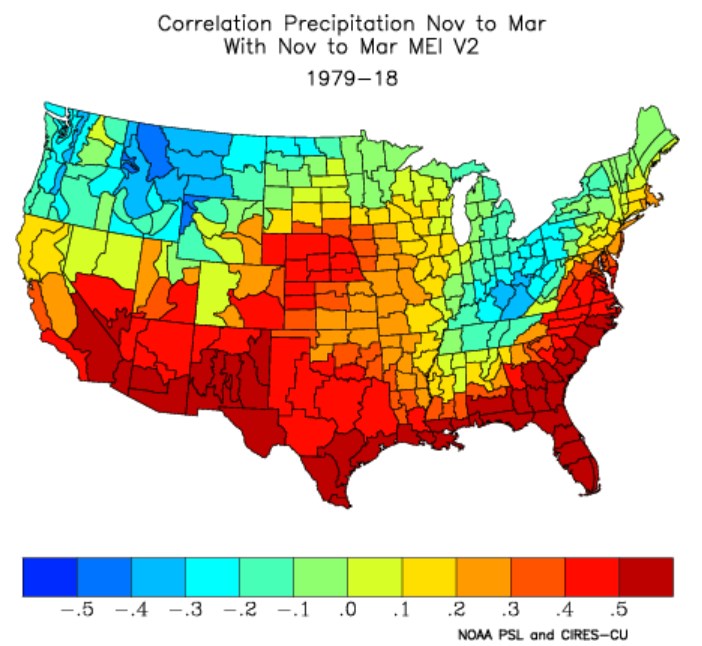
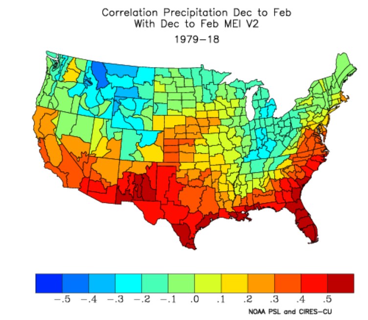
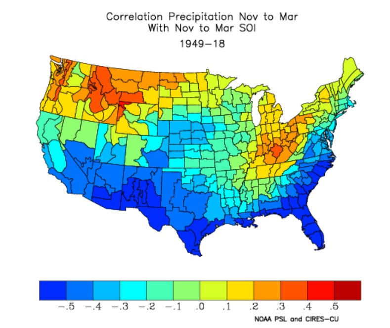
other ENSO correlations, precipitation vs MEI index or SOI index monthly (winter Nov-March)

-
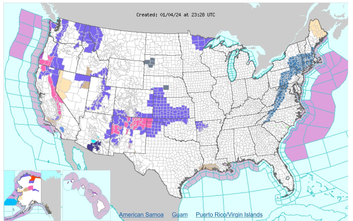
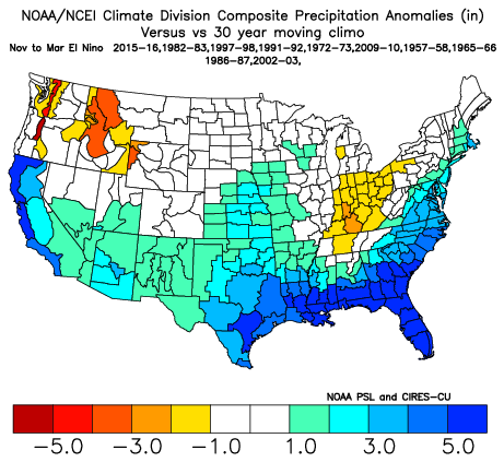
We are nearly one month into winter for the long-expected El Nino. How close are we to the typical impacts on precipitation? Not a whole lot of precipiation for E Texas, Louisiana, Mississippi, Alabama, or Nevada. So, not necessarily 100% correlation on the precipitation. Also, a drought has developed at my place in the last US Drought Monitor

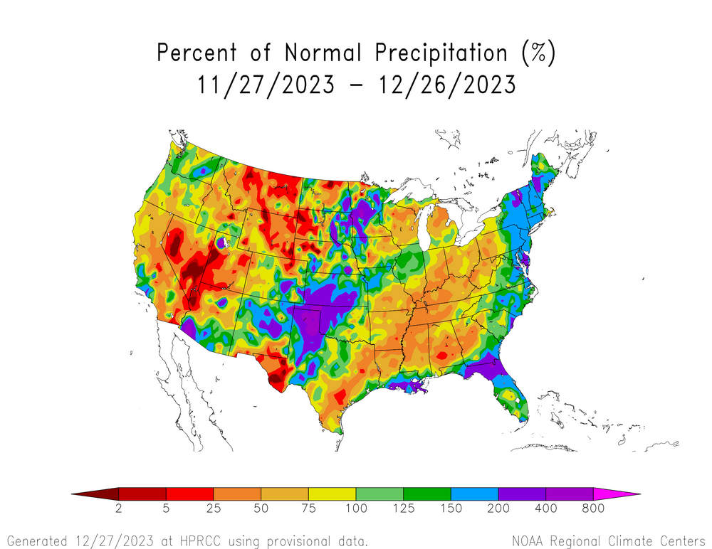
-
Mountain West Discussion- cool season '23-24
Chinook replied to mayjawintastawm's topic in Central/Western States
this is what the NWS says for the snowfall as of last night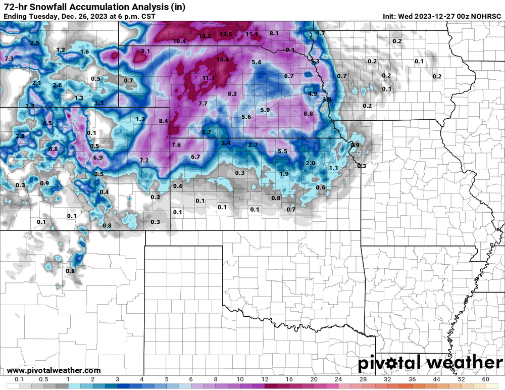
-
This is the meteorological code for "raisin". But seriously, a major city in our area is getting raindrops and snowflakes at the same time, or the airport is confused, maybe. KSTL 271651Z COR 12008KT 4SM RASN BR SCT008 OVC016 03/01 A2986 RMK AO2 SNB44 SLP118 P0010 T00280006
-
Mountain West Discussion- cool season '23-24
Chinook replied to mayjawintastawm's topic in Central/Western States
The forecasts for this snowfall continued to be shifted westward. I saw there are blizzard warnings in the area. So, I guess this is happening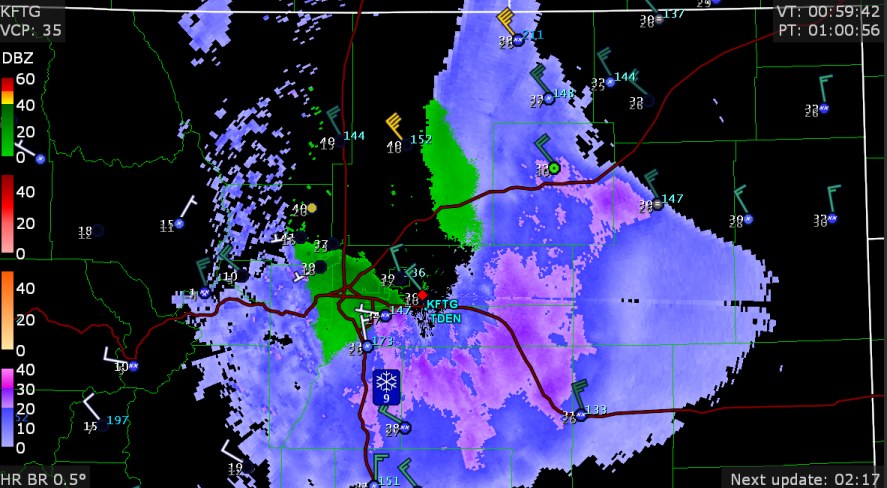
-
yikes
-
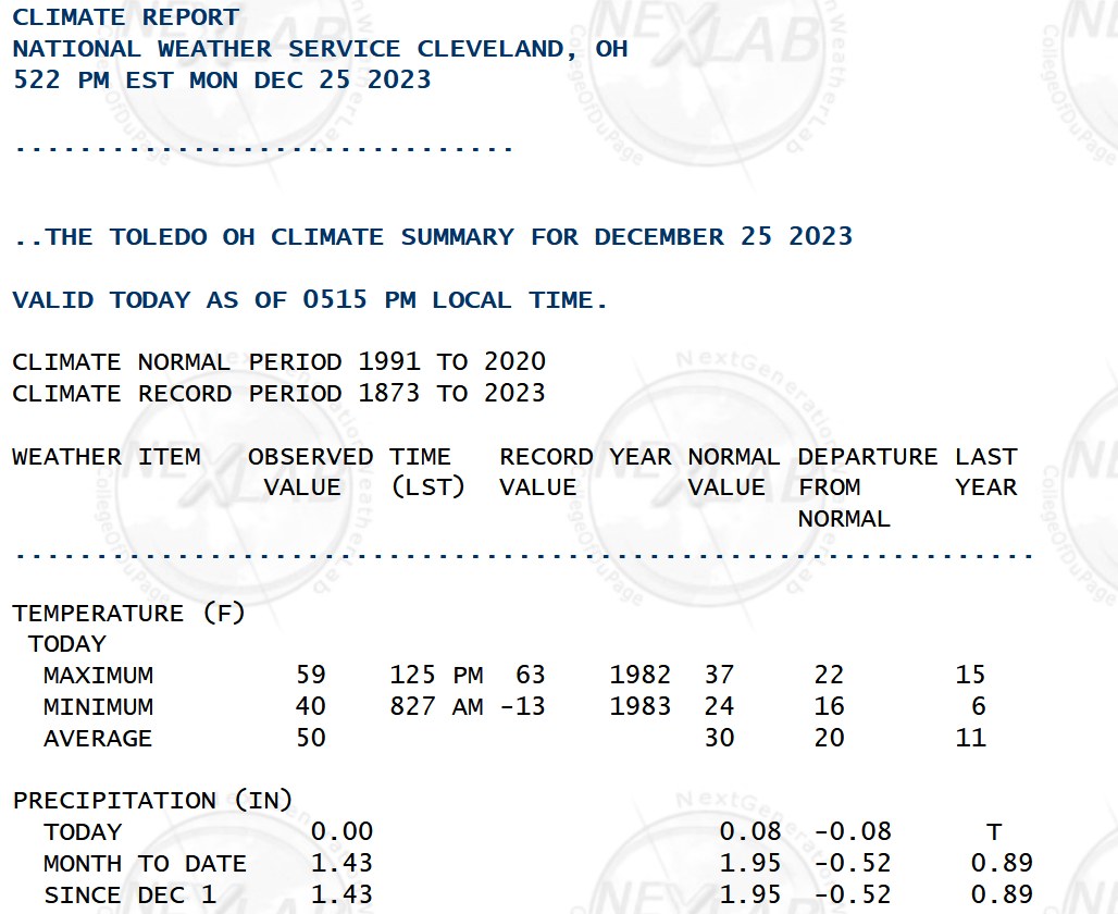
59 deg yesterday
-
some people say, "cut-off low, weatherman's woe."