Jump to content

Chinook

Meteorologist
  • Posts

    10,298
  • Joined

  • Last visited

Everything posted by Chinook

  1. Bowling Green Ohio- book by county weather historian. "Back in the extremely cold winter of 1918, a severe blizzard commenced.... snow drifts ten feet high and dropped the temperature to 18 degrees below zero." Bowling green went from +24 to -18 that day. I can't exactly say what the wind chill was at any hour. It might have been 0F with a wind of 30mph, resulting in a wind chill of -25.9F. That's probably conservative.
  2. Part of Siberia and Alaska more than 32 C below normal. That's the turquoise colors. That's 58 F below normal. source for this plot: http://policlimate.com/weather/current/raw_temp_c.html November 1st to January 23rd temperature anomalies on NCEP reanalysis. Wow. cold times in Alaska. Quite the La Nina surprise in western Canada and North Dakota.
  3. I'll be enjoying the 3C above normal range. Alaska can keep the 17C below normals for the next 8 days.
  4. 20-48 degrees F below normal in 7 days! Watch out! 8-day average temperature anomaly in southern Alaska: 5-12 Celsius.
  5. I woke up a little early this morning. Supercell composite of 50 and an effective-layer significant tornado parameter of 12. I think the highest I've seen is 44 and 11.
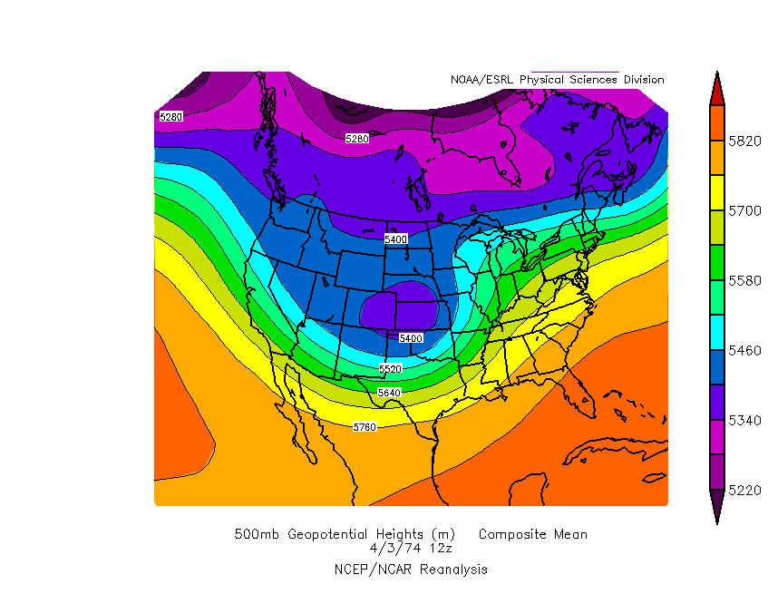
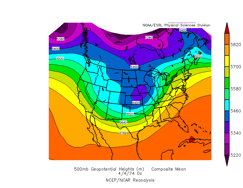
  6. Synoptically it has some similarities. Tomorrow, two low pressures (surface) will exist. In 1974, there was one main low pressure. Check the 500mb chart of the morning and evening of April 3, 1974. There are some similarities to tomorrow's 500mb chart. Nobody can know for certain what type of tornado destruction will happen, but no outbreak brought about more destruction than the Super Outbreak. It's unlikely that April 27, 2011 will go down as the worst of the worst tornado outbreaks.
×
×
  • Create New...