-
Posts
10,831 -
Joined
-
Last visited
Content Type
Profiles
Blogs
Forums
American Weather
Media Demo
Store
Gallery
Everything posted by Chinook
-
Blame it on the TV show
-
Typhoon Malakas at about the strongest point. The people of Taiwan must feel like a bad weather magnet recently. Typhoon Malakas maxed out at Cat 4, 115 kt at Sept. 16, 18z, reasonably close to Taiwan. Image is from Sept. 16, 2020z. Now it is moving toward southwestern Japan.
-
Texas/New Mexico/Louisiana/Mexico Obs And Discussion Thread Part 8
Chinook replied to wxmx's topic in Central/Western States
WPC forecast has 2.0" for Oklahoma City, Lubbock in 5 days, 1.75" for Kansas City. Kansas City and Wichita have already been very wet in the last 3 weeks. -
New JTWC forecasts take it south of Taiwan, meaning that there could be a greater wind speed when it reaches China (perhaps 105kt) near Chaozhou-Jieyang-Shantou metro. Shantou harbor is next to the sea, urban population 5.3 million.
-
JTWC now forecasts Meranti to be 160 kt in 6 hrs (2:00AM Eastern). Isn't that close to Haiyan's peak intensity?
-
recent landfalls on Taiwan Typhoon Soudelor (early August 2015) Typhoon Dujuan (late September 2015) Typhoon Nepartak (early July 2016)
-
Now I found satellite imagery that is up to date. This one is from 0120z September 12 (9:20 Eastern). I think the yellow areas are -80C, so that is some very cold -70C areas in a CDO wrapping around a narrow eye. Obviously the satellite based T-number must be very good and there is good outflow to the east and north.
-
There seems to be a lot of consensus concerning Typhoon Meranti. It has strengthened from 45kt to 100kt since the last time I posted. The GFS ensembles and HWRF predict Meranti to approach Taiwan from the southeast and track through Taiwan. The JTWC now has a max intensity forecast of 135kt at Sep 13, 06z, a few hundred miles from Taiwan. Note: Category 5 Saffir-Simpson is 137kt and greater. Typhoons are not usually given Saffir-Simpson categories. satellite image is from 0320z, which is from last night...18 hours old, it is 2134z right now. I have no idea why I can't find an updated satellite image.
-

Texas/New Mexico/Louisiana/Mexico Obs And Discussion Thread Part 8
Chinook replied to wxmx's topic in Central/Western States
Was Houston vs. Lamar football game delayed about 2 hrs by lightning? Not sure. I saw that it was delayed at some point today. It didn't look like a thunderstorm was over downtown Houston. I am not that interested in the final score, but if weather played a factor in a long delay. -
Tropical Storm Meranti, now at 45kt, is expected to be 115 kt (category 4 on Saffir-Simpson) in 72 hrs. The GFS full resolution Meranti (see TropicalTidbits) has 915 mb, 115kt at 90 hours!! It will be near Taiwan. I suppose some uncertainty exists with respect to track.
-

Texas/New Mexico/Louisiana/Mexico Obs And Discussion Thread Part 8
Chinook replied to wxmx's topic in Central/Western States
I just realized that Dallas-Fort Worth hit 107 on August 12, with dew point of 66 and heat index of 113. That is pretty bad. Or good, if you are in the business of selling air conditioners for a profit. Looks like things have been below normal for a little while. -

Central/Western Medium-Long Range Discussion
Chinook replied to andyhb's topic in Central/Western States
That's right. There were 79 tornadoes in two days (according to SPC's Severeplot database) and there was more than $1.3 billion damage from hail across the country on April 10. -

Central/Western Medium-Long Range Discussion
Chinook replied to andyhb's topic in Central/Western States
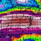
Name this severe weather event! This is the NARR reanalysis for two consecutive days, at 18z. The maps are from before 2015. What happened on these days? -

Central/Western Medium-Long Range Discussion
Chinook replied to andyhb's topic in Central/Western States
3-D visualizations of low-swirl, medium-swirl, and high-swirl tornadoes from NCAR https://www2.ucar.edu/atmosnews/perspective/21089/3d-window-tornado -

Central/Western Medium-Long Range Discussion
Chinook replied to andyhb's topic in Central/Western States
It's kind of funny how much this wind profile is different from the surrounding areas (50 - 200 m2/s2 of SRH, 30-45 kt of shear). Seriously, 500 m2/s2 next to 50 m2/s2. Now that it is so much easier to look at the various parameters from the 4km NAM, we see that deep convection on the model can lead to some very different temp/dew/wind profiles near simulated storms. Given the 25kt-35kt of wind at 500mb tomorrow, (as per the 12z GFS,) I would say tomorrow is most likely to have some multicells with hail/wind. The SPC has an enhanced (ENH) outlook for tomorrow for central Texas, which may make sense. Usually something interesting happens when there is 5000 J/kg of CAPE. For the last few days, I thought maybe tomorrow (Tuesday) would be a bigger severe weather day. With marginal winds at 850mb and 500mb, it should be kind of low on the tornado potential, maybe lower potential on high-end wind and hail. -

Central/Western Medium-Long Range Discussion
Chinook replied to andyhb's topic in Central/Western States
The 12z and 18z GFS show that the EML (warm layer) will quickly move over the warm, moist sector Monday night, from 00z to 06z, resulting in with some hundreds of J/kg of CINH by 06z. -

Central/Western Medium-Long Range Discussion
Chinook replied to andyhb's topic in Central/Western States
The 06z day-2 convective outlook, valid for Sunday: the SPC extended the slight risk to northern Oklahoma, as well as northwest IA. Here is a small piece of SPC's discussion: -- EFFECTIVE BULK SHEAR OF 35-45 KT WITH AN ORTHOGONAL ORIENTATION TO THE DRY LINE SUGGESTS DISCRETE SUPERCELLS CAN BE EXPECTED WITH ALL SEVERE HAZARDS. -

Central/Western Medium-Long Range Discussion
Chinook replied to andyhb's topic in Central/Western States
Sunday could be a regional severe weather threat for areas such as Omaha, Topeka, Kansas City, western Iowa, and Des Moines. 500mb winds will be pretty decent over the warm sector. A dryline will be out ahead of the cold front in central KS, eastern Nebraska. -

Central/Western Medium-Long Range Discussion
Chinook replied to andyhb's topic in Central/Western States
Isn't Mike Morgan the one who makes all sorts of extreme (and less than helpful) statements on live TV while covering tornadoes??? -
The 12z GFS has 0.93" liquid equivalent for north Toledo, and 0.59 Akron, 0.42" Canton, 0.56" Cleveland, 0.6", southern Michigan. The 12z NAM has 1.04" liquid equivalent for Toledo, 0.77" Cleveland. If this turns out to be 10-1 or better snow ratios, watch out! By the way, the largest snowstorm my parents had in Toledo this winter is about 3"
-

Central/Western Medium-Long Range Discussion
Chinook replied to andyhb's topic in Central/Western States
The extended range forecast out to 2 weeks in the future looks quite cool for the Midwest. The Day-3 (Easter Sunday) forecast as well as Wed March 30 look like possible severe weather setups. Otherwise the severe weather may be very close to the Gulf of Mexico or there may be none at all for 3-4 days in a row. -

Central/Western Medium-Long Range Discussion
Chinook replied to andyhb's topic in Central/Western States
It seems like Monday and Tuesday may be slight risk days. Currently the SPC is discussing these days but there are no 15% highlighted areas on the extended outlook maps. The GFS shows medium instability, 1000-2000 J/kg, through parts of the southern Plains, Monday afternoon. As for dynamics, there is a weaker shortwave near Goodland KS, and a strong 500mb jet moving in through northern Mexico into Texas on Tuesday. -

Central/Western Medium-Long Range Discussion
Chinook replied to andyhb's topic in Central/Western States
Looks like severe season for central Oklahoma just started with a severe thunderstorm watch issued tonight, and a recent wind gust to 58mph.

