-
Posts
10,830 -
Joined
-
Last visited
Content Type
Profiles
Blogs
Forums
American Weather
Media Demo
Store
Gallery
Everything posted by Chinook
-
MO/KS/AR/OK 2019-2020 Winter Wonderland Discussion
Chinook replied to JoMo's topic in Central/Western States
This potential storm system is now getting into the WPC 72-hr snow forecast -

MO/KS/AR/OK 2019-2020 Winter Wonderland Discussion
Chinook replied to JoMo's topic in Central/Western States
Bright-banding on this radar image makes the snow look super-heavy, as opposed to just sort of heavy. Congrats on 5" of snow in the Oklahoma City vicinity. I hope the freezing rain didn't affect any of you negatively. -
I drove from Akron to Toledo on Saturday, and I saw snow on the ground to about Sandusky. I think some instability snow existed in the general area.
-

MO/KS/AR/OK 2019-2020 Winter Wonderland Discussion
Chinook replied to JoMo's topic in Central/Western States
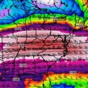
If the models make a small mistake with the low-level temps, this snow north of OKC turns to ice or rain. The low-level profile here from the GFS is good for heavy snow, it's just so close to 0*C up to 700mb. The 500mb heights are so high, that the 1000-500mb critical thickness line is in Kansas, about 10 miles north of Wichita. We have a long time before this is a short-range forecast, so the models will obviously take some time to resolve the exact rain/snow line (or freezing rain/sleet profile, if that exists.) -

MO/KS/AR/OK 2019-2020 Winter Wonderland Discussion
Chinook replied to JoMo's topic in Central/Western States
If anybody wants to *fantasize* for Oklahoma based on 1988, check out this Jan 4th-7th 1988 storm total plot! I think I see an 18" contour in there. -

MO/KS/AR/OK 2019-2020 Winter Wonderland Discussion
Chinook replied to JoMo's topic in Central/Western States
As of right now, the models have something very interesting for Oklahoma in about a week -

MO/KS/AR/OK 2019-2020 Winter Wonderland Discussion
Chinook replied to JoMo's topic in Central/Western States
I posted a Euro image like this 6 or 7 days ago -- and a rather serious storm did develop today. The 500mb is quite as closed off today as that particular run of the Euro 6 or 7 days ago, but it did sniff out a major low pressure in the region. Now, look at this for next Saturday. The Euro precip shows rain in MO and snow for Nebraska and north KS. -

MO/KS/AR/OK 2019-2020 Winter Wonderland Discussion
Chinook replied to JoMo's topic in Central/Western States
Kansas City airport now has blizzard or near-blizzard conditions KMCI 251829Z 01026G42KT 1/4SM R19R/2200V2600FT SN FZFG OVC008 M01/M02 A2962 RMK AO2 PK WND 01042/1826 P0002 T10111022 KMCI 251809Z 01027G39KT 1/4SM R19R/2200V3000FT SN FZFG SCT007 OVC011 M01/M02 A2961 RMK AO2 PK WND 01042/1758 P0000 T10061017 KMCI 251801Z 01027G42KT 1/2SM R19R/2800V3000FT SN FZFG BKN007 OVC010 M01/M02 A2961 RMK AO2 PK WND 01042/1758 P0000 T10061017 KMCI 251755Z 01028G42KT 1/4SM R19R/2800V3500FT SN FZFG SCT006 OVC010 M01/M02 A2961 RMK AO2 PK WND 36036/1754 P0000 T10061017 KMCI 251753Z 36025G42KT 1/2SM R19R/2800V3500FT SN FZFG BKN006 OVC010 M01/M02 A2961 RMK AO2 PK WND 02042/1747 SLP031 931003 P0010 60027 T10061017 10050 21006 50005 KMCI 251739Z 01021G34KT 1/2SM R19R/2600V3500FT SN FG BKN006 OVC010 00/M01 A2961 RMK AO2 PK WND 02036/1719 P0008 T00001011 KMCI 251725Z 01021G36KT 1/4SM R19R/2200V2800FT +SN FG BKN006 OVC010 00/M01 A2962 RMK AO2 PK WND 02036/1719 P0006 T00001011 -

MO/KS/AR/OK 2019-2020 Winter Wonderland Discussion
Chinook replied to JoMo's topic in Central/Western States
Well, you could go 3.42 years without a tornado watch, as DTX has. -

MO/KS/AR/OK 2019-2020 Winter Wonderland Discussion
Chinook replied to JoMo's topic in Central/Western States
Yes, this breaks a streak for Kansas City CWA. # of days since winter storm warning, as of yesterday, 11/23 -

MO/KS/AR/OK 2019-2020 Winter Wonderland Discussion
Chinook replied to JoMo's topic in Central/Western States
The latest Euro says this storm cuts off as it forms in Colorado and Kansas. The QPF shows heavy snow in Kansas and Nebraska, like 1.2" water equivalent of snow at Goodland KS. It will be interesting to see if this type of extreme is shown if we get this storm within 72-96 hours. Right now, it's 6.5 days out, essentially. -

Texas/New Mexico/Louisiana/Mexico Obs And Discussion Thread Part 8
Chinook replied to wxmx's topic in Central/Western States
Central Texas rainfall of over 7" caused some rivers to go into flood stage -
Typhoon Trami, as viewed from the International Space Station (I think.) See twitter for animated image (very cool). Typhoon Trami effectively made landfall on Okinawa, Japan, and there are a lot of U.S. Military members there.
-
Super Typhoon Mangkhut is now a textbook Category 5 cyclone, and JTWC predicts that it will impact the northern Phillipines (Luzon.) It might be a pretty close call with landfall
-
Typhoon Jebi has been analyzed by the JTWC as 80 kt (down from 90 kt earlier today) and will most likely make landfall on Japan at Shikoku, (one of the 4 main Japanese islands,) west of Kyoto. https://en.wikipedia.org/wiki/Shikoku
-
I just saw a tweet about Super Typhoon Jebi, affecting the Northern Mariana Islands, U.S. Territory.
-

Texas/New Mexico/Louisiana/Mexico Obs And Discussion Thread Part 8
Chinook replied to wxmx's topic in Central/Western States
KFWS radar storm totals for the last 48 hrs. Perhaps some areas of Texas will be changed from D3 drought to D2 drought. -

Texas/New Mexico/Louisiana/Mexico Obs And Discussion Thread Part 8
Chinook replied to wxmx's topic in Central/Western States
KFWS storm total precipitation in the past 2 days and 9 hours -

Texas/New Mexico/Louisiana/Mexico Obs And Discussion Thread Part 8
Chinook replied to wxmx's topic in Central/Western States
Finally, Texas has already seen some moderate rains this morning, and should have more in the short term -
July 4, 2004 had quite a few storm reports from Kansas to western and central Tennessee https://www.spc.noaa.gov/climo/reports/040704_rpts.html
-
This was the biggest joke of a tornado watch. Almost no severe reports in it.
-
SPC is expecting to issue a tornado watch for W Kentucky and western and central Tennessee.
-
Radar image of Typhoon Maria, from Taiwan. This shows a lot of heavy rain bands over Taiwan. It is asymmetric Cat-2 to Cat-3 intensity at this time.
-
Super Typhoon Maria (not to be confused with last year's Atlantic storm) has reached 140 knots as per the JTWC. This will weaken slowly as it approaches China and north Taiwan. (Taiwan on the west side of this map)
-

Central/Western Medium-Long Range Discussion
Chinook replied to andyhb's topic in Central/Western States
It's not too often you find the 3000 -4000 J/kg of CAPE at the same areas as 50-60 kt of shear in June. And this almost shows a good overlap of these elements. It seems to be true that multicells/ squall line(s) will be likely tomorrow. It definitely could be more interesting (discussion-wise) to see more discrete supercells. Realistically, we may see quite a few severe storms with 30 - 45 kt of shear, as maybe those 50 kt values will be in the cold air sector.


