Chinook
-
Posts
10,935 -
Joined
-
Last visited
Content Type
Profiles
Blogs
Forums
American Weather
Media Demo
Store
Gallery
Everything posted by Chinook
-
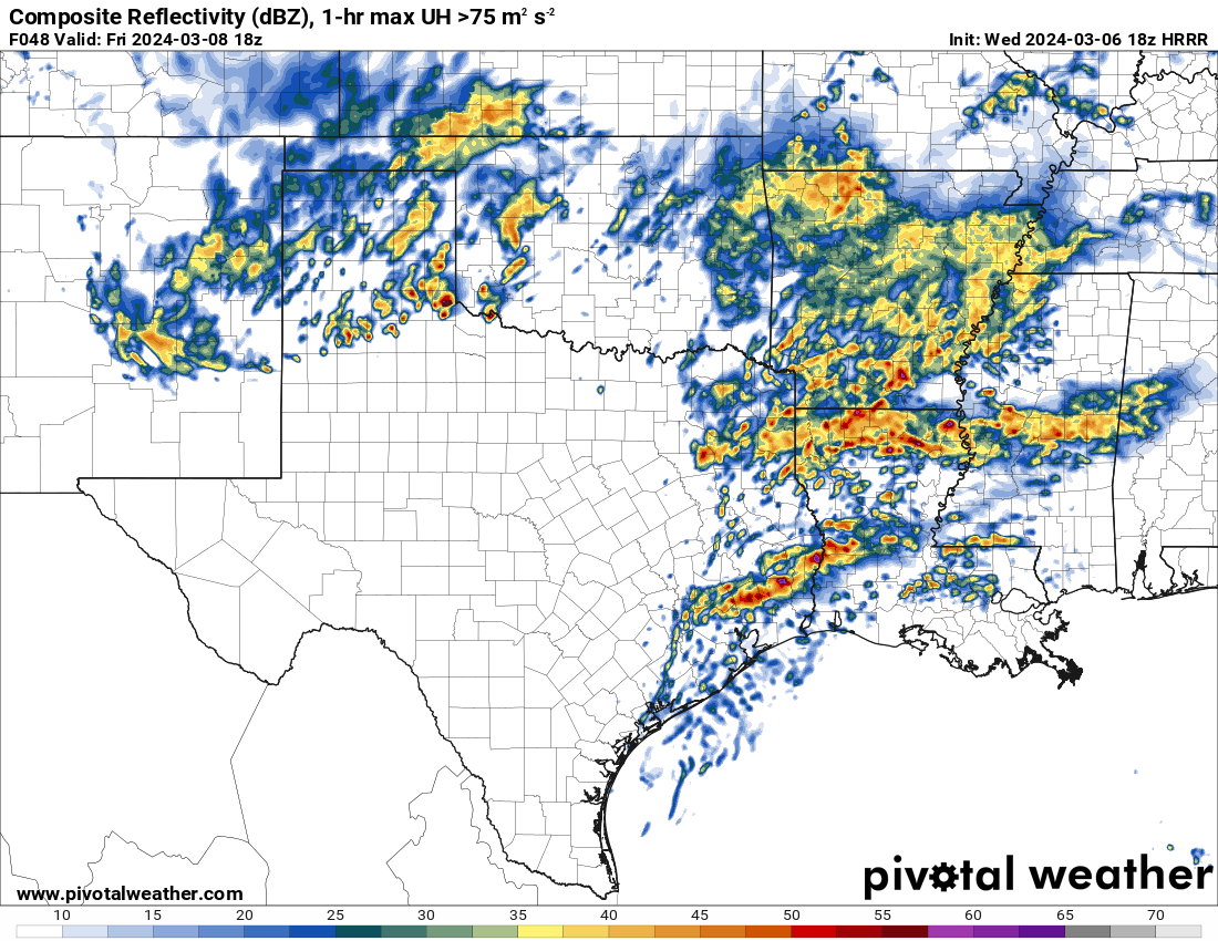
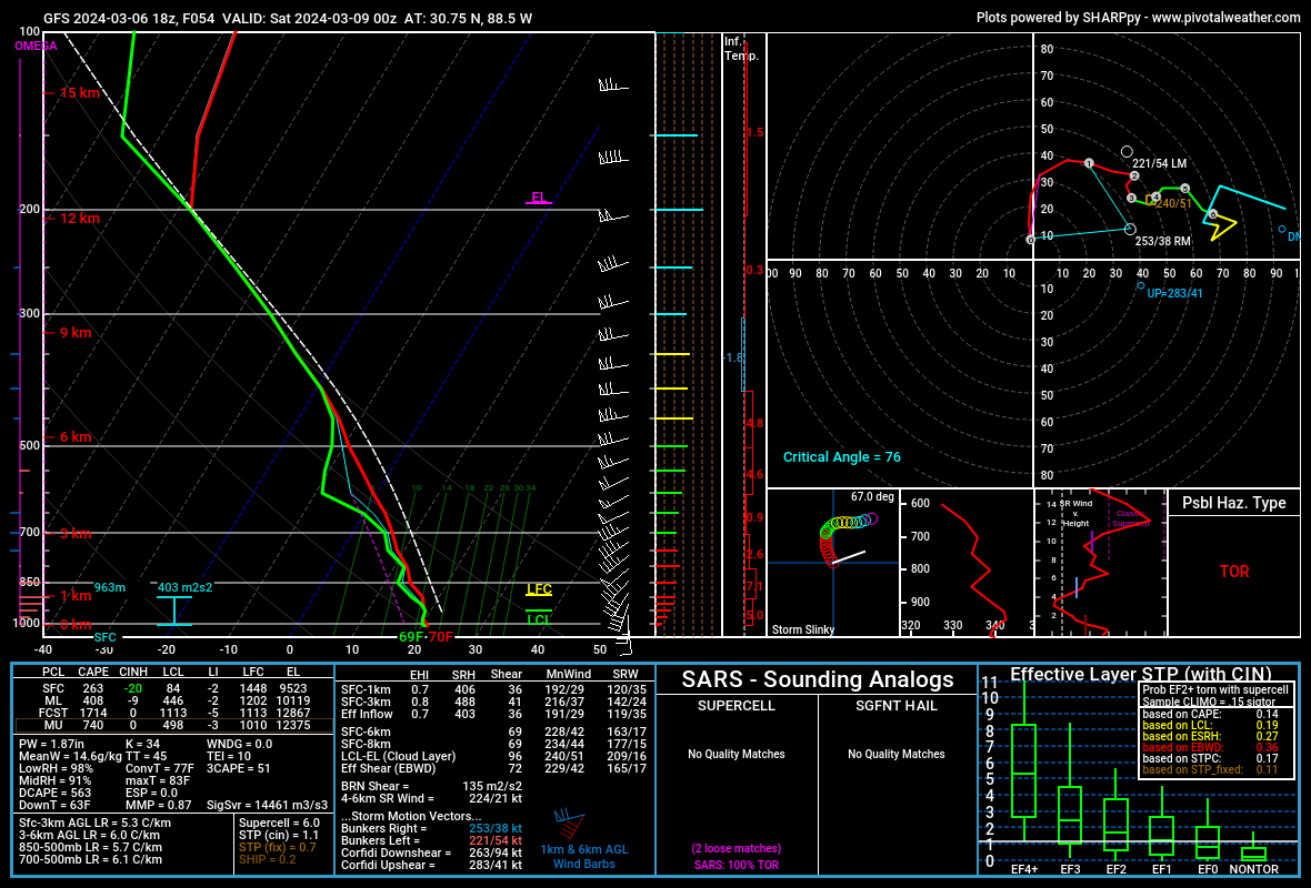
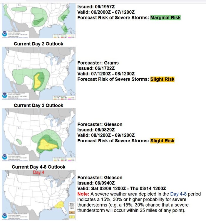
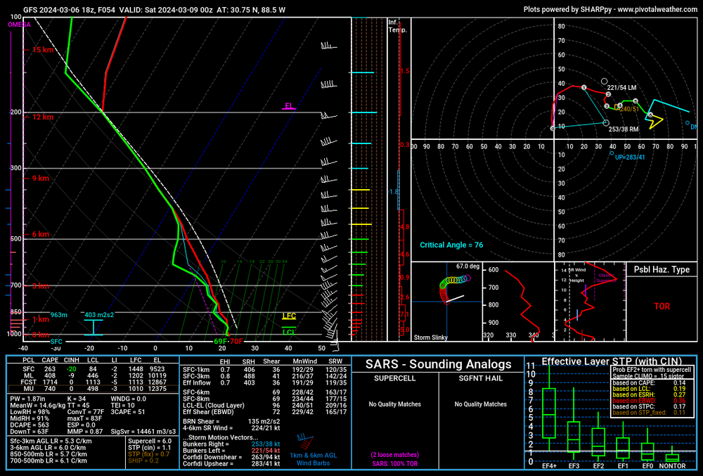
Severe weather outlooks for this week: Honestly I'm not sure what so say regarding this. I don't think a lot will get going tomorrow in the daytime. There should be more severe activity popping up from 12z to 18z Friday, along with up to 65 kt of shear in Louisiana at that time. The GFS shows high storm relative helicity in Mississippi. This is a sounding near Biloxi for Friday with low-CAPE, high humidity

-

2024 Short/Medium Range Severe Weather Discussion
Chinook replied to Chicago Storm's topic in Lakes/Ohio Valley
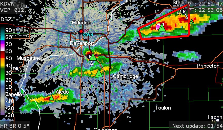
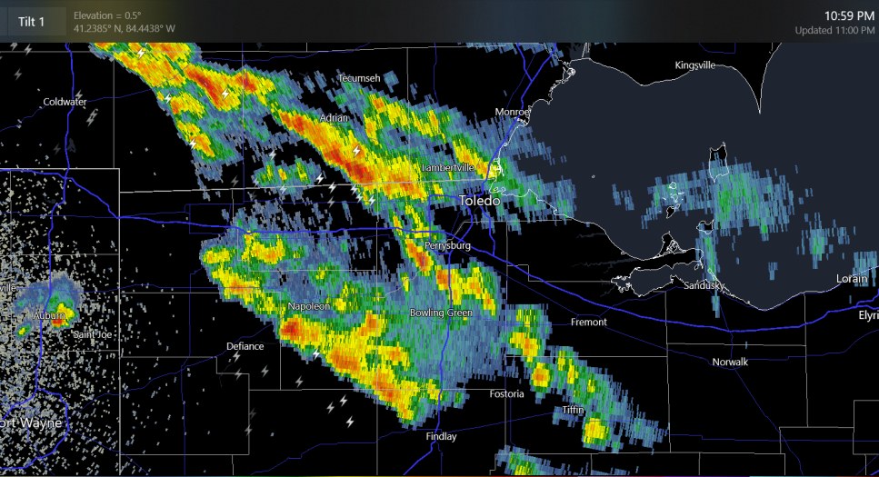
quick increase in reflectivity at Dixon -
2024 Short/Medium Range Severe Weather Discussion
Chinook replied to Chicago Storm's topic in Lakes/Ohio Valley
another two tornado warnings (almost right at Cyclone77's place) and also an unwarned cell to the east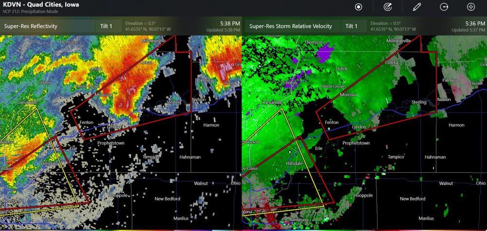
-
it's too nice
-
Mountain West Discussion- cool season '23-24
Chinook replied to mayjawintastawm's topic in Central/Western States
I posted these images in the El Nino discussion. This shows the subtropical jet stream did most of what it was supposed to do. There are also some abnormally westerly winds near the equator, with a component of the wind transporting the moisture to California. (westerly winds at the equator should be happening in the West Pacific.)


-
Mountain West Discussion- cool season '23-24
Chinook replied to mayjawintastawm's topic in Central/Western States
Washington state snow pack should be rather low in all aspects. As you can see, the southern snowpack values aren't too bad as El Nino normally favors the Southwest. These days we can say that the California jet stream is doing a good job at blasting warmer air in the middle of the country. A lot of the CO mountains should pick up some good snows from the westerly winds.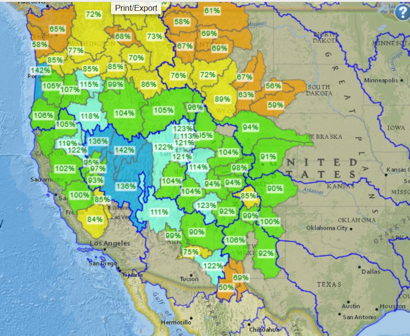
-
Mountain West Discussion- cool season '23-24
Chinook replied to mayjawintastawm's topic in Central/Western States
local storm reports have 5" - 42" from Reno up to the Donner Summit. -
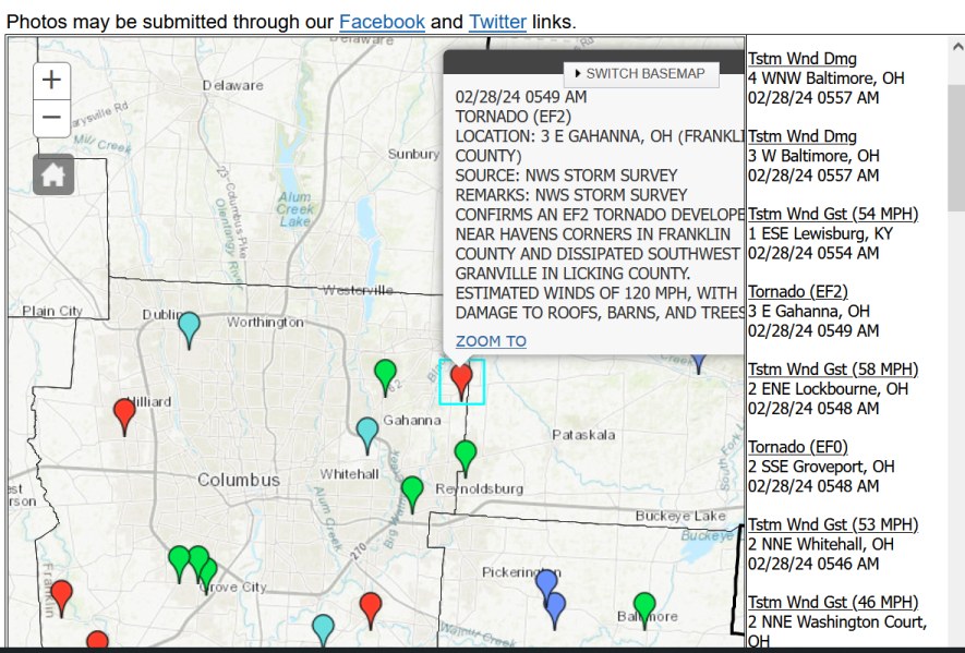
my sister used to have a place outside of Gahanna
-
Mountain West Discussion- cool season '23-24
Chinook replied to mayjawintastawm's topic in Central/Western States
I think they said 2ft-4ft for the Sierra summits. It has mostly already happened. -
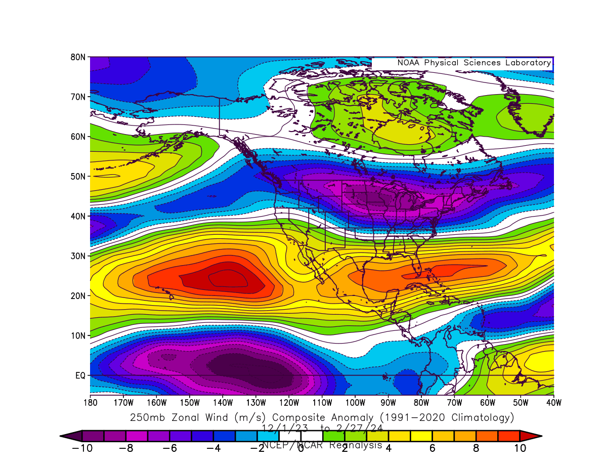
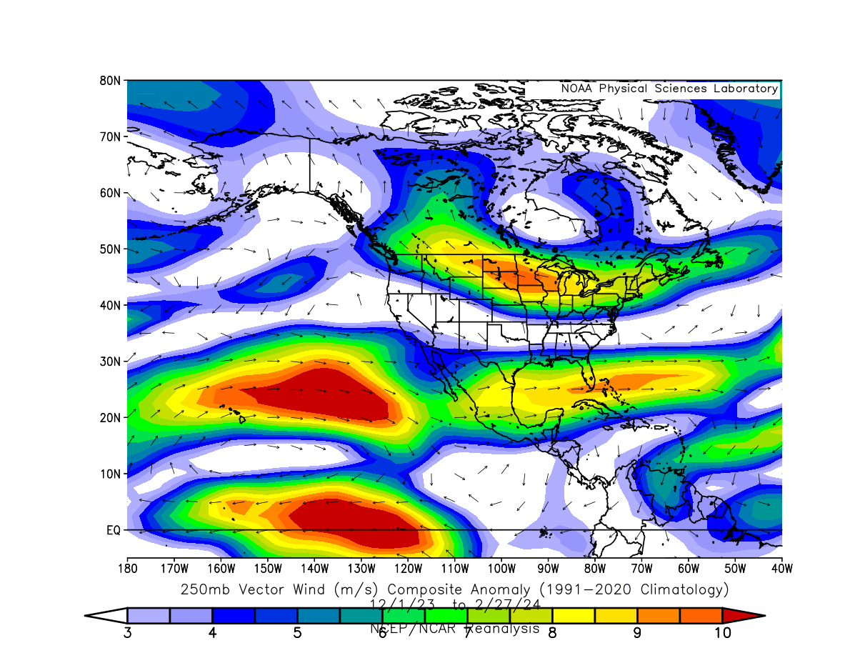
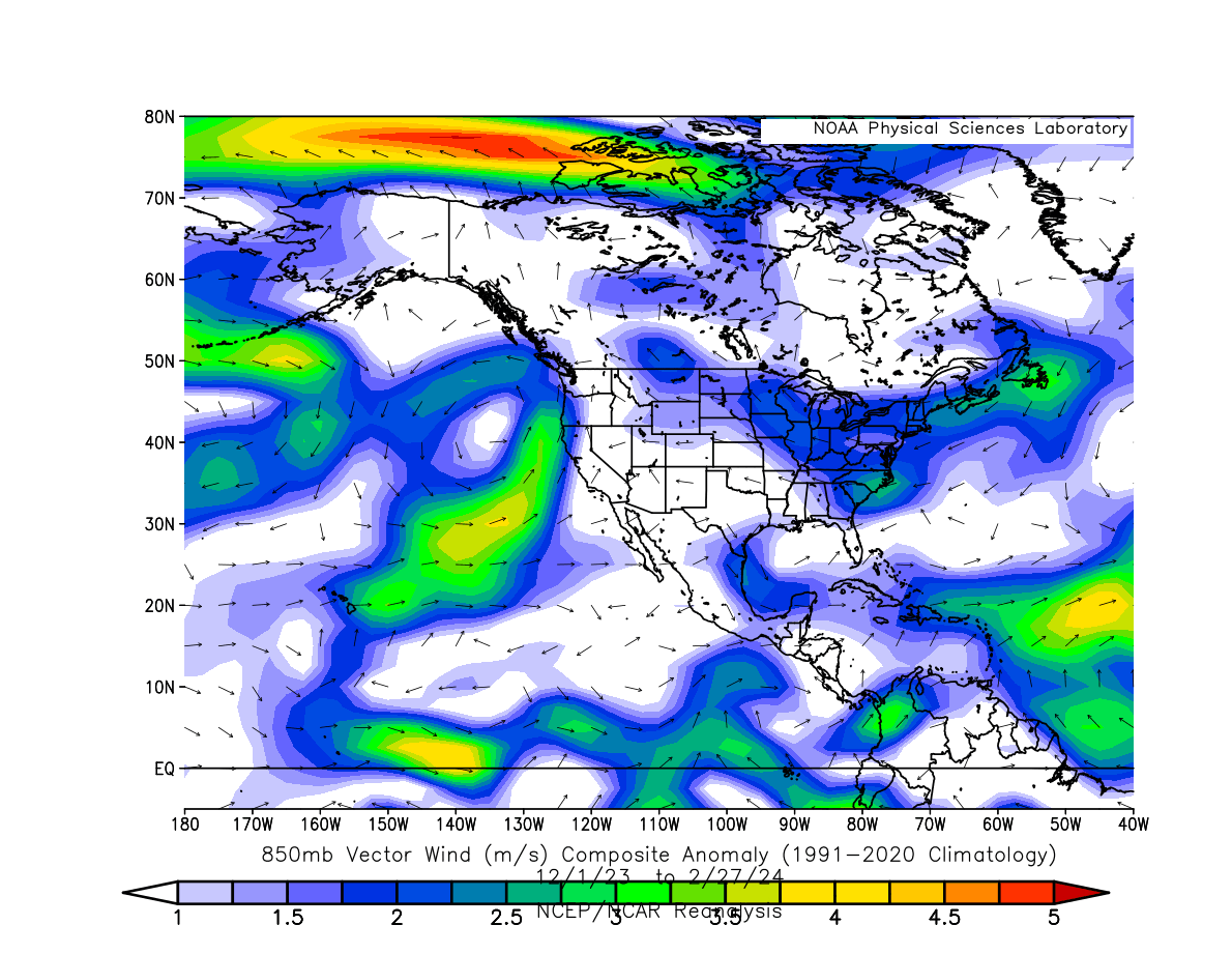
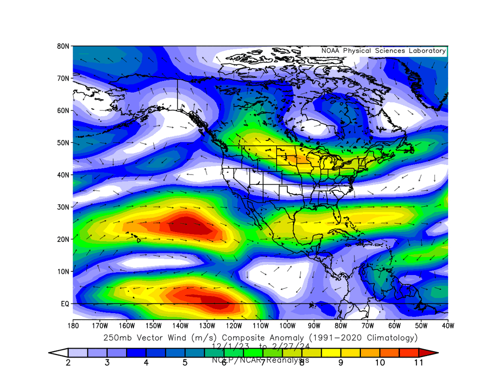
Here are my 250mb wind loops for fall/winter. https://great-lakes-salsite.web.app/Sep_1_18_2023_250mb_loop.html https://great-lakes-salsite.web.app/Sep_17_30_2023_250mb_loop.html https://great-lakes-salsite.web.app/Oct_1_15_2023_250mb_loop.html https://great-lakes-salsite.web.app/Oct_16_31_2023_250mb_loop.html https://great-lakes-salsite.web.app/Nov_1_15_2023_250mb_loop.html https://great-lakes-salsite.web.app/Nov_16_30_2023_250mb_loop.html https://great-lakes-salsite.web.app/Dec_1_10_2023_250mb_loop.html https://great-lakes-salsite.web.app/Dec_11_20_2023_250mb_loop.html https://great-lakes-salsite.web.app/Dec_21_31_2023_250mb_loop.html https://great-lakes-salsite.web.app/Jan_1_17_2024_250mb_loop.html https://great-lakes-salsite.web.app/Jan_17_31_2024_250mb_loop.html https://great-lakes-salsite.web.app/Feb_1_15_2024_250mb_loop.html https://great-lakes-salsite.web.app/Feb_16_29_2024_250mb_loop.html I made all the loops because I wanted to know what was happening far out in the Pacific, and I wanted to organize it so that others can learn from it. Here are 250mb and 850mb wind anomalies for nearly all of meteorological winter up to a couple of days ago. It looks like the 850mb winds were more likely to transport moisture towards California and Oregon. Otherwise, I think the 250mb wind anomalies are pretty standard for El Nino, but you guys can comment if you want to.


-
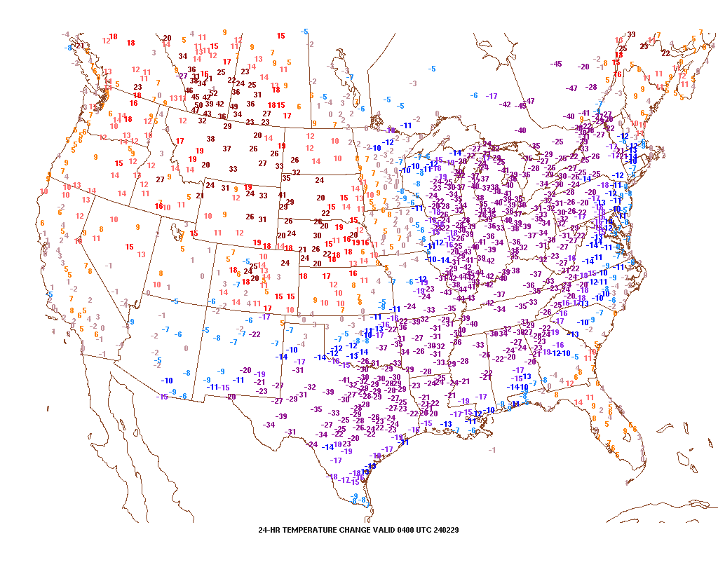
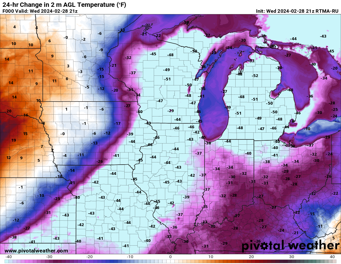
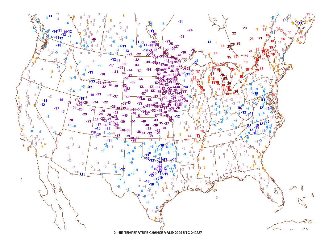
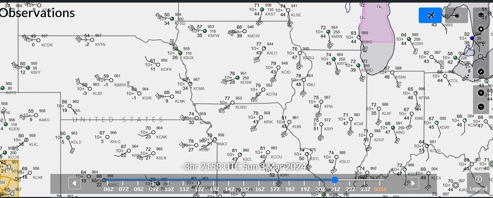
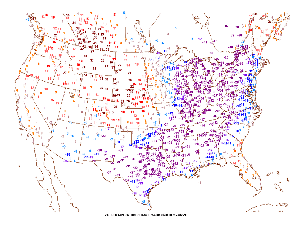
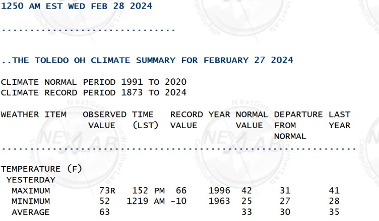
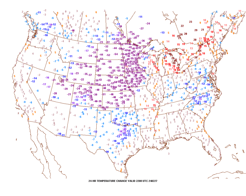
wow, didn't realize it got to 70 degrees north of Lansing. current 24 hour temp change. As for yesterday, I posted one of these that had a 60 degree temperature drop in Nebraska. For all I can remember, a value of 60 degrees downwards is close to the max I've seen in Wyoming and such areas.

-
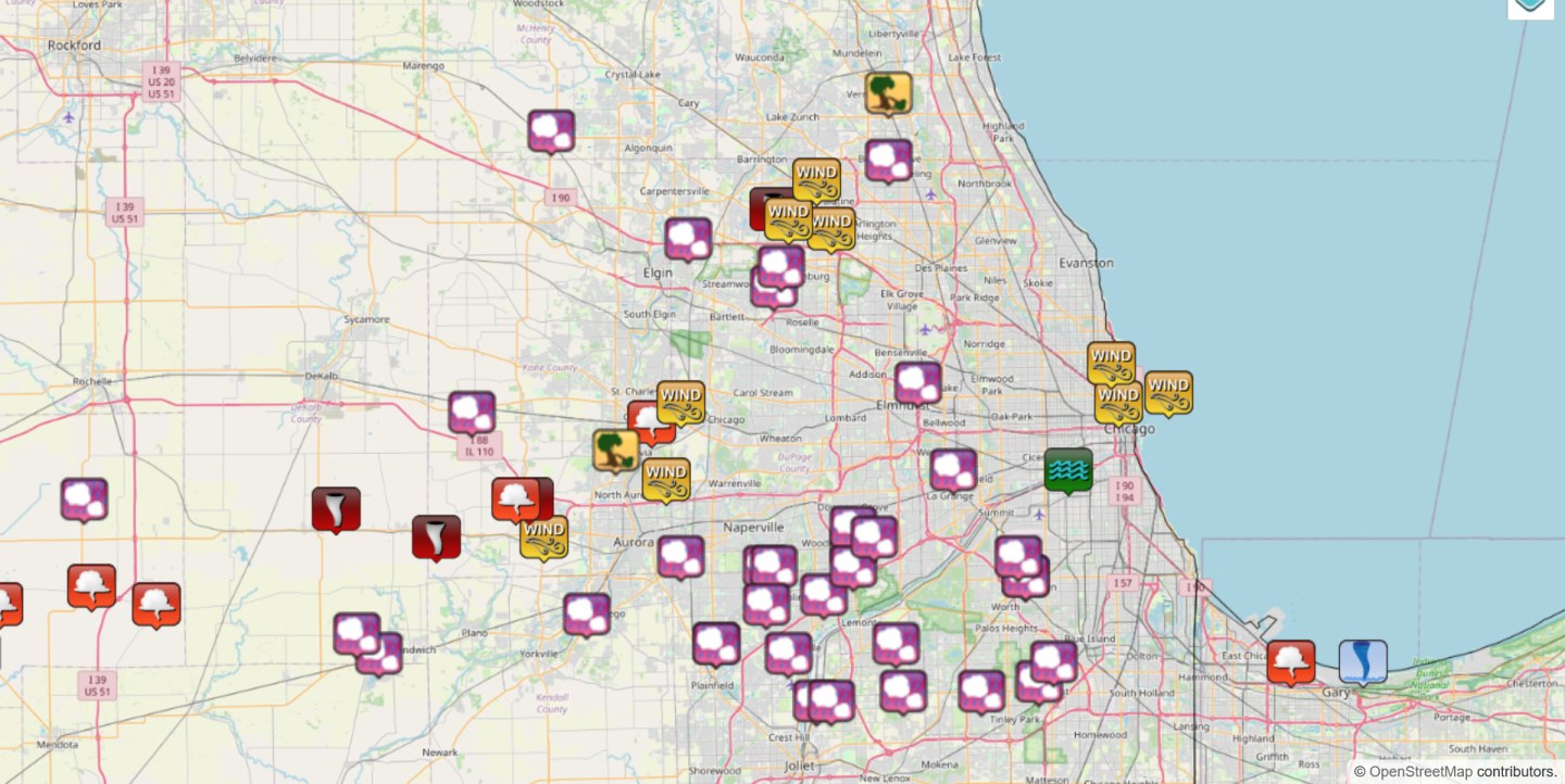
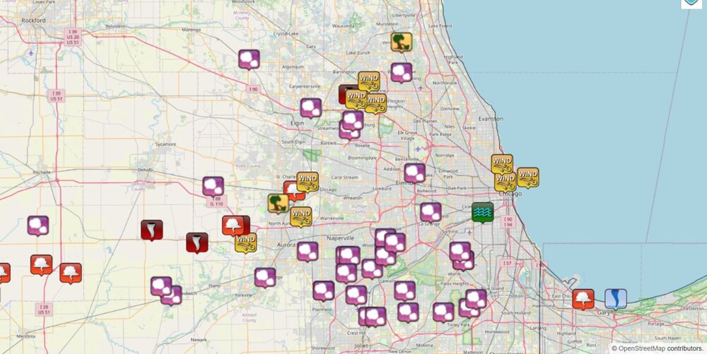
local storm reports (also including non-severe hail, non-severe wind) for Chicago
-
tornado debris signature was a few miles north of Marshall
-
seems to be a strong delta-v of about 125 mph
-
I don't have any memory of seeing lightning in February, but now I do.
-
you know what? that looks fake, but it's tough to call out a random person on twitter.
-
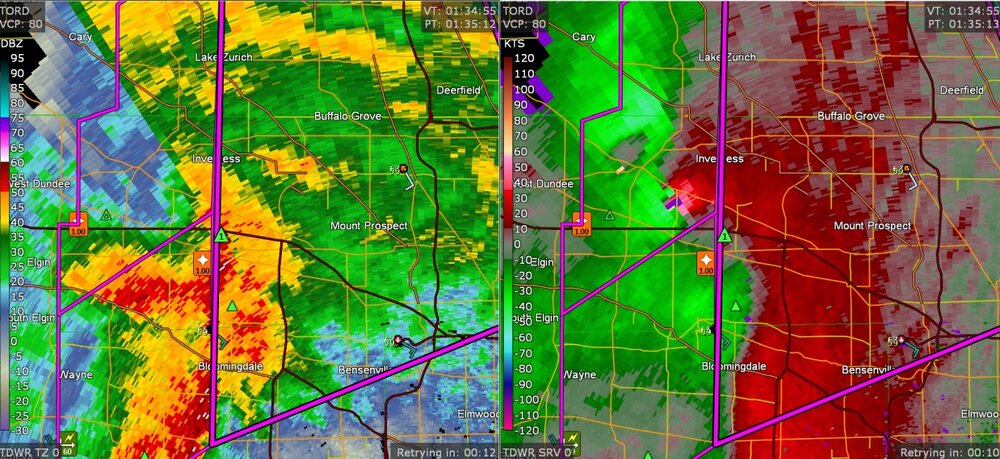
this is the "TORD" radar view of the Inverness tornado
-
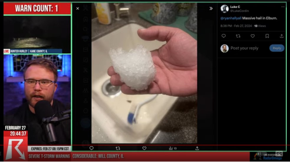
anybody here see hail like this?
-
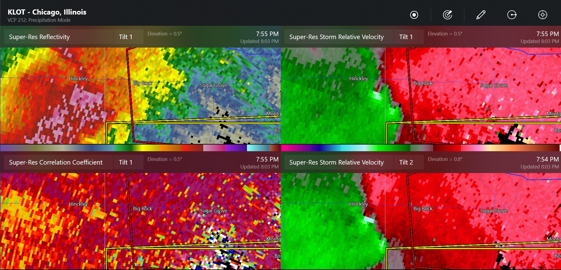
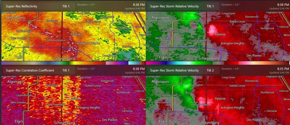
this may have been the best radar scan for the tornado at Inverness
-
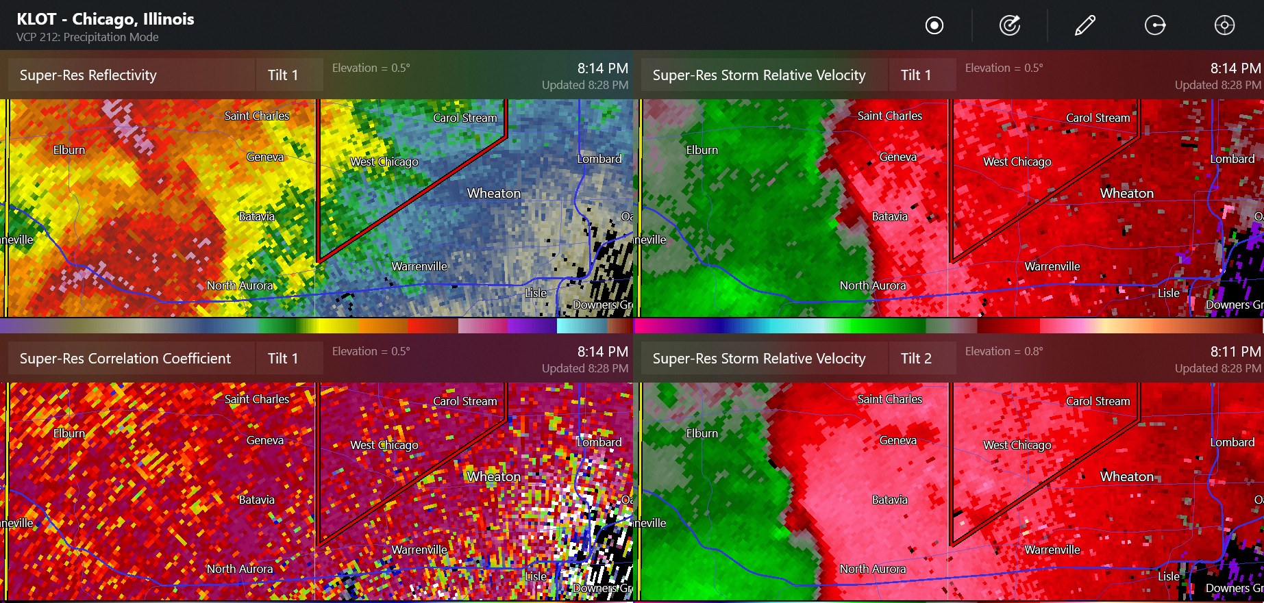
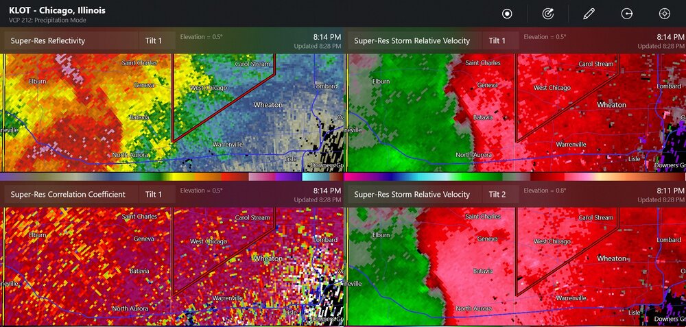
radar for possible tornado(es) at Geneva
-
possible new confirmed tornado

-
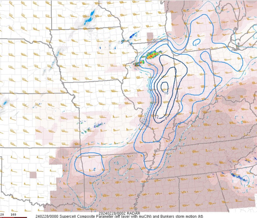
the supercell indices in February...
-
60 degrees colder
-
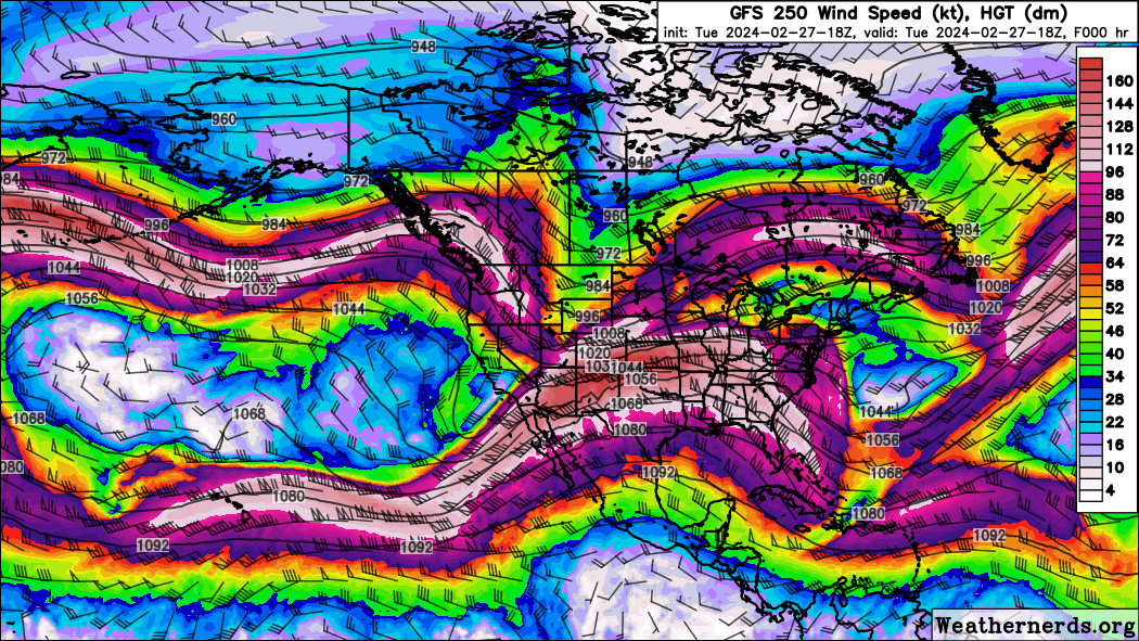
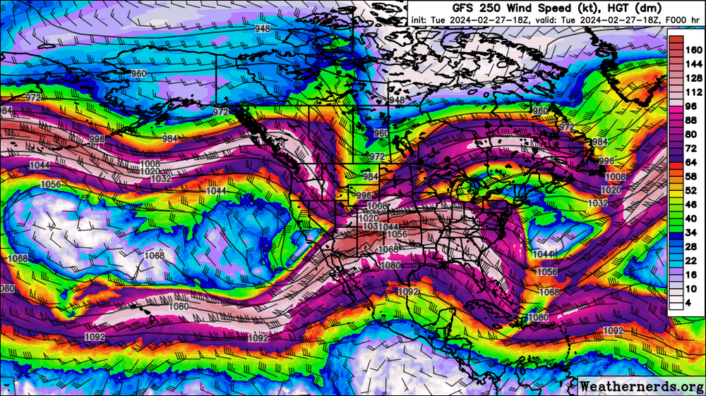
Now you can see the polar jet stream trough combining with the subtropical jet streak with lots of diffluence/divergence in the Midwest.
-
Grlevel3 already has hail information on the two new ones